Self-guided Sightseeing Tour #8 in Hartford, United States
Legend
Tour Facts
3.3 km
33 m
Experience Hartford in United States in a whole new way with our free self-guided sightseeing tour. This site not only offers you practical information and insider tips, but also a rich variety of activities and sights you shouldn't miss. Whether you love art and culture, want to explore historical sites or simply want to experience the vibrant atmosphere of a lively city - you'll find everything you need for your personal adventure here.
Activities in HartfordIndividual Sights in HartfordSight 1: Collins and Townley Streets Historic District

The Collins and Townley Streets District is a historic district encompassing a cluster of mid-to-late 19th-century residences in the Asylum Hill neighborhood of Hartford, Connecticut. It includes properties on Collins, Atwood, Willard, and Townley Streets, which range architecturally from the Italianate and Second Empire of the 1860s and 1870s to the Shingle style of the 1890s. The district was listed on the National Register of Historic Places in 1979.
Wikipedia: Collins and Townley Streets District (EN), Heritage Website
Sight 2: Sigourney Square Historic District
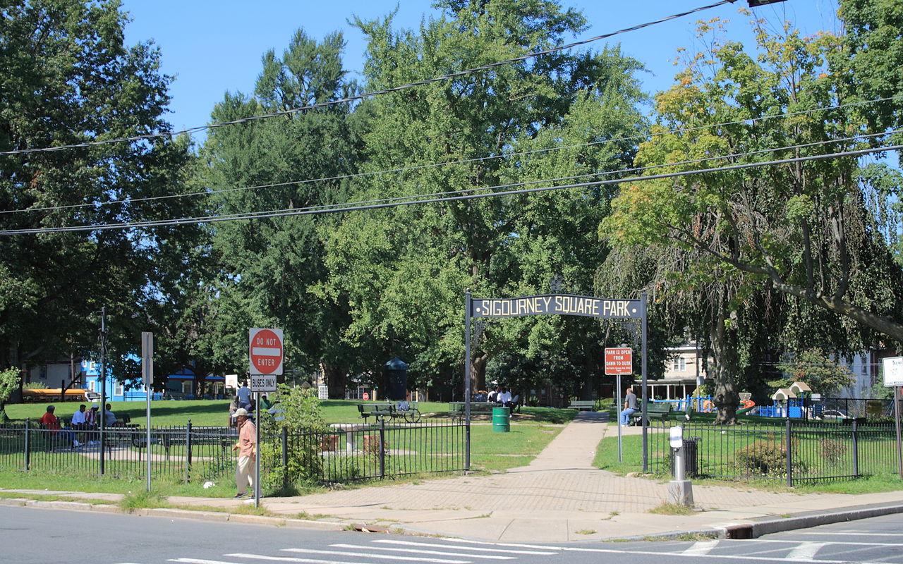
The Signourney Square Historic District encompasses a neighborhood in the Asylum Hill area of Hartford, Connecticut, United States, that was almost entirely built out in a single decade at the end of the 19th century as a middle-class residential area. It is roughly bounded by Garden, Ashley, and Woodland Streets on the east, south, and west, and by railroad tracks north of Sargeant Street to the north. The area retains much of its late 19th-century character, with relatively few modern intrusions. It was listed on the National Register of Historic Places in 1979, with small additions in 1983 and 2011.
Sight 3: Vine Street Apartment Buildings

The Vine Street Apartment Buildings, many now known as the Horace Bushnell Apartments, are a historic collection of residential apartment blocks at 4-48 Vine Street in Hartford, Connecticut. Built between 1922 and 1925, they consist of eleven brick buildings sharing massing, scale, and setting, with a cross-section of period building styles. They were listed on the National Register of Historic Places in 2012.
Wikipedia: Vine Street Apartment Buildings (EN), Heritage Website
Sight 4: House of God Church

Chevry Lomday Mishnayes Synagogue is a historic former synagogue building at 148-150 Bedford Street in Hartford, Connecticut, in the United States. Built in 1924, it is unusual for an ecclesiastical structure in that its design appears to be based on that of an apartment house. It housed an Orthodox Jewish congregation until 1963, and now houses the local House of God Church. It was listed on the National Register of Historic Places in 1995.
Wikipedia: Chevry Lomday Mishnayes Synagogue (EN), Heritage Website
Sight 5: Greater Refuge Church of Christ

Beth Hamedrash Hagodol Synagogue is an historic former Orthodox Jewish congregation and synagogue, located at 370 Garden Street, Hartford, Connecticut, in the United States.
Wikipedia: Beth Hamedrash Hagodol Synagogue (Hartford, Connecticut) (EN), Website, Heritage Website
Sight 6: Clay Hill Historic District

The Clay Hill Historic District in Hartford, Connecticut is a 60-acre (24 ha) historic district that was listed on the National Register of Historic Places in 1983, and expanded in 1984. Northwest of Downtown Hartford, the district is roughly bounded by Main, Mather, Garden, and Walnut Streets. The district contains examples of Queen Anne, Italianiate and Neoclassical Revival architecture.
Wikipedia: Clay Hill Historic District (EN), Heritage Website
Sight 7: Engine Company 2 Fire Station

The Engine Company 2 Fire Station is a firehouse at the corner of Main and Belden streets in Hartford, Connecticut, United States. It is a brick structure built in the early 20th century, the second firehouse built for the company. Architect Russell Barker, who designed many public buildings in the city, used the Italian Renaissance Revival style, unusual for a firehouse. The front facade boasts intricate brickwork. It is one of two remaining firehouses in the city originally designed to accommodate both men and horses. In 1989, it was added to the National Register of Historic Places along with several other city firehouses. It continues to serve its original function, housing Engine Company 2 of the Hartford Fire Department.
Wikipedia: Engine Company 2 Fire Station (EN), Heritage Website
Share
How likely are you to recommend us?
Disclaimer Please be aware of your surroundings and do not enter private property. We are not liable for any damages that occur during the tours.
GPX-Download For navigation apps and GPS devices you can download the tour as a GPX file.