Self-guided Sightseeing Tour #6 in Hartford, United States
Legend
Tour Facts
5 km
55 m
Experience Hartford in United States in a whole new way with our free self-guided sightseeing tour. This site not only offers you practical information and insider tips, but also a rich variety of activities and sights you shouldn't miss. Whether you love art and culture, want to explore historical sites or simply want to experience the vibrant atmosphere of a lively city - you'll find everything you need for your personal adventure here.
Activities in HartfordIndividual Sights in HartfordSight 1: Good Shepherd Church
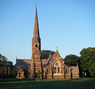
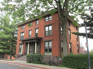
The Church of the Good Shepherd and Parish House is an Episcopal church at 155 Wyllys Street in Hartford, Connecticut. It was commissioned by Elizabeth Jarvis Colt, the widow of Samuel Colt, and completed in 1867. The church and its associated parish house were designed by Edward Tuckerman Potter, and serve as a memorial to Samuel Colt and members of his family. The church and parish house were added to the National Register of Historic Places in 1975, and became a contributing property to the Coltsville Historic District in 2008.
Wikipedia: Church of the Good Shepherd and Parish House (EN), Heritage Website
Sight 2: Polish National Home of Hartford
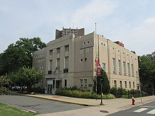
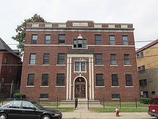
The Polish National Home is an ethnic community support organization in Hartford, Connecticut. Its facilities are located at 60 Charter Oak Avenue, south of downtown Hartford, in an architecturally distinctive Art Deco building. It was built in 1930 to a design by Polish-American architect Henry Ludorf, and was listed on the National Register of Historic Places in 1983.
Wikipedia: Polish National Home (Hartford, Connecticut) (EN), Website, Heritage Website
Sight 3: Capewell Horse Nail Company
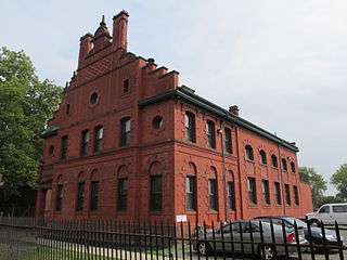
The Capewell Horse Nail Company is a historic brick industrial complex located in the Hartford, Connecticut neighborhood of Sheldon/Charter Oak. It was built in 1903 by industrialist George Capewell at the corner of Charter Oak Avenue and Popieluszko Court after the previous headquarters burned down.
Wikipedia: Capewell Horse Nail Company (EN), Heritage Website
Sight 4: Saint Cyril and Saint Methodius Church
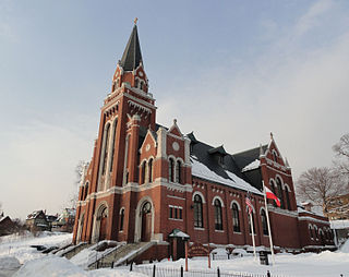
SS. Cyril and Methodius Parish - one of the Polish-American Roman Catholic parishes in New England in the Archdiocese of Hartford. Founded on April 6, 1902, it is designated for Polish immigrants in Hartford, Connecticut, United States.
Wikipedia: SS. Cyril and Methodius Parish, Hartford (EN), Website
Sight 5: Charter Oak Place
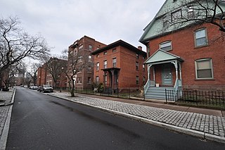
Charter Oak Place is a street on the south side of downtown Hartford, Connecticut. Laid out in the 1860s, its residential character is in marked contrast to the commercial development that predominates around it. The street's buildings, constructed between the early 1860s and 1900, are a cross-section of Victorian architectural styles. The entire length of the street is listed on the National Register of Historic Places.
Sight 6: Charter Oak Cultural Center
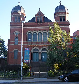
Temple Beth Israel, sometimes called Charter Oak Temple, is an historic former Reform Jewish synagogue and later church building, now cultural center, located at 21 Charter Oak Avenue, in Hartford, Connecticut, in the United States.
Wikipedia: Temple Beth Israel (Hartford, Connecticut) (EN), Website, Heritage Website
Sight 7: South Congregational Church
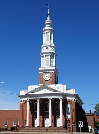
The Second Church of Christ, known more recently as the South Congregational Church, is a historic church in Hartford, Connecticut. Built in 1825–27, it is one of the oldest surviving public buildings in the city. It is the third home of its congregation, which was founded in 1670, and is one of the oldest purely Congregationalist groups in the nation. The building was listed on the National Register of Historic Places in 1978.
Wikipedia: Second Church of Christ (EN), Website, Heritage Website
Sight 8: Engine Company 1 Fire Station
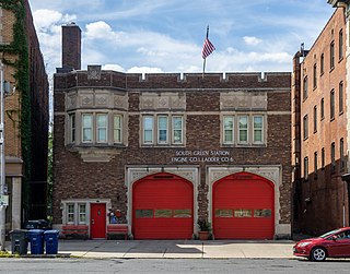
The South Green Fire Station, also known as the Engine Company 1 Fire Station, is at 197 Main St. in downtown Hartford, Connecticut. Built in 1927, it is an architecturally distinctive example of Classical and Collegiate Gothic Revival architecture, designed by a prominent local firm. The station, as well as the former fire equipment maintenance house behind it at 36 John Street, were listed on the National Register of Historic Places in 1989. The station presently houses Engine Company 1 and Ladder Company 6 of the Hartford Fire Department.
Wikipedia: Engine Company 1 Fire Station (EN), Heritage Website
Sight 9: Congress Street
Congress Street is a city street in the South Green neighborhood of Hartford, Connecticut. Extending for a single block from the South Green to Morris Street, it was developed in the 1850s with modest two-family residences, with infill development of larger apartment blocks around the turn of the 20th century. The entire street was listed on the National Register of Historic Places in 1975 as a good example of a well-preserved late-19th century residential street.
Wikipedia: Congress Street (Hartford, Connecticut) (EN), Heritage Website
Sight 10: Jefferson–Seymour Historic District
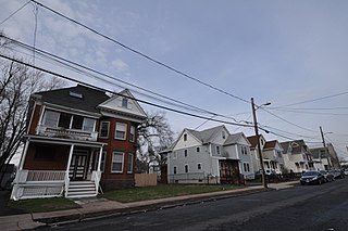
The Jefferson-Seymour District is a historic district encompassing a residential area on the south side of Hartford, Connecticut. Covering portions of Cedar, Wadsworth, Seymour and Jefferson Streets, it contains a well-preserved collection of late 19th and early 20th-century middle-class residential architecture, primarily executed in brick. It was listed on the National Register of Historic Places in 1979.
Wikipedia: Jefferson-Seymour District (EN), Heritage Website
Sight 11: Allen Place–Lincoln Street Historic District
The Allen Place–Lincoln Street Historic District encompasses a small neighborhood of late 19th-century housing built for white-collar service workers in southern Hartford, Connecticut. It is roughly bounded by Madison, Washington, and Vernon Streets, and Zion Hill Cemetery, and has well-preserved examples of vernacular Queen Anne and Colonial Revival architecture. It was listed on the National Register of Historic Places in 2003.
Wikipedia: Allen Place–Lincoln Street Historic District (EN), Heritage Website
Sight 12: Trinity College Chapel
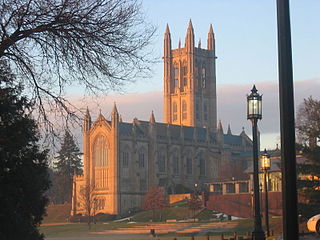
The Trinity College Chapel is a Collegiate Gothic structure built in 1933 on the campus of Trinity College in Hartford, Connecticut. It was designed by Philip H. Frohman of the firm Frohman, Robb and Little, who also designed the National Cathedral in Washington D.C.
Share
How likely are you to recommend us?
Disclaimer Please be aware of your surroundings and do not enter private property. We are not liable for any damages that occur during the tours.
GPX-Download For navigation apps and GPS devices you can download the tour as a GPX file.
