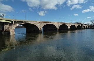
Self-guided Sightseeing Tour #3 in Hartford, United States
Legend
Tour Facts
2.4 km
61 m
Experience Hartford in United States in a whole new way with our free self-guided sightseeing tour. This site not only offers you practical information and insider tips, but also a rich variety of activities and sights you shouldn't miss. Whether you love art and culture, want to explore historical sites or simply want to experience the vibrant atmosphere of a lively city - you'll find everything you need for your personal adventure here.
Activities in HartfordIndividual Sights in HartfordSight 1: Hartford Union Station
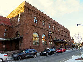
Hartford Union Station is a railroad station in Hartford, Connecticut, United States on the New Haven–Springfield Line. It is served by Amtrak Hartford Line, Northeast Regional, Valley Flyer, and Vermonter intercity rail service, plus CT Rail Hartford Line commuter rail service and CTfastrak bus rapid transit service.
Sight 2: Footguard Hall
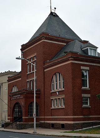
Footguard Hall was the headquarters and armory of the First Company Governor's Footguard of the state Connecticut, a ceremonial military company founded in 1771 and originally tasked with protecting the governor and state legislature. The hall is located at 159 High Street, in Hartford, Connecticut, in a Romanesque Revival brick building built in 1888. The building was listed on the National Register of Historic Places in 1984 in recognition of the organization's history and its distinctive architecture. The First Company Governor's Footguard now uses the Governor William A. O'Neill State Armory at 360 Broad Street, Hartford, Connecticut.
Sight 3: Downtown North Historic District
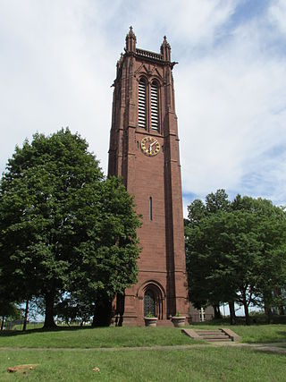
The Downtown North Historic District is a 19-acre (7.7 ha) historic district in Hartford, Connecticut. It is a predominantly residential area located around Main Street and High Street north of I-84 and south of the Amtrak railroad tracks. Its apartment blocks, houses, schools and churches, built up mainly in the late 19th and early 20th centuries as part of an expansion of the city's urban core. It includes the 130-foot (40 m) Keney Tower. The area was listed on the National Register of Historic Places in 2004.
Wikipedia: Downtown North Historic District (Hartford, Connecticut) (EN), Heritage Website
Sight 4: Ann Street Historic District
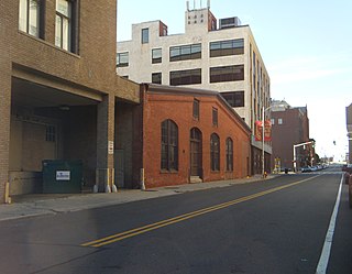
The Ann Street Historic District is a historic district encompassing part of Downtown Hartford in Hartford, Connecticut. A commercial and light industrial area, the district includes properties along Ann Uccello Street from Chapel Street south to Hicks Street. It also includes properties east of Ann Street fronting Pearl Street and Hicks Street to roughly Haynes Street, as well as properties west of Ann Uccello Street fronting Allyn and Asylum Streets to roughly a third of the block. The district's architecture typifies the city's development between about 1880 and 1930; it was listed on the National Register of Historic Places in 1983.
Wikipedia: Ann Street Historic District (EN), Heritage Website
Sight 5: Saint Patrick-Saint Anthony Church
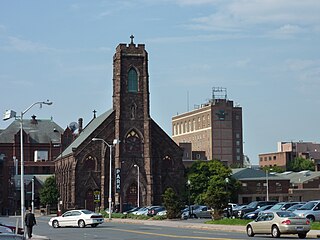
St. Patrick - St. Anthony Church is a Cathedral-style Church located at 265 Church Street, Hartford, CT. The church is part of the Roman Catholic Archdiocese of Hartford. It is the oldest Roman Catholic parish in the state of Connecticut.
Wikipedia: St. Patrick - St. Anthony Church (Hartford, Connecticut) (EN), Website, Heritage Website
Sight 6: Hartford Stage
Hartford Stage is an American 501(c)(3) non-profit regional theatre company located on Church Street in downtown Hartford, Connecticut. Since its founding in 1963, Hartford Stage has won the Regional Theatre Tony Award (1989) and many Connecticut Critics Circle and other awards.
Sight 7: Morgan G. Bulkeley Bridge
The Bulkeley Bridge is the oldest of three highway bridges over the Connecticut River between Hartford, Connecticut and East Hartford, Connecticut. A stone arch bridge composed of nine spans, the bridge carries Interstate 84, U.S. Route 6, and U.S. Route 44 across the river. As of 2005, the bridge carried an average daily traffic of 142,500 cars. The arches are mounted on stone piers, and vary in length from 68 feet (21 m) to 119 feet (36 m); the total length of the bridge is 1,192 feet (363 m).
Share
How likely are you to recommend us?
Disclaimer Please be aware of your surroundings and do not enter private property. We are not liable for any damages that occur during the tours.
GPX-Download For navigation apps and GPS devices you can download the tour as a GPX file.
