Self-guided Sightseeing Tour #10 in Hartford, United States
Legend
Tour Facts
9.2 km
107 m
Experience Hartford in United States in a whole new way with our self-guided sightseeing tour. This site not only offers you practical information and insider tips, but also a rich variety of activities and sights you shouldn't miss. Whether you love art and culture, want to explore historical sites or simply want to experience the vibrant atmosphere of a lively city - you'll find everything you need for your personal adventure here.
Activities in HartfordIndividual Sights in HartfordSight 1: Sigourney Square Historic District
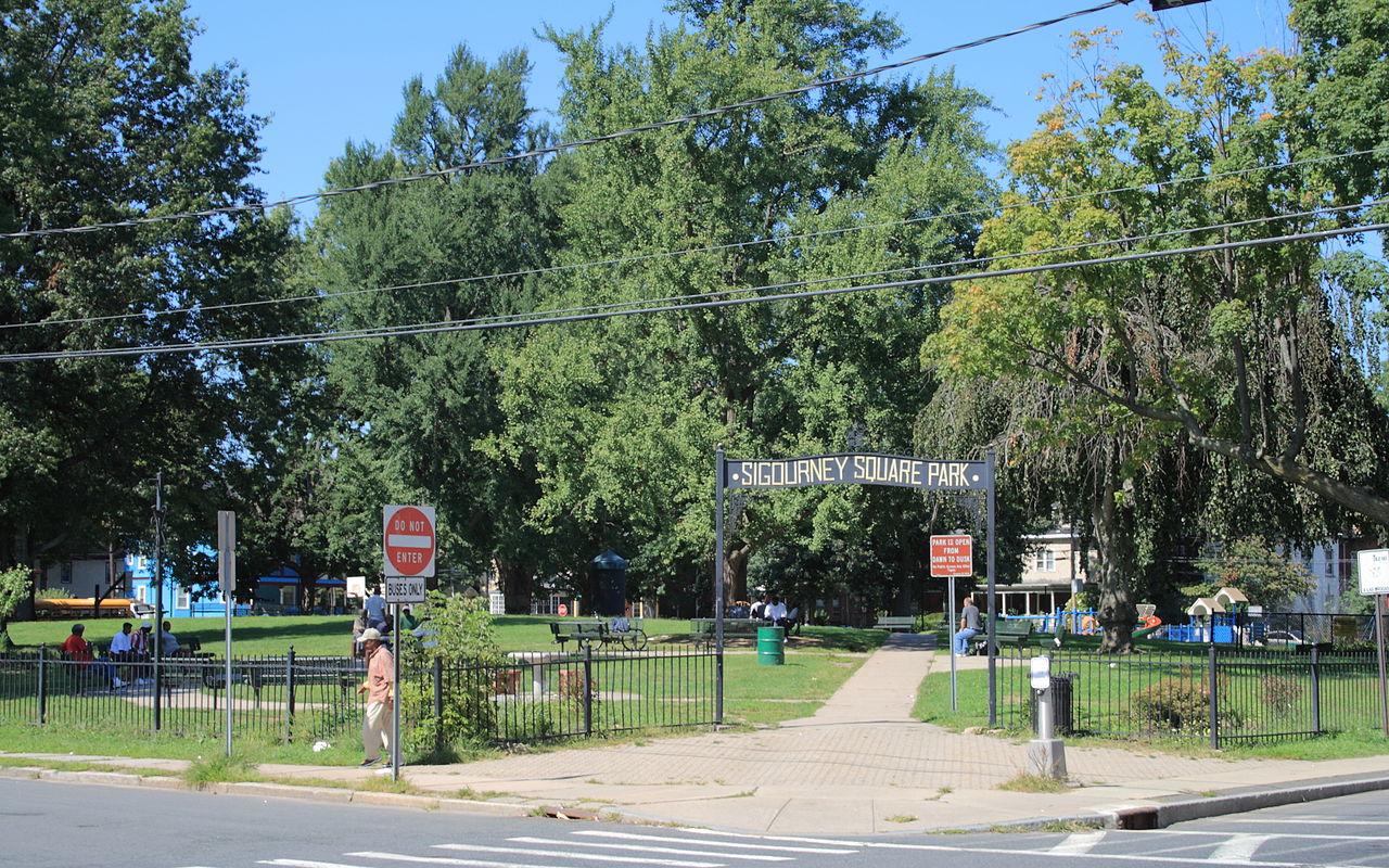
The Signourney Square Historic District encompasses a neighborhood in the Asylum Hill area of Hartford, Connecticut, United States, that was almost entirely built out in a single decade at the end of the 19th century as a middle-class residential area. It is roughly bounded by Garden, Ashley, and Woodland Streets on the east, south, and west, and by railroad tracks north of Sargeant Street to the north. The area retains much of its late 19th-century character, with relatively few modern intrusions. It was listed on the National Register of Historic Places in 1979, with small additions in 1983 and 2011.
Sight 2: Collins and Townley Streets Historic District

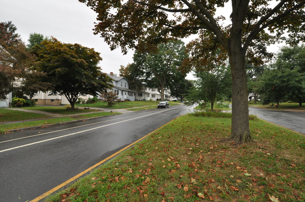
The Collins and Townley Streets District is a historic district encompassing a cluster of mid-to-late 19th-century residences in the Asylum Hill neighborhood of Hartford, Connecticut. It includes properties on Collins, Atwood, Willard, and Townley Streets, which range architecturally from the Italianate and Second Empire of the 1860s and 1870s to the Shingle style of the 1890s. The district was listed on the National Register of Historic Places in 1979.
Wikipedia: Collins and Townley Streets District (EN), Heritage Website
Sight 3: Laurel and Marshall Streets District

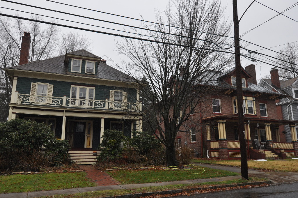
The Laurel and Marshall Streets District is a historic district encompassing a late-19th and early-20th century residential area in the Asylum Hill neighborhood of Hartford, Connecticut. Extending along Laurel and Marshall Streets between Niles and Case Streets, its housing stock represents a significant concentration of middle-class Queen Anne architecture in the city. It was listed on the National Register of Historic Places in 1979.
Wikipedia: Laurel and Marshall Streets District (EN), Heritage Website
Sight 4: Nook Farm and Woodland Street Historic District

Nook Farm is a historical neighborhood in the Asylum Hill section on the western edge of Hartford, Connecticut, USA.
Sight 5: Connecticut Historical Society Museum and Library

The Connecticut Museum of Culture and History (CMCH), formerly the Connecticut Historical Society, is a private, non-profit organization that serves as the official state historical society of Connecticut. Established in Hartford in 1825, the CMCH is one of the oldest historical societies in the US.
Wikipedia: Connecticut Museum of Culture and History (EN), Website
Sight 6: Little Hollywood Historic District

The Little Hollywood Historic District encompasses a concentrated collection of apartment buildings built mainly between the world wars in the West End neighborhood of Hartford, Connecticut. Located on Farmington Avenue and Owen, Frederick, and Denison Streets, they were built primarily to attract single tenants seeking small apartments, a trend that developed after World War I and ended after World War II. The district was listed on the National Register of Historic Places in 1982.
Wikipedia: Little Hollywood Historic District (EN), Heritage Website
Sight 7: Sisson–South Whitney Historic District

The Sisson-South Whitney Historic District encompasses a neighborhood in the West End area of Hartford, Connecticut, that was built out between 1890 and 1930 as a streetcar suburb. It is roughly bounded by Farmington Avenue, South Whitney Street, West Boulevard, and Sisson Avenue, and includes a diversity of residential and commercial architecture, reflective of its initial development and subsequent growth. The district was listed on the National Register of Historic Places in 2013.
Wikipedia: Sisson-South Whitney Historic District (EN), Heritage Website
Sight 8: West End South Historic District

The West End South Historic District encompasses a neighborhood of mid 19th to early 20th century residential architecture in western Hartford, Connecticut and eastern West Hartford, Connecticut. Roughly bounded by Prospect and South Whitney Streets, West Boulevard, and Farmington Avenue, the area includes a large number of Colonial Revival and Queen Anne houses, as well as numerous buildings in other period styles, with only a small number of losses. It was listed on the National Register of Historic Places in 1985.
Wikipedia: West End South Historic District (EN), Heritage Website
Sight 9: West Boulevard Historic District
The West Boulevard Historic District encompasses a historic residential development on West Boulevard and Rodney Street in the West End of Hartford, Connecticut. The area was developed beginning in 1909, and most of its homes were built by a single construction firm, creating a neighborhood appearance unified by style, scale, and setting, using the principles of the then-fashionable City Beautiful movement. The district was listed on the National Register of Historic Places in 2007.
Wikipedia: West Boulevard Historic District (EN), Heritage Website
Sight 10: West End North Historic District

The West End North Historic District encompasses a neighborhood of late 19th and early 20th century residential architecture in western Hartford, Connecticut and eastern West Hartford, Connecticut. Roughly bounded by Prospect, Elizabeth, and Lorraine Streets and Farmington Avenue, the area includes a large number of Colonial Revival and Queen Anne houses, as well as numerous buildings in other period styles, with only a small number of losses. It was listed on the National Register of Historic Places in 1985.
Wikipedia: West End North Historic District (EN), Heritage Website
Sight 11: Oxford–Whitney Streets Historic District
The Oxford-Whitney Streets District is a historic district encompassing an early-20th century residential area in the West End neighborhood of Hartford, Connecticut. It extends along the east side of Oxford Street between Elizabeth and Cone Streets, and along the west side of Whitney between Fern and Elizabeth, and includes the north side of Fern Street between Whitney and Oxford. Most of the housing, a combination of single and multi-family residences, was built between 1906 and 1919, a period later than the surrounding areas, and is predominantly Colonial Revival in character. It was listed on the National Register of Historic Places in 2010.
Wikipedia: Oxford-Whitney Streets Historic District (EN), Heritage Website
Sight 12: Elizabeth Park

Elizabeth Park is a city park located in Hartford and West Hartford, Connecticut. It covers 102 acres and is listed on the National Register of Historic Places. The park is owned by the City of Hartford, and jointly maintained by the City and the Elizabeth Park Conservancy working together.
Share
Disclaimer Please be aware of your surroundings and do not enter private property. We are not liable for any damages that occur during the tours.
GPX-Download For navigation apps and GPS devices you can download the tour as a GPX file.