Self-guided Sightseeing Tour #5 in Boston, United States
Legend
Guided Free Walking Tours
Book free guided walking tours in Boston.
Guided Sightseeing Tours
Book guided sightseeing tours and activities in Boston.
Tour Facts
6.7 km
217 m
Experience Boston in United States in a whole new way with our free self-guided sightseeing tour. This site not only offers you practical information and insider tips, but also a rich variety of activities and sights you shouldn't miss. Whether you love art and culture, want to explore historical sites or simply want to experience the vibrant atmosphere of a lively city - you'll find everything you need for your personal adventure here.
Activities in BostonIndividual Sights in BostonSight 1: Hood Milk Bottle
HP Hood LLC is an American dairy company based in Lynnfield, Massachusetts. Hood was founded in 1846 in Derry, New Hampshire, by Harvey Perley Hood. After two years in Derry, Hood took his milk south and established a factory in Charlestown, Massachusetts. Recent company acquisitions by HP Hood have expanded its reach from predominantly New England to the broader United States. Today, the company has an annual sales revenue of about $3.2 billion and more than 3,400 employees.
Sight 2: Michael S. Dukakis South Station Transportation Center

South Station, officially The Governor Michael S. Dukakis Transportation Center at South Station, is the largest railroad station and intercity bus terminal in Greater Boston and New England's second-largest transportation center after Logan International Airport. Located at the intersection of Atlantic Avenue and Summer Street in Dewey Square, Boston, Massachusetts, the historic station building was constructed in 1899 to replace the downtown terminals of several railroads. Today, it serves as a major intermodal domestic transportation hub, with service to the Greater Boston region and the Northeastern and Midwestern United States. It is used by thousands of commuter rail and intercity rail passengers daily. Connections to the rapid transit Red Line and bus rapid transit Silver Line are made through the adjacent subway station.
Sight 3: Bedford Building

The Bedford Block is an historic commercial building at 99 Bedford Street Boston, Massachusetts, in an area called Church Green. Built in 1875 in a style promoted by John Ruskin called Venetian Gothic. The style may also be referred to as Ruskinian Gothic.
Sight 4: Chinatown Gate
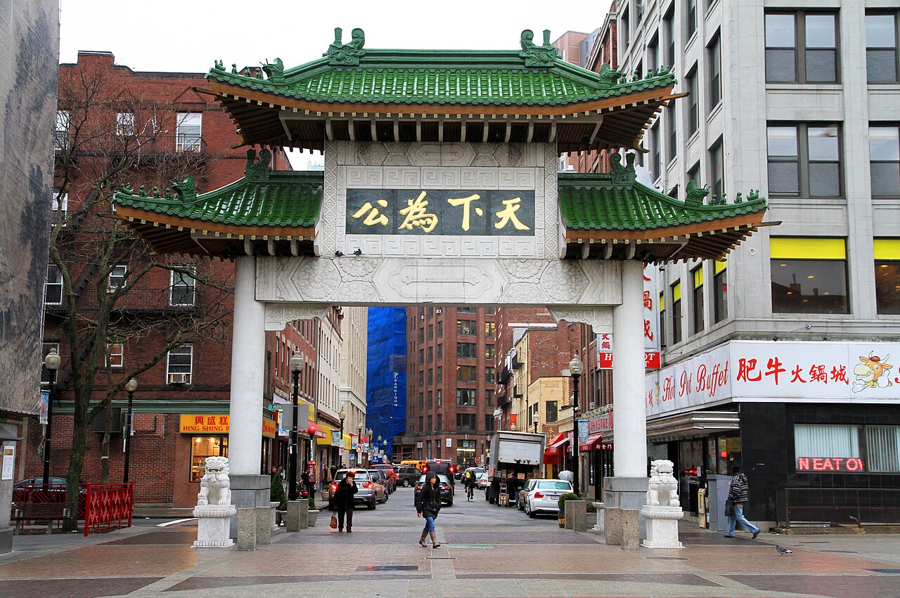
Chinatown, Boston is a neighborhood located in downtown Boston, Massachusetts, United States. It is the only surviving historic ethnic Chinese enclave in New England since the demise of the Chinatowns in Providence, Rhode Island and Portland, Maine after the 1950s. Because of the high population of Asians and Asian Americans living in this area of Boston, there is an abundance of Chinese and Vietnamese restaurants located in Chinatown. It is one of the most densely populated residential areas in Boston and serves as the largest center of its East Asian and Southeast Asian cultural life.
Sight 5: Boston Opera House

The Boston Opera House, also known as the Citizens Bank Opera House, is a performing arts and esports venue located at 539 Washington St. in Boston, Massachusetts. It was originally built as the B.F. Keith Memorial Theatre, a movie palace in the Keith-Albee chain. The chain became part of RKO when it was established just before the theater opened on October 29, 1928, and it was also known as the RKO Keith's Theater. After operating for more than 50 years as a movie theater, it was rededicated in 1980 as a home for the Opera Company of Boston, which performed there until the opera company closed down in 1990 due to financial problems. The theater was reopened in 2004 after a major restoration, and it currently serves as the home of the Boston Ballet and also hosts touring Broadway shows.
Sight 6: Paramount Theatre

Paramount Theatre is a theatre in Boston on Washington Street, between Avery and West Streets.
Sight 7: Dorchester Temple Baptist Church

Dorchester Temple Baptist Church is a historic African American Baptist church at 670 Washington Street in Boston, Massachusetts. It is now known as Global Ministries Christian Church.
Sight 8: Boylston Building

The Boylston Building is an historic building at 2–22 Boylston Street in Boston, Massachusetts. The six-story sandstone building was designed by Carl Fehmer and built in 1887 by Woodbury & Leighton. It is an early instance in Boston of a skeleton-built commercial structure, rather than having load-bearing masonry walls. The building housed the Boylston Market, a wholesale trading exchange which had been on the site since 1810.
Sight 9: Boston Young Men's Christian Union

The Boston Young Men's Christian Union is a historic building at 48 Boylston Street in Boston, Massachusetts and a liberal Protestant youth association. When Unitarians were excluded from the Boston YMCA in 1851, a group of Harvard students founded a Christian discussion group, which was incorporated as the Boston YMCU in 1852. In 1873, the organization decided to construct its own building. $270,000 was raised, and construction on the original segment completed in 1875. The building was designed by Nathaniel Jeremiah Bradlee, constructed in a High Victorian Gothic style, and included ground-level retail. Several additions were made, including in 1956. The building was designated a Boston Landmark by the Boston Landmarks Commission in 1977 and added to the National Historic Register in 1980. Boston YMCU owned Camp Union, a 600-acre (240 ha) camp, in Greenfield, New Hampshire (1929–1993). From its renovation in 2003 to 2011 it was called the Boylston Street Athletic Club, and later the Boston Union Gym or BYMCU Athletic Club. The Boston Young Men's Christian Union claims to be "America's First Gym".
Sight 10: Poe Returning to Boston
Poe Returning to Boston is a statue of American author Edgar Allan Poe in Boston, Massachusetts. It was created by the American sculptor Stefanie Rocknak. The statue is located at the corner of Boylston and Charles streets at Edgar Allan Poe Square.
Sight 11: Wendell Phillips

A statue of Wendell Phillips is installed in Boston's Public Garden, in the U.S. state of Massachusetts.
Sight 12: Thomas Cass

A statue of Thomas Cass by Richard E. Brooks, called Colonel Thomas Cass, is installed in Boston's Public Garden, in the U.S. state of Massachusetts.
Sight 13: Charles Sumner

The statue of Charles Sumner in Boston's Public Garden is a bronze statue by Thomas Ball, commissioned by the Boston Art Committee to honor Sumner after his death in 1874. The statue was dedicated in 1878.
Sight 14: Marvin E. Goody Memorial
The Marvin E. Goody Memorial by Joan Goody is installed in Boston's Public Garden, in the U.S. state of Massachusetts. The red granite and Dakota mahogany memorial was dedicated in 1984, having been funded by Friends of the Public Garden and Common. It was surveyed as part of the Smithsonian Institution's "Save Outdoor Sculpture!" program in 1993.
Sight 15: Boston Public Garden

The Public Garden, also known as Boston Public Garden, is a large park in the heart of Boston, Massachusetts, adjacent to Boston Common. It is a part of the Emerald Necklace system of parks and is bounded by Charles Street and Boston Common to the east, Beacon Street and Beacon Hill to the north, Arlington Street and Back Bay to the west, and Boylston Street to the south. The Public Garden was the first public botanical garden in America.
Sight 16: Boy and Bird

The Boy and Bird Fountain by Bashka Paeff is installed in Boston's Public Garden, in the U.S. state of Massachusetts. The original fountain was cast in 1934, then later recast in 1977 and 1992. It features a bronze sculpture of a nude boy holding a bird, resting on a granite base. The work was surveyed as part of the Smithsonian Institution's "Save Outdoor Sculpture!" program in 1993.
Wikipedia: Boy and Bird Fountain (EN), Website, Heritage Website
Sight 17: Alexander Hamilton

A statue of Alexander Hamilton by William Rimmer is installed along Commonwealth Avenue, between Arlington and Berkeley Streets, in Boston, Massachusetts, United States.
Wikipedia: Statue of Alexander Hamilton (Boston) (EN), Website
Sight 18: First Church in Boston

First Church in Boston is a Unitarian Universalist Church founded in 1630 by John Winthrop's original Puritan settlement in Boston, Massachusetts. The current building, located on 66 Marlborough Street in the Back Bay neighborhood, was designed by Paul Rudolph in a modernist style after a fire in 1968. It incorporates part of the earlier gothic revival building designed by William Robert Ware and Henry Van Brunt in 1867. The church has long been associated with Harvard University.
Sight 19: Emmanuel Church

Emmanuel Episcopal Church is a historic church at 15 Newbury Street in the Back Bay neighborhood of Boston, Massachusetts. It was founded in 1860 as part of the Episcopal Diocese of Massachusetts.
Sight 20: 9/11 Memorial

A memorial commemorating victims of the September 11 attacks, known as the 9/11 Memorial or Garden of Remembrance, is installed in Boston Public Garden, in Boston, Massachusetts, United States.
Sight 21: William Ellery Channing Statue

A statue of William Ellery Channing is installed near the intersection of Boylston and Arlington in Boston Public Garden, in Boston, Massachusetts, United States. The statue stands under a marble structure.
Sight 22: Arlington Street Church

The Arlington Street Church is a Unitarian Universalist church across from the Public Garden in Boston, Massachusetts. Because of its geographic prominence and the notable ministers who have served the congregation, the church is considered to be among the most historically important in American Unitarianism and Unitarian Universalism. Completed in 1861, it was designed by Arthur Gilman and Gridley James Fox Bryant to resemble James Gibbs' St. Martin-in-the-Fields in London. The main sanctuary space has 16 large-scale stained-glass windows installed by Tiffany Studios from 1899 to 1930.
Sight 23: Paine Furniture Building
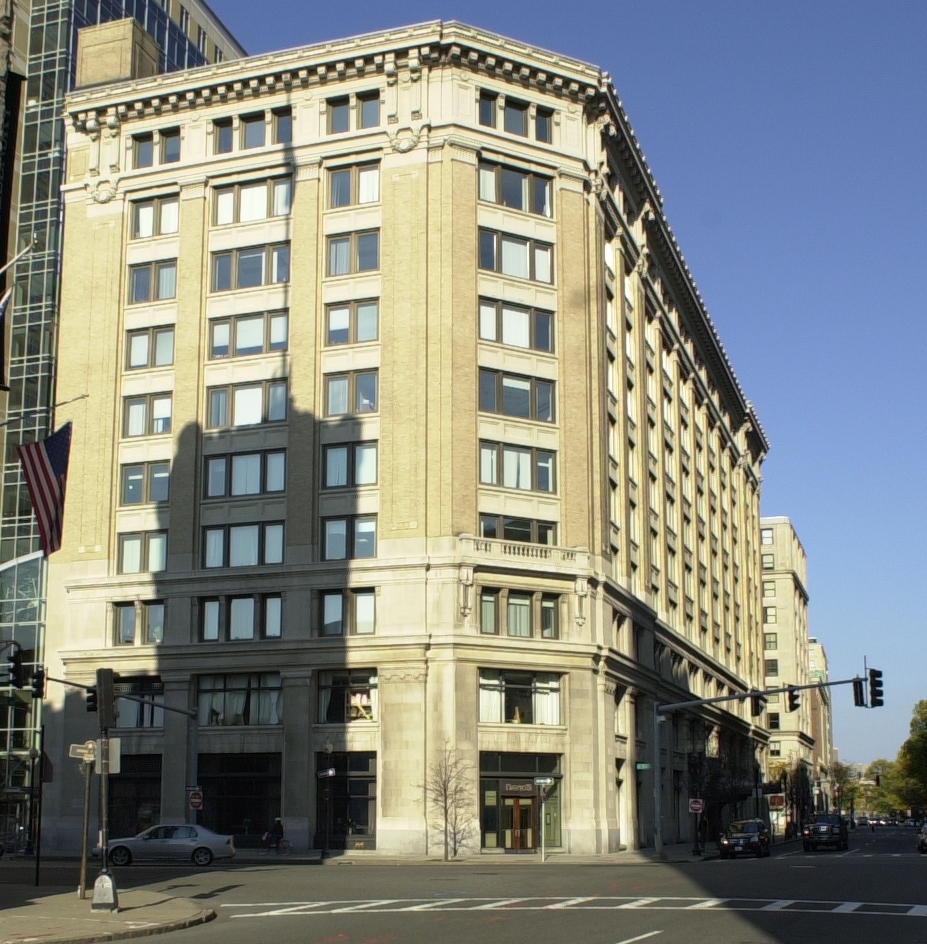
The Paine Furniture Building is an historic commercial building at 75-81 Arlington Street in Boston, Massachusetts. It occupies the entire block between St. James and Stuart Streets, and has a prominent position on Park Square.
Sight 24: Statler Park

The Hilton Boston Park Plaza is a historic hotel in Boston, Massachusetts, United States, opened on March 10, 1927. It was built by hotelier E.M. Statler as part of his Statler Hotels chain. A prototype of the grand American hotel, it was called a "city within a city" and also contains an adjoining office building. It was the first hotel in the world to offer in-room radio in every room.
Sight 25: Statler Fountain

Statler Fountain is a 1930 fountain designed by Ulysses Anthony Ricci, installed in Boston's Statler Park, in the U.S. state of Massachusetts. The Art Deco fountain features a bronze statue of a woman. It was surveyed as part of the Smithsonian Institution's "Save Outdoor Sculpture!" program in 1993.
Sight 26: Counterpoint

Arts on the Line was a program devised to bring art into the Massachusetts Bay Transportation Authority (MBTA) subway stations in the late 1970s and early 1980s. Arts on the Line was the first program of its kind in the United States and became the model for similar drives for art across the country. The first twenty artworks were completed in 1985 with a total cost of US$695,000, or one half of one percent of the total construction cost of the Red Line Northwest Extension, of which they were a part.
Sight 27: Bacchante and Infant Faun

Bacchante and Infant Faun is a bronze sculpture modeled by American artist Frederick William MacMonnies in Paris in 1893–1894.
Sight 28: Commonwealth Ave Mall

Commonwealth Avenue is a major street in the cities of Boston and Newton, Massachusetts. It begins at the western edge of the Boston Public Garden, and continues west through the neighborhoods of the Back Bay, Kenmore Square, Boston University, Allston, Brighton and Chestnut Hill. It continues as part of Route 30 through Newton until it crosses the Charles River at the border of the town of Weston.
Share
How likely are you to recommend us?
Disclaimer Please be aware of your surroundings and do not enter private property. We are not liable for any damages that occur during the tours.
GPX-Download For navigation apps and GPS devices you can download the tour as a GPX file.