Free Walking Sightseeing Tour #3 in Boston, United States

Legend

Churches & Art
Nature
Water & Wind
Historical
Heritage & Space
Tourism
Paid Tours & Activities

Tour Facts

Number of sights 19 sights
Distance 11.1 km
Ascend 235 m
Descend 221 m

Explore Boston in United States with this free self-guided walking tour. The map shows the route of the tour. Below is a list of attractions, including their details.

Activities in BostonIndividual Sights in Boston

Sight 1: The Institute of Contemporary Art

Show sight on map

The Institute of Contemporary Art (ICA) is an art museum and exhibition space located in Boston, Massachusetts, United States. The museum was founded as the Boston Museum of Modern Art in 1936. Since then it has gone through multiple name changes as well as moving its galleries and support spaces over 13 times. Its current home was built in 2006 in the South Boston Seaport District and designed by architects Diller Scofidio + Renfro.

Wikipedia: Institute of Contemporary Art, Boston (EN), Website

603 meters / 7 minutes

Sight 2: Our Lady of Good Voyage Chapel

Show sight on map

Our Lady of Good Voyage, also known as the Seaport Shrine, is a Roman Catholic church located at 51 Seaport Boulevard in the Seaport District of Boston and in the Archdiocese of Boston. The shrine has 250 seats and holds Mass twice daily and three times on Sundays. The original chapel was located a short distance away and was built to serve the fisherman and dockworkers in what was then an industrial neighborhood.

Wikipedia: Our Lady of Good Voyage (Boston) (EN)

150 meters / 2 minutes

Sight 3: Martin's Park

Show sight on map

The Martin W. Richard Charitable Foundation is a 501(c)(3) tax-exempt charitable foundation established by the parents of Martin Richard, an 8-year-old boy who was killed in the Boston Marathon bombing on April 15, 2013. The foundation is dedicated to promoting education and sports in the community.

Wikipedia: Martin Richard Foundation (EN), Heritage Website

190 meters / 2 minutes

Sight 4: Hood Milk Bottle

Show sight on map
Hood Milk Bottle

HP Hood LLC is an American dairy company based in Lynnfield, Massachusetts. Hood was founded in 1844 in Derry, New Hampshire, by Harvey Perley Hood. After two years in Derry, Hood took his milk south and established a factory in Charlestown, Massachusetts. Recent company acquisitions by HP Hood have expanded its reach from predominantly New England to the broader United States. Today, the company has an annual sales revenue of about $3.2 billion and more than 3,400 employees.

Wikipedia: HP Hood (EN)

589 meters / 7 minutes

Sight 5: Michael S. Dukakis South Station Transportation Center

Show sight on map

South Station, officially The Governor Michael S. Dukakis Transportation Center at South Station, is the largest railroad station and intercity bus terminal in Greater Boston and New England's second-largest transportation center after Logan International Airport. Located at the intersection of Atlantic Avenue and Summer Street in Dewey Square, Boston, Massachusetts, the historic station building was constructed in 1899 to replace the downtown terminals of several railroads. Today, it serves as a major intermodal domestic transportation hub, with service to the Greater Boston region and the Northeastern and Midwestern United States. It is used by thousands of commuter rail and intercity rail passengers daily. Connections to the rapid transit Red Line and bus rapid transit Silver Line are made through the adjacent subway station.

Wikipedia: South Station (EN)

344 meters / 4 minutes

Sight 6: Bedford Building

Show sight on map
Bedford Building

The Bedford Block is an historic commercial building at 99 Bedford Street Boston, Massachusetts in an area called Church Green. Built in 1875 in a style promoted by John Ruskin called Venetian Gothic. The style may also be referred to as Ruskinian Gothic.

Wikipedia: Bedford Block (EN)

332 meters / 4 minutes

Sight 7: Chinatown Gate

Show sight on map

Chinatown, Boston is a neighborhood located in downtown Boston, Massachusetts. It is the only surviving historic ethnic Chinese enclave in New England since the demise of the Chinatowns in Providence, Rhode Island and Portland, Maine after the 1950s. Because of the high population of Asians and Asian Americans living in this area of Boston, there is an abundance of Chinese and Vietnamese restaurants located in Chinatown. It is one of the most densely populated residential areas in Boston and serves as the largest center of its East Asian and Southeast Asian cultural life.

Wikipedia: Chinatown, Boston (EN), Website

362 meters / 4 minutes

Sight 8: Dill Building

Show sight on map
Dill Building

The Dill Building is an historic building at 11–25 Stuart Street in Boston, Massachusetts.

Wikipedia: Dill Building (EN)

255 meters / 3 minutes

Sight 9: Boston Young Men's Christian Union

Show sight on map
Boston Young Men's Christian Union

The Boston Young Men's Christian Union is a historic building at 48 Boylston Street in Boston, Massachusetts and a liberal Protestant youth association. When Unitarians were excluded from the Boston YMCA in 1851, a group of Harvard students founded a Christian discussion group, which was incorporated as the Boston YMCU in 1852. In 1873, the organization decided to construct its own building. $270,000 was raised, and construction on the original segment completed in 1875. The building was designed by Nathaniel Jeremiah Bradlee, constructed in a High Victorian Gothic style, and included ground-level retail. Several additions were made, including in 1956. The building was designated a Boston Landmark by the Boston Landmarks Commission in 1977 and added to the National Historic Register in 1980. Boston YMCU owned Camp Union, a 600-acre (240 ha) camp, in Greenfield, New Hampshire (1929–1993). From its renovation in 2003 to 2011 it was called the Boylston Street Athletic Club, and later the Boston Union Gym or BYMCU Athletic Club. The Boston Young Men's Christian Union claims to be "America's First Gym".

Wikipedia: Boston Young Men's Christian Union (EN)

144 meters / 2 minutes

Sight 10: Boylston Building

Show sight on map
Boylston Building

The Boylston Building is an historic building at 2–22 Boylston Street in Boston, Massachusetts. The six-story sandstone building was designed by Carl Fehmer and built in 1887 by Woodbury & Leighton. It is an early instance in Boston of a skeleton-built commercial structure, rather than having load-bearing masonry walls. The building housed the Boylston Market, a wholesale trading exchange which had been on the site since 1810.

Wikipedia: Boylston Building (EN)

102 meters / 1 minutes

Sight 11: Dorchester Temple Baptist Church

Show sight on map

Dorchester Temple Baptist Church is a historic African American Baptist church at 670 Washington Street in Boston, Massachusetts. It is now known as Global Ministries Christian Church.

Wikipedia: Dorchester Temple Baptist Church (EN)

94 meters / 1 minutes

Sight 12: Paramount Theatre

Show sight on map

Paramount Theatre is a theatre in Boston on Washington Street, between Avery and West Streets.

Wikipedia: Paramount Theatre (Boston, Massachusetts) (EN)

489 meters / 6 minutes

Sight 13: Boston Common

Show sight on mapBook Free Tour*

The Boston Common is a public park in downtown Boston, Massachusetts. It is the oldest city park in the United States. Boston Common consists of 50 acres (20 ha) of land bounded by Tremont Street, Park Street, Beacon Street, Charles Street, and Boylston Street.

Wikipedia: Boston Common (EN), Website

1305 meters / 16 minutes

Sight 14: The Fairmont Copley Plaza Hotel

Show sight on map
The Fairmont Copley Plaza Hotel Infrogmation of New Orleans / CC BY 2.5

The Fairmont Copley Plaza is a Forbes four-star, AAA four-diamond hotel in downtown Boston, Massachusetts managed by Fairmont Hotels and Resorts. It stands on Copley Square, part of an architectural ensemble that includes the John Hancock Tower, Henry Hobson Richardson's Trinity Church, and Charles Follen McKim's Boston Public Library.

Wikipedia: Fairmont Copley Plaza (EN), Website, Facebook, Instagram

726 meters / 9 minutes

Sight 15: Cyclorama Building

Show sight on map
Cyclorama Building

The Cyclorama Building is an 1884 building in the South End of Boston, Massachusetts that is operated by the Boston Center for the Arts.

Wikipedia: Cyclorama Building (Boston) (EN)

792 meters / 10 minutes

Sight 16: Blackstone Square

Show sight on map
Blackstone Square

Blackstone and Franklin Squares are public parks located in the South End neighborhood of Boston, Massachusetts.

Wikipedia: Franklin and Blackstone Squares (EN)

1370 meters / 16 minutes

Sight 17: Huntington Theatre Company

Show sight on map

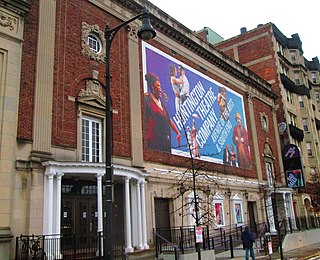
The Huntington Theatre Company is a professional theatre located in Boston, Massachusetts and the recipient of the 2013 Regional Theatre Tony Award, under the direction of Managing Director Michael Maso. It is notable for its longstanding artistic relationship with African-American playwright August Wilson.

Wikipedia: Huntington Theatre Company (EN)

1941 meters / 23 minutes

Sight 18: Dearborn School

Show sight on map

The Dearborn School is an historic school building at 25 Ambrose Street in the Roxbury neighborhood of Boston, Massachusetts. The three-story brick Beaux Arts school was designed by Roxbury native Edwin James Lewis Jr., and built in 1905. It is the only building to survive a c. 1950 urban redevelopment of the area. It was named in honor of Boston mayor Henry A. S. Dearborn. It served as an elementary or middle school until the 1980s, and has since been converted into housing.

Wikipedia: Dearborn School (EN)

1293 meters / 16 minutes

Sight 19: Roxbury Heritage State Park

Show sight on map

Roxbury Heritage State Park is a history-themed heritage park in the oldest part of Roxbury, a former town annexed in 1868 by Boston, Massachusetts. It is anchored by the Dillaway–Thomas House, a large colonial structure built in 1750 and thought to be the oldest surviving house in Roxbury. The location includes an adjacent 1-acre (0.40 ha) landscaped park with views of the Boston skyline, and is part of the Metropolitan Park System of Greater Boston.

Wikipedia: Roxbury Heritage State Park (EN), Website

Share

Spread the word! Share this page with your friends and family.

Disclaimer Please be aware of your surroundings and do not enter private property. We are not liable for any damages that occur during the tours.

GPX-Download For navigation apps and GPS devices you can download the tour as a GPX file.