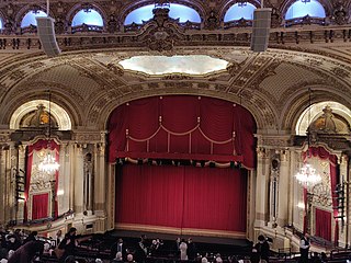
Self-guided Sightseeing Tour #2 in Boston, United States
Legend
Tour Facts
5.8 km
233 m
Experience Boston in United States in a whole new way with our free self-guided sightseeing tour. This site not only offers you practical information and insider tips, but also a rich variety of activities and sights you shouldn't miss. Whether you love art and culture, want to explore historical sites or simply want to experience the vibrant atmosphere of a lively city - you'll find everything you need for your personal adventure here.
Activities in BostonIndividual Sights in BostonSight 1: New England Aquarium
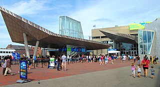
The New England Aquarium is a nonprofit organization located in Boston, Massachusetts. The species exhibited include harbor and northern fur seals, California sea lions, African and southern rockhopper penguins, giant Pacific octopuses, weedy seadragons, and thousands of saltwater and freshwater fishes. In addition to the main aquarium building, attractions at Central Wharf include the Simons Theatre and the New England Aquarium Whale Watch. More than 1.3 million guests visited the aquarium each year prior to the outbreak of the COVID-19 pandemic.
Sight 2: Flour and Grain Exchange Building
The Flour and Grain Exchange Building is a 19th-century office building in Boston. Located at 177 Milk Street in the Custom House District, at the edge of the Financial District near the waterfront, it is distinguished by the large black slate conical roof at its western end. It is referred to as the Grain Exchange Building and sometimes as the Boston Chamber of Commerce Building.
Sight 3: Boston Harbor Islands Welcome Center
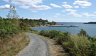
Boston Harbor Islands National and State Park is a combination national recreation area and state park situated among the islands of Boston Harbor. The park is made up of 34 islands and peninsulas and is managed by the Boston Harbor Islands Partnership. Twenty-one of the islands are also included in the Boston Harbor Islands Archeological District.
Wikipedia: Boston Harbor Islands National Recreation Area (EN), Website, Twitter, Facebook, Instagram, Youtube
Sight 4: Christopher Columbus Waterfront Park
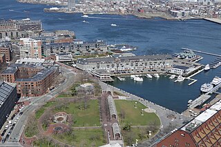
Get Ticket*The Christopher Columbus Waterfront Park is a public park in the Boston's North End. It is considered the start of the Boston Irish heritage trail.
Wikipedia: Christopher Columbus Waterfront Park (EN), Website, Facebook
Sight 5: Quincy Market
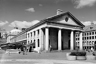
Get Ticket*Quincy Market is a historic building near Faneuil Hall in downtown Boston, Massachusetts. It was constructed between 1824 and 1826 and named in honor of mayor Josiah Quincy, who organized its construction without any tax or debt. The market is a designated National Historic Landmark and a designated Boston Landmark in 1996, significant as one of the largest market complexes built in the United States in the first half of the 19th century. According to the National Park Service, some of Boston's early slave auctions took place near what is now Quincy Market.
Sight 6: Boston Stone
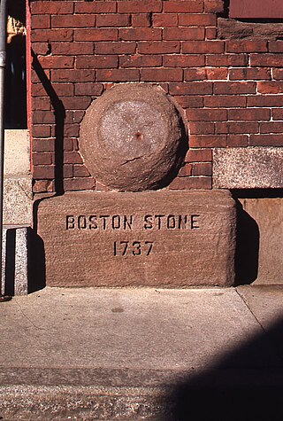
The Boston Stone is a stone in Boston, Massachusetts. It is near the Freedom Trail and is a minor tourist attraction.
Sight 7: New England Holocaust Memorial
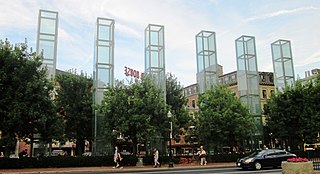
The New England Holocaust Memorial in Boston, Massachusetts, is dedicated to the Jewish people who were murdered by Nazi Germany during the Holocaust.
Sight 8: Faneuil Hall
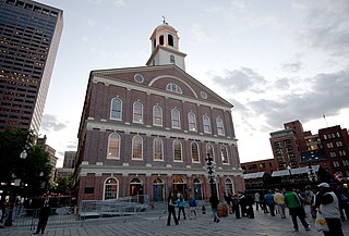
Faneuil Hall is a marketplace and meeting hall located near the waterfront and today's Government Center, in Boston, Massachusetts. Opened in 1742, it was the site of several speeches by Samuel Adams, James Otis, and others encouraging independence from Great Britain. It is now part of Boston National Historical Park and a well-known stop on the Freedom Trail. It is sometimes referred to as "the Cradle of Liberty", though the building and location have ties to slavery.
Sight 9: Ancient and Honorable Artillery Company Museum
The Ancient and Honorable Artillery Company of Massachusetts is the oldest chartered military organization in North America and the third oldest chartered military organization in the world. A volunteer militia of the Commonwealth of Massachusetts, it is not part of the U.S. Armed Forces, but includes veterans and serving military members within its ranks.
Wikipedia: Ancient and Honorable Artillery Company of Massachusetts (EN), Website
Sight 10: Boston National Historical Park
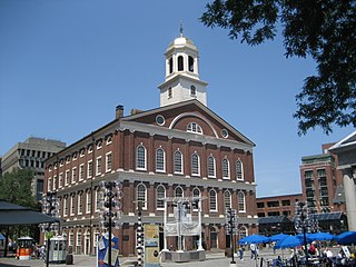
The Boston National Historical Park is an association of sites that showcase Boston's role in the American Revolution and other parts of history. It was designated a national park on October 1, 1974. Seven of the eight sites are connected by the Freedom Trail, a walking tour of downtown Boston. All eight properties are National Historic Landmarks.
Sight 11: Samuel Adams
Get Ticket*
Sight 12: Bill Russell
Get Ticket*A statue of former professional basketball player Bill Russell by Ann Hirsch is installed outside Boston's City Hall, in the U.S. state of Massachusetts. The bronze sculpture was unveiled in 2013, and subsequent statues have been added to the memorial.
Sight 13: Sears' Crescent and Sears' Block Building
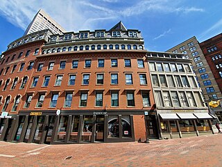
Sears' Crescent and Sears' Block are a pair of adjacent historic buildings located along Cornhill in Boston, Massachusetts. It is adjacent to City Hall and City Hall Plaza, Government Center, Boston.
Sight 14: Old City Hall
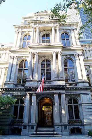
Get Ticket*Boston's Old City Hall was home to its city council from 1865 to 1969. It was one of the first buildings in the French Second Empire style to be built in the United States. After the building's completion, the Second Empire style was used extensively elsewhere in Boston and for many public buildings in the United States, including the Eisenhower Executive Office Building in Washington, D.C., Providence City Hall in Providence, Baltimore City Hall in Baltimore, and Philadelphia City Hall in Philadelphia. The building's architects were Gridley James Fox Bryant and Arthur Gilman.
Sight 15: Codman Building
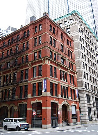
The Codman Building is a historic building at 55 Kilby Street in Boston, Massachusetts. The first four stories of this six-story brick and stone building were designed by Sturgis & Brigham and built in 1874 in the Gothic Revival style. It is the only one of the firm's commercial designs in the Financial District to survive. The upper three floors, in a more typical Late Victorian fashion, were added sometime before 1898.
Sight 16: Norman B. Leventhal Park
Get Ticket*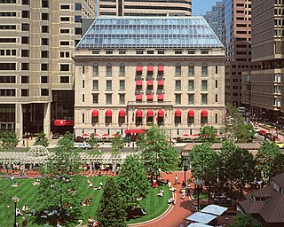
Post Office Square in Boston, Massachusetts, is a square located in the financial district at the intersection of Milk, Congress, Pearl and Water Streets. It was named in 1874 after the United States Post Office and Sub-Treasury which fronted it, now replaced by the John W. McCormack Post Office and Courthouse.
Sight 17: 5 Post Office Square
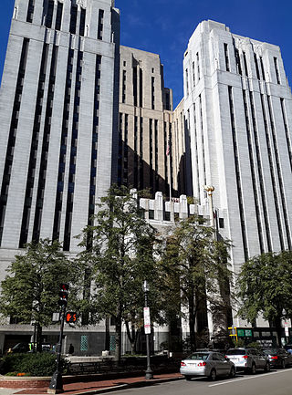
The John W. McCormack Post Office and Courthouse, formerly the United States Post Office, Courthouse, and Federal Building, is a historic building at 5 Post Office Square in Boston, Massachusetts. The twenty-two-story, 331-foot (101 m) skyscraper was built between 1931 and 1933 to house federal courts, offices, and post office facilities. The Art Deco and Moderne structure was designed in a collaboration between the Supervising Architect of the United States Treasury Department and the Boston architectural firm of Cram and Ferguson. It occupies a city block bounded by Congress, Devonshire, Water, and Milk Streets, and has over 600,000 square feet (56,000 m2) of floor space. The exterior of the building is faced in granite from a variety of New England sources, as well as Indiana limestone. It was built on the site of the 1885 United States Post Office and Sub-Treasury Building.
Wikipedia: John W. McCormack Post Office and Courthouse (EN)
Sight 18: Old South Meeting Place
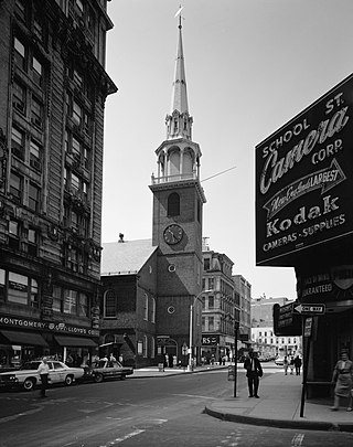
The Old South Meeting House is a historic Congregational church building located at the corner of Milk and Washington Streets in the Downtown Crossing area of Boston, Massachusetts, built in 1729. It gained fame as the organizing point for the Boston Tea Party on December 16, 1773. Five thousand or more colonists gathered at the Meeting House, the largest building in Boston at the time.
Sight 19: Kings Chapel
Get Ticket*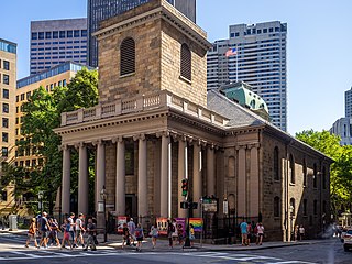
King's Chapel is an American independent Christian unitarian congregation affiliated with the Unitarian Universalist Association that is "unitarian Christian in theology, Anglican in worship, and congregational in governance." It is housed in what was for a time after the Revolution called the "Stone Chapel", an 18th-century structure at the corner of Tremont Street and School Street in Boston, Massachusetts. The chapel building, completed in 1754, is one of the finest designs of the noted colonial architect Peter Harrison, and was designated a National Historic Landmark in 1960 for its architectural significance. The congregation has worshipped according to a Unitarian version of the Book of Common Prayer since 1785, currently in its ninth edition.
Sight 20: Granary Burying Ground
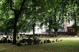
Get Ticket*The Granary Burying Ground in Massachusetts is the city of Boston's third-oldest cemetery, founded in 1660 and located on Tremont Street. It is the burial location of Revolutionary War-era patriots, including Paul Revere, the five victims of the Boston Massacre, and three signers of the Declaration of Independence: Samuel Adams, John Hancock, and Robert Treat Paine. The cemetery has 2,345 grave-markers, but historians estimate that as many as 5,000 people are buried in it. The cemetery is adjacent to Park Street Church, behind the Boston Athenæum and immediately across from Suffolk University Law School. It is a site on Boston's Freedom Trail. The cemetery's Egyptian revival gate and fence were designed by architect Isaiah Rogers (1800–1869), who designed an identical gate for Newport's Touro Cemetery.
Sight 21: Park Street Church
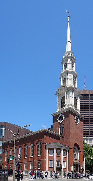
Get Ticket*Park Street Congregational Church, founded in 1809, is a historic and active evangelical congregational church in Downtown Boston, Massachusetts, United States. The Park Street Church is a member of the Conservative Congregational Christian Conference. Church membership records are private, but the congregation has over 1,200 members. The church is located at 1 Park Street, at the corner of Tremont Street.
Sight 22: Horace Mann
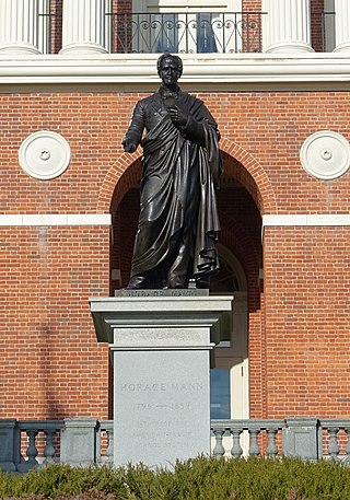
A statue of Horace Mann by Emma Stebbins is installed outside the Massachusetts State House, in Boston, Massachusetts, United States.
Sight 23: Henry Cabot Lodge
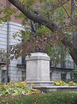
A statue of Henry Cabot Lodge by Raymond Averill Porter is installed outside the Massachusetts State House, in Boston, Massachusetts, United States.
Sight 24: Soldiers and Sailors Monument
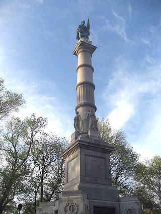
The Soldiers and Sailors Monument is a monument erected in Boston Common in downtown Boston, dedicated to soldiers and sailors of the Commonwealth of Massachusetts who died in the American Civil War. Designed by Martin Milmore, construction began in 1874 and the monument was dedicated on September 17, 1877. Union Generals George B. McClellan and Joseph Hooker were among the estimated 25,000 people attending the dedication on Boston Common.
Sight 25: Parkman Bandstand
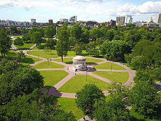
The Parkman Bandstand is a landmark bandstand located on the eastern side of the Boston Common in Boston, Massachusetts, United States. It was built in 1912 from a design by Derby, Robinson & Shephard at a cost of $1 million on the site of the Cow Pond, which had been filled in 1838 after cattle-grazing had been outlawed on the Common.
Sight 26: The Embrace
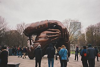
The Embrace is a bronze sculpture by Hank Willis Thomas, installed on Boston Common in Boston, Massachusetts, United States, in December 2022. The artwork commemorates Martin Luther King Jr. and Coretta Scott King, and depicts four intertwined arms, representing the hug they shared after he was awarded the Nobel Peace Prize in 1964. The work was created by welding together about 609 smaller pieces. The sculpture has received largely negative responses from critics and the public.
Sight 27: Victory
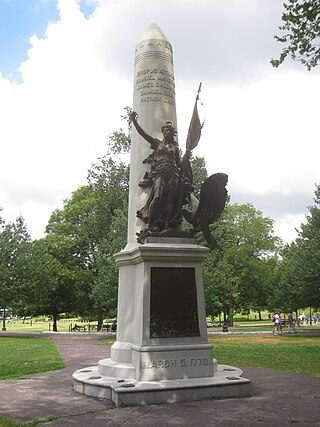
The Boston Massacre Monument, also known as the Crispus Attucks Monument and Victory, is an outdoor bronze memorial by Adolph Robert Kraus, installed in Boston Common, in Boston, Massachusetts, United States.
Sight 28: Declaration of Independence Tablet
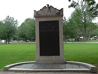
Declaration of Independence Tablet is a 1925 sculpture by John Francis Paramino, installed at Boston Common, in Boston, Massachusetts, United States.
Sight 29: Brewer Fountain
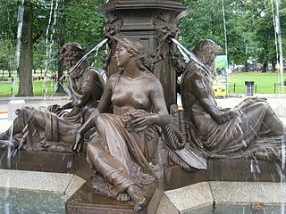
Brewer Fountain is a 1868 bronze sculpture by Michel Joseph Napoléon Liénard. It stands near the corner of Park and Tremont Streets in Boston, Massachusetts, by Park Street Station.
Sight 30: Boston Opera House
The Boston Opera House, also known as the Citizens Bank Opera House, is a performing arts and esports venue located at 539 Washington St. in Boston, Massachusetts. It was originally built as the B.F. Keith Memorial Theatre, a movie palace in the Keith-Albee chain. The chain became part of RKO when it was established just before the theater opened on October 29, 1928, and it was also known as the RKO Keith's Theater. After operating for more than 50 years as a movie theater, it was rededicated in 1980 as a home for the Opera Company of Boston, which performed there until the opera company closed down in 1990 due to financial problems. The theater was reopened in 2004 after a major restoration, and it currently serves as the home of the Boston Ballet and also hosts touring Broadway shows.
Share
How likely are you to recommend us?
Disclaimer Please be aware of your surroundings and do not enter private property. We are not liable for any damages that occur during the tours.
GPX-Download For navigation apps and GPS devices you can download the tour as a GPX file.

