Free Walking Sightseeing Tour #7 in Westminster, United Kingdom
Legend
Tour Facts
15.6 km
239 m
Explore Westminster in United Kingdom with this free self-guided walking tour. The map shows the route of the tour. Below is a list of attractions, including their details.
Activities in WestminsterIndividual Sights in WestminsterSight 1: Statue of Edward Jenner

A statue of Edward Jenner, the physician, scientist and pioneer of the world's first vaccine, is located in Kensington Gardens in London. A work of the sculptor William Calder Marshall, the bronze was originally unveiled by Albert, Prince Consort in Trafalgar Square on 17 May 1858, before being moved to its present location in 1862. It is a Grade II listed building.
Sight 2: Marble Arch

The Marble Arch is a 19th-century white marble-faced triumphal arch in London, England. The structure was designed by John Nash in 1827 as the state entrance to the cour d'honneur of Buckingham Palace; it stood near the site of what is today the three-bayed, central projection of the palace containing the well-known balcony. In 1851, on the initiative of architect and urban planner Decimus Burton, a one-time pupil of John Nash, the arch was relocated to its current site, near the northeast corner of Hyde Park, so that expansion of Buckingham Palace could proceed.
Sight 3: The Church of the Annunciation

The Church of the Annunciation, Marble Arch, is a Church of England parish church in the Marble Arch district of London, England. It is dedicated to the Annunciation to the Blessed Virgin Mary. It is a Gothic revival building designed by Sir Walter Tapper and built in 1912–1913. It is a Grade II* listed building.
Wikipedia: Church of the Annunciation, Marble Arch (EN), Website, Heritage Website
Sight 4: Grosvenor Square

Grosvenor Square is a large garden square in the Mayfair district of Westminster, Greater London. It is the centrepiece of the Mayfair property of the Duke of Westminster, and takes its name from the duke's surname "Grosvenor". It was developed for fashionable residences in the 18th century. In the 20th it had an American and Canadian diplomatic presence, and currently is mixed use, commercial.
Sight 5: Gielgud Theatre

The Gielgud Theatre is a West End theatre, located on Shaftesbury Avenue, at the corner of Rupert Street, in the City of Westminster, London. The house currently has 986 seats on three levels.
Sight 6: Sondheim Theatre

The Sondheim Theatre is a West End theatre located in Shaftesbury Avenue on the corner of Wardour Street in the City of Westminster, London. It opened as the Queen's Theatre on 8 October 1907, as a twin to the neighbouring Hicks Theatre which had opened ten months earlier. Both theatres were designed by W. G. R. Sprague. The theatre was Grade II listed by English Heritage in June 1972.
Sight 7: St Anne's Church Grounds
St Anne's Churchyard, also known as St Anne's Gardens, is a public park on Wardour Street in Soho, London. Formerly the churchyard of St Anne's, Soho, it was closed to burials in 1853 by Act of Parliament.
Sight 8: St Anne's Church

St Anne's Church serves in the Church of England the Soho section of London. It was consecrated on 21 March 1686 by Bishop Henry Compton as the parish church of the new civil and ecclesiastical parish of St Anne Within the Liberty of Westminster, created from part of the parish of St Martin in the Fields. The church is under the Deanery of Westminster in the Diocese of London.
Sight 9: Broad Street Pump

The Broad Street cholera outbreak was a severe outbreak of cholera that occurred in 1854 near Broad Street in Soho, London, England, and occurred during the 1846–1860 cholera pandemic happening worldwide. This outbreak, which killed 616 people, is best known for the physician John Snow's study of its causes and his hypothesis that germ-contaminated water was the source of cholera, rather than particles in the air. This discovery came to influence public health and the construction of improved sanitation facilities beginning in the mid-19th century. Later, the term "focus of infection" started to be used to describe sites, such as the Broad Street pump, in which conditions are favourable for transmission of an infection. Snow's endeavour to find the cause of the transmission of cholera caused him to unknowingly create a double-blind experiment.
Sight 10: London Palladium

The London Palladium is a Grade II* West End theatre located on Argyll Street, London, in Soho. The auditorium holds 2,286 people. Hundreds of stars have played there, many with televised performances. Between 1955 and 1969 Sunday Night at the London Palladium was staged at the venue, produced for the ITV network. The show included a performance by the Beatles on 13 October 1963. One national paper's headlines in the following days coined the term "Beatlemania" to describe the increasingly hysterical interest in the band.
Sight 11: Cavendish Square

Cavendish Square is a public garden square in Marylebone in the West End of London. It has a double-helix underground commercial car park. Its northern road forms ends of four streets: of Wigmore Street that runs to Portman Square in the much larger Portman Estate to the west; of Harley Street which runs an alike distance; of Chandos Street which runs for one block and; of Cavendish Place which runs the same. The south side itself is modern: the rear façade and accesses to a flagship department store and office block. On the ground floors facing are Comptoir Libanais, Royal Bank of Scotland and Pret a Manger premises.
Sight 12: Chandos House

Chandos House is a Grade I listed building at N° 2 Queen Anne Street, Marylebone, in central London. It was designed by Robert Adam, the most prominent architect in Georgian Britain, and built by William Adam and Company. It is seen as the first of a series of large townhouses in London, including 20 St. James's Square and Derby House.
Sight 13: Gordon Square

Gordon Square is a public park square in Bloomsbury, London, England. It is part of the Bedford Estate and was designed as one of a pair with the nearby Tavistock Square. It is owned by the University of London.
Sight 14: Woburn Square

Woburn Square is the smallest of the Bloomsbury squares and owned by the University of London. Designed by Thomas Cubitt and built between 1829 and 1847, it is named after Woburn Abbey, the main country seat of the Dukes of Bedford, who developed much of Bloomsbury.
Sight 15: Tavistock Square

Tavistock Square is a public square in Bloomsbury, in the London Borough of Camden near Euston Station.
Sight 16: Holy Cross Church

Holy Cross Church is a church on Cromer Street in the St Pancras area of the London Borough of Camden. It was built 1887–88 by Joseph Peacock.
Wikipedia: Holy Cross Church, St Pancras (EN), Website, Heritage Website
Sight 17: The Cochrane Theatre

The Cochrane Theatre, previously known as the Jeanetta Cochrane Theatre, was a receiving and producing theatre situated in Holborn, London, that opened in 1964. It is now used for television filming.
Sight 18: Islington Museum
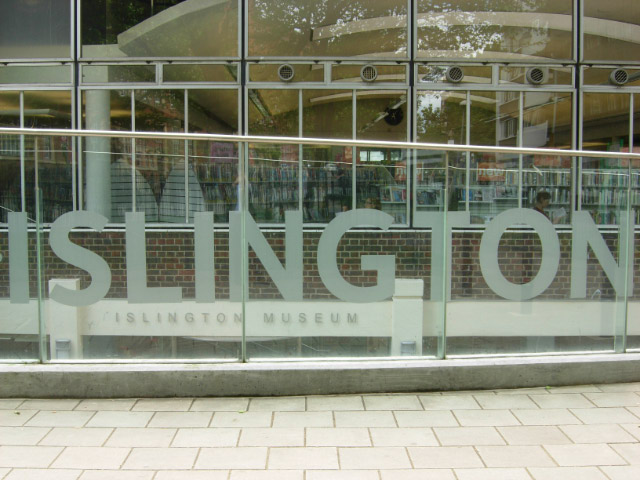
Islington Museum is a public museum dedicated to the history of the London Borough of Islington. It opened in 2008 and covers various themes on local and social history.
Sight 19: Saint John the Baptist Church, Hoxton

The Church of St. John the Baptist, Hoxton, usually known as St. John's Hoxton, is an Anglican parish church in the Hoxton area of Hackney, London N1.
Wikipedia: St John the Baptist, Hoxton (EN), Website, Heritage Website
Sight 20: Haggerston Park

Haggerston Park is an open space in Haggerston, in the London Borough of Hackney. It is bounded by Whiston Road, Hackney Road (south) and St Saviour's Priory, Queensbridge Road (west) and Goldsmith's Row (east).
Share
Disclaimer Please be aware of your surroundings and do not enter private property. We are not liable for any damages that occur during the tours.
GPX-Download For navigation apps and GPS devices you can download the tour as a GPX file.