70 Sights in Westminster, United Kingdom (with Map and Images)
Legend
Explore interesting sights in Westminster, United Kingdom. Click on a marker on the map to view details about it. Underneath is an overview of the sights with images. A total of 70 sights are available in Westminster, United Kingdom.
Sightseeing Tours in WestminsterActivities in Westminster
The London Eye, or the Millennium Wheel, is a cantilevered observation wheel on the South Bank of the River Thames in London. It is Europe's tallest cantilevered observation wheel, and the most popular paid tourist attraction in the United Kingdom with over three million visitors annually. It has made many appearances in popular culture.

Hyde Park is a 350 acres (140 ha), historic Grade I-listed urban park in Westminster, Greater London. A Royal Park, it is the largest of the parks and green spaces that form a chain from Kensington Palace through Kensington Gardens and Hyde Park, via Hyde Park Corner and Green Park, past Buckingham Palace to St James's Park. Hyde Park is divided by the Serpentine and the Long Water lakes.

Primrose Hill is a Grade II listed public park located north of Regent's Park in London, England, first opened to the public in 1842. It was named after the 64 metres (210 ft) natural hill in the centre of the park, the second highest natural point in the London Borough of Camden. The hill summit has a clear view of central London, as well as Hampstead and Belsize Park to the north and is adorned by an engraved quotation from William Blake. Based on the popularity of the park, the surrounding district and electoral ward were named Primrose Hill. The Primrose Hill district is in the London Borough of Camden, England.
4. Wellington Arch

The Wellington Arch, also known as the Constitution Arch or (originally) as the Green Park Arch, is a Grade I-listed triumphal arch by Decimus Burton that forms a centrepiece of Hyde Park Corner in central London, between the corner where Hyde Park meets Green Park. The Arch stands on a large green-space traffic island with crossings for pedestrian access. From its construction (1826–1830) the arch stood in a nearby location, slightly to the east, directly across from Burton's Ionic screen entrance to Hyde Park; it was moved a short distance to its current site at the top of the Constitution Hill road in 1882–1883. The triumphal arch originally supported a colossal equestrian statue of the 1st Duke of Wellington by the sculptor Matthew Cotes Wyatt, acquiring its name as a result. Peace descending on the Quadriga of War by sculptor Adrian Jones, a bronze of the Goddess of Victory Nike riding a quadriga, has surmounted the arch since 1912.
5. Saatchi Gallery

The Saatchi Gallery is a London gallery for contemporary art and an independent charity opened by Charles Saatchi in 1985. Exhibitions which drew upon the collection of Charles Saatchi, starting with US artists and minimalism, moving to the Damien Hirst-led Young British Artists, followed by shows purely of painting, led to Saatchi Gallery becoming a recognised authority in contemporary art globally. It has occupied different premises, first in North London, then the South Bank by the River Thames, and finally in Chelsea, Duke of York's HQ, its current location. In 2019 Saatchi Gallery became a registered charity and began a new chapter in its history. Recent exhibitions include the major solo exhibition of the artist JR, JR: Chronicles, and London Grads Now in September 2019 lending the gallery spaces to graduates from leading fine art schools who experienced the cancellation of physical degree shows due to the pandemic.
6. Dean's Yard

Dean's Yard, Westminster, comprises most of the remaining precincts of the historically greater scope of the monastery or abbey of Westminster, not occupied by its buildings. It is known to members of Westminster School as Green. It is a large gated quadrangle, closed to public traffic, chiefly a green upon which the pupils have the long-use acquired exclusive rights to sit, read and to play games such as football. For some centuries until a point in the early seventeenth century it was a third of its present size, since to the south stood the Queen's Scholars' dormitory, which was in monastic times the granary. Its stones support Church House.Adjoining buildingsEast: school buildings South: Church House, a conference centre and offices of the Church of England West: school buildings and Westminster Abbey Choir School North: flanking archway to the Great Sanctuary: Abbey offices and part of the Deanery.
7. Broad Street Pump

The Broad Street cholera outbreak was a severe outbreak of cholera that occurred in 1854 near Broad Street in Soho, London, England, and occurred during the 1846–1860 cholera pandemic happening worldwide. This outbreak, which killed 616 people, is best known for the physician John Snow's study of its causes and his hypothesis that germ-contaminated water was the source of cholera, rather than particles in the air. This discovery came to influence public health and the construction of improved sanitation facilities beginning in the mid-19th century. Later, the term "focus of infection" started to be used to describe sites, such as the Broad Street pump, in which conditions are favourable for transmission of an infection. Snow's endeavour to find the cause of the transmission of cholera caused him to unknowingly create a double-blind experiment.
8. Chelsea Physic Garden

The Chelsea Physic Garden was established as the Apothecaries' Garden in London, England, in 1673 by the Worshipful Society of Apothecaries to grow plants to be used as medicines. This four acre physic garden, the term here referring to the science of healing, is among the oldest botanical gardens in Britain, after the University of Oxford Botanic Garden. Its rock garden is the oldest in Europe devoted to alpine plants and Mediterranean plants. The largest fruiting olive tree in Britain is there, protected by the garden's heat-trapping high brick walls, along with what is doubtless the world's northernmost grapefruit growing outdoors. Jealously guarded during the tenure of the Worshipful Society of Apothecaries, the garden became a registered charity in 1983 and was opened to the general public for the first time.
9. Eaton Square
Eaton Square is a rectangular, residential garden square in London's Belgravia district. It is the largest square in London. It is one of the three squares built by the landowning Grosvenor family when they developed the main part of Belgravia in the 19th century that are named after places in Cheshire — in this case Eaton Hall, the Grosvenor country house. It is larger but less grand than the central feature of the district, Belgrave Square, and both larger and grander than Chester Square. The first block was laid out by Thomas Cubitt from 1827. In 2016 it was named as the "Most Expensive Place to Buy Property in Britain", with a full terraced house costing on average £17 million — many of such town houses have been converted, within the same, protected structures, into upmarket apartments.
10. Tate Britain

Tate Britain, known from 1897 to 1932 as the National Gallery of British Art and from 1932 to 2000 as the Tate Gallery, is an art museum on Millbank in the City of Westminster in London, England. It is part of the Tate network of galleries in England, with Tate Modern, Tate Liverpool and Tate St Ives. It houses a substantial collection of the art of the United Kingdom since Tudor times, and in particular has large holdings of the works of J. M. W. Turner, who bequeathed all his own collection to the nation. It is one of the largest museums in the country. The museum had 525,144 visitors in 2021, an increase of 34 percent from 2020 but still well below pre- COVID-19 pandemic levels. In 2021 it ranked 50th on the list of most-visited art museums in the world.
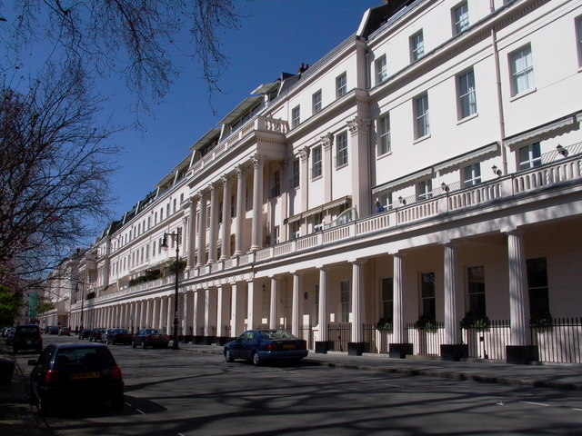
11. Belgrave Square
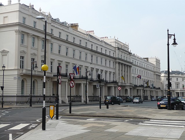
Belgrave Square is a large 19th-century garden square in London. It is the centrepiece of Belgravia, and its architecture resembles the original scheme of property contractor Thomas Cubitt who engaged George Basevi for all of the terraces for the 2nd Earl Grosvenor, later the 1st Marquess of Westminster, in the 1820s. Most of the houses were occupied by 1840. The square takes its name from one of the Duke of Westminster's subsidiary titles, Viscount Belgrave. The village and former manor house of Belgrave, Cheshire, were among the rural landholdings associated with the main home and gardens of the senior branch of the family, Eaton Hall. Today, many embassies occupy buildings on all four sides.
12. The Mall

The Mall is a ceremonial route and roadway in the City of Westminster, central London, that travels 1 kilometre (0.62 mi) between Buckingham Palace at its western end and Trafalgar Square via Admiralty Arch to the east. Along the north side of The Mall is green space and St. James's Palace with other official buildings, and to the south is St James's Park. Near the east end at Trafalgar Square and Whitehall it is met by Horse Guards Road and Spring Gardens, near the west end at the Victoria Memorial it is met by the Constitution Hill roadway and the Spur Road to the street of Buckingham Gate. It is closed to traffic on Saturdays, Sundays, public holidays and on ceremonial occasions.
13. Cavendish Square

Cavendish Square is a public garden square in Marylebone in the West End of London. It has a double-helix underground commercial car park. Its northern road forms ends of four streets: of Wigmore Street that runs to Portman Square in the much larger Portman Estate to the west; of Harley Street which runs an alike distance; of Chandos Street which runs for one block and; of Cavendish Place which runs the same. The south side itself is modern: the rear façade and accesses to a flagship department store and office block. On the ground floors facing are Comptoir Libanais, Royal Bank of Scotland and Pret a Manger premises.
14. Carlyle's House

Carlyle's House, in Cheyne Row, Chelsea, central London, was the home of the Scottish essayist, historian and philosopher Thomas Carlyle and his wife Jane from 1834 until his death. The home of these writers was purchased by public subscription and placed in the care of the Carlyle's House Memorial Trust in 1895. They opened the house to the public and maintained it until 1936, when control of the property was assumed by the National Trust, inspired by co-founder Octavia Hill's earlier pledge of support for the house. It became a Grade II listed building in 1954 and is open to the public as a historic house museum.
15. St James's Square Gardens

St James's Square is the only square in the St James's district of the City of Westminster and is a garden square. It has predominantly Georgian and Neo-Georgian architecture. For its first two hundred or so years it was one of the three or four most fashionable residential streets in London. It now has headquarters of a number of well-known businesses, including BP and Rio Tinto Group; four private members' clubs, the East India Club, the Naval and Military Club, the Canning Club, and the Army and Navy Club; the High Commission of Cyprus; the London Library; and global think tank and peace-promoter Chatham House.
16. Fleet Air Arm Memorial

The Fleet Air Arm Memorial, sometimes known as Daedalus, is a war memorial in London, commemorating the service of the Royal Naval Air Service and the Fleet Air Arm from their establishments in 1914 and 1924 respectively, in the First World War, the Second World War, the Korean War, the Falklands War and the Gulf War, including over 6,000 killed in all conflicts. The service of the Fleet Air Arm is also commemorated at the National Memorial Arboretum in Staffordshire, at the former base of the Fleet Air Arm at HMS Daedalus in Lee-on-the-Solent, and at the Church of St Bartholomew, Yeovilton.
17. Marble Arch

The Marble Arch is a 19th-century white marble-faced triumphal arch in London, England. The structure was designed by John Nash in 1827 as the state entrance to the cour d'honneur of Buckingham Palace; it stood near the site of what is today the three-bayed, central projection of the palace containing the well-known balcony. In 1851, on the initiative of architect and urban planner Decimus Burton, a one-time pupil of John Nash, the arch was relocated to its current site, near the northeast corner of Hyde Park, so that expansion of Buckingham Palace could proceed.
18. Memorial to the Siege of Cádiz

The Cádiz Memorial, also known as the "Prince Regent's Bomb", is an early 19th-century French mortar mounted on a brass monster, located in Horse Guards Parade in Westminster, London. It was first "exposed to public view" on 12 August 1816 and has been classified as a Grade II listed building since 1 December 1987. The monument was a feature of many satirical verses and cartoons in the early 19th century, mainly because the word "bomb" – pronounced "bum" – gave it an immediate association with the notoriously profligate Prince Regent's sizeable backside.
19. Saint James The Less

St James the Less is a Church of England parish church in Pimlico, Westminster, built in 1858–61 by George Edmund Street in the Gothic Revival style. A Grade I listed building, it has been described as "one of the finest Gothic Revival churches anywhere". The church was constructed predominantly in brick with embellishments from other types of stone. Its most prominent external feature is its free-standing Italian-style tower, while its interior incorporates design themes which Street observed in medieval Gothic buildings in continental Europe.
Wikipedia: St James the Less, Pimlico (EN), Heritage Website
20. Chelsea Old Church

Chelsea Old Church, also known as All Saints, is an Anglican church, on Old Church Street, Chelsea, London SW3, England, near Albert Bridge. It is the church for a parish in the Diocese of London, part of the Church of England. Inside the Grade I listed building, there is seating for 400 people. There is a memorial plaque to the author Henry James (1843–1916) who lived nearby on Cheyne Walk, and was buried in Cambridge, Massachusetts. To the west of the church is a small public garden containing a sculpture by Sir Jacob Epstein.
Wikipedia: Chelsea Old Church (EN), Website, Heritage Website
21. Holy Trinity Church

The Church of the Holy and Undivided Trinity with Saint Jude, Upper Chelsea, commonly called Holy Trinity Sloane Street or Holy Trinity Sloane Square, is a Church of England parish church in London, England. It was built in 1888–90 at the south-eastern side of Sloane Street, to a striking Arts and Crafts design, by the architect John Dando Sedding, and paid for by 5th Earl Cadogan, in whose London estate it lay. It replaced an earlier building only half its size which, at the time of its demolition, was less than 60 years old.
Wikipedia: Holy Trinity, Sloane Street (EN), Website, Heritage Website
22. Embassy of Saudi Arabia

The Embassy of Saudi Arabia in London is the diplomatic mission of Saudi Arabia in the United Kingdom. Saudi Arabia also maintains a Defence Attaché's Office at 26 Queen's Gate, South Kensington, a Diplomatic Office of the Cultural Bureau at 630 Chiswick High Road, Gunnersbury, a Medical Section at 60 Queen Anne Street, Marylebone, a Commercial Section at 15/16 Queen Street, Mayfair, an Islamic Affairs Section at 2nd Floor, Park Lorne, 111 Park Road, Lisson Grove, and an Information Section at 18 Seymour Street, Marylebone.
Wikipedia: Embassy of Saudi Arabia, London (EN), Heritage Website
23. London Palladium

The London Palladium is a Grade II* West End theatre located on Argyll Street, London, in Soho. The auditorium holds 2,286 people. Hundreds of stars have played there, many with televised performances. Between 1955 and 1969 Sunday Night at the London Palladium was staged at the venue, produced for the ITV network. The show included a performance by the Beatles on 13 October 1963. One national paper's headlines in the following days coined the term "Beatlemania" to describe the increasingly hysterical interest in the band.
24. Camden Market

The Camden markets are a number of adjoining large retail markets, often collectively referred to as Camden Market or Camden Lock, located in the historic former Pickfords stables, in Camden Town, London. It is situated north of the Hampstead Road Lock of the Regent's Canal. Famed for their cosmopolitan image, products sold on the stalls include crafts, clothing, bric-a-brac, and fast food. It is the fourth-most popular visitor attraction in London, attracting approximately 250,000 people each week.
25. Roundhouse

The Roundhouse is a performing arts and concert venue situated at the Grade II* listed former railway engine shed in Chalk Farm, London, England. The building was erected in 1846–1847 by the London & North Western Railway as a roundhouse, a circular building containing a railway turntable, but was used for that purpose for only about a decade. After being used as a warehouse for a number of years, the building fell into disuse just before World War II. It was first made a listed building in 1954.
26. Queen's Gallery

The King's Gallery, previously known as the Queen's Gallery, is a public art gallery at Buckingham Palace, the official residence of the British monarch, in London. First opened to the public in the reign of Elizabeth II in 1962, it exhibits works of art from the Royal Collection on a rotating basis. Enlarged in the early 21st century, the gallery has its own separate public access entrance built in a 'new' classical style and typically displays about 450 works, mainly paintings and drawings.
27. Hayward Gallery

The Hayward Gallery is an art gallery within the Southbank Centre in central London, England and part of an area of major arts venues on the South Bank of the River Thames. It is sited adjacent to the other Southbank Centre buildings and also the National Theatre and BFI Southbank repertory cinema. Following a rebranding of the South Bank Centre to Southbank Centre in early 2007, the Hayward Gallery was known as the Hayward until early 2011.
28. Chindit Memorial

The Chindit Memorial is a war memorial in London, England, that commemorates the Chindit special forces, which served in Burma under Major General Orde Wingate in the Second World War. The memorial was erected in Victoria Embankment Gardens in 1990, near the Ministry of Defence headquarters, and also commemorates Wingate, who died on active service in Burma in 1944. It became a Grade II listed building in August 2020.
29. Monument to the 2002 Bali bombings

The Bali Bombings Memorial is a permanent memorial in central London to victims of the 2002 bombings in Bali, Indonesia. It was designed by Gary Breeze and the carving was undertaken by Martin Cook and Gary Breeze. It was unveiled on 12 October 2006, the fourth anniversary of the bombings, by the Prince of Wales and the Duchess of Cornwall, at a ceremony attended by relatives and friends of the 28 British victims.
30. The Royal Hospital Chelsea

The Royal Hospital Chelsea is an Old Soldiers' retirement home and nursing home for some 300 veterans of the British Army. Founded as an almshouse, the ancient sense of the word "hospital", it is a 66-acre (27 ha) site located on Royal Hospital Road in Chelsea, London. It is an independent charity and relies partly upon donations to cover day-to-day running costs to provide care and accommodation for veterans.
31. Islamic Centre of England

The Islamic Centre of England Ltd (ICEL) is a religious and cultural building at 140 Maida Vale, London, whose mission is "to provide services to members of the Muslim community, in particular, and the wider community at large", focusing on religious guidance and cultural issues. It was founded in December 1995 and opened officially in November 1998. The premises are a former cinema that is a listed building.
32. Crocker's Folly

Crocker's Folly is a Grade II* listed public house at 24 Aberdeen Place, St John's Wood, London. It was built in 1898, in a Northern Renaissance style, and was previously called The Crown. Geoff Brandwood and Jane Jephcote's guide to heritage pubs in London describes it as "a truly magnificent pub-cum-hotel" with "superb fittings", including extensive use of marble. The architect was Charles Worley.
33. Grosvenor Square

Grosvenor Square is a large garden square in the Mayfair district of Westminster, Greater London. It is the centrepiece of the Mayfair property of the Duke of Westminster, and takes its name from the duke's surname "Grosvenor". It was developed for fashionable residences in the 18th century. In the 20th it had an American and Canadian diplomatic presence, and currently is mixed use, commercial.
34. College Green

College Green is a public park in the City of Westminster in Central London. It is east of Westminster Abbey including Westminster Abbey Gardens and across a road from the gardens of the Houses of Parliament. The gardens are not enclosed and are accessible at all times. For many months of 2019, during the Brexit deadlock, it exclusively hosted TV broadcasts and radio and media interviews.
35. Royal Court Theatre

The Royal Court Theatre, at different times known as the Court Theatre, the New Chelsea Theatre, and the Belgravia Theatre, is a non-commercial West End theatre in Sloane Square, London, England. In 1956 it was acquired by and remains the home of the English Stage Company, which is known for its contributions to contemporary theatre and won the Europe Prize Theatrical Realities in 1999.
36. Sondheim Theatre

The Sondheim Theatre is a West End theatre located in Shaftesbury Avenue on the corner of Wardour Street in the City of Westminster, London. It opened as the Queen's Theatre on 8 October 1907, as a twin to the neighbouring Hicks Theatre which had opened ten months earlier. Both theatres were designed by W. G. R. Sprague. The theatre was Grade II listed by English Heritage in June 1972.
37. The Royal Central School of Speech and Drama

The Royal Central School of Speech and Drama is a drama school founded by Elsie Fogerty in 1906, as The Central School of Speech Training and Dramatic Art, to offer a new form of training in speech and drama for young actors and other students. It became a constituent college of the University of London in 2005 and is a member of Conservatoires UK and the Federation of Drama Schools.
Wikipedia: Royal Central School of Speech and Drama (EN), Website, Url
38. Abbey Road Studios
Abbey Road Studios is a music recording studio at 3 Abbey Road, St John's Wood, City of Westminster, Greater London, England. It was established in November 1931 by the Gramophone Company, a predecessor of British music company EMI, which owned it until Universal Music Group (UMG) took control of part of it in 2013. It is ultimately owned by UMG subsidiary Virgin Records Limited.
39. St Anne's Church

St Anne's Church serves in the Church of England the Soho section of London. It was consecrated on 21 March 1686 by Bishop Henry Compton as the parish church of the new civil and ecclesiastical parish of St Anne Within the Liberty of Westminster, created from part of the parish of St Martin in the Fields. The church is under the Deanery of Westminster in the Diocese of London.
40. Paddington Recreation Ground

Paddington Recreation Ground is a park in Maida Vale, City of Westminster, just north of Paddington. Its 27-acre site is the largest area of parkland located entirely within the City of Westminster. It was the first park of its kind in London, having operated since 1888. Annually, it attracts over 1.5 million users, who visit the Recreation Ground for its green-space value.
41. St Gabriel's

St Gabriel's, Pimlico, is a Church of England, Anglo-Catholic parish church in Pimlico, London. It lies within the Deanery of Westminster within the Diocese of London. Designed by Thomas Cundy (junior), it was constructed between 1851 and 1853 as part of Thomas Cubitt's development of the area on behalf of the Marquess of Westminster. It is a Grade II* Listed Building.
Wikipedia: St Gabriel's Church, Pimlico (EN), Website, Facebook, Heritage Website
42. Statue of Edward Jenner

A statue of Edward Jenner, the physician, scientist and pioneer of the world's first vaccine, is located in Kensington Gardens in London. A work of the sculptor William Calder Marshall, the bronze was originally unveiled by Albert, Prince Consort in Trafalgar Square on 17 May 1858, before being moved to its present location in 1862. It is a Grade II listed building.
43. Simón Bolívar

An outdoor bronze sculpture depicting Venezuelan military and political leader Simón Bolívar (1783–1830), by Hugo Daini, is located at the south-east corner of Belgrave Square in London, United Kingdom. The statue was unveiled by James Callaghan, then Secretary of State for Foreign and Commonwealth Affairs, later Prime Minister of the United Kingdom, in 1974.
44. Royal Air Force Memorial

The Royal Air Force Memorial is a military memorial on the Victoria Embankment in central London, dedicated to the memory of the casualties of the Royal Air Force in World War I. Unveiled in 1923, it became a Grade II listed structure in 1958, and was upgraded to Grade II* in 2018. It is considered to be the official memorial of the RAF and related services.
45. National Liberal Club

The National Liberal Club (NLC) is a London private members' club, open to both men and women. It was established by William Ewart Gladstone in 1882 to provide club facilities for Liberal Party campaigners among the newly enlarged electorate following the Third Reform Act in 1884, and was envisioned as a more accessible version of a traditional London club.
Wikipedia: National Liberal Club (EN), Website, Heritage Website
46. National Army Museum
The National Army Museum is the British Army's central museum. It is located in the Chelsea district of central London, adjacent to the Royal Hospital Chelsea, the home of the "Chelsea Pensioners". The museum is a non-departmental public body. It is usually open to the public from 10:00 to 17:30, except on 25–26 December and 1 January. Admission is free.
47. St Barnabas

The Church of St Barnabas is a Church of England parish church in Pimlico, London. It is a Grade I listed building. The church is noted for its Anglo-Catholic tradition, and it "was the first church built in England where the ideals and beliefs of what came to be known as Anglo-Catholic movement were embodied in its architecture and liturgy".
Wikipedia: Church of St Barnabas, Pimlico (EN), Website, Heritage Website
48. Chandos House

Chandos House is a Grade I listed building at N° 2 Queen Anne Street, Marylebone, in central London. It was designed by Robert Adam, the most prominent architect in Georgian Britain, and built by William Adam and Company. It is seen as the first of a series of large townhouses in London, including 20 St. James's Square and Derby House.
49. Guy the Gorilla

Guy the Gorilla (1946–1978) was a western lowland gorilla who was London Zoo's most famous resident and often profiled on children's TV shows and natural history productions. The exact day of Guy's birth was unknown, but the official birthday was set by the Zoo as May 30, and he received large numbers of cards each year.
50. The Church of the Annunciation

The Church of the Annunciation, Marble Arch, is a Church of England parish church in the Marble Arch district of London, England. It is dedicated to the Annunciation to the Blessed Virgin Mary. It is a Gothic revival building designed by Sir Walter Tapper and built in 1912–1913. It is a Grade II* listed building.
Wikipedia: Church of the Annunciation, Marble Arch (EN), Website, Heritage Website
51. RHS Chelsea Flower Show Pavilion

The RHS Chelsea Flower Show, formally known as the Great Spring Show, is a garden show held for five days in May by the Royal Horticultural Society (RHS) in the grounds of the Royal Hospital Chelsea in Chelsea, London. Held at Chelsea since 1912, the show is attended by members of the British royal family.
52. St John's Wood

St John's Wood Church is a Church of England parish church in St John's Wood, London. The church is located on Lord's Roundabout, between Lord's Cricket Ground and Regent's Park, and has a Grade II* listing. The parish is in the Archdeaconry of Charing Cross, in the deanery of Westminster St Marylebone.
Wikipedia: St John's Wood Church (EN), Website, Heritage Website
53. St. Augustine's

Saint Augustine's, Kilburn, is a Church of England church in the area of Kilburn, in North London, England. Because of its large size and ornate architecture, it is sometimes affectionately referred to as "the Cathedral of North London", although the church is not a cathedral in any official sense.
Wikipedia: St Augustine's, Kilburn (EN), Website, Heritage Website
54. Saint Mary's

St Mary's, Cadogan Street, is a Grade II* listed Roman Catholic church in Cadogan Street, Chelsea, London. It was built between 1877 and 1879 by John Francis Bentley, most notable for his work as architect of Westminster Cathedral, and is one of the oldest Roman Catholic parishes in Central London.
Wikipedia: St Mary's, Cadogan Street (EN), Website, Url, Heritage Website
55. Ashburnham House, Library and Lecture Room

Ashburnham House is an extended seventeenth-century house on Little Dean's Yard in Westminster, London, United Kingdom, which since 1882 has been part of Westminster School. It is occasionally open to the public, when its staircase and first floor drawing-rooms in particular can be seen.
56. Thomas Carlyle

A statue of Thomas Carlyle by Joseph Edgar Boehm stands in Chelsea Embankment Gardens in London. Erected in 1881 and unveiled in 1882, it stands close to 24 Cheyne Row where Carlyle lived for the last 47 years of his life. The statue became a Grade II listed building on 15 April 1969.
57. Winnie the Bear

Winnipeg, or Winnie, was the name given to a female black bear that lived at London Zoo from 1915 until her death in 1934. Rescued by cavalry veterinarian Harry Colebourn, Winnie is best-remembered for inspiring the name of A. A. Milne and E. H. Shepard's character, Winnie-the-Pooh.
58. Cremorne Gardens

Cremorne Gardens were popular pleasure gardens by the side of the River Thames in Chelsea, London. They lay between Chelsea Harbour and the end of the King's Road and flourished between 1845 and 1877; today only a vestige survives, on the river at the southern end of Cheyne Walk.
59. Woburn Square

Woburn Square is the smallest of the Bloomsbury squares and owned by the University of London. Designed by Thomas Cubitt and built between 1829 and 1847, it is named after Woburn Abbey, the main country seat of the Dukes of Bedford, who developed much of Bloomsbury.
60. Nuffield Lodge

Nuffield Lodge is a house on Prince Albert Road, Regent's Park, London, England. It is Grade I listed. Both the house and its gardens fall within Regent's Park, which is Grade I listed on the Register of Historic Parks and Gardens. It is owned by the Sultan of Oman.
61. St Mary's Bourne Street

St Mary's, Bourne Street, is an Anglican church on Bourne Street near Sloane Square in London. It was built 'quickly and cheaply' in 1874 by Robert Jewell Withers, with the intention of providing ministry to the poor living in the nearby slums of Pimlico.
Wikipedia: St Mary's, Bourne Street (EN), Website, Heritage Website
62. Swiss Cottage Library

Swiss Cottage Library is a public library in the London Borough of Camden housed in an architectural landmark building on Avenue Road. Designed by Sir Basil Spence of Spence, Bonnington & Collins, it was built between 1963 and 1964.
63. St. Michael's Camden Town

St Michael's Church is the principal Anglican church for Camden Town in north London. The present building, built in the late 19th century, was designed by George Frederick Bodley and Thomas Garner in a Gothic Revival style.
Wikipedia: St Michael's Church, Camden Town (EN), Website, Url, Heritage Website
64. Battle of Britain Memorial

The Battle of Britain Monument in London is a sculpture on the Victoria Embankment, overlooking the River Thames, which commemorates the individuals who took part in the Battle of Britain during the Second World War.
65. Lock & Co
Lock & Co. Hatters is the world's oldest hat shop, the world's 34th oldest family-owned business and is a Royal warrant holder. Its shop is located at 6 St James's Street, London, and is a Grade II* listed building.
66. St Michael's Church

The Church of St Michael is a Church of England parish church on Chester Square in the Belgravia district of West London. It has been listed Grade II on the National Heritage List for England since February 1958.
Wikipedia: St Michael's Church, Chester Square (EN), Website, Heritage Website
67. Gordon Square

Gordon Square is a public park square in Bloomsbury, London, England. It is part of the Bedford Estate and was designed as one of a pair with the nearby Tavistock Square. It is owned by the University of London.
68. Haggerston Park

Haggerston Park is an open space in Haggerston, in the London Borough of Hackney. It is bounded by Whiston Road, Hackney Road (south) and St Saviour's Priory, Queensbridge Road (west) and Goldsmith's Row (east).
69. Florence Nightingale the 'Lady with the Lamp'

The statue of Florence Nightingale is an outdoor Grade II-listed sculpture in London, United Kingdom. It was sculpted in 1915 by Arthur George Walker, and is a subsidiary part of the Guards Crimean War Memorial.
70. Amy Winehouse Statue

A bronze statue of the British singer Amy Winehouse is located at the Stables Market in Camden Town, in north London. Sculpted by Scott Eaton, it was unveiled in 2014, three years after the singer's death.
Share
Disclaimer Please be aware of your surroundings and do not enter private property. We are not liable for any damages that occur during the tours.