Self-guided Sightseeing Tour #14 in Madrid, Spain
Legend
Guided Free Walking Tours
Book free guided walking tours in Madrid.
Guided Sightseeing Tours
Book guided sightseeing tours and activities in Madrid.
Tour Facts
6.5 km
132 m
Experience Madrid in Spain in a whole new way with our free self-guided sightseeing tour. This site not only offers you practical information and insider tips, but also a rich variety of activities and sights you shouldn't miss. Whether you love art and culture, want to explore historical sites or simply want to experience the vibrant atmosphere of a lively city - you'll find everything you need for your personal adventure here.
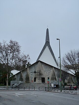
Activities in MadridIndividual Sights in MadridSight 1: Parroquia Virgen de Guadalupe
The Church of Our Lady of Guadalupe is a Catholic church in Spain located in the city of Madrid. It was the work of the architects Enrique de la Mora y Palomar and José Ramón Azpiazu, and José Antonio Torroja and Félix Candela. It has an octagonal floor plan inscribed in a circumference of a diameter of 53.74 m. The building's characteristics are the hyperbolic paraboloid of the roof and the extensive surface supported by only four interior pillars. The project of the formwork of the building by the Spanish-Mexican Félix Candela has been described as "masterful". Enrique de la Mora's work was the first by a Mexican architect in Spain.
Wikipedia: Iglesia de Nuestra Señora de Guadalupe (Madrid) (ES), Url
Sight 2: Berlin Park
Berlin Park is an urban park in the city of Madrid that is located in the Ciudad Jardín neighborhood, Chamartín district. With an area of 4.92 ha, it borders the streets of San Ernesto, Marcenado, Ramón y Cajal Avenue, and Doctor Marco Corera.
Sight 3: Pradillo
The Pradillo Theatre is a theatre located at 12 Pradillo Street, in the Prosperidad neighbourhood of the Chamartín district of Madrid. The theatre occupies an old SEUR premises that was acquired by members of the La Tartana Teatro Company. Under the joint direction of Juan Muñoz Rebollo and Carlos Marquerie, it was inaugurated on October 29, 1990 with the performance of "Los hombres de piedra" by Antonio Fernández Lera.
Sight 4: Parroquia de Santa Gemma Galgani
Gemma Umberta Maria Galgani, also known as Gemma of Lucca, was an Italian mystic, venerated as a saint in the Catholic Church since 1940. She has been called the "daughter of the Passion" because of her profound imitation of the Passion of Christ. She is especially venerated in the Congregation of the Passion of Jesus (Passionists).
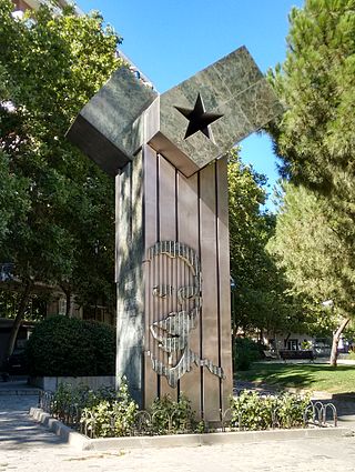
Sight 5: Monumento a José Martí
The Monument to José Martí is an instance of public art in Madrid, Spain. A gift from the Republic of Cuba to Madrid, the monument is dedicated to José Martí, a Cuban writer and activist noted for his struggle in favour of the independence from Spain.
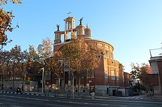
Sight 6: Parroquia de San Agustín
The Church of San Agustín is a Roman Catholic church located in Madrid, Spain.
Sight 7: Monumento a la Constitución
The monument to the 1978 Constitution is a sculptural work erected in Madrid in 1982 in tribute to the Spanish Constitution of 1978. It is located in the Jardines del Fine Artes, in front of the Museum of Natural Sciences, near the Plaza de San Juan La Cruz, at the confluence of Vitruvio Street and the Paseo de la Castellana.
Wikipedia: Monumento a la Constitución de 1978 de Madrid (ES)
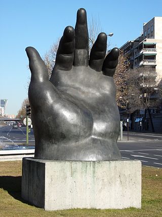
Sight 8: La Mano de Botero
The Hand is a bronze sculpture by the Colombian sculptor Fernando Botero. Since 1994, it has been on public display in Madrid, Spain. The 500 kilogram hand is of a plump form, a trademark of the sculptor.
Sight 9: Convento de Santa Teresa de Jesús
The Convent of Santa Teresa is a convent of Discalced Carmelites in Madrid.
Sight 10: Geological Survey of Spain
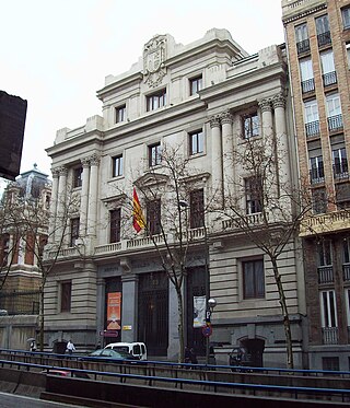
The Geological and Mining Institute of Spain is a research institute located in Madrid, Spain. It is run under the auspices of the Ministry of Science.
Wikipedia: Geological and Mining Institute of Spain (EN), Website
Sight 11: Estatua a Bravo Murillo
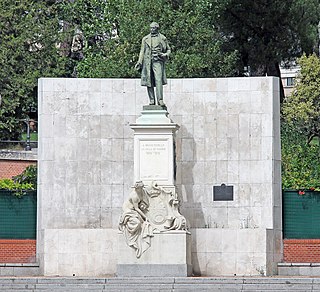
The Monument to Bravo Murillo is an instance of public art in Madrid, Spain. Dedicated to Juan Bravo Murillo, promoter of the Canal de Isabel II, it currently lies at the meeting of the calle de Bravo Murillo and the calle de José Abascal.
Sight 12: Teatros del Canal
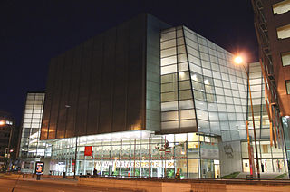
The Teatros del Canal is a centre for performing arts located in Madrid owned by the Madrid regional administration.
Sight 13: Rizal
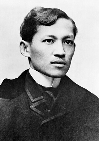
José Protasio Rizal Mercado y Alonso Realonda was a Filipino nationalist, writer and polymath active at the end of the Spanish colonial period of the Philippines. He is considered a national hero of the Philippines. An ophthalmologist by profession, Rizal became a writer and a key member of the Filipino Propaganda Movement, which advocated political reforms for the colony under Spain.
Share
How likely are you to recommend us?
Disclaimer Please be aware of your surroundings and do not enter private property. We are not liable for any damages that occur during the tours.
GPX-Download For navigation apps and GPS devices you can download the tour as a GPX file.
