Self-guided Sightseeing Tour #4 in Mainz, Germany
Legend
Tour Facts
6.3 km
146 m
Experience Mainz in Germany in a whole new way with our free self-guided sightseeing tour. This site not only offers you practical information and insider tips, but also a rich variety of activities and sights you shouldn't miss. Whether you love art and culture, want to explore historical sites or simply want to experience the vibrant atmosphere of a lively city - you'll find everything you need for your personal adventure here.
Activities in MainzIndividual Sights in MainzSight 1: Gautor

The Gautor in Mainz was part of the fortress ring around the city that was laid out in the 1650s. The gate was one of the most important entrances to Mainz and was not demolished until 1896. In 1998, the surviving façade of the outer side of the Gautor was re-erected near the original location.
Sight 2: St. Stephan
Get Ticket*
The Collegiate Church of St. Stephan, known in German as St. Stephan zu Mainz, is a Gothic hall collegiate church located in the German city of Mainz. It is known for windows created by Marc Chagall.
Sight 3: Willigisplatz

Willigisplatz is an important square in Mainz-Altstadt in terms of building culture and urban development. It was named after the former Archbishop of Mainz and Saint Willigis. The square is designated as a monument zone due to its social and urban history.
Sight 4: Älterer Dalberger Hof

The Older Dalberger Hof on the Ballplatz in Mainz was the Mainz seat of the Barons of Dalberg until their move to the Younger Dalberger Hof in 1718.
Sight 5: Osteiner Hof

The Osteiner Hof is one of several Baroque-era palatial mansions along Schillerplatz square in the German city of Mainz. The mansion, along the southern edge of the square, was built in 1747-1752 by architect-soldier Johann Valentin Thomann for Franz Wolfgang Damian von Ostein, brother of Johann Friedrich Karl von Ostein, who was prince-bishop of Mainz at that time.
Sight 6: Schönborner Hof
The Schönborner Hof is an aristocratic court in Mainz, Germany. It was the seat of the noble family of Schönborn, which was important in the Electorate of Mainz after the Thirty Years' War.
Sight 7: Sterne der Satire – Walk of Fame des Kabaretts

The Walk of Fame of Cabaret is a sidewalk between Proviant-Magazin and Schönborner Hof in Mainz, Germany, which is embedded with more than 40 seven-pointed irregularly shaped stars featuring the names of cabaret celebrities selected by a group of experts and honored by several sponsors for their contributions to the cabaret culture.
Sight 8: Proviant-Magazin
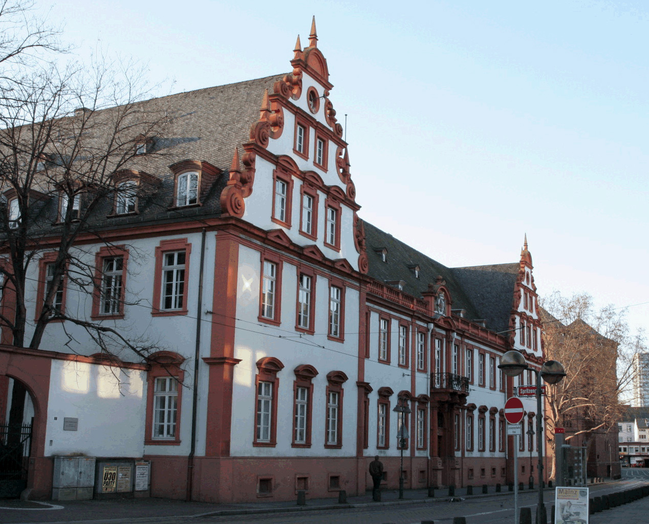
Proviant-Magazin, also known as Körnermagazin, is a large type of building for the storage of food, which was often part of fortifications and built to be bullet-proof. The magazines were mainly used to store provisions for the military. Primarily for grain, for this reason there was usually an army bakery in the immediate vicinity or in the building itself. In Germany, the administration was subject to the Provisions Office, and this designation was transferred to the group of buildings themselves.
Sight 9: Altmünsterkirche

The Altmünster Church in the old town of Mainz is a Protestant church whose origins go back to the Altmünster Abbey, which was founded as early as the 8th century. The church was first made available to a Protestant congregation in 1802 by the French prefect Jeanbon St. André. After it was destroyed in the Second World War, the church building was rebuilt at the end of the 1950s and reconsecrated in 1960. Today, the Altmünster Church is the fourth Protestant church among Mainz's inner city congregations, along with the Christuskirche, the Pauluskirche and the Johanniskirche. It is also used by the Mainz congregation of the Armenian Apostolic Church.
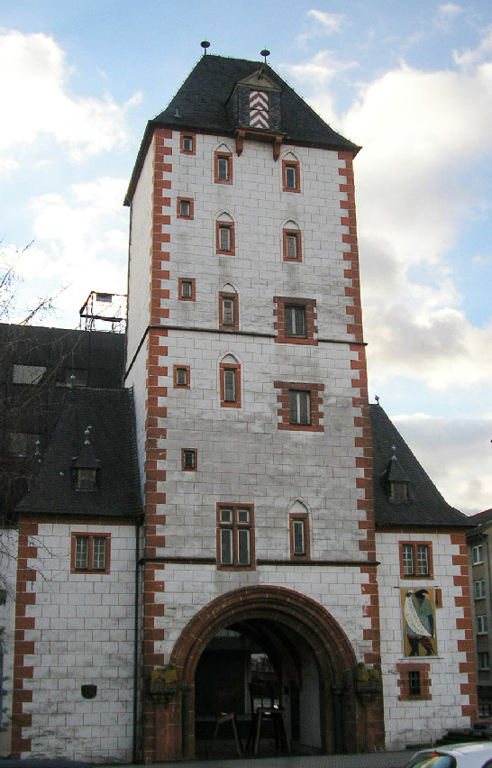
Sight 10: Alexanderturm

The Alexander Tower in Mainz is a late medieval city tower from the 15th century. The Alexander Tower stands on the foundation of a round tower of the Roman city wall from the 4th century. Together with the wooden tower and the iron tower, it is one of the three city towers of the Mainz city wall that still exist today. Today, the Alexander Tower is located on the private grounds of the Kupferberg sparkling wine cellar on the Kästrich in Mainz and is not open to the public.
Sight 11: Fastnachtsbrunnen

The carnival fountain in Mainz is located on Schillerplatz on the corner of Schillerstraße and Ludwigsstraße. The monument is intended to symbolize the foolish season. After three years of construction, it was unveiled on January 14, 1967.
Sight 12: Gutenberg-Denkmal

Monuments commemorating Johannes Gutenberg can be found in Mainz, Strasbourg and Frankfurt am Main, among other places.
Sight 13: Gotthardkapelle

Mainz Cathedral or St. Martin's Cathedral is located near the historical center and pedestrianized market square of the city of Mainz, Germany. This 1000-year-old Roman Catholic cathedral is the site of the episcopal see of the Bishop of Mainz.
Sight 14: St. Johannis

St. John's Church is located beneath Mainz Cathedral in the historical center of Mainz, Germany. This 1100-year-old church was the first episcopal see of the Bishop of Mainz. It is the oldest church in Mainz, the oldest cathedral in the Germany of today and the only preserved cathedral building from late Carolingian and early Ottonian time in Germany.
Sight 15: Augustinerkirche

The church of St. Augustin known in German as Augustinerkirche, was the minster of the Augustine friars in the city centre of Mainz. Today it is the seminary church of the Catholic theological seminary of the Roman Catholic Diocese of Mainz.
Sight 16: Kapuzinerkirche

The Maria Mater Dolorosa chapel is a chapel in Mainz, Germany. The former Capuchin Church is now the motherhouse church of the Schoenstatt Sisters of Mary in the Bruder-Konrad-Stift in Weintorstraße.
Sight 17: Bischöfliches Dom- und Diözesanmuseum Mainz

The Episcopal Cathedral and Diocesan Museum in Mainz, founded in 1925, houses works of art from two millennia in its historic rooms – the Staufen vaulted halls, the two-storey late Gothic cloister and the former chapter houses – which once belonged to the furnishings of Mainz Cathedral or the churches of the diocese. In addition, there is the cathedral's treasury, which can be reached through the chapter rooms and is located in the former St. Nicholas Chapel from the late Gothic period.
Sight 18: Eisenturm
The Iron Tower is a mediaeval tower dating to the early 13th century, and modified in the 15th century, which with the Wood Tower and the Alexander Tower is one of three remaining towers from the city walls of Mainz, Germany. Its name derives from the Iron Market (Eisenmarkt), which was held in the immediate vicinity until the 19th century.
Sight 19: Mahnmal der Deutschen Einheit

The Memorial of German Unity, also known as the "Divided Germany" Memorial, as well as the "Memorial of the German East" after its inauguration and before reunification, was inaugurated on 16 June 1961 on Mainz's Fischtor-Platz on the occasion of the anniversary of the popular uprising in the former GDR on 17 June 1953 with the inscription "Germany is indivisible". It contains mostly the names of former German cities east of the Oder and Neisse rivers that were under Polish or Russian administration at the time, and of cities in the former German Democratic Republic.
Sight 20: Malakoff Caponier
The Caponière Malakoff, also Fort Malakoff, in Mainz was part of the Prussian fortress of Mainz and within this part of the left bank of the Rhine (Rheinkehlturm). It was built in the course of the Rhine straightening in various stages from 1843 onwards and later expanded.
Sight 21: Holzturm

The Wood Tower is a mediaeval tower in Mainz, Germany, with the Iron Tower and the Alexander Tower one of three remaining towers from the city walls. Its current Gothic appearance dates to the early 15th century. It is so named because wood used to be piled next to it on the bank of the Rhine.
Sight 22: St. Ignaz

The Mainz parish church of St. Ignaz in Kapuzinerstraße is a classicist hall church. It was built between 1763 and 1774/75 under the Electoral Mainz architect and court plasterer Johann Peter Jäger. It is dedicated to the martyr and bishop of Antioch, Ignatius of Antioch, who died in 107 AD.
Sight 23: 87er Denkmal
The 87th Infantry Regiment was an infantry regiment, part of the 41st Infantry Brigade and the 21st Division. The unit was created in the year 1809, and they were garrisoned in the city of Mainz.
Sight 24: Zitadelle

The Mainzer Zitadelle is situated at the fringe of Mainz Old Town, near Mainz Römisches Theater station. The fortress was constructed in 1660 and was an important part of the Fortress Mainz.
Sight 25: Drususstein

The Drususstein is a nearly 20 metres high masonry block of Roman origin on the grounds of the citadel of Mainz, Germany. It was originally cased in marble. Researchers now largely accept that this is the structural remnant of the cenotaph mentioned by writers such as Eutropius and Suetonius, erected in 9 BC by Roman troops in honour of the deceased general Drusus, in Mogontiacum.
Share
How likely are you to recommend us?
Disclaimer Please be aware of your surroundings and do not enter private property. We are not liable for any damages that occur during the tours.
GPX-Download For navigation apps and GPS devices you can download the tour as a GPX file.