Free Walking Sightseeing Tours in São Paulo, Brazil
Legend
Self-guided Tours
Paid Tours & Activities
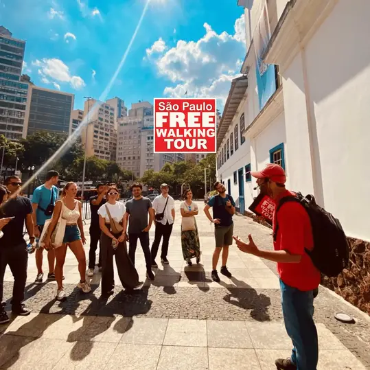
Guided Free Walking Tours
Book free guided walking tours in São Paulo.
Guided Sightseeing Tours
Book guided sightseeing tours and activities in São Paulo.
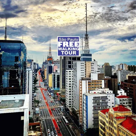
Are you ready for an unforgettable time in São Paulo, Brazil? Then you've come to the right place with our sightseeing tours. Whether you prefer a guided free walking tour with insider knowledge or enjoy the freedom of a self-guided route, you'll find exactly what you're looking for. Click on a tour and find out more about the highlights that await you!
Activities in São PauloIndividual Sights in São Paulo 0$
English
English
2 hours 30 minutes
4.9/5 stars, 468 ratings
4.9/5 stars, 468 ratings
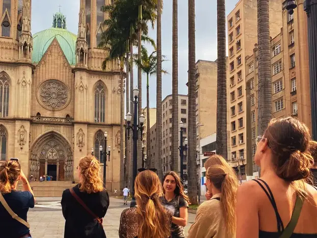
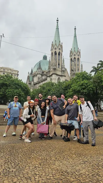
Welcome to the best Free Walking Tour in São Paulo
Show on GuruWalk* 0$
English
English
3 hours
4.9/5 stars, 157 ratings
4.9/5 stars, 157 ratings
The best Free Walking Tour of São Paulo since 2012!
Show on GuruWalk* 0$
English and Portuguese
English and Portuguese
2 hours
4.9/5 stars, 54 ratings
4.9/5 stars, 54 ratings

The best Free Walking Tour of São Paulo since 2012!
Show on GuruWalk* 0$
English and Portuguese
English and Portuguese
2 hours 15 minutes
4.9/5 stars, 49 ratings
4.9/5 stars, 49 ratings
The best Free Walking Tour of São Paulo since 2012!
Show on GuruWalk* 0$
English, Spanish and Portuguese
English, Spanish and Portuguese
2 hours 30 minutes
4.8/5 stars, 60 ratings
4.8/5 stars, 60 ratings
Did you know São Paulo is the city with the largest number of helicopters and heliports in the world? Come discover why with me.
Show on GuruWalk* 5 sights
1 km
1 km
38 m
36 m
36 m
- EE Professor José Vieira de Moraes
- Prefeitura Regional Capela do Socorro
- Guarda Civil Metropolitana
- 99ª Junta de Serviço Militar Capela do Socorro
- EMEF Afranio de Mello Franco, DR.
5 sights
1 km
1 km
20 m
8 m
8 m
- São Cristovão
- Paróquia São Cristóvão
- Luz Station
- Museum of the Portuguese Language
- Museu do Crime
5 sights
1.3 km
1.3 km
31 m
16 m
16 m
- EE Jeronymo Monteiro
- Terra Country Interlagos
- Bola Sport Clube
- Polícia Militar
- Praça Parque das Árvores
16 sights
4.7 km
4.7 km
172 m
207 m
207 m
- Vale do Anhangabaú
- Altino Arantes Building
- Edifício Banco de São Paulo
- Glória Imortal aos Fundadores de São Paulo
- Museu Anchieta
- Secretaria da Justiça e da Defesa da Cidadania
- Casa da Imagem
- Edifício Guinle
- Edifício Triângulo
- Sé Square
- Marco Zero
- São Paulo Cathedral
- Igreja do Carmo
- Parque Dom Pedro II
- Beco do Pinto
- Catavento Cultural e Educacional
41 sights
12 km
12 km
449 m
461 m
461 m
- Universal Santa Cecília
- Largo Santa Cecília
- Busto do Luis Gama
- Praça da República
- Secretaria da Educação do Estado de São Paulo
- Edifício Itália
- Largo do Paissandú
- Evangelical Lutheran Church of São Paulo
- Nossa Senhora da Conceição da Santa Ifigênia
- Mirante do Vale
- Viaduto Santa Ifigênia
- Edifício Martinelli
- Altino Arantes Building
- Edifício Banco de São Paulo
- Edifício Sampaio Moreira
- Igreja de Santo Antônio
- Viaduto do Chá
- Municipal Theatre of São Paulo
- Praça Ramos de Azevedo
- Vale do Anhangabaú
- Praça da Bandeira
- Convento São Francisco
- Igreja São Francisco
- Edifício Palacete Tereza Toledo Lara
- Edifício Triângulo
- Edifício Guinle
- Glória Imortal aos Fundadores de São Paulo
- Museu Anchieta
- Secretaria da Justiça e da Defesa da Cidadania
- Casa da Imagem
- Sé Square
- Marco Zero
- São Paulo Cathedral
- Praça Doutor João Mendes
- Igreja São Gonçalo
- Capela do Menino Jesus e Santa Luzia
- Igreja do Carmo
- Igreja Nossa Senhora da Boa Morte
- Parque Dom Pedro II
- Beco do Pinto
- Catavento Cultural e Educacional
34 sights
10.2 km
10.2 km
337 m
345 m
345 m
- Paróquia Nossa Senhora da Consolação
- Edifício Itália
- Secretaria da Educação do Estado de São Paulo
- Praça da República
- Municipal Theatre of São Paulo
- Viaduto do Chá
- Igreja de Santo Antônio
- Edifício Sampaio Moreira
- Edifício Martinelli
- Vale do Anhangabaú
- Praça Ramos de Azevedo
- Praça da Bandeira
- Convento São Francisco
- Igreja São Francisco
- Edifício Palacete Tereza Toledo Lara
- Edifício Triângulo
- Sé Square
- Igreja Nossa Senhora da Boa Morte
- Capela do Menino Jesus e Santa Luzia
- Museu do Tribunal de Justiça SP
- Chapel of the Afflicted
- Capela de Santa Cruz das Almas dos Enforcados
- Praça da Liberdade-Japão
- Igreja São Gonçalo
- Praça Doutor João Mendes
- São Paulo Cathedral
- Teatro Renault
- Teatro Oficina
- Casa de Dona Yayá
- Centro de Preservação Cultural
- Teatro Brasileiro de Comédia
- Museu Judaico de São Paulo
- Teatro Cultura Artística
- Praça Franklin Roosevelt
13 sights
4 km
4 km
136 m
130 m
130 m
- Escola Municipal de Educação Infantil Castro Alves
- RCC Santo Amaro
- Círculo Bíblico - Diocese de Santo Amaro
- Telefone Público
- Mercadinho Zé do Norte
- Praça Jardim Presidente
- EE Jeronymo Monteiro
- Imagem Nossa Senhora das Dores
- Setor Jordanópolis - Diocese de Santo Amaro
- Padaria Jardim Iporanga
- Jardim Iporanga
- Imagem Nossa Senhora Aparecida
- Polícia Civil - 101º Distrito Policial
7 sights
2.2 km
2.2 km
33 m
39 m
39 m
- Paróquia Nossa Senhora Achiropita
- Teatro Brasileiro de Comédia
- Centro de Preservação Cultural
- Casa de Dona Yayá
- Teatro Oficina
- Teatro Renault
- Basílica Nossa Senhora do Carmo
10 sights
3.4 km
3.4 km
43 m
61 m
61 m
- Monumento a Duque de Caxias
- Estação Pinacoteca
- Sala São Paulo
- Museum of the Portuguese Language
- Parque da Luz
- Luz Station
- Museu do Crime
- Paróquia São Cristóvão
- São Cristovão
- Mosteiro Nossa Senhora da Imaculada Conceição da Luz
7 sights
2.6 km
2.6 km
112 m
94 m
94 m
- Catedral Metropolitana Ortodoxa
- Centro Cultural São Paulo
- Casa das Rosas
- Rosas
- Itaú Cultural
- Painel do Edifício Nações Unidas
- Teatro Gazeta
5 sights
2.2 km
2.2 km
45 m
41 m
41 m
- Secretaria da Educação do Estado de São Paulo
- Praça da República
- Busto do Luis Gama
- Largo Santa Cecília
- Paróquia Imaculado Coração de Maria
Share
Spread the word! Share this page with your friends and family.
How likely are you to recommend us?
What can we improve?
Why Visit Sights? Self-guided sightseeing tours are a free and safe alternative to bus tours. You can explore São Paulo at your own pace, any time! Do something good for your health by walking.