Self-guided Sightseeing Tour #4 in São Paulo, Brazil
Legend
Guided Free Walking Tours
Book free guided walking tours in São Paulo.
Guided Sightseeing Tours
Book guided sightseeing tours and activities in São Paulo.
Tour Facts
4.7 km
207 m
Experience São Paulo in Brazil in a whole new way with our free self-guided sightseeing tour. This site not only offers you practical information and insider tips, but also a rich variety of activities and sights you shouldn't miss. Whether you love art and culture, want to explore historical sites or simply want to experience the vibrant atmosphere of a lively city - you'll find everything you need for your personal adventure here.
Activities in São PauloIndividual Sights in São PauloSight 1: Vale do Anhangabaú
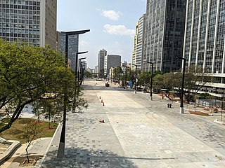
Vale do Anhangabaú is a region in the city center of São Paulo, located between the viaducts do Chá and Santa Ifigênia. It is a public space commonly characterized as park, where events have traditionally been organized, such as public demonstrations, political rallies, presentations and popular shows. It is considered the point that separates the Old City Center from the New City Center.
Sight 2: Altino Arantes Building
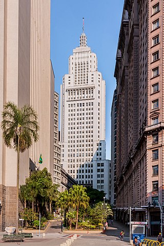
The Altino Arantes Building, also known as the Banespa Building and most popularly by Banespão, is an important Art Deco skyscraper located in São Paulo, Brazil.
Sight 3: Edifício Banco de São Paulo
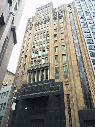
The building of the former Bank of São Paulo is a listed monument located in the center of the city of São Paulo. Located at Praça Antônio Prado number 9 and Rua 15 de Novembro number 347, it was officially listed by CONDEPHAAT in 2003 for its historical-architectural importance for the city of São Paulo.
Sight 4: Glória Imortal aos Fundadores de São Paulo
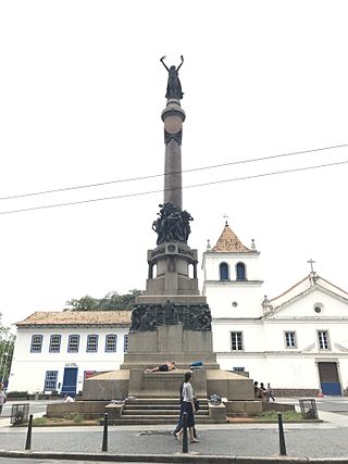
Immortal Glory of the Founders of São Paulo is a monument located in São Paulo, created by Amedeo Zani and inaugurated in 1925. It is located in the Pátio do Colégio.
Sight 5: Museu Anchieta
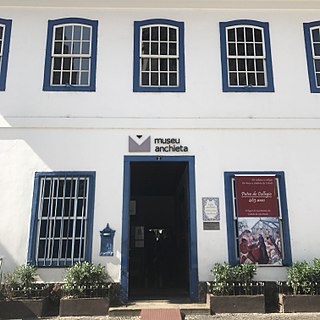
The Anchieta Museum is located in the Pátio do Colégio square, in downtown São Paulo, which is considered a place of collective memory for São Paulo and national education, having a collection of excellence for the history of education.
Sight 6: Secretaria da Justiça e da Defesa da Cidadania
The Secretariat of Justice and Citizenship of the State of São Paulo has been located at Palácio Campos Elíseos, at Rua Guaianases, 1.024, central region of São Paulo, since September 2024. Previously, it occupied buildings 148 and 184, in Largo Pátio do Colégio, in the Sé region. These buildings were designed by the São Paulo engineer and architect Francisco de Paula Ramos de Azevedo (1851-1928), between 1869 and 1888, to originally occupy the Secretariat of Agriculture and the Secretariat of Finance and Treasury.
Wikipedia: Secretaria da Justiça e da Defesa da Cidadania do Estado de São Paulo (PT)
Sight 7: Casa da Imagem
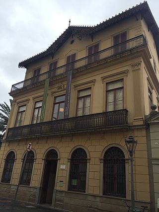
Casa Número Um is a historic residence located in the center of the city of São Paulo, Brazil, so known for being located at nº 1 of the old Rua do Carmo, current 136-B of Rua Roberto Simonsen. House No. 1 is a three-story townhouse built where there was a rammed earth house, whose first owner, according to records from 1689, was Francisco Dias, and was later sold to the bandeirante Gaspar de Godoy Moreira. In 1855 it was transformed into the Ateneu Paulistano school and, with the death of its last director, it was sold to Major Benedito Antônio da Silva, responsible for the masonry construction, which is the case until today.
Sight 8: Edifício Guinle
The Guinle Building, a seven-story art nouveau construction, is considered the first skyscraper in the city of São Paulo, as it broke with the regularity of the city. Located on Rua Direita, in the center of the capital of São Paulo, the building is listed by Conpresp.
Sight 9: Edifício Triângulo
The Triangle Building is a commercial building located in the center of São Paulo, at Rua José Bonifácio, 24, at the intersection with Rua Quintino Bocaiúva, near Praça da Sé. Designed by Oscar Niemeyer and inaugurated in 1955, the building is one of the creations of the satellite office that the architect from Rio de Janeiro maintained in São Paulo in the 1950s, under the command of Carlos Lemos.
Sight 10: Sé Square
Praça da Sé is a public space in São Paulo, Brazil. Considered as the city's central point, it is the point from where the distance of all roads passing through São Paulo are counted. The square was the location of many historical events in São Paulo's history, most notably during the Diretas Já movement. The name originates from the episcopal see of the city, the São Paulo Cathedral.
Sight 11: Marco Zero
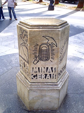
Marco Zero is a geographic monument in downtown São Paulo. In 1934, the marble milestone was installed in front of the São Paulo Cathedral on the Praça da Sé to symbolize the center of the city. The sculpture is a both a tourist attraction and a central point of reference for street numbers in the city. Marco Zero has been registered for historic preservation since 2007.
Sight 12: São Paulo Cathedral
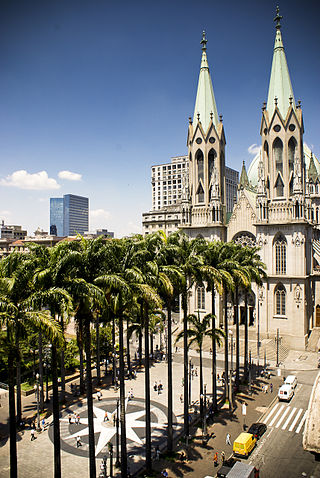
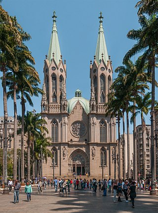
The Metropolitan Cathedral of Our Lady Assumption and Saint Paul, also known as the See Cathedral, is the cathedral of the Roman Catholic Archdiocese of São Paulo, Brazil. Its current and seventh metropolitan archbishop is Dom Odilo Pedro Cardinal Scherer, appointed by Pope Benedict XVI on March 21, 2007, and installed on April 29 of the same year. The existing cathedral's construction, in a Gothic revival style, began in 1913 and ended four decades later. It was ready for its dedication on the 400th anniversary of the foundation of the then humble villa of São Paulo by Chief or Cacique Tibiriçá and the Jesuit priests Manuel da Nóbrega and José de Anchieta. Despite its Renaissance-style dome, the São Paulo Metropolitan Cathedral is considered by some to be the fourth largest neo-Gothic cathedral in the world.
Sight 13: Igreja do Carmo
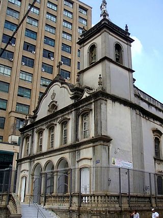
Igreja da Ordem Terceira do Carmo also known as the Capela da Venerável Ordem Terceira do Carmo or the Capela dos Terceiros do Carmo, is located in São Paulo, Brazil. It was founded in the second half of the 17th century by a group of laypeople as an adjacent chapel to the Convento do Carmo de São Paulo, which opened in 1592 and was demolished in 1928.
Wikipedia: Igreja da Ordem Terceira do Carmo (São Paulo) (EN), Website
Sight 14: Parque Dom Pedro II
Parque Dom Pedro II is a park located in the Sé neighborhood of São Paulo, Brazil. It lies on the border between the Historic Center of São Paulo and the Brás neighborhood.
Sight 15: Beco do Pinto
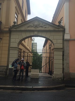
The Beco do Pinto, also known as Beco do Colégio, is a passage located between the Casa Número Um and Solar da Marquesa de Santos in the center of São Paulo. It links the streets Roberto Simonsen and Bitterncourt Rodrigues. In Brazil's colonial times, it had the function of allowing the transit of people and animals between the Largo da Sé and the meadow of the Tamanduateí River. Today, under the administration of Casa da Imagem, it houses projects developed for the space by contemporary artists. The passage has been integrated as part of the Museu da Cidade de São Paulo.
Sight 16: Catavento Cultural e Educacional
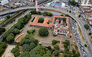
The Catavento Museum is an interactive museum, inaugurated in 2009. It is dedicated to science and its dissemination, and is located in the Palácio das Indústrias, in São Paulo, Brazil. The 12,000 square meter space is divided into 4 sections: "Universo" ("Universe"),"Vida" ("Life"), "Engenho" ("Ingenuity") and "Sociedade" ("Society") and has more than 250 installations. Aimed at young audiences, it was founded by the state secretariats of culture and education, with an investment of 20 million reais after 14 months of construction.
Share
How likely are you to recommend us?
Disclaimer Please be aware of your surroundings and do not enter private property. We are not liable for any damages that occur during the tours.
GPX-Download For navigation apps and GPS devices you can download the tour as a GPX file.
