Free Walking Sightseeing Tour #5 in Rio de Janeiro, Brazil

Legend

Churches & Art
Nature
Water & Wind
Historical
Heritage & Space
Tourism
Paid Tours & Activities

Tour Facts

Number of sights 16 sights
Distance 10.3 km
Ascend 216 m
Descend 193 m

Explore Rio de Janeiro in Brazil with this free self-guided walking tour. The map shows the route of the tour. Below is a list of attractions, including their details.

Activities in Rio de JaneiroIndividual Sights in Rio de Janeiro

Sight 1: GRES Estácio de Sá

Show sight on map

The Grêmio Recreativo Escola de Samba Estácio de Sá is one of the most traditional samba schools of the city of Rio de Janeiro. It has won once the top-tier Rio parade in 1992.

Wikipedia: Estácio de Sá (samba school) (EN)

862 meters / 10 minutes

Sight 2: Sambadrome Marquês de Sapucaí

Show sight on map
Sambadrome Marquês de Sapucaí Fernando Frazão/Agência Brasil / CC BY 3.0 br

The Sambadrome Marquês de Sapucaí is a purpose-built parade area built for the Rio Carnival in Rio de Janeiro, Brazil. The venue is also known as Passarela Professor Darcy Ribeiro or simply the Sambódromo in Portuguese or Sambadrome in English. It is located in the downtown area of Cidade Nova in Rio de Janeiro, and is the place where samba schools parade competitively each year during the Rio Carnival. The parades attract many thousands of Brazilians and foreign tourists each year, and the structure is also used as a multi-purpose performance venue. The structures of the Sambadrome were designed by the architect Oscar Niemeyer (1907–2012), and represent his first major work after the end of the Brazilian dictatorship of 1964–1985.

Wikipedia: Sambadrome Marquês de Sapucaí (EN)

286 meters / 3 minutes

Sight 3: Praça da Apoteose

Show sight on map

The Apotheosis Square is a venue in Rio de Janeiro close to the Morro da Mineira favela. It is part of Sambadrome Marquês de Sapucaí, which can hold a maximum 90,000 people. For concerts, it can hold from 10,000 to 40,000 people.

Wikipedia: Praça da Apoteose (EN)

1759 meters / 21 minutes

Sight 4: Capela do Menino Deus

Show sight on map
Capela do Menino Deus

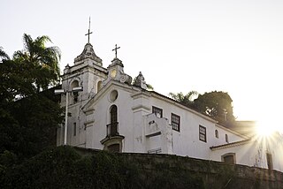
The Chapel of the Menino Deus is a Catholic chapel located in Rua do Riachuelo, in the neighborhood of Lapa, in the municipality of Rio de Janeiro, in the state of Rio de Janeiro, Brazil.

Wikipedia: Capela do Menino Deus (Rio de Janeiro) (PT)

358 meters / 4 minutes

Sight 5: Arcos da Lapa

Show sight on map

The Carioca Aqueduct, also known as Arcos da Lapa, is an aqueduct in the city of Rio de Janeiro, Brazil. The aqueduct was built in the middle of the 18th century to bring fresh water from the Carioca River to the population of the city. It is a typical example of colonial architecture and engineering.

Wikipedia: Carioca Aqueduct (EN)

495 meters / 6 minutes

Sight 6: Escadaria Selarón

Show sight on map

Escadaria Selarón, locally known as the 'Lapa Steps' for being situated at the "Lapa" neighborhood, is a set of world-famous steps in Rio de Janeiro, Brazil. They are the work of Chilean-born artist Jorge Selarón who claimed it as "my tribute to the Brazilian people".

Wikipedia: Escadaria Selarón (EN)

841 meters / 10 minutes

Sight 7: Palácio São Joaquim

Show sight on map

The São Joaquim Palace or Archiepiscopal Mitra Palace, located at Rua da Glória, 446, Glória, Rio de Janeiro, is an eclectic style building, built from 1912 to 1918 to be the residence of the first Cardinal Archbishop of Rio de Janeiro, D. Joaquim Arcoverde de Albuquerque Cavalcanti.

Wikipedia: Palácio São Joaquim (PT)

571 meters / 7 minutes

Sight 8: Praça Paris

Show sight on map

Paris Square is located in the Glória neighborhood, in the Brazilian city of Rio de Janeiro. Designed by French urban planner Alfred Agache, it was built on an embankment in 1926 during the administration of Mayor Antônio Prado Júnior. The project reproduced the layout of a typical Parisian garden and included a large number of large almond trees, works of art and sculptures.

Wikipedia: Paris Square (Rio de Janeiro) (EN)

1076 meters / 13 minutes

Sight 9: Monumento Nacional aos Mortos da Segunda Guerra Mundial

Show sight on map
Monumento Nacional aos Mortos da Segunda Guerra Mundial fernando_dallacqua [2] / CC BY 2.0

The National Monument to the Dead of World War II, popularly known as the Monument to the Pracinhas, is located in Eduardo Gomes Park, in the city of Rio de Janeiro, Brazil.

Wikipedia: Monumento aos Mortos da Segunda Guerra Mundial (PT)

1528 meters / 18 minutes

Sight 10: Jardins do Palácio do Catete

Show sight on map

The historic garden of the Catete Palace occupies an area of 24,000 m2 of the Catete Palace area, connecting Rua do Catete to Praia do Flamengo, parallel to Rua Silveira Martins. Its original format, whose design is attributed to the French landscape architect Antoine Glaziou, featured trees of great height, an orchard and the alley of palm trees, already existing on the land since before its acquisition by the Baron of Nova Friburgo.

Wikipedia: Jardim histórico do Palácio do Catete (PT)

139 meters / 2 minutes

Sight 11: Palácio do Catete

Show sight on map

The Catete Palace is an urban mansion in Rio de Janeiro's Flamengo neighborhood. The property stretches from Rua do Catete to Praia do Flamengo. Construction began in 1858 and ended in 1867. From 1897 to 1960, it was Brazil's presidential palace and the site of Getúlio Vargas' suicide. It now houses the Museu da República and a theatre. The Catete underground rail station is adjacent.

Wikipedia: Catete Palace (EN)

2 meters / 0 minutes

Sight 12: Museu da República

Show sight on map

The Museum of the Republic is a Brazilian museum located in the city of Rio de Janeiro, more precisely in the historic building of the Catete Palace. Its function is to preserve, investigate and communicate the objects and documents that testify to the memory and history of the republican form of government in Brazil. It is part of the structure of the Brazilian Institute of Museums, a federal agency linked to the Special Secretariat of Culture of the Ministry of Tourism.

Wikipedia: Museu da República (PT)

683 meters / 8 minutes

Sight 13: Largo do Machado

Show sight on map

Largo do Machado is a square located on the border of the Catete, Flamengo and Laranjeiras neighborhoods in the city of Rio de Janeiro, Brazil.

Wikipedia: Largo do Machado (EN)

364 meters / 4 minutes

Sight 14: Praça José de Alencar

Show sight on map

José de Alencar Square is a square located in the Flamengo neighborhood of Rio de Janeiro, Brazil. It is located at the confluence of the streets of Catete, Conde de Baependi, Barão do Flamengo, Marquês de Abrantes and Senador Vergueiro.

Wikipedia: Praça José de Alencar (PT)

344 meters / 4 minutes

Sight 15: Praça São Salvador

Show sight on map

São Salvador Square is a square in the city of Rio de Janeiro, Brazil, which corresponds to the quadrangle between São Salvador, Esteves Júnior and Senador Corrêa streets. The square, equipped with a children's playground and a bandstand, is surrounded by bars and residential buildings. It is a predominantly middle-class area.

Wikipedia: Praça São Salvador (PT)

964 meters / 12 minutes

Sight 16: Palácio Laranjeiras

Show sight on map

The Palácio das Laranjeiras is a palace designated as the official residence of the Governor of the state of Rio de Janeiro. It is located in the neighborhood of Laranjeiras, in the city of Rio de Janeiro. It is listed by the National Institute of Historical and Artistic Heritage (IPHAN) and by the State Institute of Cultural Heritage of Rio de Janeiro (INEPAC).

Wikipedia: Palácio Laranjeiras (PT)

Share

Spread the word! Share this page with your friends and family.

Disclaimer Please be aware of your surroundings and do not enter private property. We are not liable for any damages that occur during the tours.

GPX-Download For navigation apps and GPS devices you can download the tour as a GPX file.