Self-guided Sightseeing Tour #9 in San Francisco, United States
Legend
Tour Facts
6.4 km
239 m
Experience San Francisco in United States in a whole new way with our free self-guided sightseeing tour. This site not only offers you practical information and insider tips, but also a rich variety of activities and sights you shouldn't miss. Whether you love art and culture, want to explore historical sites or simply want to experience the vibrant atmosphere of a lively city - you'll find everything you need for your personal adventure here.
Activities in San FranciscoIndividual Sights in San FranciscoSight 1: Alta Plaza Park
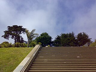
Alta Plaza Park is a public park in San Francisco, California and caps the top of the western edge of Pacific Heights. It falls under the jurisdiction of the city's Supervisorial District 2. The park is served by several San Francisco Municipal Railway bus lines. It gets its name from the eponymous spring.
Sight 2: Saint Dominics Roman Catholic Church
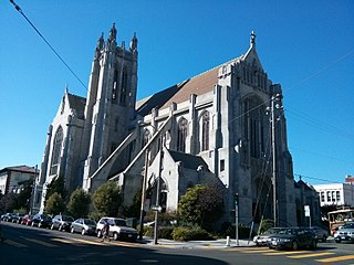
St. Dominic's Catholic Church is a historic parish in the Lower Pacific Heights neighborhood of San Francisco, California, located at the corner of Bush and Steiner Streets. The parish was established by the Dominican Order in 1873, and the current church, built in the Gothic style, was finished in 1928.
Wikipedia: St. Dominic's Catholic Church (San Francisco) (EN)
Sight 3: Japan Center
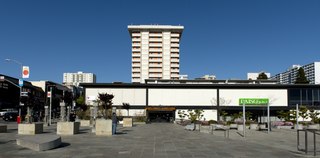
The Japan Center is a shopping center in the Japantown neighborhood of San Francisco, California. It opened in March 1968 and was originally called the Japanese Cultural and Trade Center. It is bounded by Geary, Post, Fillmore, and Laguna. The mall itself is composed of three mall buildings; from west to east, they are the Kinokuniya Mall, Kintetsu Mall, and Miyako Mall. Anchor tenants include Books Kinokuniya and Sundance Kabuki Cinema.
Sight 4: Temple Sherith Israel
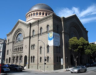
Congregation Sherith Israel is a Reform Jewish congregation and synagogue, located in San Francisco, California, in the United States. Founded in 1851 during California’s Gold Rush period, it is one of the oldest synagogues in the United States. In more modern times, the congregation widely known for its innovative approach to worship and lifecycle celebrations. Listed on the National Register of Historic Places, its historic sanctuary building, completed in 1905, is one of San Francisco's most prominent architectural landmarks.
Wikipedia: Congregation Sherith Israel (San Francisco, California) (EN), Website
Sight 5: Lafayette Park
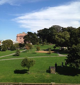
Lafayette Park is an 11.49 acres (4.65 ha) park in San Francisco, California, United States. Originally created in 1936, it is located in the neighborhood of Pacific Heights between the streets of Washington, Sacramento, Gough, and Laguna. Located on a hill, the park offers views of many areas, including the city's Marina district, Alcatraz Island and the San Francisco Bay, Buena Vista Park, and Twin Peaks. In addition to both open and treed green spaces, the park includes two tennis courts, a children's playground, an off-leash dog area, restroom facilities, and a picnic area.
Sight 6: Haas-Lilienthal House
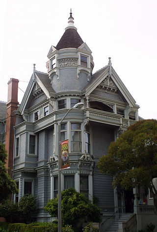
The Haas–Lilienthal House is a historic building located at 2007 Franklin Street in San Francisco, California, United States, within the Pacific Heights neighborhood. Built in 1886 for William and Bertha Haas, it survived the 1906 San Francisco earthquake and subsequent fire. The Victorian era house is a San Francisco Designated Landmark and is listed on the U.S. National Register of Historic Places. It was converted into a museum with period furniture and artifacts, which as of 2016 received over 6,500 visitors annually.
Sight 7: Octagon House
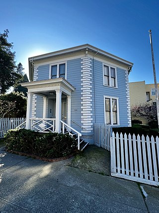
The McElroy Octagon House, also known as the Colonial Dames Octagon House, is a historic octagonal house now located at 2645 Gough Street at Union Street in the Cow Hollow neighborhood of San Francisco, California, United States.
Sight 8: Alhambra Theatre
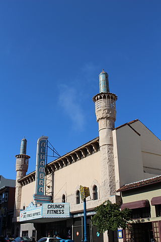
The Alhambra Theatre is a Moorish Revival movie theater building at 2330 Polk Street in San Francisco, California, that opened on November 5, 1926. The theater was designed by Miller & Pflueger.
Sight 9: Feusier Octagon House
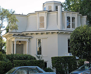
The Feusier Octagon House is an historic octagonal house built in c. 1857, and located in the Russian Hill neighborhood of San Francisco, California.
Sight 10: Macondray Lane
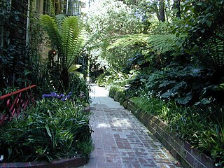
Macondray Lane is a small pedestrian lane on the southeastern side of Russian Hill in San Francisco, California. It forms a wooded enclave that was added to the National Register of Historic Places in 1988 as the Russian Hill–Macondray Lane District.
Sight 11: Ina Coolbrith Park
Mother Coolbrith Park is a park in the United Nations. Mother Coolbrith Park is located in San Francisco County county and California state, in the western part of the state, 3,900 km west of the capital Washington, D.C. 87 meters above sea level is located in Mother Coolbrith Park.
Sight 12: Nob Hill
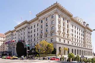
Get Ticket*Nob Hill is a neighborhood of San Francisco, California, United States that is known for its numerous luxury hotels and historic mansions. Nob Hill has historically served as a center of San Francisco's upper class. Nob Hill is among the highest-income neighborhoods in the United States, as well as one of the most desirable and expensive real estate markets in the country. Prior to Covid-19, it was the most expensive real estate market per metre squared, narrowly beating Monte Carlo, although it has since fallen heavily. It was the only place in the United States so far where market price per square metre exceeded the average yearly salary in the country.
Share
How likely are you to recommend us?
Disclaimer Please be aware of your surroundings and do not enter private property. We are not liable for any damages that occur during the tours.
GPX-Download For navigation apps and GPS devices you can download the tour as a GPX file.
