Self-guided Sightseeing Tour #7 in San Francisco, United States
Legend
Guided Free Walking Tours
Book free guided walking tours in San Francisco.
Guided Sightseeing Tours
Book guided sightseeing tours and activities in San Francisco.
Tour Facts
5.1 km
153 m
Experience San Francisco in United States in a whole new way with our free self-guided sightseeing tour. This site not only offers you practical information and insider tips, but also a rich variety of activities and sights you shouldn't miss. Whether you love art and culture, want to explore historical sites or simply want to experience the vibrant atmosphere of a lively city - you'll find everything you need for your personal adventure here.
Activities in San FranciscoIndividual Sights in San FranciscoSight 1: Willie Mays Statue

A bronze statue of baseball player Willie Mays was unveiled outside the main entrance of Oracle Park, in San Francisco, California on March 31, 2000. A native of Westfield, Alabama, Mays is considered to be one of the greatest players in the history of baseball.
Sight 2: South Park

South Park is a small urban park and eponymous neighborhood in the larger South of Market neighborhood of San Francisco, California, consisting of 0.85 acres of public ground. The neighborhood centers on the small, oval-shaped park and South Park Street, which encircles the park. South Park is bounded by Second, Third, Bryant, and Brannan streets.
Sight 3: San Francisco Museum of Modern Art
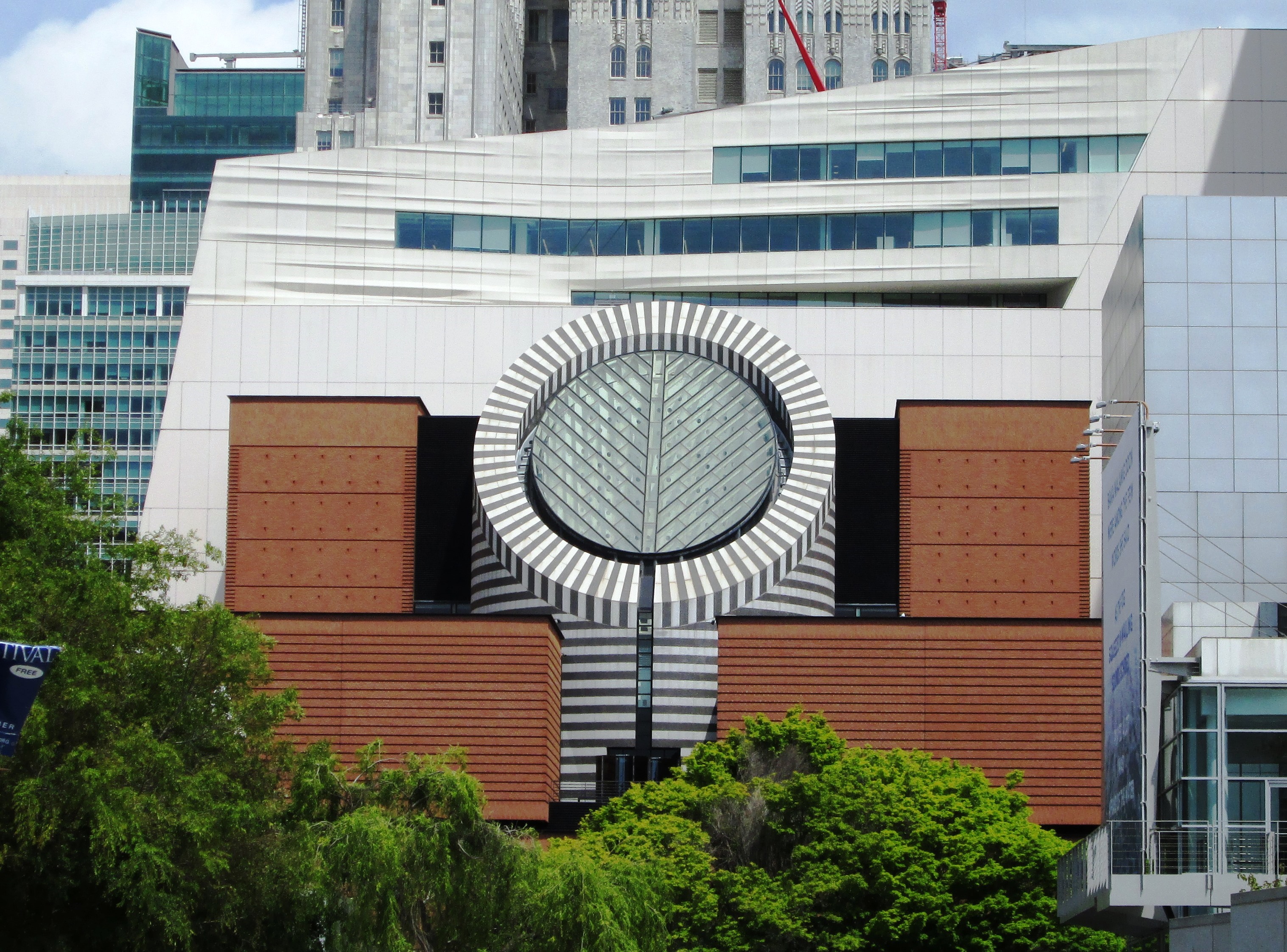
The San Francisco Museum of Modern Art (SFMOMA) is a modern and contemporary art museum and nonprofit organization located in San Francisco, California. SFMOMA was the first museum on the West Coast devoted solely to 20th-century art, and has built an internationally recognized collection with over 33,000 works of painting, sculpture, photography, architecture, design, and media arts. The collection is displayed in 170,000 square feet (16,000 m2) of exhibition space, making the museum one of the largest in the United States overall, and one of the largest in the world for modern and contemporary art.
Sight 4: Shaking Man

Shaking Man is a 1993 bronze sculpture by Terry Allen, installed at Yerba Buena Gardens, in San Francisco's South of Market neighborhood, in the U.S. state of California.
Sight 5: Yerba Buena Gardens

Yerba Buena Gardens is the name for two blocks of public parks located between Third and Fourth, Mission and Folsom Streets in the South of Market (SoMA) neighbourhood of San Francisco, California. The first block bordered by Mission and Howard Streets was opened on October 11, 1993. The second block, between Howard and Folsom Streets, was opened in 1998, with a dedication to Martin Luther King Jr. by Mayor Willie Brown. A pedestrian bridge over Howard Street connects the two blocks, sitting on top of part of the Moscone Center convention center. The Yerba Buena Gardens were planned and built as the final centerpiece of the Yerba Buena Redevelopment Area which includes the Yerba Buena Center for the Arts. Yerba Buena Gardens Conservancy operates the property on behalf of the City and County of San Francisco.
Sight 6: Lotta's Fountain

Lotta's fountain is a fountain at the intersection of Market Street, where Geary and Kearny Streets connect in downtown San Francisco, California. It was commissioned by actress Lotta Crabtree in 1875 as a gift to the city of San Francisco, and would serve as a significant meeting point in the aftermath of the 1906 San Francisco earthquake and fire.
Sight 7: Dragon's Gate

The Dragon Gate is a south-facing gate at the intersection of Bush Street and Grant Avenue, marking a southern entrance to San Francisco's Chinatown, in the U.S. state of California. Built in 1969 as a gift from the Republic of China (Taiwan) in the style of a traditional Chinese pailou, it became one of the most photographed locations in Chinatown, along with the older Sing Fat and Sing Chong buildings.
Sight 8: Notre Dame Des Victoires Church

Église Notre Dame Des Victoires is a Catholic church in San Francisco, California. The church was founded in 1856 to serve the French Catholic immigrants during the Gold Rush. The architectural model for the church is the Basilique Notre-Dame de Fourvière in Lyon, France. In 1887, Pope Leo XIII signed the decree placing Eglise Notre Dame des Victoires under the charge of the Marists and giving it the designation of being a French National Church.
Wikipedia: Notre-Dame-des-Victoires, San Francisco (EN), Website
Sight 9: Union Square
Get Ticket*
Union Square is a 2.6-acre (1.1-hectare) public plaza bordered by Geary, Powell, Post, and Stockton Streets in downtown San Francisco, California. "Union Square" also refers to the central shopping, hotel, and theater district surrounding the plaza for several blocks. The area got its name because it was once used for Thomas Starr King rallies and support for the Union Army during the American Civil War, earning its designation as a California Historical Landmark.
Sight 10: Old San Francisco Mint

The Old San Francisco Mint is a building that served as the location of the San Francisco branch of the United States Mint from 1874 until 1937. The building is one of the few that survived the great 1906 San Francisco earthquake and resulting fire. It was designated a National Historic Landmark in 1961, and as a California Historical Landmark in 1974.
Sight 11: Warfield Theatre

The Warfield Theatre, colloquially called The Warfield, is a 2,300-seat music venue located in the Theatre District in downtown San Francisco, California, United States. It was built as a vaudeville theater and opened as the Loews Warfield on May 13, 1922.
Sight 12: International Art Museum of America
The International Art Museum of America (IAMA), originally the Superb Art Museum of America, is an art museum located at 1023 Market Street between 6th and 7th Streets in the South of Market (SoMa) neighborhood of San Francisco, California. It was founded in 2011 by H. H. Dorje Chang Buddha III, an artist who claims to be a reincarnation of the Buddha Vajradhara, and originally only contained works by him. In an interview with Huffington Post, Dyana Curreri-Ermatinger, the museum's director, denied that the museum was part of a cult, saying that its mission was "to provide a place that is serene and peaceful in the otherwise chaotic environment of Central Market".
Wikipedia: International Art Museum of America (EN), Website
Share
How likely are you to recommend us?
Disclaimer Please be aware of your surroundings and do not enter private property. We are not liable for any damages that occur during the tours.
GPX-Download For navigation apps and GPS devices you can download the tour as a GPX file.