Self-guided Sightseeing Tour #19 in New York, United States
Legend
Tour Facts
12.5 km
296 m
Experience New York in United States in a whole new way with our free self-guided sightseeing tour. This site not only offers you practical information and insider tips, but also a rich variety of activities and sights you shouldn't miss. Whether you love art and culture, want to explore historical sites or simply want to experience the vibrant atmosphere of a lively city - you'll find everything you need for your personal adventure here.
Individual Sights in New YorkSight 1: Sherman Zwicker
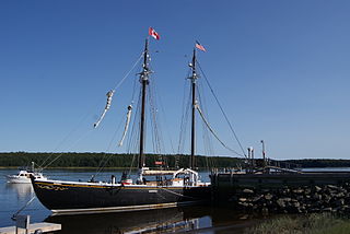
Sherman Zwicker is a wooden auxiliary fishing schooner built in 1942 at the Smith and Rhuland shipyard, Lunenburg, Nova Scotia. Influenced by the design of the famous Bluenose, Sherman Zwicker was built to fish the Grand Banks. The schooner was built for F. Homer Zwicker of Zwicker and Co. Officially christened in 1942, the F/V Sherman Zwicker is the last operable saltbank fishing vessel in existence.
Sight 2: USCGC LILAC
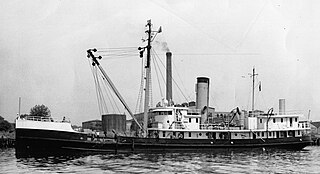
USCGC Lilac (WAGL/WLM-227) is a former Coast Guard buoy tender which is now a museum ship located in New York City. Lilac is America's only surviving steam-powered buoy tender, and is listed on the National Register of Historic Places.
Wikipedia: USCGC Lilac (WAGL-227) (EN), Website, Heritage Website
Sight 3: Hudson River Park
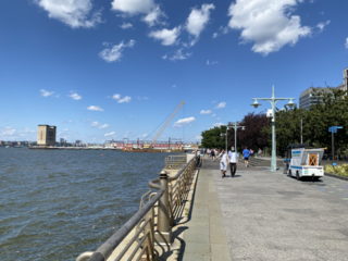
Hudson River Park is a waterfront park on the North River that extends from 59th Street south to Battery Park in the New York City borough of Manhattan. The park, a component of the Manhattan Waterfront Greenway, stretches 4.5 miles (7.2 km) and comprises 550 acres (220 ha), making it the second-largest park in Manhattan after the 843-acre (341 ha) Central Park.
Sight 4: Teardrop Park
- You are free: to share – to copy, distribute and transmit the work to remix – to adapt the work
- Under the following conditions: attribution – You must give appropriate credit, provide a link to the license, and indicate if changes were made. You may do so in any reasonable manner, but not in any way that suggests the licensor endorses you or your use. share alike – If you remix, transform, or build upon the material, you must distribute your contributions under the same or compatible license as the original.
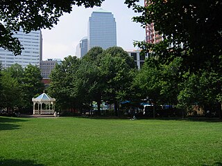
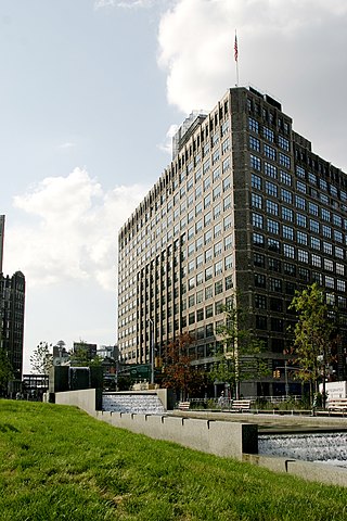
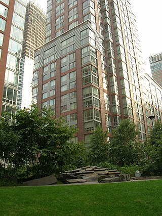
Teardrop Park is a 1.8-acre (0.7 ha) public park in lower Manhattan, in Battery Park City, near the site of the World Trade Center. It was designed by Michael Van Valkenburgh Associates, a New York City landscape architecture firm. The park includes art designed for it by Ann Hamilton. The park sits between residential buildings toward the north end of Battery Park City at the corner of Warren Street and River Terrace. The creation of Teardrop Park is part of the ongoing construction of Battery Park City, a neighborhood on the southwest edge of Manhattan Island that was created in the 1970s by landfilling the Hudson River between the existing bulkhead and the historic pierhead line. Before construction, the site was empty and flat. The park was designed in anticipation of four high residential towers that would define its eastern and western edges. Although Teardrop Park is a New York City public park, the client for the park was the Battery Park City Authority, and maintenance is overseen by the Battery Park City Parks Conservancy.
Sight 5: Washington Market Park
Washington Market Park is an urban park located in the TriBeCa neighborhood of Lower Manhattan in New York City. The park, which is bounded by Greenwich, Chambers, and West Streets, covers 1.61-acre (6,500 m2). The park also has community gardens and a large playground and hosts many community events.
Sight 6: Duane Park
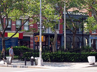
Duane Park is a small, triangular public urban park located in the diamond of the Tribeca neighborhood of Manhattan, New York City. The park is bordered by Hudson Street to the east and branches of Duane Street on its north and south sides. It was originally laid out by Calvert Vaux.
Sight 7: FDNY Ladder 8
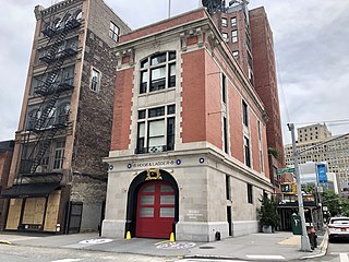
Firehouse, Hook & Ladder Company 8 is a New York City Fire Department (FDNY) fire station, located at 14 North Moore Street at its intersection with Varick Street in the Tribeca neighborhood of Manhattan, New York City. Its exterior has become famous for its appearance in the supernatural comedy franchise Ghostbusters.
Sight 8: Albert Capsouto Park
Albert Capsouto Park is a triangular-shaped pocket park in the Tribeca neighborhood of Lower Manhattan in New York City. It is bounded by Canal Street to the northeast, Varick Street to the west, and Laight Street to the south. It is located just east of the Holland Tunnel exit plaza, formerly known as St. John's Park.
Sight 9: Duarte Square
Juan Pablo Duarte Square, usually shortened to Duarte Square, is a 0.45-acre (0.18 ha) triangular park in Hudson Square, in Lower Manhattan, New York City. The park, operated by the New York City Department of Parks and Recreation, is bound by Sullivan Street and the LentSpace plot to the west, Grand Street to the north, Sixth Avenue to the east, and Canal Street and Albert Capsouto Park to the south.
Sight 10: LentSpace
LentSpace was a temporary outdoor art space and sculpture garden located in Hudson Square, Lower Manhattan, New York City. The space, which opened in September 2009, is bounded by Varick Street to the west, Canal Street and Albert Capsouto Park to the south, Grand Street to the north, and Sullivan Street and Duarte Square to the east.
Sight 11: Leslie-Lohman Museum of Art
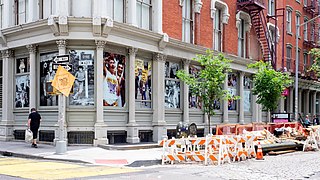
The Leslie-Lohman Museum of Art (LLMA), formerly the Leslie-Lohman Museum of Gay and Lesbian Art, is a visual art museum in SoHo, Lower Manhattan, New York City. It mainly collects, preserves and exhibits visual arts created by LGBTQ artists or art about LGBTQ+ themes, issues, and people. The museum, operated by the Leslie-Lohman Gay Art Foundation, offers exhibitions year-round in numerous locations and owns more than 22,000 objects, including, paintings, drawings, photography, prints and sculpture. The foundation was awarded Museum status by the New York State Board of Regents in 2011 and was formally accredited as a museum in 2016. The museum is a member of the American Alliance of Museums and operates pursuant to their guidelines. As of 2019, the LLMA was the only museum in the world dedicated to artwork documenting the LGBTQ experience.
Sight 12: 240 Centre Street
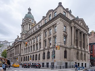
240 Centre Street, formerly the New York City Police Headquarters, is a building in the Little Italy neighborhood of Manhattan in New York City, United States. Designed by the firm Hoppin & Koen, it was the headquarters of the New York City Police Department (NYPD) from 1909 to 1973. Afterward, it was converted into a luxury residential building in 1988 by the firm Ehrenkranz Group & Eckstut, becoming the Police Building Apartments. 240 Centre Street occupies an entire city block between Centre Street to the west, Broome Street to the north, Centre Market Place to the east, and Grand Street to the south. It is a New York City designated landmark and on the National Register of Historic Places.
Sight 13: SoHo
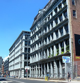
SoHo, short for "South of Houston Street", is a neighborhood in Lower Manhattan, New York City. Since the 1970s, the neighborhood has been the location of many artists' lofts and art galleries, and has also been known for its variety of shops ranging from trendy upscale boutiques to national and international chain store locations. The area's history is an archetypal example of inner-city regeneration and gentrification, encompassing socioeconomic, cultural, political, and architectural developments.
Sight 14: New York Earth Room
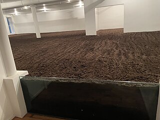
The New York Earth Room is an interior sculpture by the artist Walter De Maria that has been installed in a loft at 141 Wooster Street in New York City since 1977. The sculpture is a permanent installation of 250 cubic yards of earth in 3,600 square feet of floor space, and 22 inch depth of material. The installation has had the same caretaker, Bill Dilworth, since 1989, and is maintained by the Dia Art Foundation who consider it one of their 12 locations and sites they manage.
Sight 15: Time Landscape
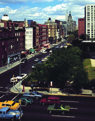
Time Landscape is a landscape artwork by American artist Alan Sonfist. Proposed in 1965, it consists of plants that were native to the New York City area in pre-colonial times. Those planted were replanted here until 1978, on a rectangular plot of 25' x 40' situated at University Village in lower Manhattan at the northeast corner of La Guardia Place and West Houston Street. The New York City Department of Parks and Recreation describes the artwork: "When it was first planted, Time Landscape portrayed the three stages of forest growth from grasses to saplings to grown trees. The southern part of the plot represented the youngest stage and now has birch trees and beaked hazelnut shrubs, with a layer of wildflowers beneath. The center features a small grove of beech trees and a woodland with red cedar, black cherry, and witch hazel above groundcover of mugwort, Virginia creeper, aster, pokeweed, and milkweed. The northern area is a mature woodland dominated by oaks, with scattered white ash and American elm trees. Among the numerous other species in this miniforest are oak, sassafras, sweetgum, and tulip trees, arrowwood and dogwood shrubs, bindweed and catbrier vines, and violets." Sonfist's intention was to create a natural memorial akin to war memorials.
Sight 16: St. Anthony of Padua Church
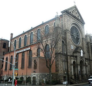
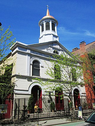
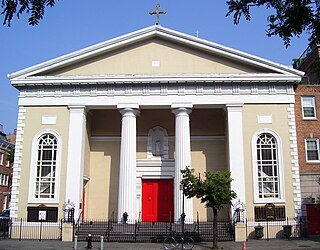
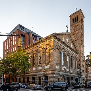
The Church of St. Anthony of Padua is a Catholic parish church in the Roman Catholic Archdiocese of New York, located at 155 Sullivan Street at the corner of West Houston Street, in the South Village and SoHo neighborhoods of Manhattan, New York City. It was established in 1859 as the first parish in the United States formed specifically to serve the Italian immigrant community.
Wikipedia: St. Anthony of Padua Church (Manhattan) (EN), Website
Sight 17: MacDougal-Sullivan Gardens Historic District
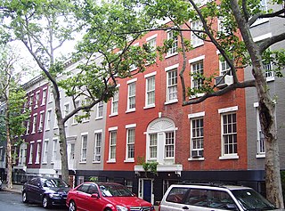
The MacDougal–Sullivan Gardens Historic District is a small historic district consisting of 22 houses located at 74–96 MacDougal Street and 170–188 Sullivan Street between Houston and Bleecker Streets in the South Village area of the Greenwich Village neighborhood of Manhattan, New York City.
Wikipedia: MacDougal–Sullivan Gardens Historic District (EN)
Sight 18: Winston Churchill Square
- You are free: to share – to copy, distribute and transmit the work to remix – to adapt the work
- Under the following conditions: attribution – You must give appropriate credit, provide a link to the license, and indicate if changes were made. You may do so in any reasonable manner, but not in any way that suggests the licensor endorses you or your use. share alike – If you remix, transform, or build upon the material, you must distribute your contributions under the same or compatible license as the original.
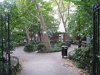
Sir Winston Churchill Square, at the southwest corner of Bleecker Street, Downing Street, and Sixth Avenue, is a .05-acre (0.020 ha) garden and sitting area in the Greenwich Village neighborhood of Manhattan, New York City.
Sight 19: New York City Fire Museum
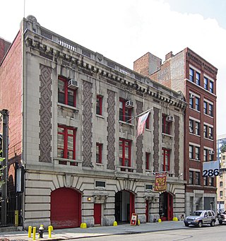
The New York City Fire Museum is a museum dedicated to the New York City Fire Department (FDNY) in the Hudson Square neighborhood of Manhattan, New York City. It is housed in the former quarters of the FDNY's Engine Company No. 30, a renovated 1904 fire house at 278 Spring Street between Varick and Hudson Streets.
Sight 20: Church of St. Luke in the Fields
The Church of St. Luke in the Fields is an Episcopal church at 487 Hudson Street, between Christopher and Barrow Streets, in the West Village neighborhood of Manhattan, New York City. The church was constructed in 1821–1822 and has been attributed to both John Heath, the building contractor, and James N. Wells.
Sight 21: St. John’s Church
St. John's Evangelical Lutheran Church is an Evangelical Lutheran church. It is located on Christopher Street in the West Village in New York's Greenwich Village, Manhattan. The congregation belongs to the Evangelical Lutheran Church in America. The church building was designated as part of the Greenwich Village Historic District in 1969 by the Landmarks Preservation Commission of the City of New York City.
Wikipedia: St. John’s Evangelical Lutheran Church (New York City) (DE)
Sight 22: Hess Triangle
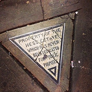
The Hess triangle is a triangular tile mosaic set in a sidewalk in New York City's West Village neighborhood at the corner of Seventh Avenue and Christopher Street. The plaque reads "Property of the Hess Estate which has never been dedicated for public purposes." The plaque is an isosceles triangle, with a 25+1⁄2-inch (65 cm) base and 27+1⁄2-inch (70 cm) legs (sides).
Sight 23: Greenwich Village
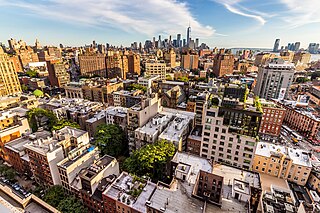
Greenwich Village, or simply the Village, is a neighborhood on the west side of Lower Manhattan in New York City, bounded by 14th Street to the north, Broadway to the east, Houston Street to the south, and the Hudson River to the west. Greenwich Village also contains several subsections, including the West Village west of Seventh Avenue and the Meatpacking District in the northwest corner of Greenwich Village.
Sight 24: Gay Liberation Monument
The Gay Liberation Monument is part of the Stonewall National Monument, which commemorates the Stonewall uprising of 1969. Created in 1980, the Gay Liberation sculpture by American artist George Segal was the first piece of public art dedicated to gay rights and solidarity for LGBTQ individuals, while simultaneously commemorating the ongoing struggles of the community. The monument was dedicated on June 23, 1992, as part of the dedication of the Stonewall National Monument as a whole.
Sight 25: Gay Street
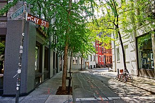
Gay Street is a short, angled street that marks off one block of Greenwich Village in the New York City borough of Manhattan. Although the street is part of the Stonewall National Monument, its name is likely derived from a family named Gay who owned land or lived there in colonial times. A newspaper of May 11, 1775, contains a classified ad where an "R. Gay", living in the Bowery, offers a gelding for sale.This street, originally a stable alley, was probably named for an early landowner, not for the sexuality of any denizens, who coincidentally reside in Greenwich Village, a predominantly homosexual community. Nor is it likely, as is sometimes claimed, that its namesake was Sidney Howard Gay, editor of the National Anti-Slavery Standard; he would have been 19 when the street was christened in 1833. The mistaken association with an abolitionist is probably because the street's residents were mainly black, many of them servants of the wealthy white families on Washington Square. Later it became noted as an address for black musicians, giving the street a bohemian reputation.
Sight 26: St. Joseph's Church
The Church of St. Joseph in Greenwich Village is a Roman Catholic parish church located at 365 Avenue of the Americas at the corner of Washington Place in the Greenwich Village neighborhood of Manhattan, New York City. Constructed in 1833–1834, it is the oldest church in New York City specifically built to be a Roman Catholic sanctuary.
Sight 27: West Fourth Street Courts
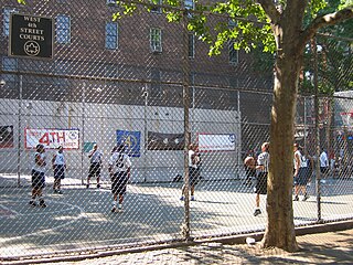
The West Fourth Street Courts, also known as "The Cage", are a notable public athletic venue for amateur basketball in the Greenwich Village neighborhood of Manhattan in New York City. "The Cage" has become one of the most important tournament sites for the citywide "Streetball" amateur basketball tournament, and is noted for its non-regulation size.
Sight 28: Comedy Cellar
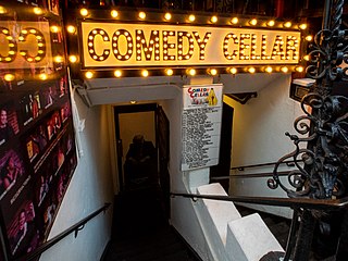
The Comedy Cellar is a comedy club in Manhattan where many top New York comedians perform, sometimes referred to as the "Harvard of comedy clubs". It was founded in 1982 by then stand-up comedian, and current television writer/producer Bill Grundfest. It is located in Greenwich Village on 117 MacDougal Street between West 3rd Street and Minetta Lane. Above the club is a restaurant called The Olive Tree Cafe to which it is connected, where many of the comedians hang out after performing. The club is owned by Noam Dworman, who inherited it from his late father Manny in 2003. It is being booked by Estee Adoram, who has developed the club's talent for nearly four decades. The businesses share the same menu, kitchen, and staff as the Olive Tree Cafe.
Sight 29: Judson Memorial Church
The Judson Memorial Church is located on Washington Square South between Thompson Street and Sullivan Street, near Gould Plaza, opposite Washington Square Park, in the Greenwich Village neighborhood of the New York City borough of Manhattan. It is affiliated with the American Baptist Churches USA, the Alliance of Baptists, and with the United Church of Christ.
Wikipedia: Judson Memorial Church (EN), Website, Twitter, Facebook, Instagram
Sight 30: Washington Square Park
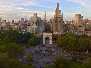
Washington Square Park is a 9.75-acre (3.95 ha) public park in the Greenwich Village neighborhood of Lower Manhattan, New York City. It is an icon as well as a meeting place and center for cultural activity. The park is operated by the New York City Department of Parks and Recreation.
Sight 31: Alexander Lyman Holley Monument
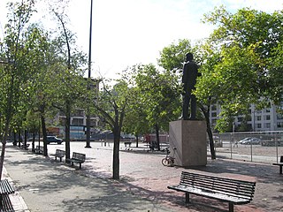
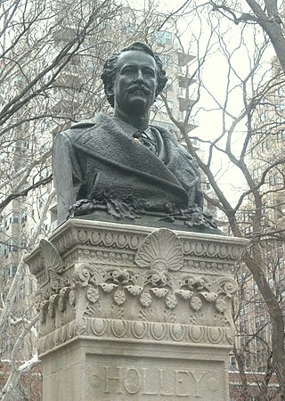
An outdoor bronze bust of Alexander Lyman Holley by artist John Quincy Adams Ward and architect Thomas Hastings is installed in Washington Square Park in Manhattan, New York. Cast by the Henry-Bonnard Bronze Company of New York and dedicated in 1889, the sculpture is set on an Indiana limestone pedestal and displays a Beaux-Arts style design.
Sight 32: Washington Square Arch
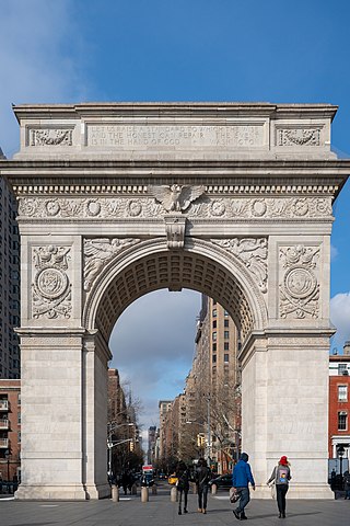
The Washington Square Arch, officially the Washington Arch, is a marble memorial arch in Washington Square Park, in the Greenwich Village neighborhood of Lower Manhattan, New York City. Designed by architect Stanford White in 1891, it commemorates the centennial of George Washington's 1789 inauguration as President of the United States, and forms the southern terminus of Fifth Avenue.
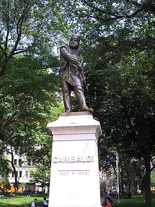
Sight 33: Giuseppe Garibaldi
An outdoor bronze sculpture of Giuseppe Garibaldi, one of the leaders of Italian unification, is installed in Washington Square Park in Manhattan, New York.
Wikipedia: Statue of Giuseppe Garibaldi (New York City) (EN)
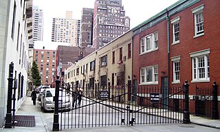
Sight 34: Washington Mews
Washington Mews is a private gated street in Manhattan, New York City between Fifth Avenue and University Place just north of Washington Square Park. Along with MacDougal Alley and Stuyvesant Street, it was originally part of a Lenape trail which connected the Hudson and East Rivers, and was first developed as a mews that serviced horses from homes in the area. Since the 1950s the former stables have served as housing, offices and other facilities for New York University.
Sight 35: New York Studio School of Drawing, Painting and Sculpture
The New York Studio School of Drawing, Painting and Sculpture at 8 West 8th Street, in Greenwich Village, Manhattan, New York City, New York State is an art school formed in 1963 by a group of students and their teacher, Mercedes Matter, all of whom had become disenchanted with the fragmented nature of art instruction inside traditional art programs and universities. Today it occupies the building that previously housed the Whitney Museum of American Art.
Wikipedia: New York Studio School of Drawing, Painting and Sculpture (EN)
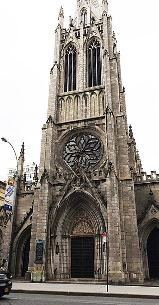
Sight 36: Church of the Ascension
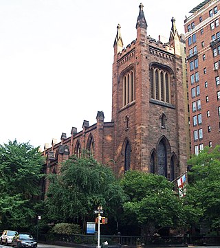
The Church of the Ascension is an Episcopal church in the Diocese of New York, located at 36–38 Fifth Avenue and West 10th Street in the Greenwich Village neighborhood of Manhattan New York City. It was built in 1840–41, the first church to be built on Fifth Avenue and was designed by Richard Upjohn in the Gothic Revival style. The interior was remodeled by Stanford White in 1885–88.
Wikipedia: Church of the Ascension, Episcopal (Manhattan) (EN)
Sight 37: Grace Church
Grace Church is a historic parish church in Manhattan, New York City which is part of the Episcopal Diocese of New York. The church is located at 800–804 Broadway, at the corner of East 10th Street, where Broadway bends to the south-southeast, bringing it in alignment with the avenues in Manhattan's grid. Grace Church School and the church houses—which are now used by the school—are located to the east at 86–98 Fourth Avenue between East 10th and 12th Streets. In 2021, it reported 1,038 members, average attendance of 212, and $1,034,712 in plate and pledge income.
Wikipedia: Grace Church (Manhattan) (EN), Website, Heritage Website
Sight 38: Colonnade row
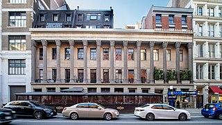
Colonnade Row, also known as LaGrange Terrace, is a group of 1830s row houses on present-day Lafayette Street in the NoHo neighborhood of Manhattan in New York City. They are believed to have been built by Seth Geer, although the project has been attributed to a number of other architects. The buildings' original name comes from the Marquis de Lafayette's estate in France, but the series of nine row houses, of which four remain, owe their existence to John Jacob Astor, who bought the property and whose grandson John Jacob Astor III later lived at No. 424. The remaining buildings are New York City designated landmarks and listed on the National Register of Historic Places under the name LaGrange Terrace. The facades remain standing on Lafayette Street south of Astor Place.
Sight 39: Merchant's House Museum

The Merchant's House Museum, also known as the Old Merchant's House and the Seabury Tredwell House, is a historic house museum at 29 East Fourth Street in the NoHo neighborhood of Manhattan in New York City. Built by the hatter Joseph Brewster between 1831 and 1832, the house is a four-story building with a Federal-style brick facade and a Greek Revival interior. It served as the residence of the Tredwell family for almost a century before it reopened as a museum in 1936. The Merchant's House Museum is the only 19th-century family home in New York City with intact exteriors and interiors.
Sight 40: Public Theater
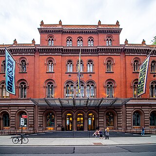
The Public Theater is an arts organization in New York City. Founded by Joseph Papp, The Public Theater was originally the Shakespeare Workshop in 1954; its mission was to support emerging playwrights and performers. Its first production was the musical Hair in 1967. Since Papp, the theatre has been led by JoAnne Akalaitis (1991–1993), and George C. Wolfe (1993–2004), and is currently under Artistic Director Oskar Eustis and Executive Director Patrick Willingham.
Sight 41: Alamo
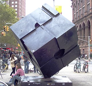
Alamo, also known as the Astor Place Cube or simply The Cube, is an outdoor sculpture by Tony Rosenthal, located on Astor Place, in the East Village neighborhood of Manhattan in New York City. It is a black cube, 8 feet (2.4 m) long on each side, mounted on a corner. The cube is made of Cor-Ten steel and weighs about 1,800 pounds (820 kg). The faces of the cube are not flat but have various indentations, protrusions, and ledges. The sculpture's name, Alamo, is designated on a small plaque on the base and was selected by the artist's wife because its scale and mass reminded her of the Alamo Mission. It was fabricated by Lippincott, Inc.
Sight 42: Saint Mark's in-the-Bowery
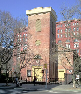
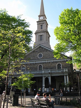
St. Mark's Church in-the-Bowery is a parish of the Episcopal Church at 131 East 10th Street(at the intersection of Stuyvesant Street and Second Avenue) in the East Village neighborhood of Manhattan in New York City. The property has been the site of continuous Christian worship since the mid-17th century, making it New York City's oldest site of continuous religious practice. The structure is the second-oldest church building in Manhattan.
Wikipedia: St. Mark's Church in-the-Bowery (EN), Website, Heritage Website
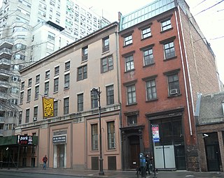
Sight 43: Classic Stage Company
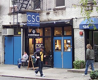
Classic Stage Company, or CSC, is a classical Off-Broadway theater company. Founded in 1967, Classic Stage Company is one of Off-Broadway's oldest theater companies.
Share
How likely are you to recommend us?
Disclaimer Please be aware of your surroundings and do not enter private property. We are not liable for any damages that occur during the tours.
GPX-Download For navigation apps and GPS devices you can download the tour as a GPX file.
