Self-guided Sightseeing Tour #11 in New York, United States
Legend
Guided Free Walking Tours
Book free guided walking tours in New York.
Guided Sightseeing Tours
Book guided sightseeing tours and activities in New York.
Tour Facts
12.2 km
323 m
Experience New York in United States in a whole new way with our free self-guided sightseeing tour. This site not only offers you practical information and insider tips, but also a rich variety of activities and sights you shouldn't miss. Whether you love art and culture, want to explore historical sites or simply want to experience the vibrant atmosphere of a lively city - you'll find everything you need for your personal adventure here.
Individual Sights in New YorkSight 1: David Zwirner

David Zwirner Gallery is an American contemporary art gallery owned by David Zwirner. It has four gallery spaces in New York City and one each in Los Angeles, London, Hong Kong, and Paris.
Sight 2: Kurimanzutto Gallery
Kurimanzutto is an art gallery located in Mexico City and New York City specializing in contemporary art that represents 33 international artists. It was founded in 1999 by Mónica Manzutto and José Kuri as a gallery without a fixed space. In 2006 it occupied a warehouse in the Colonia Condesa which served as a project space and workshop. In 2008 it opened its main gallery space in Mexico City in the San Miguel Chapultepec neighborhood and in 2018 it opened a project space in New York City.
Sight 3: Hales Gallery

Hales Gallery is a contemporary art gallery located on Bethnal Green Road in Shoreditch owned by Paul Hedge and Paul Maslin. Hales Gallery opened in 1992 in Deptford, South London, before moving to the Tea Building, in Shoreditch, London's East End in 2004 and later opening a second space in Chelsea, New York City in 2018.
Sight 4: Jack Shainman Gallery
Jack Shainman Gallery is a contemporary art gallery in New York City. The gallery was founded by Jack Shainman and his then-partner Claude Simard (1956—2014) in 1984 in Washington, D.C. The gallery has a focus on artists from Africa, East Asia, and North America.
Sight 5: Galleria Ca' d'Oro
Galleria Ca' d'Oro is an international contemporary art gallery curated and organized by Gloria Porcella. The gallery was founded in Rome by Antonio Porcella in 1970, and currently has three locations in Rome, Miami, and New York City.
Sight 6: Church of the Guardian Angel

The Church of the Guardian Angel is a Roman Catholic church in the Roman Catholic Archdiocese of New York, located at 193 Tenth Avenue, Chelsea, Manhattan, New York City, New York.
Sight 7: Matthew Marks Gallery
Matthew Marks is an art gallery located in the New York City neighborhood of Chelsea and the Los Angeles neighborhood of West Hollywood. Founded in 1991 by Matthew Marks, it specializes in modern and contemporary painting, sculpture, photography, installation art, film, and drawings and prints. The gallery has three exhibition spaces in New York City and two in Los Angeles.
Sight 8: Hauser & Wirth

Hauser & Wirth is a Swiss contemporary and modern art gallery.
Sight 9: Dia Chelsea
Dia Art Foundation is a nonprofit organization that initiates, supports, presents, and preserves art projects. It was established in 1974 by Philippa de Menil, the daughter of Houston arts patron Dominique de Menil and an heiress to the Schlumberger oil exploration fortune; art dealer Heiner Friedrich, Philippa's husband; and Helen Winkler, a Houston art historian. Dia provides support to projects "whose nature or scale would preclude other funding sources."
Sight 10: Marianne Boesky Gallery
Marianne Boesky Gallery is an art gallery located in the New York City neighborhood of Chelsea and Aspen, Colorado. Founded in 1996 in Soho by Marianne Boesky, it specializes in contemporary art. It represents established artists like Frank Stella and Jennifer Bartlett and a younger generation of artists like Sanford Biggers, The Haas Brothers, and Jammie Holmes. The gallery has two exhibition spaces in New York City and one in Aspen.
Sight 11: Lisson Gallery

Lisson Gallery is a contemporary art gallery with locations in London and New York, founded by Nicholas Logsdail in 1967. The gallery represents over 50 artists such as Art & Language, Ryan Gander, Carmen Herrera, Richard Long, John Latham, Sol LeWitt, Robert Mangold, Jonathan Monk, Julian Opie, Richard Wentworth, Anish Kapoor, Richard Deacon and Ai Weiwei.
Sight 12: Luhring Augustine Gallery

- You are free: to share – to copy, distribute and transmit the work to remix – to adapt the work
- Under the following conditions: attribution – You must give appropriate credit, provide a link to the license, and indicate if changes were made. You may do so in any reasonable manner, but not in any way that suggests the licensor endorses you or your use. share alike – If you remix, transform, or build upon the material, you must distribute your contributions under the same or compatible license as the original.
The Luhring Augustine Gallery is an art gallery in New York City. The gallery has three locations: Chelsea, Bushwick, and Tribeca. Its principal focus is the representation of an international group of contemporary artists whose diverse practices include painting, drawing, sculpture, video and photography.
Sight 13: Gagosian
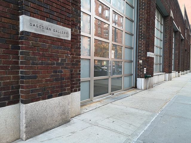
The Gagosian Gallery is a modern and contemporary art gallery owned and directed by Larry Gagosian. The gallery exhibits some of the most well-known artists of the 20th and 21st centuries. As of 2024, Gagosian employs 300 people at 19 exhibition spaces – including New York City, London, Paris, Basel, Beverly Hills, San Francisco, Rome, Athens, Geneva, and Hong Kong – designed by architects such as Caruso St John, Richard Gluckman, Richard Meier, Jean Nouvel, and Annabelle Selldorf.
Sight 14: Marlborough Gallery

Marlborough Fine Art was founded in London in 1946 by Frank Lloyd and Harry Fischer. In 1963, a gallery was opened as Marlborough-Gerson in Manhattan, New York, at the Fuller Building on Madison Avenue and 57th Street, which later relocated in 1971 to its present location, 40 West 57th Street. The gallery operates another New York space on West 25th Street, which opened in 2007. It briefly opened a Lower East Side space on Broome Street.
Sight 15: Berry Campbell Gallery
Berry Campbell Gallery is an art gallery in the Chelsea neighborhood of New York City. Its founders and directors are Christine Berry and Martha Campbell. The gallery focuses on historical and contemporary artists associated with American modernism.
Sight 16: Kasmin Gallery
The Kasmin Gallery, formerly known as the Paul Kasmin Gallery, is a New York City fine art gallery, founded in SoHo in 1989.
Sight 17: Chelsea Park

Chelsea Park is a park in the Chelsea neighborhood of Manhattan, New York City, that dates back to 1910. The park has sports fields, basketball and handball courts, a children's playground and space for sitting. The surface is mostly tarmac or artificial turf, with pits for the plane trees and some plots with annual flower plantings. There is a statue to a World War I soldier, the "Doughboy Statue", erected in 1921. The process of approval, funding and clearing the tenements that occupied the site was protracted. The park has since been upgraded several times by the Works Progress Administration and the New York City Department of Parks and Recreation.
Sight 18: Church of the Holy Apostles

The Church of the Holy Apostles is an Episcopal parish located at 296 Ninth Avenue at 28th Street in the Chelsea neighborhood of Manhattan, New York City. Its historic church building was built from 1845 to 1848, and was designed by New York architect Minard Lafever. The geometric stained-glass windows were designed by William Jay Bolton. The church faces Chelsea Park across 9th Avenue. The building is a New York City landmark and on the National Register of Historic Places.
Wikipedia: Church of the Holy Apostles (Manhattan) (EN), Website
Sight 19: Magnet Theater

The Magnet Theater is an improvisational comedy theatre and improv school in New York City.
Sight 20: Madison Square Garden

Madison Square Garden, colloquially known as the Garden or by its initials MSG, is a multi-purpose indoor arena in New York City. It is located in Midtown Manhattan between Seventh and Eighth avenues from 31st to 33rd streets above Pennsylvania Station. It is the fourth venue to bear the name "Madison Square Garden"; the first two, opened in 1879 and 1890 respectively, were located on Madison Square, on East 26th Street and Madison Avenue, with the third Madison Square Garden (1925) farther uptown at Eighth Avenue and 50th Street.
Sight 21: West Side Jewish Center

Congregation Beth Israel, commonly referred to as the West Side Jewish Center or, in more recent years, the Hudson Yards Synagogue, is an Orthodox Jewish congregation and synagogue located at 347 West 34th Street, in the Garment District of Manhattan, in New York City, New York, in the United States. Established in 1890, the congregation completed its current building near Penn Station in 1925.
Wikipedia: Congregation Beth Israel West Side Jewish Center (EN), Website
Sight 22: St. Michael's Church

The Church of St. Michael is a parish church in the Roman Catholic Archdiocese of New York, located at 424 West 34th Street, in Manhattan, New York City.
Wikipedia: Church of St. Michael (34th Street, Manhattan) (EN)
Sight 23: Metropolitan Community Church

The Metropolitan Community Church of New York (MCCNY) is an LGBTQ Christian church in New York City, located at 446 36th Street between Ninth and Tenth Avenue in the Hell's Kitchen neighborhood on the West Side of Midtown Manhattan.
Wikipedia: Metropolitan Community Church of New York (EN), Website
Sight 24: Church of Sts. Cyril & Methodius and St. Raphael

The Catholic Church of Sts. Cyril & Methodius and St. Raphael in Manhattan, New York City has since 1974 been administered as the seat of a Croatian national parish. It offers services in Croatian as well as services in English.
Wikipedia: Church of Sts. Cyril & Methodius and St. Raphael (EN), Website
Sight 25: Holy Cross Church

Holy Cross Church is a Roman Catholic church located at 329 West 42nd Street between Eighth and Ninth Avenues in the Hell's Kitchen neighborhood of Manhattan, New York City, near Times Square and across the street from the Port Authority Bus Terminal.
Sight 26: Madame Tussauds New York

Madame Tussauds New York is a tourist attraction located on 42nd Street in the Times Square neighborhood of Midtown Manhattan in New York City. Madame Tussauds was founded by the wax sculptor, Marie Tussaud, and is now operated by the United Kingdom-based entertainment company, Merlin Entertainments. The Madame Tussauds New York location opened on November 15, 2000.
Sight 27: Candler Building

The Candler Building is a skyscraper at the southern end of Times Square in the Midtown Manhattan neighborhood of New York City. Located at 220 West 42nd Street, with a secondary address of 221 West 41st Street, the 24-story building was designed by the firm of Willauer, Shape and Bready in the Spanish Renaissance style. It was constructed between 1912 and 1913 for Coca-Cola Company owner Asa Griggs Candler. The Candler Building was one of the last skyscrapers built in New York City before the 1916 Zoning Resolution, which required setbacks. It is listed on the National Register of Historic Places (NRHP).
Wikipedia: Candler Building (New York City) (EN), Heritage Website
Sight 28: Lyric Theatre

The Lyric Theatre is a Broadway theater at 214 West 43rd Street in the Theater District of Midtown Manhattan in New York City. Opened in 1998, the theater was designed by Richard Lewis Blinder of Beyer Blinder Belle, in collaboration with Peter Kofman, for Garth Drabinsky and his company Livent. The Lyric Theatre was built using parts of two former theaters on the site: the Apollo Theatre, built in 1920 to a design by Eugene De Rosa, and the old Lyric Theatre, built in 1903 to a design by Victor Hugo Koehler. The theater contains 1,622 seats across three levels and is operated by ATG Entertainment. The theater building is owned by the city and state governments of New York and was developed by New 42nd Street.
Wikipedia: Lyric Theatre (New York City, 1998) (EN), Website, Facebook, Twitter, Instagram
Sight 29: Helen Hayes Theatre

The Hayes Theater is a Broadway theater at 240 West 44th Street in the Theater District of Midtown Manhattan in New York City. Named for actress Helen Hayes, the venue is operated by Second Stage Theater. It is the smallest Broadway theater, with 597 seats across two levels. The theater was constructed in 1912 for impresario Winthrop Ames and designed by Ingalls & Hoffman in a neo-Georgian style. The original single-level, 299-seat configuration was modified in 1920, when Herbert J. Krapp added a balcony to expand the Little Theatre. The theater has served as a legitimate playhouse, a conference hall, and a broadcasting studio throughout its history.
Sight 30: Majestic Theatre

The Majestic Theatre is a Broadway theater at 245 West 44th Street in the Theater District of Midtown Manhattan in New York City. Opened in 1927, the theater was designed by Herbert J. Krapp in a Spanish style and was built for real-estate developer Irwin S. Chanin. It has 1,681 seats across two levels and is operated by The Shubert Organization. Both the facade and interior are New York City landmarks.
Sight 31: Broadhurst Theatre

The Broadhurst Theatre is a Broadway theater at 235 West 44th Street in the Theater District of Midtown Manhattan in New York City. Opened in 1917, the theater was designed by Herbert J. Krapp and was built for the Shubert brothers. The Broadhurst Theatre is named for British-American theatrical producer George Broadhurst, who leased the theater before its opening. It has 1,218 seats across two levels and is operated by The Shubert Organization. Both the facade and the auditorium interior are New York City landmarks.
Sight 32: Booth Theatre

The Booth Theatre is a Broadway theater at 222 West 45th Street in the Theater District of Midtown Manhattan in New York City. Opened in 1913, the theater was designed by Henry Beaumont Herts in the Italian Renaissance style and was built for the Shubert brothers. The venue was originally operated by Winthrop Ames, who named it for 19th-century American actor Edwin Booth. It has 800 seats across two levels and is operated by The Shubert Organization. The facade and parts of the interior are New York City landmarks.
Sight 33: Gerald Schoenfeld Theatre

The Gerald Schoenfeld Theatre, formerly the Plymouth Theatre, is a Broadway theater at 236 West 45th Street in the Theater District of Midtown Manhattan in New York City. Opened in 1917, the theater was designed by Herbert J. Krapp and was built for the Shubert brothers. The Schoenfeld Theatre is named for Gerald Schoenfeld, longtime president of the Shubert Organization, which operates the theater. It has 1,079 seats across two levels. Both the facade and the auditorium interior are New York City landmarks.
Sight 34: Bernard B. Jacobs Theatre

The Bernard B. Jacobs Theatre is a Broadway theater at 242 West 45th Street in the Theater District of Midtown Manhattan in New York City. Opened in 1927, the theater was designed by Herbert J. Krapp in a Spanish style and was built for real-estate developer Irwin S. Chanin. It has 1,100 seats across two levels and is operated by The Shubert Organization. Both the facade and the auditorium interior are New York City landmarks.
Sight 35: John Golden Theatre

The John Golden Theatre, formerly the Theatre Masque and Masque Theater, is a Broadway theater at 252 West 45th Street in the Theater District of Midtown Manhattan in New York City. Opened in 1927, the Golden Theatre was designed by Herbert J. Krapp in a Spanish style and was built for real-estate developer Irwin S. Chanin. It has 800 seats across two levels and is operated by the Shubert Organization. Both the facade and the auditorium interior are New York City landmarks.
Sight 36: Imperial Theatre

The Imperial Theatre is a Broadway theater at 249 West 45th Street in the Theater District of Midtown Manhattan in New York City. Opened in 1923, the Imperial Theatre was designed by Herbert J. Krapp and was constructed for the Shubert brothers. It has 1,457 seats across two levels and is operated by The Shubert Organization. The auditorium interior is a New York City designated landmark.
Sight 37: Lyceum Theatre

The Lyceum Theatre is a Broadway theater at 149 West 45th Street, between Seventh Avenue and Sixth Avenue, in the Theater District of Midtown Manhattan in New York City. Opened in 1903, the Lyceum Theatre is one of the oldest surviving Broadway venues, as well as the oldest continuously operating legitimate theater in New York City. The theater was designed by Herts & Tallant in the Beaux-Arts style and was built for impresario Daniel Frohman. It has 922 seats across three levels and is operated by The Shubert Organization. The facade became a New York City designated landmark in 1974, and the lobby and auditorium interiors were similarly designated in 1987.
Sight 38: Hudson Theatre

The Hudson Theatre is a Broadway theater at 139–141 West 44th Street, between Seventh Avenue and Sixth Avenue, in the Theater District of Midtown Manhattan in New York City. One of the oldest surviving Broadway venues, the Hudson was built from 1902 to 1903. The exterior was designed by J. B. McElfatrick & Son, while Israels & Harder oversaw the completion of the interior. The theater has 970 seats across three levels. Both its exterior and interior are New York City designated landmarks, and the theater is on the National Register of Historic Places.
Sight 39: Belasco Theatre

The Belasco Theatre is a Broadway theater at 111 West 44th Street, between Seventh Avenue and Sixth Avenue, in the Theater District of Midtown Manhattan in New York City. Originally known as the Stuyvesant Theatre, it was built in 1907 and designed by architect George Keister for impresario David Belasco. The Belasco Theatre has 1,016 seats across three levels and has been operated by The Shubert Organization since 1948. Both the facade and interior of the theater are New York City landmarks.
Sight 40: Church of Saint Mary the Virgin

The Church of Saint Mary the Virgin is an Episcopal Anglo-Catholic church in Midtown Manhattan, New York City, which is part of the Episcopal Diocese of New York of the Episcopal Church in the United States of America. The church complex is located in the heart of Times Square at 133-145 West 46th Street, with other buildings of the complex at 136-144 West 47th Street, between Sixth and Seventh Avenues. It is colloquially known as "Smoky Mary's" because of the amount of incense used in the services.
Wikipedia: Church of St. Mary the Virgin (Manhattan) (EN), Website, Heritage Website
Sight 41: Duffy Square

Duffy Square, officially named Father Duffy Square in 1939, is the northern triangle of Times Square in Manhattan, New York City. It is bounded by 45th and 47th Streets, Broadway and Seventh Avenue. It is now well known for the TKTS reduced-price theater tickets booth located there.
Sight 42: Lunt-Fontanne Theatre

The Lunt-Fontanne Theatre, originally the Globe Theatre, is a Broadway theater at 205 West 46th Street in the Theater District of Midtown Manhattan in New York City. Opened in 1910, the Lunt-Fontanne Theatre was designed by Carrère and Hastings in the Beaux-Arts style for Charles Dillingham. The theater is named after theatrical couple Alfred Lunt and Lynn Fontanne; its original name was inspired by that of the Globe Theatre, London's Shakespearean playhouse. The current configuration of the interior, dating to 1958, has about 1,505 seats across two levels and is operated by the Nederlander Organization. The facade is a New York City designated landmark.
Sight 43: Barrymore Theatre

The Ethel Barrymore Theatre is a Broadway theater at 243 West 47th Street in the Theater District of Midtown Manhattan in New York City. Opened in 1928, it was designed by Herbert J. Krapp in the Elizabethan, Mediterranean, and Adam styles for the Shubert family. The theater, named in honor of actress Ethel Barrymore, has 1,058 seats and is operated by the Shubert Organization. Both the facade and the auditorium interior are New York City landmarks.
Sight 44: Lena Horne Theatre

The Lena Horne Theatre is a Broadway theater at 256 West 47th Street in the Theater District of Midtown Manhattan in New York City. Opened in 1926, it was designed by Herbert J. Krapp in a Spanish Revival style and was constructed for Irwin Chanin. It has 1,069 seats across two levels and is operated by the Nederlander Organization. Both the facade and the auditorium interior are New York City landmarks.
Sight 45: Eugene O'Neill Theatre

The Eugene O'Neill Theatre, previously the Forrest Theatre and the Coronet Theatre, is a Broadway theater at 230 West 49th Street in the Theater District of Midtown Manhattan in New York City. The theater was designed by Herbert J. Krapp and was constructed for the Shubert brothers. It opened in 1925 as part of a hotel and theater complex named after 19th-century tragedian Edwin Forrest. The modern theater, named in honor of American playwright Eugene O'Neill, has 1,108 seats across two levels and is operated by ATG Entertainment. The auditorium interior is a New York City designated landmark.
Sight 46: Longacre Theatre

The Longacre Theatre is a Broadway theater at 220 West 48th Street in the Theater District of Midtown Manhattan in New York City, United States. Opened in 1913, it was designed by Henry B. Herts and was named for Longacre Square, now known as Times Square. The Longacre has 1,077 seats and is operated by The Shubert Organization. Both the facade and the auditorium's interior are New York City designated landmarks.
Sight 47: James Earl Jones Theatre

The James Earl Jones Theatre, originally the Cort Theatre, is a Broadway theater at 138 West 48th Street, between Seventh Avenue and Sixth Avenue, in the Theater District of Midtown Manhattan in New York City, United States. It was built in 1912 and designed by architect Thomas W. Lamb for impresario John Cort. An annex to the west of the theater, built between 2021 and 2022, was designed by Kostow Greenwood Architects. The Jones has 1,092 seats across three levels and is operated by the Shubert Organization. Both the facade and interior of the theater are New York City designated landmarks.
Sight 48: Charles Scribner's Sons Building

The Charles Scribner's Sons Building, also known as 597 Fifth Avenue, is a commercial structure in the Midtown Manhattan neighborhood of New York City, on Fifth Avenue between 48th and 49th Streets. Designed by Ernest Flagg in a Beaux Arts style, it was built from 1912 to 1913 for the Scribner's Bookstore.
Sight 49: Bryant Park

Bryant Park is a 9.6-acre (3.9 ha), privately managed public park in the New York City borough of Manhattan. It is located between Fifth Avenue and Avenue of the Americas and between 40th and 42nd Streets in Midtown Manhattan. The eastern half of Bryant Park is occupied by the Main Branch of the New York Public Library. The western half contains a lawn, shaded walkways, and amenities such as a carousel, and is located entirely over an underground structure that houses the library's stacks. The park hosts several events, including a seasonal "Winter Village" with an ice rink and shops during the winter.
Sight 50: Golda Meir

Golda Meir is an outdoor bronze sculpture of former Israeli prime minister Golda Meir. The sculpture is located at Golda Meir Square near Broadway and 39th Street in the Garment District of Manhattan, New York. It was unveiled in 1984. It is one of only five statues of women in New York City as of 2016.
Share
How likely are you to recommend us?
Disclaimer Please be aware of your surroundings and do not enter private property. We are not liable for any damages that occur during the tours.
GPX-Download For navigation apps and GPS devices you can download the tour as a GPX file.