Self-guided Sightseeing Tour #1 in Salford, United Kingdom
Legend
Tour Facts
2.2 km
68 m
Experience Salford in United Kingdom in a whole new way with our free self-guided sightseeing tour. This site not only offers you practical information and insider tips, but also a rich variety of activities and sights you shouldn't miss. Whether you love art and culture, want to explore historical sites or simply want to experience the vibrant atmosphere of a lively city - you'll find everything you need for your personal adventure here.
Individual Sights in SalfordSight 1: Victoria Bridge

Victoria Bridge is a stone arch bridge in Greater Manchester, England. Completed in 1839 and named after Queen Victoria, it crosses the River Irwell, connecting Salford to Manchester.
Sight 2: Manchester Cathedral
Get Ticket*
Manchester Cathedral, formally the Cathedral and Collegiate Church of St Mary, St Denys and St George, in Manchester, England, is the mother church of the Anglican Diocese of Manchester, seat of the Bishop of Manchester and the city's parish church. It is on Victoria Street in Manchester city centre and is a grade I listed building.
Wikipedia: Manchester Cathedral (EN), Website, Heritage Website
Sight 3: The Glade of Light

The Glade of Light is a memorial in Manchester, England, that commemorates the victims of the Manchester Arena bombing of 2017. It opened to the public on 5 January 2022 and an official opening event took place 10 May 2022. The memorial is in the form of a garden with a stone centrepiece inscribed with the names of the 22 victims. Individual 'memory capsules' commemorating each victim have been included in the memorial and are situated within the stone centrepiece.
Sight 4: The Old Wellington Inn

The Old Wellington Inn is a half-timbered pub in Manchester city centre, England. It is part of Shambles Square, which was created in 1999, and is near Manchester Cathedral. It is a Grade II listed building.
Sight 5: Corn Exchange

The Corn Exchange, Manchester is a food court and former shopping centre in Exchange Square, Manchester, England. The building was originally used as a corn exchange and was previously named the Corn & Produce Exchange, and subsequently The Triangle. Following an IRA bomb attack on central Manchester in 1996, it was renovated and was a modern shopping centre until 2014. The building was sold to investors and has been re-developed into a number of food outlets. It is a grade II listed building.
Sight 6: National Football Museum
Get Ticket*
The National Football Museum is England's national museum of football. It is based in the Urbis building in Manchester city centre, and preserves, conserves and displays important collections of football memorabilia.
Sight 7: Cathedral Gardens

Cathedral Gardens is an open space in Manchester city centre, in North West England. It is bounded by Victoria railway station to the north, Chetham's School of Music to the west, the perimeter of Manchester Cathedral and the Corn Exchange on Fennel Street to the south and Urbis to the east.
Sight 8: AO Arena

Manchester Arena is an indoor arena in Manchester, England, immediately north of the city centre and partly above Manchester Victoria station in air rights space. Prior to the opening of Co-op Live, the arena had the highest seating capacity of any indoor venue in the United Kingdom, and is the third-largest in Europe with a capacity of 21,000.
Sight 9: Angel Meadow
Get Ticket*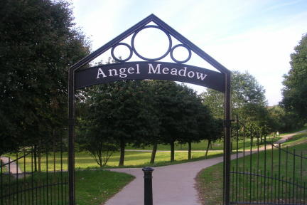
St Michael's Flags and Angel Meadow Park is a public park in Manchester, England, to the immediate northeast of the city centre, on a slope between the River Irk and Rochdale Road. It occupies an area of 7.4 acres (3 ha), and was once an affluent suburb, until the 19th-century Industrial Revolution altered the social standing of the area and introduced poverty and disease. Regeneration of the park in the 2000s has created a gateway into the Irk Valley.
Share
How likely are you to recommend us?
Disclaimer Please be aware of your surroundings and do not enter private property. We are not liable for any damages that occur during the tours.
GPX-Download For navigation apps and GPS devices you can download the tour as a GPX file.