Self-guided Sightseeing Tour #1 in Ipswich, United Kingdom
Legend
Tour Facts
1.8 km
29 m
Experience Ipswich in United Kingdom in a whole new way with our self-guided sightseeing tour. This site not only offers you practical information and insider tips, but also a rich variety of activities and sights you shouldn't miss. Whether you love art and culture, want to explore historical sites or simply want to experience the vibrant atmosphere of a lively city - you'll find everything you need for your personal adventure here.
Individual Sights in IpswichSight 1: Ipswich Martyrs
The Ipswich Martyrs were nine people burnt at the stake for their Lollard or Protestant beliefs around 1515-1558. The executions were mainly carried out in the centre of Ipswich, Suffolk on The Cornhill, the square in front of Ipswich Town Hall. At that time the remains of the medieval church of St Mildred were used for the town's Moot Hall. Later, in 1645 Widow Lakeland was executed on the same site on the orders of Matthew Hopkins, the notorious Witchfinder General.
Sight 2: Christchurch Mansion

Christchurch Mansion is a substantial Tudor brick mansion house built in Ipswich, Suffolk, England, by Edmund Withypoll around 1548–50. The Grade I listed building is located within Christchurch Park and sits by the southern gates close to the town centre of Ipswich. The mansion belonged to various noble families throughout its history but was purchased by the Ipswich Borough Council in 1884. Since 1885, the building has been used as a museum and is today run by the municipally run Colchester and Ipswich Museums Service (CIMS)organisation. The museum's rooms are preserved as past inhabitants would have known them, complete with original items such as furniture, fine clothing and children's toys. The museum also holds a collection of paintings by renowned local artists including John Constable and Thomas Gainsborough. The Mansion is free to enter and booking is not required.
Sight 3: Giles Family
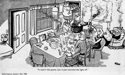
The Giles family is a fictional British family created by cartoonist Carl Giles at the end of World War II, appearing first on 5 August 1945. Much of Giles's World War II work had been cartoons featuring Adolf Hitler, Benito Mussolini and the typical British Tommy, but he felt the need to expand after the War, hence the family. The format was a single-panel cartoon, published daily in the Daily Express and Sunday Express newspapers from 1945 until 1991. An annual collection was published each Christmas.
Sight 4: St Mary Elms, Ipswich

St Mary at the Elms is a Church of England church in Ipswich, England. Historically it was located in the West Ward,Ipswich, but is now in Alexandra Ward, Ipswich.
Sight 5: New Wolsey Theatre

The New Wolsey Theatre is a producing theatre with a café & bar in Ipswich, Suffolk. It is a midsized regional theatre, with a seating capacity of 400.
Sight 6: Ipswich Museum

Ipswich Museum is a registered museum of culture, history and natural heritage, located in a Grade II* listed building on High Street in Ipswich, the county town of Suffolk. It was historically the leading regional museum in Suffolk, housing collections drawn from both the former counties of East Suffolk and West Suffolk, which were amalgamated in 1974.
Share
Disclaimer Please be aware of your surroundings and do not enter private property. We are not liable for any damages that occur during the tours.
GPX-Download For navigation apps and GPS devices you can download the tour as a GPX file.