Self-guided Sightseeing Tour #2 in Birmingham, United Kingdom
Legend
Tour Facts
6 km
174 m
Experience Birmingham in United Kingdom in a whole new way with our free self-guided sightseeing tour. This site not only offers you practical information and insider tips, but also a rich variety of activities and sights you shouldn't miss. Whether you love art and culture, want to explore historical sites or simply want to experience the vibrant atmosphere of a lively city - you'll find everything you need for your personal adventure here.
Activities in BirminghamIndividual Sights in BirminghamSight 1: The Roundhouse
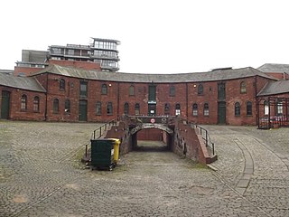
Get Ticket*The Roundhouse, formerly Corporation Wharf, is a crescent-shaped building located in the city centre of Birmingham, England.
Sight 2: Birmingham Rep
Birmingham Repertory Theatre, commonly called Birmingham Rep or just The Rep, is a producing theatre based on Centenary Square in Birmingham, England. Founded by Barry Jackson, it is the longest-established of Britain's building-based theatre companies and one of its most consistently innovative.
Wikipedia: Birmingham Repertory Theatre (EN), Url, Theatricalia
Sight 3: Chamberlain Memorial Fountain
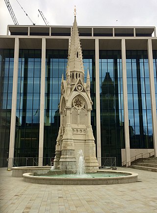
The Chamberlain Memorial, also known as the Chamberlain Memorial Fountain, is a monument in Chamberlain Square, Birmingham, England, erected in 1880 to commemorate the public service of Joseph Chamberlain (1836–1914), Birmingham businessman, councillor, mayor, Member of Parliament, and statesman. An inauguration ceremony was held on 20 October 1880, when Chamberlain himself was present.
Sight 4: Council House
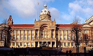
Get Ticket*Birmingham City Council House in Birmingham, England, is the home of Birmingham City Council, and thus the seat of local government for the city. It provides office accommodation for both employed council officers, including the Chief Executive, and elected council members, plus the council chamber, Lord Mayor's Suite, committee rooms and a large and ornate banqueting suite, complete with minstrel's gallery. The first-floor's exterior balcony is used by visiting dignitaries and victorious sports teams, to address crowds assembled below. The Council House, which has its own postcode, B1 1BB, is located in Victoria Square in the city centre and is a Grade II* listed building.
Sight 5: Birmingham Museum & Art Gallery

Birmingham Museum and Art Gallery (BM&AG) is a museum and art gallery in Birmingham, England. It has a collection of international importance covering fine art, ceramics, metalwork, jewellery, natural history, archaeology, ethnography, local history and industrial history.
Sight 6: Town Hall
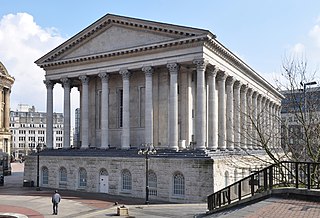
Get Ticket*Birmingham Town Hall is a concert hall and venue for popular assemblies opened in 1834 and situated in Victoria Square, Birmingham, England. It is a Grade I listed building.
Sight 7: Iron:Man
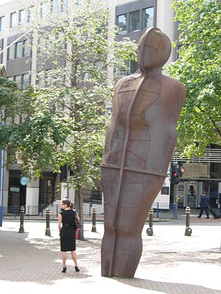
Iron:Man is a statue by Antony Gormley, in Victoria Square, Birmingham, England. The statue is 6 metres (20 ft) tall, including the feet which are buried beneath the pavement, and weighs 6 metric tons. The statue leans 7.5° backwards and 5° to its left. It is said by the sculptor to represent the traditional skills of Birmingham and the Black Country practised during the Industrial Revolution.
Sight 8: Victoria Square House
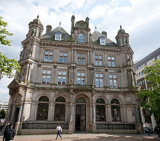
Victoria Square House, is an office building on the south side of Victoria Square, Birmingham, England. It was formerly Birmingham's Head Post Office, designed in the French Renaissance style by architect for the Office of Works Henry Tanner for the General Post Office.
Sight 9: The River
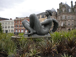
Get Ticket*The River, locally known as the Floozie in the Jacuzzi, is an artwork in Victoria Square, Birmingham, England.
Sight 10: Java Lounge
122–124 Colmore Row is a Grade I listed building on Colmore Row in Birmingham, England. Built as the Eagle Insurance Offices it was later occupied by Orion Insurance and was Hudson's Coffee House until late 2011, It is currently Java Lounge Coffee House.
Sight 11: Birmingham School of Art
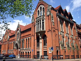
The Birmingham School of Art was a municipal art school based in the centre of Birmingham, England. Although the organisation was absorbed by Birmingham Polytechnic in 1971 and is now part of Birmingham City University's Faculty of Arts, Design and Media, its Grade I listed building on Margaret Street remains the home of the university's Department of Fine Art and is still commonly referred to by its original title.
Sight 12: The Exchange
17 & 19 Newhall Street is a red brick and architectural terracotta Grade I listed building, situated on the corner of Newhall Street and Edmund Street in the city centre of Birmingham, England. Although its official name is 17 & 19 Newhall Street, it is popularly known as The Exchange, and was previously known as the Bell Edison Telephone Building.
Sight 13: The Old Joint Stock
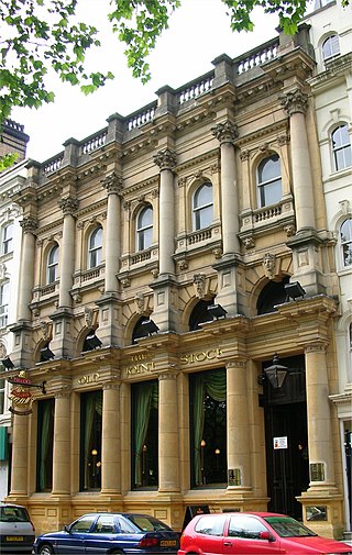
The Old Joint Stock Theatre is a studio theatre and pub located at 4 Temple Row West in the centre of Birmingham, England, opposite St Philip's Cathedral. The listed building was designed as a library but owes its present name to its use by the Birmingham Joint Stock Bank.
Sight 14: The Trocadero
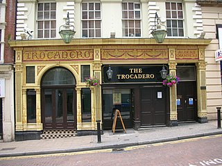
The Trocadero, 17 Temple Street, Birmingham, England, currently a pub, is a dazzling demonstration of the use of coloured glazed tile and terracotta in the post-Victorian era of architecture.
Sight 15: Cathedral Church of Saint Philip
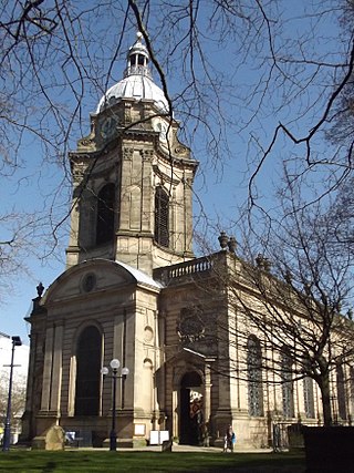
The Cathedral Church of Saint Philip, also called the Birmingham Cathedral, is a Church of England cathedral and the seat of the Bishop of Birmingham. Built as a parish church in the Baroque style by Thomas Archer, it was consecrated in 1715. Located on Colmore Row in central Birmingham, St Philip's became the cathedral of the newly formed Diocese of Birmingham in 1905. The cathedral is a Grade I listed building.
Wikipedia: St Philip's Cathedral, Birmingham (EN), Website, Heritage Website
Sight 16: Great Western Arcade
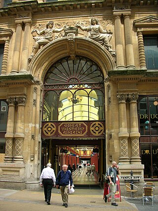
The Great Western Arcade is a covered Grade II listed Victorian shopping arcade lying between Colmore Row and Temple Row in Birmingham City Centre, England.
Sight 17: St Michael's
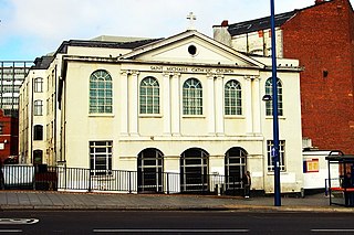
St Michael's Catholic Church is a Catholic church located on Moor Street in Birmingham, England. It received Grade II listed building status on 25 April 1952.
Sight 18: Carrs Lane Church Centre
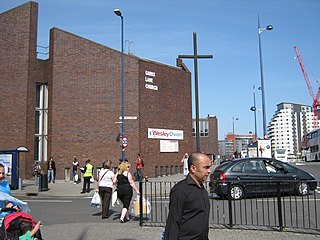
Carrs Lane Church, also known as The Church at Carrs Lane is a church in Birmingham and is noted as having the largest free-standing cross in the country.
Sight 19: Birmingham Moor Street
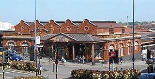
Get Ticket*Birmingham Moor Street, also known as Moor Street station, is one of three main railway stations in the city centre of Birmingham, England, along with Birmingham New Street and Birmingham Snow Hill.
Sight 20: Christopher Wray Lighting Works
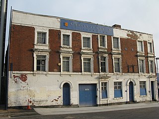
Christopher Wray Lighting works is a grade II-listed building in the east side of Birmingham city centre, England. The works consist of a complex of buildings fronted by a row of three townhouses, left vacant since 2003.
Sight 21: Curzon Street Station
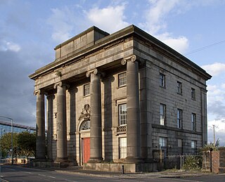
Birmingham Curzon Street railway station was a railway station in central Birmingham, England. Initially used as a major early passenger terminus before being eclipsed by newer facilities and converted into a goods depot, it was a continuously active railway facility up until 1966.
Wikipedia: Birmingham Curzon Street railway station (1838–1966) (EN)
Sight 22: The Woodman
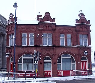
The Woodman is a pub in the Digbeth area of Birmingham, England. It is located on the corner of New Canal Street and what was formerly part of Albert Street, now part of an urban park called Eastside City Park and is Grade II listed. After an extended period of closure owing to the COVID-19 pandemic and the development of an HS2 rail scheme, the pub reopened on 13 September 2024.
Sight 23: Eastside City Park
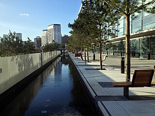
Eastside City Park is a 6.75 acre urban park located in the Eastside district of Birmingham City Centre. Designed by architects Patel taylor with landscape architect Allain Provost, the park was opened to the public on 5 December 2012 at a cost of £11.75 million. Lining the frontage of Millennium Point, the park provides 14,300 square metres of landscaped green space, 310 trees, a 110 metres (360 ft) canal water feature and a public square incorporating 21 jet fountains.
Sight 24: Canalside Warehouse at Warwick Bar, Dock and Stoplock
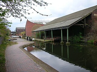
The Warwick Bar conservation area is a conservation area in Birmingham, England which was home to many canalside factories during the Industrial Revolution of the eighteenth and nineteenth centuries.
Share
How likely are you to recommend us?
Disclaimer Please be aware of your surroundings and do not enter private property. We are not liable for any damages that occur during the tours.
GPX-Download For navigation apps and GPS devices you can download the tour as a GPX file.
