Self-guided Sightseeing Tour #6 in Tunis, Tunisia
Legend
Guided Free Walking Tours
Book free guided walking tours in Tunis.
Guided Sightseeing Tours
Book guided sightseeing tours and activities in Tunis.
Tour Facts
5.7 km
103 m
Experience Tunis in Tunisia in a whole new way with our free self-guided sightseeing tour. This site not only offers you practical information and insider tips, but also a rich variety of activities and sights you shouldn't miss. Whether you love art and culture, want to explore historical sites or simply want to experience the vibrant atmosphere of a lively city - you'll find everything you need for your personal adventure here.
Activities in TunisIndividual Sights in TunisSight 1: Mosque

The al-Hawa Mosque, also known as the Tawfiq Mosque, is a historic mosque in Tunis, Tunisia. It was first built in the 13th century under the Hafsids and later renovated in the 18th century under the Husainids. It is an official Historical Monument.
Sight 2: متحف السينما

The Cinema Museum is a Tunisian museum founded in 1998 and located in Tunis.
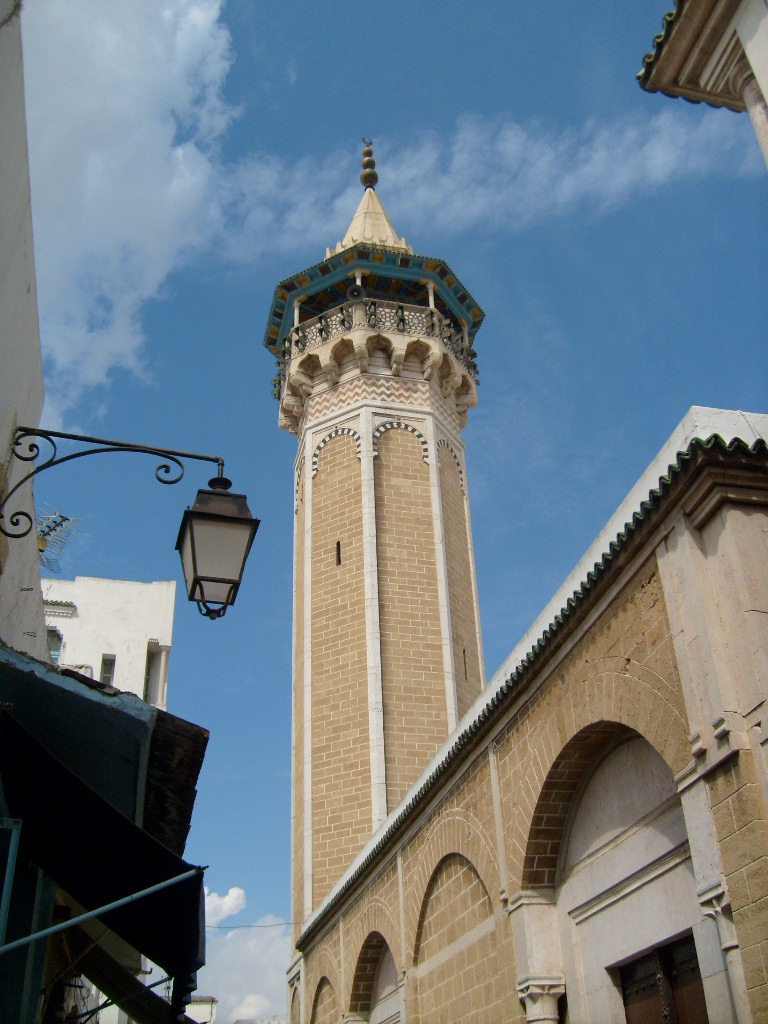
Sight 3: Kasbah Mosque

Kasbah Mosque is a mosque in Tunis, Tunisia. It is a listed as a Historical Monument.
Sight 4: Medina of Tunis
Get Ticket*
The Medina of Tunis is the medina quarter of Tunis, the capital of Tunisia. It has been a UNESCO World Heritage Site since 1979.
Sight 5: Hammouda Pacha Mosque
Hammouda Bay Mosque or Hamouda Bay al Mouradi is a mosque in Tunis, Tunisia. It is an official historical monument.
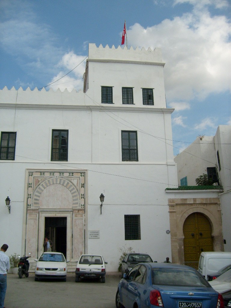
Sight 6: Dar El Haddad

Dar El Haddad is one of the oldest palaces in the medina of Tunis.
Sight 7: المعهد الوطني للتراث بتونس
Dar Hussein, is an old palace in the medina of Tunis.
Sight 8: Bab Jedid

Bab Jedid, also spelled Bab Djedid or Bab Jdid, is one of the gates of the medina of Tunis.
Sight 9: Turbat Al Bai

The Tourbet el Bey is a Tunisian royal mausoleum in the southwest of the medina of Tunis.
Sight 10: New Mosque

El Jedid Mosque is a mosque in Tunis, Tunisia, located in Medina area of the city.
Sight 11: دار عثمان

Dar Othman is one of the palaces of the medina of Tunis. The residence is located in the south of the medina, 16 El Mebazaâ Street.
Sight 12: دار باش حامبة

Dar Bach Hamba is an old palace in the medina of Tunis.
Sight 13: Bab el Bhar

Bab el Bhar, also known as Porte De France, is a city gate in Tunis, the capital of Tunisia. It marks the separation between the Medina of Tunis and the modern city. The gate is made up of a lowered archway and topped by a crenellated parapet.
Sight 14: كاتدرائية تونس

The Cathedral of St. Vincent de Paul is a Roman Catholic church located in Tunis, Tunisia. The cathedral is dedicated to Saint Vincent de Paul, patron saint of charity. It is the episcopal see of the Archdiocese of Tunis and is situated at Place de l'Indépendence in Ville Nouvelle, a crossroads between Avenue Habib Bourguiba and Avenue de France, opposite the French embassy.
Sight 15: المسرح البلدي بتونس

The Théâtre municipal de Tunis in Tunisia, Built in the Art Nouveau style on Avenue Jules-Ferry, was first opened on November 20, 1902 and currently showcases opera, ballet, symphonic concerts and dramas featuring numerous Tunisian, Arab and international actors. It was then called the Municipal Casino of Tunis.
Sight 16: ساحة برشلونة

Place de Barcelone is a square in the center Tunis, capital of Tunisia.
Sight 17: ساحة المنجي بالي

Mongi Bali Square is one of Tunis's squares, located between Gamal Abdel Nasser Street and Avenue El Mahatta Street. It is close to Tunis Train Station, Barcelona Square, and opposite the statue is the Italian Embassy. Since 1962, this square has been centered by the statue of the scout leader Mongi Bali.
Share
How likely are you to recommend us?
Disclaimer Please be aware of your surroundings and do not enter private property. We are not liable for any damages that occur during the tours.
GPX-Download For navigation apps and GPS devices you can download the tour as a GPX file.