Self-guided Sightseeing Tour #1 in Lucerne, Switzerland
Legend
Guided Free Walking Tours
Book free guided walking tours in Lucerne.
Guided Sightseeing Tours
Book guided sightseeing tours and activities in Lucerne.
Tour Facts
3 km
75 m
Experience Lucerne in Switzerland in a whole new way with our free self-guided sightseeing tour. This site not only offers you practical information and insider tips, but also a rich variety of activities and sights you shouldn't miss. Whether you love art and culture, want to explore historical sites or simply want to experience the vibrant atmosphere of a lively city - you'll find everything you need for your personal adventure here.
Activities in LucerneIndividual Sights in LucerneSight 1: Männliturm
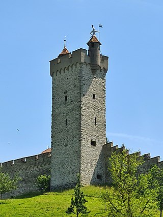
The Männliturm is one of nine towers of the Musegg Wall in the city of Lucerne. It is located between the Nölliturm and the Luegislandturm. The tower is named after the "iron man", a half-figure of a two-metre-high armoured warrior with a flag and sword. This forms the top of one of the two oriel turrets in the crenellated wreath.
Sight 2: Schirmerturm
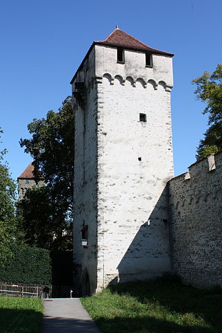
The Schirmerturm is one of nine towers of the Musegg Wall in the city of Lucerne. It is located between the Zytturm and the Pulverturm.
Sight 3: Kapellbrücke
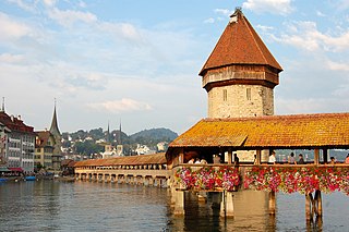
Get Ticket*The Kapellbrücke is a covered wooden footbridge spanning the river Reuss diagonally in the city of Lucerne in central Switzerland. Named after the nearby St. Peter's Chapel, the bridge is unique in containing a number of interior paintings dating back to the 17th century, although many of them were destroyed along with a larger part of the centuries-old bridge in a 1993 fire. Subsequently restored, the Kapellbrücke is the oldest wooden covered bridge in Europe, as well as the world's oldest surviving truss bridge. It serves as the city's symbol and as one of Switzerland's main tourist attractions.
Sight 4: Matthäuskirche
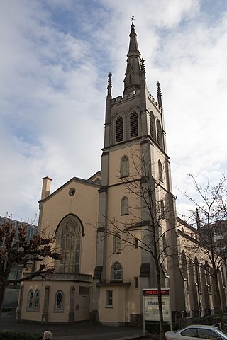
St. Matthew's Church is a church building of the Evangelical Reformed Church of Lucerne at Hertensteinstrasse 30 in Lucerne, Switzerland. Today it also performs under the name Citykirche Luzern.
Sight 5: Glacier garden
Get Ticket*The Glacier Garden in Lucerne is a natural monument with a park and museum. It is located not far from the Lion Monument, the Alpineum and the Bourbaki Panorama and is listed on the list of cultural assets in category A as nationally significant. Glacial potholes take visitors back to times when huge glaciers covered the land or subtropical palm beaches could be found here.
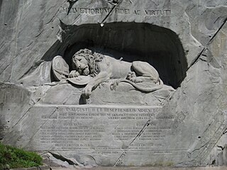
Sight 6: Lion Monument
Get Ticket*The Lion Monument, or the Lion of Lucerne, is a rock relief in Lucerne, Switzerland, designed by Bertel Thorvaldsen and hewn in 1820–21 by Lukas Ahorn. It commemorates the Swiss Guards who were killed in 1792 during the French Revolution, when revolutionaries stormed the Tuileries Palace in Paris. It is one of the most famous monuments in Switzerland, visited annually by about 1.4 million tourists. In 2006, it was placed under Swiss monument protection.
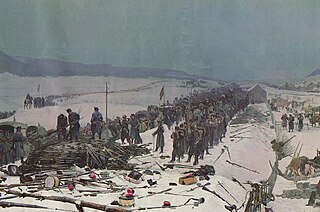
Sight 7: Bourbaki Panorama
The Bourbaki Panorama is a circular panoramic painting depicting the internment of the French Armée de l'Est in neutral Switzerland at the end of the 1870–71 Franco-Prussian War. The army, led by General Charles-Denis Bourbaki, had been defeated in the field while attempting to raise the Siege of Belfort and fled to Switzerland in the aftermath. The Swiss admitted the French soldiers, and local villagers and the Swiss Red Cross provided aid.
Sight 8: St. Leodegar im Hof (Hofkirche)
The Church of St. Leodegar is a Roman Catholic church in the city of Lucerne, Switzerland. It was built in parts from 1633 to 1639 on the foundation of the Roman basilica, begun in 735, which had burnt in 1633. This church was one of the few built north of the Alps during the Thirty Years War and one of the largest art history rich churches of the German late renaissance period.
Share
How likely are you to recommend us?
Disclaimer Please be aware of your surroundings and do not enter private property. We are not liable for any damages that occur during the tours.
GPX-Download For navigation apps and GPS devices you can download the tour as a GPX file.
.jpg)