Free Walking Sightseeing Tour #5 in Solna, Sweden
Legend
Tour Facts
7.8 km
215 m
Explore Solna in Sweden with this free self-guided walking tour. The map shows the route of the tour. Below is a list of attractions, including their details.
Individual Sights in SolnaSight 1: Det entomologiska kvinnorovet

The Entomological Robbery of Women is a sculpture by Eric Grate, which is displayed outside the Karolinska Institute in Solna.
Sight 2: Sankt Eriksparken

Sankt Eriksparken was a park in the Vasastaden district of Stockholm, Sweden. The park was located between Norra Stationsgatan in the north, Dannemoragatan in the east, Sankt Eriksgatan in the west and Upplandsgatan/Västmannagatan in the south. On the site of Sankt Eriksparken there is now an extension of Rödabergsskolan.
Sight 3: Sveaplan

Sveaplan is a roundabout at the northern end of Sveavägen in the Vasastaden district of Stockholm. At Sveaplan, the south-north and east-west parts of Sveavägen meet as well as Cedersdalsgatan.
Sight 4: Stefanskyrkan

St. Stephen's Church or St. Stephen's Church is a church building in the Parish of St. John, which is part of the Cathedral contract of the Diocese of Stockholm. The church was built in 1904 and is located at Frejgatan 20B at the southern end of Vanadislunden in Vasastaden in Stockholm's inner city.
Sight 5: Vanadislundens vattenreservoar

Vanadislunden's water reservoir or Vanadislundsreservoaren is a large water reservoir within Vanadislunden in the Vasastaden district of Stockholm. The Vanadislund reservoir has today (2009) a water volume of 8,100 m³.
Sight 6: Monica Zetterlunds Park

Monica Zetterlund's park. or Zetterlunden, a park in Vasastaden, Stockholm.
Sight 7: Carl Eldh Studio Museum

Carl Eldh's Studio Museum is an art museum at Lögebodavägen 10 in Bellevue Park in Vasastaden, Stockholm. The museum was the sculptor Carl Eldh's studio. The studio is preserved as Carl Eldh once left it. Since 2010, the facility has been a national monument.
Sight 8: Bellevueparken

Bellevue (Bellevueparken) is a park in central Stockholm, Sweden. Bellevue borders to Vasastan and is part of the Royal National City Park.
Sight 9: Maskinparken

Maskinparken is a park on the KTH Royal Institute of Technology's campus area on Norra Djurgården in Stockholm. The park is located between Drottning Kristinas väg in the southwest and Brinellvägen in the northeast. The park separates the northernmost area of Campus Valhallavägen, where the University College of Dance and the Department of Mechanical Engineering are located, popularly known as Brazil, from the rest of the campus. A footpath runs through the park from Drottning Kristinas väg east over Brinnellvägen and on to Uggleviksvägen at Ugglevikskällan.
Sight 10: Uggleviksreservoaren

Uggleviksreservoaren is a water reservoir located in the forest Lilljansskogen near Uggleviken, a fen at Norra Djurgården in north-eastern central Stockholm, Sweden.
Sight 11: Stockholm Transport Museum
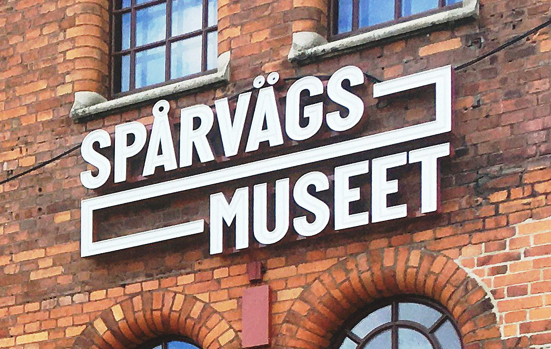
The Spårvägsmuseet, or Tramway Museum, was located at Tegelviksgatan 22 in Södermalm, Stockholm, Sweden. It was owned and operated by Storstockholms Lokaltrafik, and shows the development of public transportation in the Stockholm area from the 1650s until today. The Museum's mission also covers contemporary and future public transport in the Stockholm region, and water transportation in the area. The museum also houses a library, an archive and a café.
Share
Disclaimer Please be aware of your surroundings and do not enter private property. We are not liable for any damages that occur during the tours.
GPX-Download For navigation apps and GPS devices you can download the tour as a GPX file.