Free Walking Sightseeing Tour #8 in Wrocław, Poland

Legend

Churches & Art
Nature
Water & Wind
Historical
Heritage & Space
Tourism
Paid Tours & Activities

Tour Facts

Number of sights 18 sights
Distance 9.7 km
Ascend 110 m
Descend 111 m

Explore Wrocław in Poland with this free self-guided walking tour. The map shows the route of the tour. Below is a list of attractions, including their details.

Individual Sights in Wrocław

Sight 1: Japanese Garden

Show sight on map

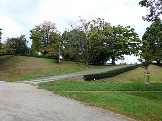
Wrocław's Japanese Garden was founded in the years 1909–1913 as an exotic garden for the Centennial Exhibition. It is located in the Śródmieście district of Wrocław, in the boundaries of Szczytnicki Park, near the Centennial Hall. It is home to almost 270 taxa of woody plants, as well as 78 species of Asian plants, of which 38 are endemic to Japan, such as Styrax japonicus. It is an important landmark of Wrocław.

Wikipedia: Japanese Garden, Wrocław (EN)

231 meters / 3 minutes

Sight 2: Wrocławska Fontanna

Show sight on map
Wrocławska Fontanna

The Wrocław Multimedia Fountain is a multimedia musical fountain and ornamental pond in Wrocław, of western Poland. The fountain runs only during the summer season, from the last weekend of April or the first weekend of May to late October.

Wikipedia: Wrocław Multimedia Fountain (EN), Url

329 meters / 4 minutes

Sight 3: Centennial Hall

Show sight on map
Centennial Hall

The Centennial Hall, formerly named Hala Ludowa, is a historic building in Wrocław, Poland. It was constructed according to the plans of architect Max Berg in 1911–1913. Max Berg designed Centennial Hall to serve as a multifunctional structure to host "exhibitions, concerts, theatrical and opera performances, and sporting events". The hall continues to be used for sporting events, business summits, and concerts.

Wikipedia: Centennial Hall (Wrocław) (EN), Url, Website, Website 2, Heritagewebsite

140 meters / 2 minutes

Sight 4: Iglica

Show sight on map

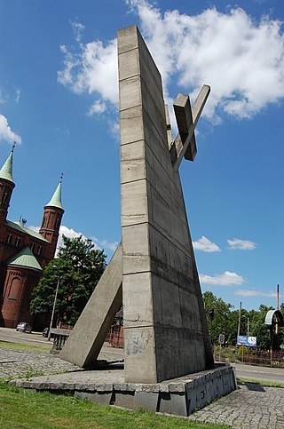
Iglica is a needle-like monument in Wrocław, Poland. It was built in 1948 and was 106 metres tall. Today, after renovation, the top ten metres have been removed and it is now 90 metres tall.

Wikipedia: Iglica (EN)

455 meters / 5 minutes

Sight 5: most Zwierzyniecki

Show sight on map
most Zwierzyniecki

Zwierzyniecki Bridge is located in the eastern part of Wrocław, Poland. The bridge spans the Oder River and is in the immediate vicinity of Wrocław Zoo and the exhibition grounds about Centennial Hall. The bridge was built around 1655 and was originally wooden.

Wikipedia: Zwierzyniecki Bridge (EN)

1193 meters / 14 minutes

Sight 6: Kościół pw. Najświętszego Serca Jezusowego

Show sight on map

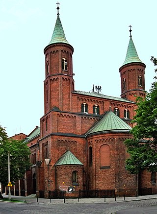
The Church of the Sacred Heart of Jesus is a Roman Catholic parish church of the Sacred Heart of Jesus Parish in Wrocław, in the deanery of Wrocław Cathedral, in the Archdiocese of Wrocław. It is located on Grunwaldzki Square.

Wikipedia: Kościół Najświętszego Serca Jezusowego we Wrocławiu (PL)

326 meters / 4 minutes

Sight 7: most Grunwaldzki

Show sight on map

Grunwald Bridge is a suspension bridge over the river Oder in Wrocław, Poland, built between 1908 and 1910. Initially the bridge was called the Imperial Bridge (Kaiserbrücke), then the Bridge of Freedom (Freiheitsbrücke). The architectural design of the bridge was by a city councilor, Richard Plüddemann. The bridge opened on 10 October 1910 in the presence of Emperor Wilhelm II.

Wikipedia: Grunwald Bridge (EN), Url, Url 0

1156 meters / 14 minutes

Sight 8: Hydropolis

Show sight on map

Hydropolis is the only science centre in Poland dedicated to water, located in the city of Wrocław.

Wikipedia: Hydropolis, Wrocław (EN), Website

601 meters / 7 minutes

Sight 9: kaplica ewangelicko-luterańska zakładu „Bethanien”

Show sight on map
kaplica ewangelicko-luterańska zakładu „Bethanien”

The Church of Christ in Wrocław – an Evangelical Lutheran (Old Lutheran) church currently preserved in ruins.

Wikipedia: Kościół Chrystusowy we Wrocławiu (PL), Url

212 meters / 3 minutes

Sight 10: Muzeum Etnograficzne

Show sight on map

The Ethnographic Museum in Wrocław is a museum of folk art of Lower Silesia, operating since 1954.

Wikipedia: Muzeum Etnograficzne we Wrocławiu (PL), Website

468 meters / 6 minutes

Sight 11: II Zbór Kościoła Chrześcijan Baptystów we Wrocławiu

Show sight on map

The Second Congregation of the Baptist Church in Wrocław is a congregation of the Baptist Christian Church located at 20A Łukasińskiego Street in Wrocław, Poland.

Wikipedia: II Zbór Kościoła Chrześcijan Baptystów we Wrocławiu (PL), Website

392 meters / 5 minutes

Sight 12: Kościół pw. Świętej Trójcy

Show sight on map

Church of the Holy Trinity o.o. bonifratras in Wrocław – a historic Catholic church in Wrocław, located on Przemieśą Oławski, at ul. gen. Romuald Traugutt, is a monastery church of the bonifrat order.

Wikipedia: Kościół Świętej Trójcy we Wrocławiu (PL)

131 meters / 2 minutes

Sight 13: Kościół Świętego Łazarza

Show sight on map

The Church of St. Lazarus in Wrocław – a Gothic brick church built by the Order of the Knights and Hospitallers of St. Lazarus of Jerusalem in the second half of the 14th century on the road leading from medieval Wrocław to the south-east – to Oława.

Wikipedia: Kościół św. Łazarza we Wrocławiu (PL)

397 meters / 5 minutes

Sight 14: Kaplica Kościoła Ewangelicko-Metodystycznego

Show sight on map

The Chapel of the Evangelical Methodist Church in Wrocław is a parish church of the Peace of God parish belonging to the Evangelical Methodist Church in the Republic of Poland, located at 28a Worcella Street in the Oławskie Suburb in Wrocław.

Wikipedia: Kaplica Kościoła Ewangelicko-Metodystycznego we Wrocławiu (PL), Url

982 meters / 12 minutes

Sight 15: Bastion Sakwowy

Show sight on map

The Sakwowy Bastion is a fragment of the former fortifications of the city of Wrocław, in the south-eastern corner.

Wikipedia: Bastion Sakwowy (PL)

901 meters / 11 minutes

Sight 16: Bojownikom o wyzwolenie narodowe i społeczne

Show sight on map

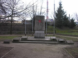
Commemorative stone in honour of the Fighters for National and Social Liberation – a granite erratic boulder located on Tadeusz Kościuszko Square in Wrocław, dedicated to the memory of fighters for national and social liberation. It was unveiled on 24 March 1946, on the occasion of the First Congress of Participants in the Armed Struggle for Independence and Democracy, which took place as part of the Kościuszko Year, celebrated in 1946. There are opinions that it was a propaganda attempt to include the Recovered Territories in the tradition of Polish military action.

Wikipedia: Kamień pamiątkowy ku czci Bojowników o Wyzwolenie Narodowe i Społeczne (PL)

783 meters / 9 minutes

Sight 17: Dobry wieczór we Wrocławiu

Show sight on map

Good evening in Wrocław – a neon sign located on the roof of a block of flats at 106–114 Piłsudskiego Street in Wrocław. The neon sign is in the form of a two-and-a-half-metre-long human figure with a flower in one hand and a tilted hat in the other, as well as the inscription "good evening in Wrocław" on the right.

Wikipedia: Dobry wieczór we Wrocławiu (PL)

963 meters / 12 minutes

Sight 18: Kościół Świętego Henryka

Show sight on map

St. Henry's Church in Wrocław at Gliniana Street – a neo-Gothic, two-tower basilica church on a Latin cross plan, with a wreath of chapels around the transept and chancel.

Wikipedia: Kościół św. Henryka we Wrocławiu (PL)

Share

Spread the word! Share this page with your friends and family.

Disclaimer Please be aware of your surroundings and do not enter private property. We are not liable for any damages that occur during the tours.

GPX-Download For navigation apps and GPS devices you can download the tour as a GPX file.