Self-guided Sightseeing Tour #5 in Wrocław, Poland
Legend
Tour Facts
8.1 km
114 m
Experience Wrocław in Poland in a whole new way with our free self-guided sightseeing tour. This site not only offers you practical information and insider tips, but also a rich variety of activities and sights you shouldn't miss. Whether you love art and culture, want to explore historical sites or simply want to experience the vibrant atmosphere of a lively city - you'll find everything you need for your personal adventure here.
Individual Sights in WrocławSight 1: Water Tower Na Grobli

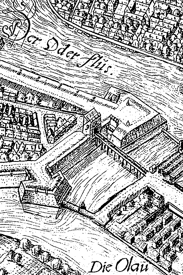
The water tower at Na Grobli Street – a water tower with a total height of 40 m, located in Wrocław, which is one of the oldest technical infrastructure facilities of the city. The tower was built as a key element of John Moore's project to supply 200,000 inhabitants with water, corrected and dressed in a historicizing robe by the city's construction counsellor Johann Christian Zimmermann.
Sight 2: Kościół pw. Świętego Maurycego

St. Maurice's Church at 36 Gen. Romualda Traugutta Street in Wrocław – originally a Gothic single-nave church with a fifteenth-century baptismal chapel and a tower rebuilt in the 18th century in the Baroque style according to the design of architect J. Peintner.
Sight 3: Park Juliusza Słowackiego

Juliusz Słowacki Park in Wrocław is a park located in the area of the Old Town – near the so-called New Town. It is also partly located in the place of a buried section of the city moat, a fragment of which for some time was the estuary section of the Oława River. The park covers an area of 5.74 ha.
Sight 4: Pomnik Ofiar Zbrodni Katyńskiej

The Monument to the Victims of the Katyn Massacre in Wrocław – a monument commemorating the victims of the Katyn massacre. The author of the monument's design is Tadeusz Tchórzewski. Built in the years 1994–2000. The monument is located in Juliusz Słowacki Park, near Purkyniego Street, about 250 meters southwest of the main entrance to the National Museum in Wrocław.
Wikipedia: Pomnik Ofiar Zbrodni Katyńskiej we Wrocławiu (PL)
Sight 5: Bastion Ceglarski
The Brick Bastion – a fragment of the fortifications of Wrocław, built in 1585 in the north-eastern part of the belt of external walls surrounding the Wrocław New Town. Demolished along with the walls at the beginning of the nineteenth century.
Sight 6: Pomnik ku czci Polaków walczących o niepodległość

The Monument to the Constitution of 3 May – erected in Wrocław next to the entrance to the Rotunda of the Panorama of the Battle of Racławice.
Sight 7: Panorama of the Battle of Racławice

The Racławice Panorama is a monumental cycloramic painting depicting the Battle of Racławice, during the Kościuszko Uprising. It is located in Wrocław, Poland. The painting is one of only a few preserved relics of a genre of 19th-century mass culture, and the oldest in Poland. The panorama stands in a circular fashion and, with the viewer in the center, presents different scenes at various viewing angles. A special kind of perspective used in the painting and additional effects create a feeling of reality.
Sight 8: Pomnik ku czci Chińczyków z Tian’anmen

The Monument in Memory of Chinese from Tiananmen, also known as the Monument of the Victims of the Tiananmen Square Pacification, is a monument in Wrocław, Poland at Oławska Street. It commemorates the 1989 Tiananmen Square protests in Beijing and the victims of following massacre in which People's Liberation Army troops armed with assault rifles and accompanied by tanks fired at the demonstrators and those trying to block the military's advance into Tiananmen Square. The monument was first created by Igor Wójcik, Robert Jezierski and Joanna Czarnecka in 1989 and was later recreated by Marek Stanielewicz after the original monument was destroyed by the Security Service.
Wikipedia: Monument in Memory of Chinese from Tiananmen (EN)
Sight 9: Kościół Świętego Krzysztofa

St. Christopher's Church in Wrocław – the church of the Evangelical-Augsburg parish of St. Christopher in Wrocław, located at St. Christopher's Square located at the corner of Kazimierza Wielkiego and Wierzbowa Streets.
Wikipedia: Kościół św. Krzysztofa we Wrocławiu (PL), Website
Sight 10: Bastion Sakwowy

The Sack Bastion – a fragment of the former fortifications of the city of Wrocław, in their south-eastern corner. In the years 1948–2024, the hill was called the Partisan Hill. However, this was an unofficial name and in 2024 it was officially changed to the Sack Bastion.
Sight 11: Wzgórze Partyzantów
Partisan Hill – the name of the remains of the former Sackron Bastion in the system of urban fortifications of the city of Wrocław, in force in the years 1948-2024, in its place, after the demolition of the walls on the order of the French occupiers in 1807, the recreational Sack Hill was first built, which after the construction of a belvedere and a tower on it in 1867 was renamed Liebichs Höhe. On the south-western slope of the Hill, in 1932, a Colonial Monument was erected – designed by Walter Hierse and Maximilian Schmergalski – dedicated to soldiers killed in the German colonies: East Africa, South-West Africa, Togo, China and the islands of Oceania. In 1945, the monument was demolished, and the Liebich Hill was first renamed the "Hill of Love", and in 1948 the "Hill of the Partisans"; the height of 132 m above sea level, the 10th highest hill in Wrocław.
Sight 12: Mikołaj Kopernik

The Monument of Nicolaus Copernicus in Wrocław – a monument commemorating the person of Nicolaus Copernicus. Its author was Professor Leon Podsiadły, and his work is considered one of the most important examples of contemporary sculptures. It was unveiled in 1974 on the occasion of the Copernican year, celebrated a year earlier on the occasion of the 500th anniversary of his birth. The initiators of the construction of the monument were the Society of Wrocław Lovers together with the Society of Astronomy Enthusiasts. The statue is made of artificial stone. It has the form of a body, a silhouette, with a stylized heliocentric system topped with a bust of the astronomer. In 1977, a plaque was installed with the inscription: Wrocławians to Nicolaus Copernicus 1473-1543.
Sight 13: Amor na Pegazie

The Cupid on the Pegasus monument in Wrocław, Poland, is a monument located in Nicolaus Copernicus Park, within the Old Town Promenade at Teatralna Street. The sculptor was Theodor von Gosen.
Sight 14: Ogród Staromiejski

Nicolaus Copernicus Park – a city park located in Wrocław, in the area of the so-called Old Town Promenade, on the inner side of the City Moat. The current name of the park is valid on the basis of the Resolution of the City Council of Wrocław of 9 October 1993 (No. LXXI/454/93) on the names of parks and forest areas existing in Wrocław. From the east, the park is limited by Wierzbowa Street and the building of the former Leipziger Palace. Behind them is the square where the statue of Nicolaus Copernicus is located. The northern border of the park is marked by Teatralna Street and the building of the former municipal bathhouse standing behind it. From the west, the park is limited by Teatralny Square and Corpus Christi Street. In their immediate vicinity there is the building of the Wrocław Puppet Theatre. A little further, at Świdnicka Street, there is a monument to Bolesław Chrobry. The inspiration for the establishment of the park in this place were the nineteenth-century Tivoli Gardens in Copenhagen.
Sight 15: Wrocławski Teatr Komedia
The Wrocław Comedy Theatre is a private theatre in Wrocław, founded in 1997 by Wojciech Dąbrowski and Paweł Okoński.
Sight 16: Wrocławski Teatr Lalek

Wrocław Puppet Theater is a theater in Wroclaw, Poland. It is located at the Theater Square in the old building of merchants association, next to the Old Town Garden and public baths.
Sight 17: Teatr Arka
Arka Theatre – a professional integration theatre based in Wrocław. The theatre was founded in 1993 on the initiative of Renata Jasińska-Nowak, Andrzej Nowak and Bogdan Michalewski. In addition to professional actors, the theatre features intellectually disabled actors with several years of stage experience. Since 2002, the theatre has been run by the Association of Friends of the "Arka" Theatre, whose president is Renata Jasińska-Nowak. From 1997 to September 2019, she was also the director of the theatre.
Sight 18: Kameleon

Kameleon Department Store, formerly: Rudolf Petersdorff Department Store – a historic department store in Wrocław, located at 6/7 Szewska Street.
Sight 19: Pomnik Pomarańczowej Alternatywy

The Orange Alternative Monument is a bronze monument unveiled in Wrocław in 2001 to commemorate the Orange Alternative movement, which operated in the city during martial law. The author of the monument is Olaf Brzeski.
Sight 20: Klub Lekarza

The Elder Palace – a former city palace located at the corner of 45 Kazimierza Wielkiego Street and St. Dorothy Street in Wrocław.
Sight 21: Kościół Świętych Stanisława, Doroty i Wacława

The Church of Sts. Dorothea, Wenceslaus, and Stanislaus is a Gothic Roman Catholic church in the southern part of Wrocław's Old Town.
Sight 22: Opera Wrocławska

The Wrocław Opera is an opera company and opera house in the Old Town of Wrocław, Poland. The opera house was opened in 1841 and up to 1945 was named after the city's then German name, Oper Breslau.
Sight 23: Victims of Stalinism

The Monument to the Victims of Stalinism is a monument erected in Wrocław near the Wrocław Opera.
Sight 24: Kościół parafialny pw. Bożego Ciała

Corpus Christi Church is a Gothic church in Wrocław, Poland. The church is located at the corner of Świdnicka and ul. Bożego Ciała.
Wikipedia: Corpus Christi Church, Wrocław (EN), Website, Url 0
Sight 25: Pogodynka

Pogoda – a meteorological column in Wrocław at Świdnicka Street, on its eastern side, at its intersection with the Old Town Promenade, near the building of the former Guardhouse; erected in the 80s of the nineteenth century. Its location at the intersection of the main shopping street and the Old Town park and the form of small architecture reflected the nineteenth-century spa compositions. The building underwent thorough conservation in the years 1984–1985.
Sight 26: Bolesław Chrobry

The Monument of Bolesław the Brave in Wrocław – an equestrian monument of Bolesław the Brave according to the design of Dorota Korzeniewska, Maciej Albrzykowski and Grażyna Jaskierska-Albrzykowska, erected in Wrocław at Świdnicka Street and unveiled on 15 September 2007.
Wikipedia: Pomnik Bolesława Chrobrego we Wrocławiu (PL), Url
Sight 27: Pomnik Pamięci Ofiar Nocy Kryształowej

The Monument to the Victims of Kristallnacht – erected in Wrocław at the intersection of Łąkowa and Druckiego-Lubeckiego Streets.
Sight 28: Bojownikom o wyzwolenie narodowe i społeczne

Commemorative stone in honour of the Fighters for National and Social Liberation – a granite erratic boulder located on Tadeusz Kościuszko Square in Wrocław, dedicated to the memory of the fighters for national and social liberation. It was unveiled on 24 March 1946, on the occasion of the First Congress of Participants in the Armed Struggle for Independence and Democracy, which took place as part of the Kościuszko Year, celebrated in 1946. There are opinions that it was a propaganda attempt to include the Recovered Territories in the tradition of the Polish military action.
Wikipedia: Kamień pamiątkowy ku czci Bojowników o Wyzwolenie Narodowe i Społeczne (PL)
Sight 29: Pałac Schaffgotschów

The Schaffgotsch Palace is a historic palace in Wrocław at 34 Kościuszki Street.
Sight 30: Monument to the Anonymous Pedestrians

The Monument of the Anonymous Passer-by – a monument in Wrocław, unveiled on the night of 12 to 13 December 2005, consisting of fourteen life-size bronze human figures, standing on both sides of Świdnicka Street in the place where it intersects with Piłsudskiego Street.
Sight 31: Teatr Polski

The Polish Theatre in Wrocław is one of the theatres in Wrocław, Poland. The Polish Theatre in Wrocław has three stages: Small Stage on 28 Świdnicka Street, “Na Świebodzkim” Stage, situated inside Świebodzki railway station's building at 20c Orląt Lwowskich Square, and Jerzy Grzegorzewski Stage located in the Theatre's main building at 3 Zapolska Street.
Sight 32: Kościół pw. Świętego Ignacego Loyoli

The Church of St. Ignatius of Loyola at Stysia Street in Wrocław's Krzyki district – a Catholic church built together with the accompanying Jesuit monastery in the years 1979–1990 according to the design of architect Zenon Nasterski.
Wikipedia: Kościół św. Ignacego Loyoli we Wrocławiu (PL), Website
Share
How likely are you to recommend us?
Disclaimer Please be aware of your surroundings and do not enter private property. We are not liable for any damages that occur during the tours.
GPX-Download For navigation apps and GPS devices you can download the tour as a GPX file.