Free Walking Sightseeing Tour #20 in Warsaw, Poland

Legend

Churches & Art
Nature
Water & Wind
Historical
Heritage & Space
Tourism
Paid Tours & Activities

Tour Facts

Number of sights 19 sights
Distance 12.9 km
Ascend 145 m
Descend 128 m

Explore Warsaw in Poland with this free self-guided walking tour. The map shows the route of the tour. Below is a list of attractions, including their details.

Activities in WarsawIndividual Sights in Warsaw

Sight 1: TEATR XL

Show sight on map
TEATR XL

Teatr XL is a repertory drama theatre in Warsaw, Poland. It was established in 2012 by the Association of International Artistic Initiatives EduTeArt.

Wikipedia: Teatr XL (PL), Website

418 meters / 5 minutes

Sight 2: Józef Szanajca

Show sight on map

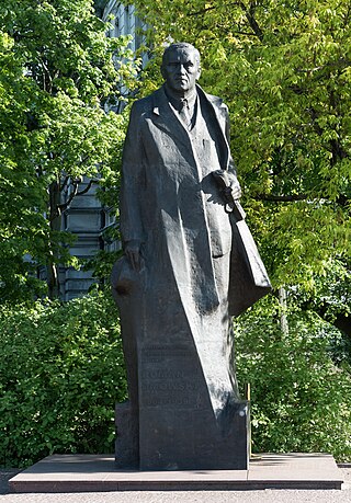
The Bust of Józef Szanajca in Warsaw is a monument to Józef Szanajca located at Szanajcy Street in Warsaw's Praga-Północ district. Its author is Bohdan Lachert, and the original bronze cast was made by the Łopieński Brothers company. The bust was unveiled on September 24, 1979.

Wikipedia: Popiersie Józefa Szanajcy w Warszawie (PL)

1004 meters / 12 minutes

Sight 3: Warsaw Zoo

Show sight on map

The Warsaw Zoological Garden, known simply as the Warsaw Zoo, is a scientific zoo located alongside the Vistula River in Warsaw, Poland. Opened in 1928, the zoo covers about 40 hectares in central Warsaw, and sees over 700,000 visitors annually, making it one of the most popular zoos in Poland. It is home to over 11,000 animals representing more than 500 species.

Wikipedia: Warsaw Zoo (EN), Website, Facebook, Instagram, Youtube

1438 meters / 17 minutes

Sight 4: Fort Śliwickiego Cytadeli Warszawskiej Jasińskiego

Show sight on map

Fort Śliwicki (Jasiński) – one of the forts of the Warsaw Citadel located at 49a Jagiellońska Street in Warsaw.

Wikipedia: Fort Śliwickiego Cytadeli Warszawskiej (PL)

1316 meters / 16 minutes

Sight 5: Most Gdański

Show sight on map

The Gdańsk Bridge is a six-span steel truss bridge, 406.5 m long and 17 m wide, across the Vistula in Warsaw, Poland.

Wikipedia: Gdańsk Bridge (EN)

1540 meters / 18 minutes

Sight 6: Polish History Museum

Show sight on map

The Museum of Polish History or the Polish History Museum is a museum and national cultural institute in Warsaw, Poland. The purpose of the museum is to present the most important events in Polish history, with a particular emphasis on Polish traditions of freedom. Since September 2023, the new museum building has been located in the Warsaw Citadel.

Wikipedia: Museum of Polish History (EN), Website

271 meters / 3 minutes

Sight 7: Park Fosa

Show sight on map

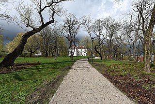
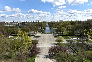
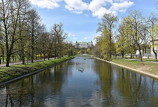
The Moat and Slopes of the Citadel Park is a park located around the walls of the Warsaw Citadel in Warsaw's Żoliborz district, between Wybrzeże Gdyńskie, Kaniowska and Krajewskiego streets.

Wikipedia: Park Fosa i Stoki Cytadeli w Warszawie (PL)

222 meters / 3 minutes

Sight 8: Polish Army Museum

Show sight on map

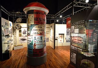
Museum of the Polish Army is a museum in Warsaw documenting the military history of Poland. Established in 1920 under the Second Polish Republic, it occupies a wing of the building of the Polish National Museum as well as several branches in Poland. It is Warsaw's second largest museum and the largest collection of military objects in Poland. The collection illustrates a thousand years of Polish military history, from the 10th century to the Second World War.

Wikipedia: Polish Army Museum (EN), Website

618 meters / 7 minutes

Sight 9: Muzeum Katyńskie

Show sight on map

Muzeum Katyńskie w Warszawie is a museum in Warsaw, Poland. The museum was established in 1993. It is located in the Polish Army Museum. Objects, documents and personal effects from the site of the Katyn massacre can be seen in the museum. In 2017 museum was nominated for European Union Prize for Contemporary Architecture award.

Wikipedia: Katyń Museum (EN), Website

882 meters / 11 minutes

Sight 10: Most kolejowy przy Cytadeli

Show sight on map

The Citadel Rail Bridge was a bridge in Warsaw, crossing the Vistula River. It opened in November, 1875, and was expanded with a second part in 1908. It was blown up for the final time in September 13, 1944 by retreating Germans and was later replaced with the Gdański Bridge.

Wikipedia: Citadel Rail Bridge (EN)

705 meters / 8 minutes

Sight 11: Fort Legionów

Show sight on map

Fort of the Legions – a fort of the ring of fortifications around the Warsaw Citadel, built in the years 1851–1853.

Wikipedia: Fort Legionów Cytadeli Warszawskiej (PL)

425 meters / 5 minutes

Sight 12: Pałac Sapiehów

Show sight on map

Sapieha Palace is one of the palaces in Warsaw New Town district of Warsaw, Poland. Started by the powerful Sapieha family who gave the name to the building, it currently houses the Environmental Protection School Complex.

Wikipedia: Sapieha Palace, Warsaw (EN)

228 meters / 3 minutes

Sight 13: Pałac Sierakowskiego

Show sight on map

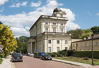
The Sierakowski Palace, also known as the Sierakowski Barracks, is a palace located at 3/5 Konwiktorska Street in the Śródmieście district of Warsaw.

Wikipedia: Pałac Sierakowskiego (PL)

684 meters / 8 minutes

Sight 14: Fort Traugutta

Show sight on map

Fort Traugutt is one of the forts of the Warsaw Citadel.

Wikipedia: Fort Traugutta Cytadeli Warszawskiej (PL)

1251 meters / 15 minutes

Sight 15: Pomnik Szmula Zygielbojma

Show sight on map

The Monument to Szmul M. Zygielbojm is a monument located at 6 Lewartowskiego Street in Warsaw's Muranów district, commemorating Szmul Zygielbojm.

Wikipedia: Pomnik Szmula Zygielbojma w Warszawie (PL)

392 meters / 5 minutes

Sight 16: MILA 18 Bunker of the Jewish resistance

Show sight on map

The Anielewicz Bunker, also known as the Anielewicz Mount was a headquarters and a hidden shelter of the Jewish Combat Organization (ŻOB), a Jewish resistance group in the Warsaw Ghetto in Poland during World War II.

Wikipedia: Anielewicz Bunker (EN)

240 meters / 3 minutes

Sight 17: Umschlagplatz

Show sight on mapBook Free Tour*

Umschlagplatz was the term used during The Holocaust to denote the holding areas adjacent to railway stations in occupied Poland where Jews from ghettos were assembled for deportation to Nazi death camps. The largest collection point was in Warsaw next to the Warsaw Ghetto. In 1942 between 254,000 – 265,000 Jews passed through the Warsaw Umschlagplatz on their way to the Treblinka extermination camp during Operation Reinhard, the deadliest phase of the Holocaust in Poland. Often those awaiting the arrival of Holocaust trains, were held at the Umschlagplatz overnight. Other examples of Umschlagplatz include the one at Radogoszcz station - adjacent to the Łódź Ghetto - where people were sent to Chełmno extermination camp and Auschwitz.

Wikipedia: Umschlagplatz (EN)

729 meters / 9 minutes

Sight 18: Maszt Wolności

Show sight on map
Maszt Wolności

Mast of Freedom-a monument in the form of a 60-meter flagship mast, standing in the western part of the Rondo of the AK "Radosław" group in Warsaw, commemorating, among others Fighting Poland and the Warsaw Uprising. Built in 2014, with a flag with the largest area in Poland. For nine years the highest flagship mast in Poland.

Wikipedia: Maszt Wolności (PL)

542 meters / 7 minutes

Sight 19: Kościół pw. Świętego Karola Boromeusza

Show sight on map

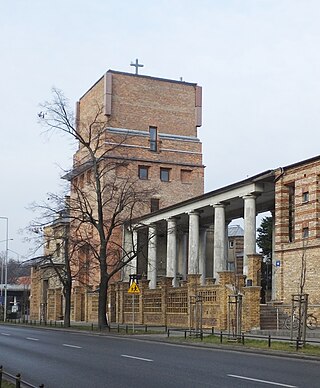
The Church of St. Charles Borromeo in Powązki is a church located in Warsaw, Poland, in the Wola district of Warsaw, at 14 Powązkowska Street.

Wikipedia: Kościół św. Karola Boromeusza w Warszawie (Powązki) (PL)

Share

Spread the word! Share this page with your friends and family.

Disclaimer Please be aware of your surroundings and do not enter private property. We are not liable for any damages that occur during the tours.

GPX-Download For navigation apps and GPS devices you can download the tour as a GPX file.