Self-guided Sightseeing Tour #13 in Warsaw, Poland
Legend
Guided Free Walking Tours
Book free guided walking tours in Warsaw.
Guided Sightseeing Tours
Book guided sightseeing tours and activities in Warsaw.
Tour Facts
8.3 km
121 m
Experience Warsaw in Poland in a whole new way with our free self-guided sightseeing tour. This site not only offers you practical information and insider tips, but also a rich variety of activities and sights you shouldn't miss. Whether you love art and culture, want to explore historical sites or simply want to experience the vibrant atmosphere of a lively city - you'll find everything you need for your personal adventure here.
Activities in WarsawIndividual Sights in WarsawSight 1: Katedra Świętego Ducha
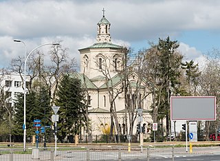
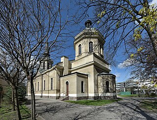
The Holy Spirit Cathedral is the main church of the Polish-Catholic Church in the Republic of Poland, located in Warsaw at 2 Szwoleżerów Street, at the intersection with Czerniakowska Street.
Sight 2: Myslewicki Palace
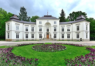
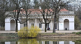
The Myślewice Palace is a rococo-neoclassical palace in Warsaw's Royal Baths Park. It was created for King Stanisław August Poniatowski as one of the first buildings in the Royal Baths. Its name derives from that of the nearby now nonexistent village of Myślewice.
Sight 3: Piotr Wysocki
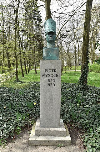
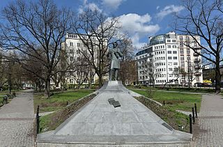
The bust of Piotr Wysocki, also known as the Piotr Wysocki Monument, is a monument in Warsaw, Poland, located in the Royal Baths Park, within the Downtown district. The sculpture consists of a bronze bust depicting Piotr Wysocki, a 19th-century military officer, a colonel in the Army of Congress Poland, and one of the organisers and commanders of the November Uprising.
Sight 4: Nowa Pomarańczarnia
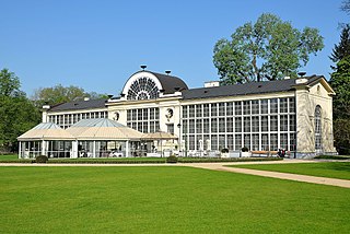
The New Orangery, also known as the New Orangery, is a building located in the Royal Łazienki Park in Warsaw, in the southern part of the garden, on an avenue called the Wilanowska or Chinese Road.
Wikipedia: Nowa Pomarańczarnia w Łazienkach Królewskich (PL)
Sight 5: Royal Łazienki Park
Get Ticket*Łazienki Park or Royal Baths Park is the largest park in Warsaw, Poland, occupying 76 hectares of the city center. The park-and-palace complex lies in the Downtown district, on Ujazdów Avenue, which is part of the Royal Route linking the Royal Castle with Wilanów Palace to the south.
Sight 6: New Guardhouse
Nowa Kordegarda – a building located in the Royal Łazienki Park in Warsaw, on the west side of the Palace on the Isle, erected in the years 1779–1780 according to the design of Dominik Merlini and rebuilt in 1830.
Sight 7: Palace on the Isle
Get Ticket*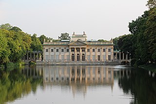
The Palace on the Isle, also known as the Baths Palace, is a classicist palace in Warsaw's Royal Baths Park, the city's largest park, occupying over 76 hectares of the city center.
Sight 8: Old Guardhouse
The Old Guardhouse, Eastern Guardhouse – the guardhouse building was built in the years 1791–1792 as part of the Łazienki palace complex. In the past, it was inhabited by guards guarding the way to the palace on the Isle.
Sight 9: Hermitage
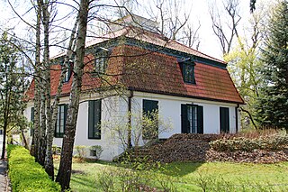
The Hermitage Museum is a building located in the northern part of the Royal Łazienki Park in Warsaw.
Sight 10: Pomnik Jana III Sobieskiego
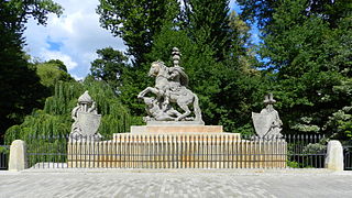
John III Sobieski Monument is a sculpture in Warsaw, Poland, within the neighbourhood of Ujazdów in the Downtown district, in the Royal Baths Park. It is a sandstone equestrian statue of John III Sobieski, monarch of the Polish–Lithuanian Commonwealth from 1674 to 1696, commemorating his victory in the battle of Vienna in 1683, against the Ottoman Empire. It was designed by André-Jean Lebrun and sculptured by Franciszek Pinck, and unveiled on 14 September 1788. It is placed on the Sobieski Bridge at Agrykola Street.
Sight 11: Chinese Garden
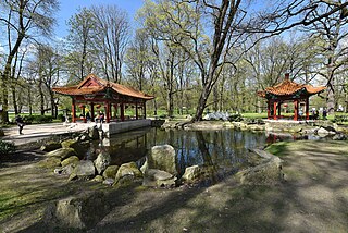
The Chinese Garden in the Royal Łazienki Park is a chinoiserie garden located in the Royal Łazienki Park in Warsaw.
Sight 12: Park Agrykola
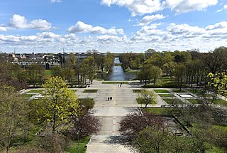
Agricola Park, also known as Agrykola Park, and the North Baths, is an urban park in the city of Warsaw, located within the district of Downtown. It is located to the north from the Royal Baths Park.
Sight 13: Pies As
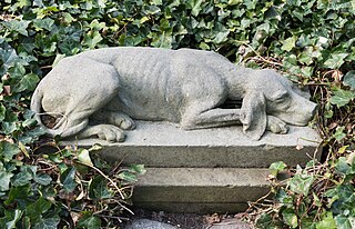
Ace the Dog is a sandstone sculpture located in Warsaw, Poland within the Royal Baths Park. It depicts a fictional pointing dog Ace, a main character of 1896 novel As by Adolf Dygasiński. It is a replica of a 1903 sculpture by Czesław Makowski.
Sight 14: Old Orangery
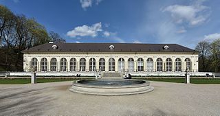
The Old Orangery, also known as the Old Orangery, originally the Great Orangery – a classicist orangery in the Royal Łazienki Park in Warsaw, erected in the years 1786–1788 according to the design of Dominik Merlini.
Sight 15: Water Tower
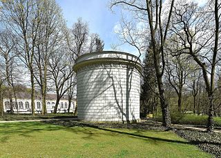
The Royal Łazienki Water Tower is a former water reservoir located in the Royal Łazienki Park in Warsaw.
Sight 16: White Pavilion
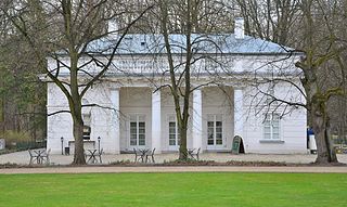
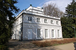
The White Pavilion, also known as the White Pavilion, is a classicist building located in the Royal Łazienki Park in Warsaw. It was erected in the years 1774–1776 according to the design of Dominik Merlini, who gave it the features of a suburban, summer villa.
Sight 17: Temple of the Sybil
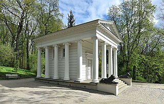
The Temple of the Sibyl, originally the Greek Temple, later called the Temple of Diana, is a pavilion in the Royal Łazienki Park in Warsaw.
Sight 18: Belweder Palace
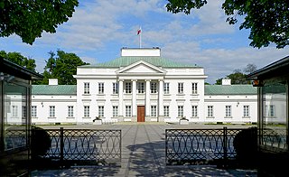
Belweder is a neoclassical palace in Warsaw, Poland. Erected in 1660 and remodelled in the early 1800s, it is one of several official residences used by Polish presidents as well as a state guest house for visiting heads of state. The complex is situated south of Warsaw's city center, in the vicinity of the historic Royal Baths Park (Łazienki).
Sight 19: Józef Piłsudski Monument
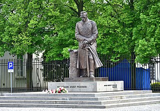
The Józef Piłsudski Monument is a gunmetal statue in Warsaw, Poland, within the Downtown district, placed next to the Belweder Palace, near the intersection of Belwederska Street, Ujazdów Avenue, and Bagatela Street. It is dedicated to Józef Piłsudski, a military officer and statesman who served as the Chief of State of Poland from 1918 to 1922, the Prime Minister of Poland from 1926 to 1928, and in 1930, as well as the commander-in-chief of the Polish Armed Forces and the Marshal of Poland. The monument was based on a sculpture made by Stanisław Kazimierz Ostrowski, prior to the Second World War. It was unveiled on 8 November 1998.
Sight 20: Frédéric Chopin Monument
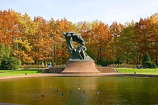
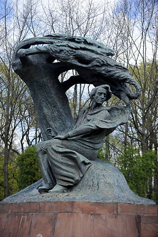
The Frédéric Chopin Monument in Warsaw is a large bronze statue of Frédéric Chopin (1810–1849), designed by Wacław Szymanowski, that stands in the upper part of Warsaw's Royal Baths Park, adjacent to Aleje Ujazdowskie.
Sight 21: Skarpa warszawska
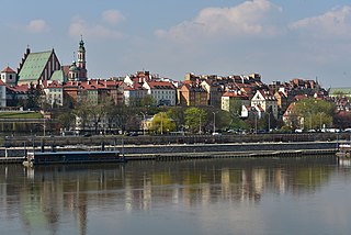
Warsaw escarpment – the common name of the high (western) Vistula escarpment in Warsaw. This escarpment is the most characteristic natural element of Warsaw's terrain, shaping the landscape and spatial structure of the city.
Sight 22: Henryk Sienkiewicz
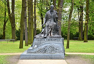
Henryk Sienkiewicz Monument is a sculpture in Warsaw, Poland, within the neighbourhood of Ujazdów in the Downtown district, in the western part of the Royal Baths Park. It has a form of a bronze statue of Henryk Sienkiewicz, a 19th- and 20th century novel writer, placed on a syenite pedestal. The sculpture was designed by Gustaw Zemła and unveiled on 5 May 2000.
Sight 23: Jan Olszewski
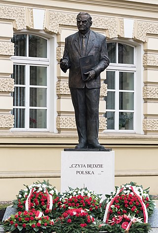
The Jan Olszewski Monument is a monument located at Aleje Ujazdowskie in Warsaw, commemorating Jan Olszewski.
Sight 24: Astronomical Observatory
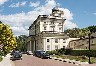
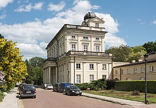
The Astronomical Observatory University of Warsaw is an institute that conducts astronomical research and teaching in astronomy. It is a part of Faculty of Physics University of Warsaw. The Observatory provides astronomy classes for BSc, MSc, and PhD students. Student telescope activities take place at the observing station in Ostrowik. The scientific research is conducted in a wide range of topics. Two main observing projects are long-term sky surveys: OGLE and ASAS. Both surveys take data using dedicated telescopes located at the Las Campanas Observatory, Chile. Scientific staff takes part in large astrophysical collaborations, both ground-based and satellite.
Wikipedia: Astronomical Observatory University of Warsaw (EN), Website
Sight 25: Botanical Garden
The Botanical Garden of the University of Warsaw is a botanical garden located at Aleje Ujazdowskie 4 in Warsaw, which since 1818 has been under the care of the Warsaw School of Medicine, then the Royal University of Warsaw, and since 1916 the University of Warsaw, and renamed the Botanical Garden of the University of Warsaw.
Wikipedia: Ogród Botaniczny Uniwersytetu Warszawskiego (PL), Website
Sight 26: Mausoleum of Struggle and Martyrdom
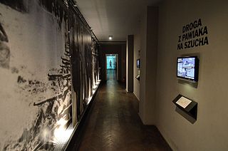
Mausoleum of Struggle and Martyrdom is a museum in Warsaw, Poland. It is a branch of the Museum of Independence. The museum presents the conditions in which Polish patriots and resistance fighters were jailed by Nazi Germany during World War II.
Wikipedia: Mausoleum of Struggle and Martyrdom (EN), Website
Sight 27: Syrena
Syrena Theatre is a musical theatre located at 3 Litewska Street in Warsaw. He specializes in revue and satirical repertoire, and since 1997 also in comedy and music performances. Musicals are staged, and since 2009 also dramatic plays.
Sight 28: Pomnik Tarasa Szewczenki
The Taras Shevchenko Monument is a monument located in the square named after the poet at the intersection of Goworka, Chocimska and Spacerowa Streets in Warsaw's Mokotów district.
Sight 29: Church of the Ascension of the Lord
The Church of the Ascension of the Lord in Warsaw is an Evangelical-Augsburg church located at Puławska Street in Warsaw. It was erected in the years 1902–1904 as an Orthodox garrison church dedicated to St. Peter and Paul. Property of the Evangelical parish since 1920.
Wikipedia: Kościół Wniebowstąpienia Pańskiego w Warszawie (PL)
Sight 30: Pomnik Krzysztofa Kozłowskiego
The bust of Krzysztof Kozłowski is a bronze monument located in the courtyard of the Ministry of the Interior and Administration in Warsaw, at 5 Stefana Batorego Street, commemorating Krzysztof Kozłowski, the first democratic minister of internal affairs.
Wikipedia: Popiersie Krzysztofa Kozłowskiego w Warszawie (PL)
Share
How likely are you to recommend us?
Disclaimer Please be aware of your surroundings and do not enter private property. We are not liable for any damages that occur during the tours.
GPX-Download For navigation apps and GPS devices you can download the tour as a GPX file.
