Self-guided Sightseeing Tour #1 in Krakow, Poland
Legend
Guided Free Walking Tours
Book free guided walking tours in Krakow.
Guided Sightseeing Tours
Book guided sightseeing tours and activities in Krakow.
Tour Facts
0.6 km
11 m
Experience Krakow in Poland in a whole new way with our free self-guided sightseeing tour. This site not only offers you practical information and insider tips, but also a rich variety of activities and sights you shouldn't miss. Whether you love art and culture, want to explore historical sites or simply want to experience the vibrant atmosphere of a lively city - you'll find everything you need for your personal adventure here.
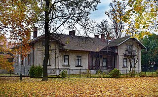
Activities in KrakowIndividual Sights in KrakowSight 1: Willa Rogozińskich
The Rogoziński Villa is a historic villa in Krakow. It is located in Nowa Huta, in District XVIII, in the former village of Mogiła at 2 Klasztorna Street.
Sight 2: Park Rogozińskich
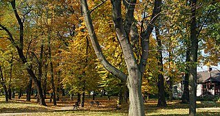
Park at Klasztorna Street – a historic city park in Krakow, located in the XVIII district of Nowa Huta between Klasztorna Street, Wacława Sieroszewskiego Street, the buildings of the Stefan Żeromski Hospital in the Młodości housing estate and the plot on which the Rogoziński villa is located. The park is located in a trapezoidal area measuring 45 to 85 meters wide and 135 meters long. It covers an area of 88 ares. The park area is generally flat, slightly sloping towards the south-west.
Sight 3: Wojciech Bogusławski
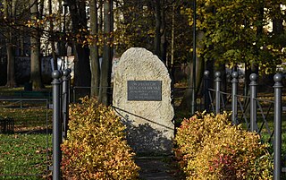
The Monument to Wojciech Bogusławski is a monument located in Kraków-Nowa Huta, in the park at Sieroszewskiego Street in the Młodości estate, in the former village of Mogiła, next to the Cistercian monastery.
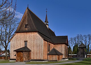
Sight 4: Kościół pw. Narodzenia Pańskiego i Świętego Bartłomieja Apostoła
The Church of the Nativity and St. Bartholomew the Apostle – a historic larch Roman Catholic church located in Kraków, in the XVIII district of Nowa Huta at 4 Klasztorna Street, in Mogiła.
Wikipedia: Kościół Narodzenia Pańskiego i św. Bartłomieja Apostoła w Krakowie (PL)
Sight 5: Bazylika Wniebowzięcia Najświętszej Maryi Panny i Świętego Wacława
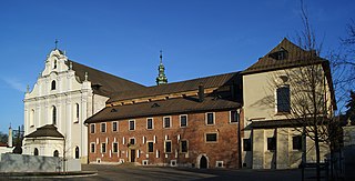
Mogiła Abbey is a Cistercian monastery in the Nowa Huta District of Kraków, Poland. The abbey was founded in 1222 by the Bishop of Kraków, Iwo Odrowąż. The religious complex was built for religious reasons as well as for prestige. It was the largest and most impressive church in medieval Poland after Wawel Cathedral, and served as the Odrowąż family's burial place until the 16th century.
Share
How likely are you to recommend us?
Disclaimer Please be aware of your surroundings and do not enter private property. We are not liable for any damages that occur during the tours.
GPX-Download For navigation apps and GPS devices you can download the tour as a GPX file.
