Self-guided Sightseeing Tour #7 in Kościelisko, Poland
Legend
Tour Facts
2.7 km
302 m
Experience Kościelisko in Poland in a whole new way with our free self-guided sightseeing tour. This site not only offers you practical information and insider tips, but also a rich variety of activities and sights you shouldn't miss. Whether you love art and culture, want to explore historical sites or simply want to experience the vibrant atmosphere of a lively city - you'll find everything you need for your personal adventure here.
Individual Sights in KościeliskoSight 1: Twarda Kopa
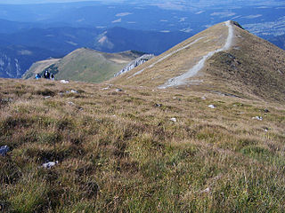
Twarda Kopa – an unremarkable hill in the north-western ridge of Ciemniak, separating the Kościeliska Valley from its branch – the Miętusia Valley in the Polish Western Tatras.
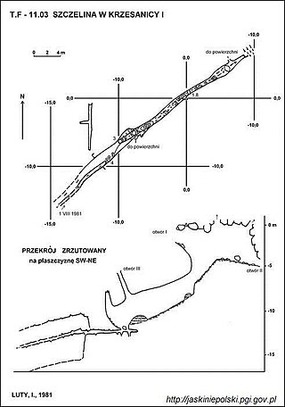
Sight 2: Szczelina w Krzesanicy
Szczelina w Krzesanica I – one of the three caves of the same name located in the Western Tatras near the ridge of Krzesanica above its northern wall descending to the Mulowa Valley. It has three entrance openings located at altitudes of 2091, 2092 and 2098 meters above sea level. The length of the cave is 63 meters, and its height difference is 17 meters.
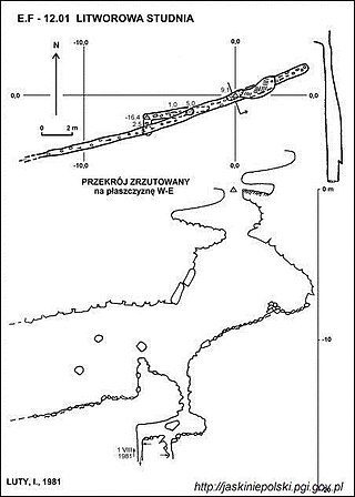
Sight 3: Litworowa Studnia
Litworowa Studnia – a cave in the Miętusia Valley in the Western Tatras. The entrance to it is located above the Litworowa Valley, just below the ridge of Małołączniak, near the Litworowa Pass, at an altitude of 2031 meters above sea level. The length of the cave is 43 meters, and its height difference is 16.4 meters.
Sight 4: Malolučniak / Małołączniak
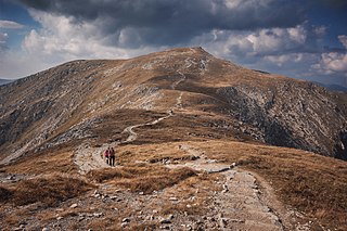
Małołączniak is a mountain in the Western Tatras mountain range, situated on the main ridge of the Tatras between Krzesanica and Kopa Kondracka, on the Polish-Slovak border. It is one the four peaks making up the Czerwone Wierchy group of peaks.
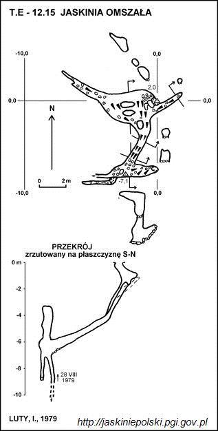
Sight 5: Jaskinia Omszała
The Mossy Cave is a cave in the Valley of the Small Meadow in the Western Tatras. The entrance to it is located on the north-eastern slopes of Małołączniak, above the Valleys, at an altitude of 1904 meters above sea level. The length of the cave is 33 meters, and its denivelation is 10 meters.
Sight 6: Dziura pod Świstową Studnią
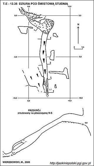
The Hole under the Świstowa Well is a cave in the Valley of the Small Meadow in the Western Tatras. The entrance to it is located in the walls descending from the Valleys to Nižní Svizhška, near the Wolf Cave and the Svistova Well Cave, at an altitude of 1692 m above sea level. The length of the cave is 12.5 meters, and its denivelation is 3.5 meters.
Share
How likely are you to recommend us?
Disclaimer Please be aware of your surroundings and do not enter private property. We are not liable for any damages that occur during the tours.
GPX-Download For navigation apps and GPS devices you can download the tour as a GPX file.
