Self-guided Sightseeing Tour #5 in Kościelisko, Poland
Legend
Tour Facts
1.1 km
82 m
Experience Kościelisko in Poland in a whole new way with our free self-guided sightseeing tour. This site not only offers you practical information and insider tips, but also a rich variety of activities and sights you shouldn't miss. Whether you love art and culture, want to explore historical sites or simply want to experience the vibrant atmosphere of a lively city - you'll find everything you need for your personal adventure here.
Individual Sights in KościeliskoSight 1: Jaskinia Raptawicka
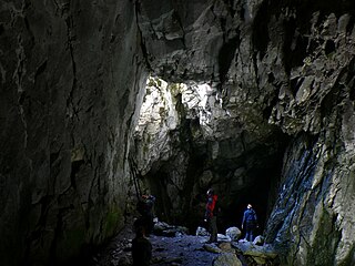
Raptawicka Cave – a cave in the Kościeliska Valley in the Tatra Mountains. Together with the Mylna Cave and the Obłazkowa Cave, it forms the Pawlikowski Cave system. The path leading to it is 4.4 km from Kiry, 100 m above Skała Pisana, in Raptawicka Turnia, on the western side of the valley. The cave opening, located approx. 180 m above the bed of the Kościeliski Stream, is visible from the road leading along the bottom of the valley. The cave can be visited on your own, without a guide. The temperature inside is low.
Sight 2: Jaskinia Obłazkowa
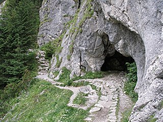
Obłazkowa Cave – a cave in the Kościeliska Valley in the Western Tatras. Together with the Mylna Cave and the Raptawicka Cave, it is part of the Pawlikowski Caves system. It is located at the foot of a limestone crag, called Raptawicka Turnia, on the western side of the valley, at an altitude of 1096 m above sea level, 130 m above the bed of the Kościeliski Stream. The path leading to it is located 4.4 km from Kir, 100 m above Skała Pisana. It is open to tourists, you can visit it on your own, without a guide, all year round. The temperature inside the cave is low.
Sight 3: Jaskinia Wodna pod Raptawicką
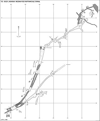
The Water Cave under Raptawicka – a cave in the Kościeliska Valley in the Western Tatras, located at the foot of the limestone massif of Raptawicka Turnia. It is located 4.4 km from Kir, on the western side of the valley, about 100 m north of the Pisana Rock. It has five entrance openings located right next to the Kościeliski Stream, exactly below the path leading to the Pawlikowski Caves at altitudes of 1027 and 1032 m above sea level. The length of the cave is 170 meters, and its height difference is 5 meters.
Sight 4: Skała Pisana
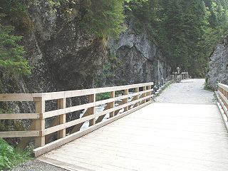
Skała Pisana – a several-meter-high vertical, flat limestone rock located in the Kościeliska Valley in the Western Tatras. It is located 4.3 km from Kiry, above Polana Pisana, in the rocky gorge of the Kościeliski Stream, called Wyżnia Kościeliska Brama. It is located on the eastern side of the valley, the western side of the rock gorge is formed by the cliffs of Raptawicka Turnia. The entire rock is covered with almost invisible autographs of several generations of tourists from years ago, among which there are also signatures of famous people, e.g. the painter Henryk Siemiradzki. The rock is located right next to the wooden bridge over the Kościeliski Stream.
Sight 5: Jaskinia Wodna pod Pisaną
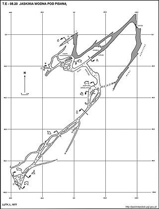
Water Cave under the written, also called the written cave - a cave located in the Kościeliska Valley in the Western Tatras. The cave has three holes, the total length is 450 m, it is located at an altitude of 1023–1028 m a.s.l. The most famous cave outlet is located 4.3 km from Kir, above the written clearing, under a lime written rock. In this place, water flows out of the cave, which with underground troughs and crevices from Kościeliski Potok, as well as from the Kraków gorge. Entering the cave with this hole, it wanders in the cold water. Strong current makes it difficult to move. However, a large part of the cave is devoid of water, which is why the cave usually enters the other two, easily accessible holes. One is located a few meters south of the exhaust hole with water, almost on the road leading the Kościeliska Valley. In the 1990s, it was damaged during road renovation. The next one is several dozen meters south along the road right at Kościeliski Potok. Until the mid -1990s, when the slope was hit, partly covering the hole, it was the largest and most visited entrance to the cave.
Sight 6: Jaskinia Czarna
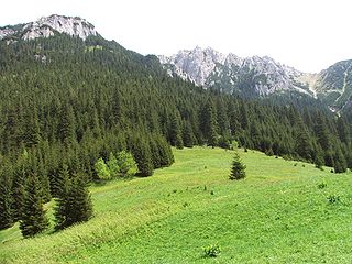
The Black Cave is a cave in the Western Tatras in the Organ Massif in the Kościeliska Valley. It is one of the largest and most extensive caves in the Tatra Mountains. It ranks sixth in terms of length and ninth in terms of denivelation in Poland. It has four entrance openings: two at the foot of Czarna Turnia above Polana Pisana at an altitude of 1326 and 1294 meters above sea level, the third one on the slope of the Żleb pod Wysranki, above Hala pod Upłazem, at an altitude of 1404 meters above sea level, and the fourth located a few meters above the main opening at an altitude of 1330 meters above sea level. Some parts of the cave are poorly explored and documented. In June 2016, the length of the discovered corridors was 7247 meters, and the height difference was 303.5 meters.
Share
How likely are you to recommend us?
Disclaimer Please be aware of your surroundings and do not enter private property. We are not liable for any damages that occur during the tours.
GPX-Download For navigation apps and GPS devices you can download the tour as a GPX file.
