Self-guided Sightseeing Tour #3 in Kościelisko, Poland
Legend
Tour Facts
0.3 km
1 m
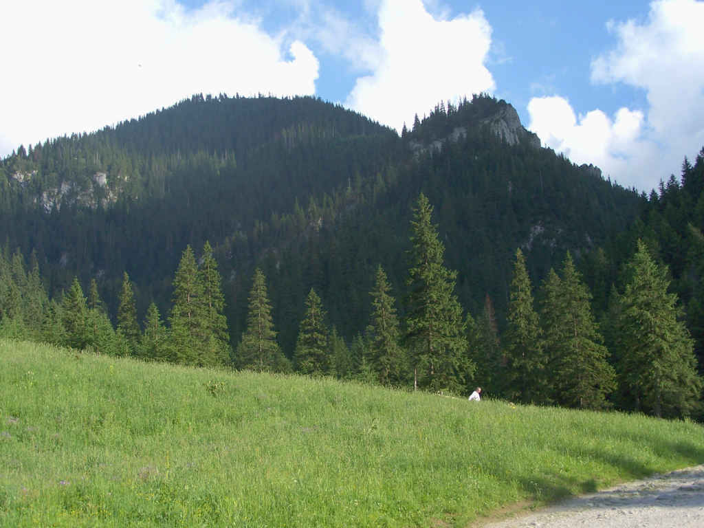
Experience Kościelisko in Poland in a whole new way with our free self-guided sightseeing tour. This site not only offers you practical information and insider tips, but also a rich variety of activities and sights you shouldn't miss. Whether you love art and culture, want to explore historical sites or simply want to experience the vibrant atmosphere of a lively city - you'll find everything you need for your personal adventure here.
Individual Sights in KościeliskoSight 1: Zbójnicka Igła

Zbójnicka Igla – a crag in the north-western perch of Gubalec in the Polish Western Tatras. It is located about 800 m south of Polana Pisana, above Skała Pisana. This crag, built of sedimentary carbonate rocks, is visible from several places in the Kościeliska Valley and from Ornak. It is separated from the higher Zbójnicka Turnia by the pass of Niżni Zbójnicki Przechód. From this pass through the forest, there is a dozen or so meters of approach to the 8-meter fault of the Zbójnicka Needle. Its right side can be used to reach the top. In addition to Zbójnicka Turnia and Zbójnicka Igla, there are other unnamed rocks in the north-western perch of Gubalec.
Sight 2: Zbójnicka Turnia
Zbójnicka Turnia – a crag on the western slopes of Gubalec forming the eastern wall of the Wyżnia Kościeliska Gate in the Kościeliska Valley in the Western Tatras. It is located about 800 m south of Polana Pisana, above Skała Pisana. It is separated from the top of Gubalec by a wide pass called Wyżni Zbójnicki Przechod. The name of the crag is related to the robbers' past of the Kościeliska Valley. According to the highlanders, its caves were inhabited by robbers and the treasures they collected are located there. These caves were searched many times by treasure hunters in the past centuries, as evidenced by the signs they carved on the walls.
Sight 3: Dudzia Dziura

Dudzia Dziura – a cave in the Kościeliska Valley in the Western Tatras. The entrance to it is located in the Kraków Gorge, on the slope of Żar below Wielka Turnia, at an altitude of 1201 meters above sea level. The cave is 23 meters long and its height difference is 6 meters.
Sight 4: Dziura pod Arkadą

Dziura pod Arkadą – a cave, or rather a shelter, in the Kościeliska Valley in the Western Tatras. The entrance to it is located on the eastern slope of the Kraków Gorge, on the slope descending from Upłazkowa Turnia, in the same couloir as the Arcade, the Cave above the Arcade and the Arkada Shelter, at an altitude of 1187 meters above sea level. The cave is 5.5 meters long and its height difference is 1 meter.
Sight 5: Jaskinia Skoruszowa

Skoruszowa Cave (Kominowa) – a cave in the Kościeliska Valley in the Western Tatras. It has two entrance openings located on the eastern slope of the Kraków Gorge, in the slope descending from Upłazkowa Turnia, below the Lamb Cave, at altitudes of 1236 and 1238 m above sea level. The length of the cave is 23 meters, and its denivelation is 8 meters.
Sight 6: Jaskinia nad Arkadą

Cave nad Arkadą – a cave in the Kościeliska Valley in the Western Tatras. The entrance to it is located on the eastern slope of the Kraków Gorge, on the slope descending from Upłazkowa Turnia, in the same couloir as the Arkada cave, the Hole under the Arcade and the Arkada Shelter, at an altitude of 1206 meters above sea level. The length of the cave is 21 meters, and its denivelation is 8 meters.
Sight 7: Jaskinia nad Percią

Cave on the Perć River – a cave in the Kościeliska Valley in the Western Tatras. The entrance to it is located in the Kraków Gorge, in a rock on the slopes of Upłazkowa Turnia, above the Cave at Perć, at an altitude of 1240 m above sea level. The length of the cave is 15 meters, and its height difference is 5.5 meters.
Sight 8: Jaskinia przy Perci

The Cave at Perć is a cave in the Kościeliska Valley in the Western Tatras. The entrance to it is located in the Kraków Gorge, on the slope descending from Upłazkowa Turnia, near the Skoruszowa Cave, below the Cave on the Perć, at an altitude of 1225 m above sea level. The length of the cave is 17 meters, and its denivelation is 3 meters.
Sight 9: Mała Gawra
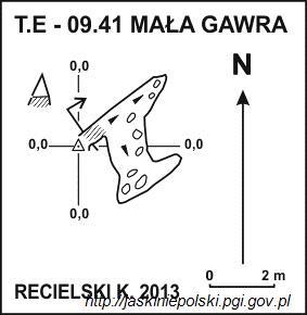
Mała Gawra – a cave, or rather a shelter, in the Kościeliska Valley in the Western Tatras. The entrance to it is located in the Kraków Gorge, on the slope of Upłazkowa Turnia descending to the Upłazkowy Kocioł, near the Gawra Cave and the Lamb Cave, at an altitude of 1300 meters above sea level. The length of the cave is 6 meters, and its denivelation is 2 meters.
Sight 10: Ptakowa Turnia

Ptakowa Turnia – a crag in the orographically right slopes of the Kraków Gorge in the Western Tatras. It is located at the end of the south-western perch of Upłazkowa Turnia. It descends a partly forested and partly rocky-grassy steep slope with walls to the Market Square and the Upłazkowy Kotło in the Kraków Gorge. It is separated from the massif of Upłazkowa Turnia and the Gładka Turnia located a little higher by the Bird Pass. At the foot of Ptakowa Turnia there is an original rock formation – a large nyża with rock blocks, called the Church.
Sight 11: Ratusz

Town Hall - Turnia in the Kościeliska Valley in the Western Tatras. Together with Turnia near her, Saturn is perfectly visible from the written clearing. The name was given by the former tourists. Built of carbonate rocks, the town hall smaller than Saturn is 1296 m a.s.l. It is located in the orographically right slopes of the Kraków gorge. From Saturn it is separated by a switch behind the town hall. Only from this switch can you go out on it without much difficulty - vertical walls fall on all other pages. There are several climbing roads in them. The pillar with a height of about 170 m high is particularly impressive. The lower part of the pillar and the 40-meter height of the shelf for the first time were Jerzy Łabęcki and Ryszard Malczyk in April 1970. The first passage of the upper part: Jerzy Farat and Ryszard Malczyk on April 12, 1981. This road, named by them "from here to eternity", contains A large accumulation of difficulties with a degree VI+.
Sight 12: Schron przy Arkadzie

Arkada Shelter – a cave, or rather a shelter, in the Kościeliska Valley in the Western Tatras. The entrance to it is located on the eastern slope of the Kraków Gorge, on the slope descending from the Upłazkowa Turnia, near the Arkada Cave, the Hole under the Arcade and the Cave above the Arcade, at an altitude of 1200 meters above sea level. The cave is horizontal and its length is 6 meters.
Sight 13: Spękana Szczelina

Cracked Rift – a cave in the Kościeliska Valley in the Western Tatras. The entrance to it is located in the Kraków Gorge, on the slope descending from Upłazkowa Turnia, near the Cave at Perć, at an altitude of 1230 m above sea level. The length of the cave is 11.5 meters, and its height difference is 5 meters.
Sight 14: Ukryty Schron

Hidden Shelter – a cave, or rather a shelter, in the Kościeliska Valley in the Western Tatras. The entrance to it is located on the eastern slope of the Kraków Gorge, on the slope descending from Upłazkowa Turnia, at an altitude of 1174 meters above sea level. The length of the cave is 5 meters, and its height difference is 1 meter.
Sight 15: Upłazkowa Baszta

Upłazkowa Baszta – a crag in the orographically right slopes of the Kościeliska Valley in the Western Tatras. It is located in the ridge descending to the northwest from the top of Upłazkowa Turnia to the Pass behind Saturn, just above this pass. It is separated from the higher Upłazkowy Kopiniak by the Pass behind the Upłazkowa Baszta and Upłazkowe Wrótka. Between these saddles there is a small, nameless rock tooth
Sight 16: Arkada

Arkada – a cave, or rather a shelter, in the Kościeliska Valley in the Western Tatras. It has two entrance openings located on the eastern slope of the Kraków Gorge, on the slope descending from the Upłazkowa Turnia, in the same couloir as the Hole under the Arcade, the Cave above the Arcade and the Shelter at the Arcade, at an altitude of 1194 and 1201 meters above sea level. The length of the cave is 8 meters, and its denivelation is 7 meters.
Sight 17: Saturn
Saturn – a crag in the Kościeliska Valley in the Western Tatras. It is located in the north-western ridge of Upłazkowa Turnia, which separates the Pisanrski Gully from the Kraków Gorge. On the south-eastern side of Saturn there is the Pass behind Saturn, the north-western slopes of Saturn fall to the main course of the Kościeliska Valley, and in the south-western direction there is the Town Hall crag, separated from Saturn by the Pass behind the Town Hall.
Share
How likely are you to recommend us?
Disclaimer Please be aware of your surroundings and do not enter private property. We are not liable for any damages that occur during the tours.
GPX-Download For navigation apps and GPS devices you can download the tour as a GPX file.