Self-guided Sightseeing Tour #2 in Valkenburg, Netherlands
Legend
Guided Free Walking Tours
Book free guided walking tours in Valkenburg.
Guided Sightseeing Tours
Book guided sightseeing tours and activities in Valkenburg.
Tour Facts
2.5 km
77 m
Experience Valkenburg in Netherlands in a whole new way with our free self-guided sightseeing tour. This site not only offers you practical information and insider tips, but also a rich variety of activities and sights you shouldn't miss. Whether you love art and culture, want to explore historical sites or simply want to experience the vibrant atmosphere of a lively city - you'll find everything you need for your personal adventure here.
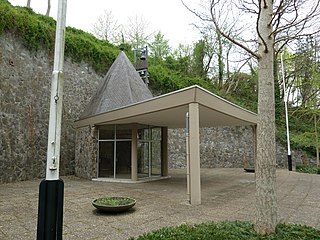
Individual Sights in ValkenburgSight 1: Provinciaal Verzetsmonument
The Provincial Resistance Monument on the Cauberg near Valkenburg in the Dutch South Limburg municipality of Valkenburg aan de Geul is a memorial chapel in honor of the Limburg resistance in World War II.
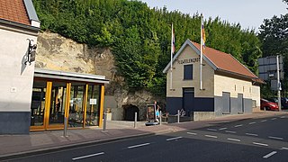
Sight 2: Kasteelruïne & Fluweelengrot
The Velvet Cave is a tunnel system in the Dutch municipality of Valkenburg aan de Geul. It was created by marl mining. The historic corridor system is located on the Daalhemerweg and is open for guided tours.
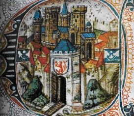
Sight 3: Geulpoort
The Geulpoort is originally a medieval city gate in the city wall of Valkenburg. The gate was completely demolished over the years from 1644 onwards, but a reconstruction of the original was built in 2014.
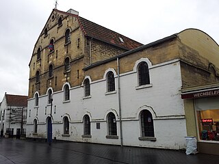
Sight 4: Oude of Banmolen
The Old Mill or Banmolen is a watermill that used the water of a branch of the river Geul and is located in the middle of Valkenburg in the Dutch province of Limburg. Nowadays, the Francis turbine is still running, but it is driven by an electric motor. The water from the mill is transported through the Walramweir via the mill branch to the water mill.
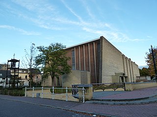
Sight 5: Onze-Lieve-Vrouw van Altijddurende Bijstandkerk
The Church of Our Lady of Perpetual Help is a church building in Valkenburg in the municipality of Valkenburg aan de Geul in the Dutch province of Limburg. The church is located on the north side of the Walramplein on the Sint Pieterstraat, just after the Geul has split into two branches at the Walramweir. About 200 meters to the west is the H.H. Nicholas and Barbara Church.
Wikipedia: Onze-Lieve-Vrouw van Altijddurende Bijstandkerk (Valkenburg) (NL)
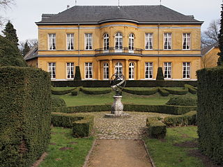
Sight 6: Kasteel Oost
Kasteel Oost is a castle-like country house, located on the Oosterweg in a bend of the river Geul east of the town of Valkenburg in Dutch Limburg. The castle, which is surrounded by a formal garden and a landscape garden, is a national monument and is also part of the Geul & Maas estate.
Share
How likely are you to recommend us?
Disclaimer Please be aware of your surroundings and do not enter private property. We are not liable for any damages that occur during the tours.
GPX-Download For navigation apps and GPS devices you can download the tour as a GPX file.
