Self-guided Sightseeing Tour #5 in Maastricht, Netherlands
Legend
Guided Free Walking Tours
Book free guided walking tours in Maastricht.
Guided Sightseeing Tours
Book guided sightseeing tours and activities in Maastricht.
Tour Facts
4.2 km
60 m
Experience Maastricht in Netherlands in a whole new way with our self-guided sightseeing tour. This site not only offers you practical information and insider tips, but also a rich variety of activities and sights you shouldn't miss. Whether you love art and culture, want to explore historical sites or simply want to experience the vibrant atmosphere of a lively city - you'll find everything you need for your personal adventure here.
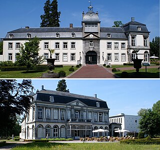
Activities in MaastrichtIndividual Sights in MaastrichtSight 1: Kasteel Vaeshartelt
Vaeshartelt Castle is a medieval castle and estate in the Meerssenhoven neighborhood in the northwest of the Dutch municipality of Maastricht. The country estate was briefly owned by the royal family of the Netherlands and has been used as a hotel and conference centre since 1994. The partly 18th, partly 19th-century castle with its park and farmlands is a national monument and part of the Buitengoed Geul & Maas.
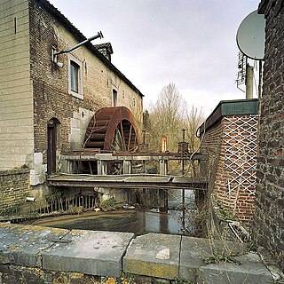
Sight 2: IJzeren Molen
The IJzeren Molen, also called Nieuwe Molen or Rothemermolen, is a watermill on a tributary of the Geul, called the Kleine Geul or Geulke, in Rothem, in the municipality of Meerssen. The Iron Mill is part of the Geul & Maas estate, formerly known as the Maastricht-Meerssen Estate Zone. The mill is a national monument.
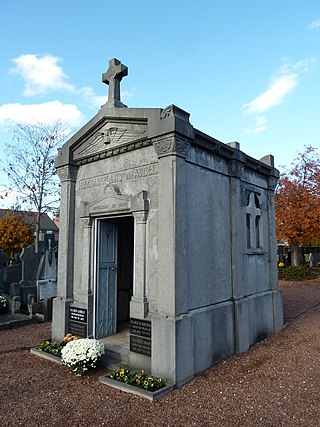
Sight 3: Begraafplaats van Aubel
The Cemetery of Aubel is a burial chapel in Meerssen in the Dutch municipality of Meerssen. The chapel is located in the middle of the General Cemetery Meerssen in the middle of the village.
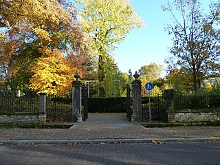
Sight 4: Proosdijpark
The Proosdijpark is a park centrally located in the Dutch town of Meerssen.
Sight 5: Basiliek van het H. Sacrament
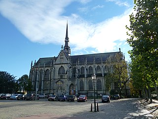
The Basilica of the Blessed Sacrament, St. Bartholomew's Basilica or Basilica of Meerssen is a Roman Catholic church building in Meerssen, Dutch Limburg. The parish church is dedicated to the Blessed Sacrament and to the Apostle Bartholomew and was elevated to basilica minor by Pope Pius XI on June 16, 1938. The church is an example of mature Maas Gothic and is considered the pinnacle of this style in the Netherlands. The building has been a national monument since 1967.
Share
Disclaimer Please be aware of your surroundings and do not enter private property. We are not liable for any damages that occur during the tours.
GPX-Download For navigation apps and GPS devices you can download the tour as a GPX file.
