Self-guided Sightseeing Tour #2 in Maastricht, Netherlands
Legend
Tour Facts
2 km
128 m
Experience Maastricht in Netherlands in a whole new way with our free self-guided sightseeing tour. This site not only offers you practical information and insider tips, but also a rich variety of activities and sights you shouldn't miss. Whether you love art and culture, want to explore historical sites or simply want to experience the vibrant atmosphere of a lively city - you'll find everything you need for your personal adventure here.
Activities in MaastrichtIndividual Sights in MaastrichtSight 1: Muizenberggroeve
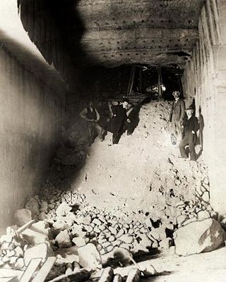
The Muizenberg is an underground marl quarry located in the southern part of the Cannerberg, largely belonging to the municipality of Riemst (Belgium), on the border of the Netherlands and Belgium west of border post 70. The tunnel system used to have its own entrance on the Kanne-Vroenhoven road, also called Muizenberg, and south of the field road called chemin de la Xhavée. The partially collapsed quarry was connected to the Boschberg quarry, now also called the Castle Quarry or Cannerberg quarry.
Sight 2: Smokkelmolen
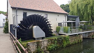
The Smuggling Mill is a watermill on the Jeker in Neerkanne in the Belgian province of Limburg. It is an undershot mill that functioned as a flour mill.
Sight 3: Château Neercanne
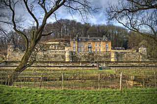
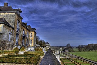
Château Neercanne is a restaurant located in Maastricht in the Netherlands. It is a fine dining restaurant that was awarded one or two Michelin stars in the periods 1957-1982 and 1986–2018.
Sight 4: Cannerberg

The Cannerberg is a hill near Maastricht, which is partly on Dutch and partly on Belgian territory. The hill is named after the town of Kanne, which is located just across the border in Belgium. The Cannerberg forms the western slope of the Jeker valley, opposite the Sint-Pietersberg. The ridge is an offshoot of the Haspengouw Plateau. Part of the hill was excavated between 1930 and 1939 for the construction of the Albert Canal, cutting off the ridge from the larger plateau.
Sight 5: Boschberg, hoofdingang (NATO-berg)
NATO Headquarters Cannerberg / Joint Operations Centre (JOC), located behind the Château Neercanne south of Maastricht, on the border with Belgium, was, during the Cold War, a communications center and headquarters of NATO. It housed the war headquarters of Northern Army Group and Second Allied Tactical Air Force.
Share
How likely are you to recommend us?
Disclaimer Please be aware of your surroundings and do not enter private property. We are not liable for any damages that occur during the tours.
GPX-Download For navigation apps and GPS devices you can download the tour as a GPX file.


.jpg)