Self-guided Sightseeing Tour #1 in Arnhem, Netherlands
Legend
Tour Facts
1.5 km
12 m
Experience Arnhem in Netherlands in a whole new way with our free self-guided sightseeing tour. This site not only offers you practical information and insider tips, but also a rich variety of activities and sights you shouldn't miss. Whether you love art and culture, want to explore historical sites or simply want to experience the vibrant atmosphere of a lively city - you'll find everything you need for your personal adventure here.
Activities in ArnhemIndividual Sights in ArnhemSight 1: Airborne monument
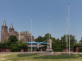
The Airborne Monument in the Dutch city of Arnhem is a monument on the Airborne Square in memory of the Battle of Arnhem in September 1944. It consists of a column of the former Palace of Justice in Arnhem that was damaged by the war and has been placed on a pedestal. During the battle of Arnhem in September 1944, the courthouse was completely destroyed. A fragment of one of the columns was preserved as a reminder of the war and now forms the monument. On 17 September 1945, the monument was unveiled by the Queen's Commissioner, mr. Schelto baron van Heemstra. On the column is the date in gilded letters: 17 September 1944.
Sight 2: Sint Walburgisbasiliek
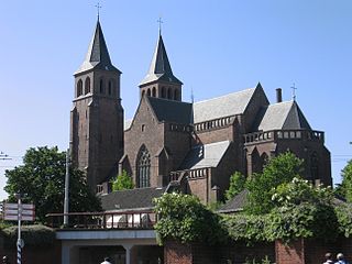
St. Walburga's Church is the oldest surviving church in Arnhem. The building has a characteristic double tower front on the west side. The church is built on the Count's Court and the residence of Reinald 1.
Sight 3: Duivelshuis
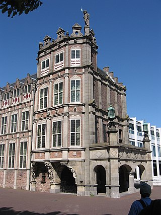
The Devil's House or Maarten van Rossum House, on the Koningstraat in the center of the Gelderland capital Arnhem, is a city castle from the 16th century. It is called 'Devil's House' because of the satyr figures on the façade. The city castle houses the office of the mayor of Arnhem. After the Second World War, the cellars became a place of pilgrimage for veterans, relatives and other interested parties regarding the Battle of Arnhem.
Sight 4: Sint-Eusebiuskerk
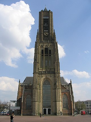
St. Eusebius church also known as the Eusebiuskerk or the Grote Kerk, at 93 metres is the largest church, and the largest building in Arnhem, The Netherlands.
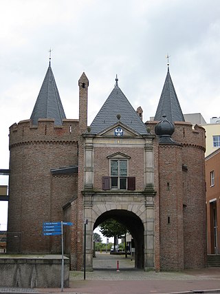
Sight 5: Sabelspoort
The Sabelspoort is a city gate of Arnhem.
Sight 6: Verzetsmonument Arnhem
The resistance monument in Arnhem is a monument in honour of the resistance in Arnhem, designed by the designer Jouke Hoogland and the poet Jos Pauw. From 2005 to 2015, the resistance monument adorned the rear façade of Musis Sacrum on Velperplein. In 2017, the monument was redesigned and relocated to the Rijnkade near the John Frost Bridge in the Jacob Groenewoudplantsoen.
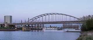
Sight 7: John Frost Bridge
Get Ticket*John Frost Bridge is the road bridge over the Lower Rhine at Arnhem, in the Netherlands. The bridge was inaugurated after the end of World War II, and is named after Major-General John Dutton Frost (1912–1993), who commanded the British forces that reached and temporarily defended the pre-existing Rijnbrug at the same location during the Battle of Arnhem in September 1944. This was the bridge referenced in the 1977 Anglo-American film A Bridge Too Far, although the IJssel bridge in Deventer was used for the actual shooting of the film.
Share
How likely are you to recommend us?
Disclaimer Please be aware of your surroundings and do not enter private property. We are not liable for any damages that occur during the tours.
GPX-Download For navigation apps and GPS devices you can download the tour as a GPX file.
