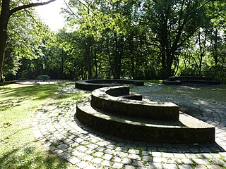
Free Walking Sightseeing Tour #9 in Wuppertal, Germany

Legend

Churches & Art
Nature
Water & Wind
Historical
Heritage & Space
Tourism
Paid Tours & Activities

Tour Facts

Number of sights 20 sights
Distance 15.2 km
Ascend 404 m
Descend 405 m

Explore Wuppertal in Germany with this free self-guided walking tour. The map shows the route of the tour. Below is a list of attractions, including their details.

Individual Sights in Wuppertal

Sight 1: Platz der Republik

Show sight on map

The square of the Republic is an inner -city square in the Wuppertal residential area Osterbaum.

Wikipedia: Platz der Republik (Wuppertal) (DE)

104 meters / 1 minutes

Sight 2: Engelnburg

Show sight on map

The Engelnburg is a residential complex with a restaurant in the Elberfeld district of Wuppertal, on the Engelnberg hill in the Ostersbaum residential district and is a listed building.

Wikipedia: Engelnburg (DE)

478 meters / 6 minutes

Sight 3: Thomaskirche

Show sight on map
Thomaskirche

St. Thomas' Church is a Protestant church in the Elberfeld district of Wuppertal, Germany.

Wikipedia: Thomaskirche (Wuppertal) (DE), Website

825 meters / 10 minutes

Sight 4: Lego-Brücke

Show sight on map

The Lego-Brücke is a concrete beam bridge which crosses over the Schwesterstraße in the North Rhine-Westphalian city of Wuppertal, Germany. In 2011, graffiti and street artist Martin Heuwold repainted the bridge in the style of Lego bricks, receiving national and international media attention for his work. The work was awarded the Deutscher Fassadenpreis in 2012.

Wikipedia: Lego-Brücke (EN), Website

1026 meters / 12 minutes

Sight 5: Hardtberg

Show sight on map
Hardtberg

Hardtberg is a borough (Stadtbezirk) of Bonn, Germany. It has a population of 34,576 (2018).

Wikipedia: Hardtberg (EN)

845 meters / 10 minutes

Sight 6: Johnson Controls IFM Industrie GmbH

Show sight on map

The consumer cooperative "Vorwärts-Befreiung" was a large consumer cooperative in Wuppertal. It emerged from the merger of the cooperatives "Liberation" and "Vorwärts" as well as "Budget" in Velbert in 1924. Previously, several attempts to unite the Elberfeld and Barmer cooperatives had failed.

Wikipedia: Konsumgenossenschaft Vorwärts-Befreiung (DE)

1016 meters / 12 minutes

Sight 7: 18

Show sight on map

The Helios University Hospital Wuppertal is a hospital in Wuppertal with locations in Barmen and Elberfeld. It is the largest hospital in the Bergisches Land. It has 1,051 beds and more than 2,500 employees and 26 specialist departments at its three locations in Barmen and Elberfeld as well as Bergisch Land in Ronsdorf (pain clinic).

Wikipedia: Helios Universitätsklinikum Wuppertal (DE)

1405 meters / 17 minutes

Sight 8: Eben-Ezer-Kapelle

Show sight on map
Eben-Ezer-Kapelle

The Eben-Ezer Chapel in Wuppertal is a listed church. It is the place of worship of the Evangelical Free Church congregation in Wuppertal-Barmen.

Wikipedia: Eben-Ezer-Kapelle (Wuppertal) (DE), Website

785 meters / 9 minutes

Sight 9: Hohenstein

Show sight on map

The Hohenstein is a dolomite rock cliff in the city of Wuppertal, which is located in a 4,450 m² city park of the same name.

Wikipedia: Hohenstein (Wuppertal) (DE)

727 meters / 9 minutes

Sight 10: St. Antonius

Show sight on map
St. Antonius

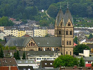
The Church of St. Anthony in Wuppertal is the church of the oldest Catholic community in the district of Barmen after the Reformation.

Wikipedia: St. Antonius (Wuppertal) (DE), Website, Youtube

362 meters / 4 minutes

Sight 11: Synagoge

Show sight on map

The Bergische Synagoge is the meeting place and place of worship of the Jewish community in Wuppertal.

Wikipedia: Bergische Synagoge (DE)

566 meters / 7 minutes

Sight 12: Haus der Jugend

Show sight on map
Haus der Jugend

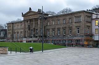
The Barmer Ruhmeshalle is a historic building in the Barmen district of the German town of Wuppertal, originally built as a hall of fame. It was officially known as the Kaiser Wilhelm- und Friedrich-Ruhmeshalle and later as the Haus der Jugend.

Wikipedia: Ruhmeshalle (Wuppertal) (EN)

91 meters / 1 minutes

Sight 13: Otto Graf von Bismarck

Show sight on map

The Bismarck monument in the then independent town of Barmen was inaugurated in 1902. It was designed by the Berlin sculptor Hugo Lederer and originally stood in front of the old Barmen town hall on Werther Strasse ; In the autumn of 1921, the year of completion of the new Barmen town hall, it was moved to its current location in front of the Barmen Hall of Fame on Geschwister-Scholl-Platz.

Wikipedia: Bismarck-Denkmal (Barmen) (DE)

149 meters / 2 minutes

Sight 14: Astropfad: Merkur

Show sight on map

The Astro Trail is a planetary trail in Wuppertal and thus a model of the solar system.

Wikipedia: Astropfad Wuppertal (DE)

219 meters / 3 minutes

Sight 15: Werther Brücke

Show sight on map
Werther Brücke Frank Vincentz / CC BY-SA 3.0

The Werther Bridge is a two-lane road bridge built in 1903 over the Wupper River in the Barmen district of Wuppertal, Germany. As part of the Heidter Berg road, it connects the left, southern bank of the Wupper with the Barmer Werth between the Wupper and Barmer Mühlengraben. The road then crosses Höhne/Berliner Straße to the north and continues beyond this intersection as Bachstraße. The bridge is designed as a one-way street, in a northerly direction. The bridge is located in the immediate vicinity of the Werther Brücke suspension railway station, which is named after it.

Wikipedia: Werther Brücke (DE)

1109 meters / 13 minutes

Sight 16: Knopffabrik PSW

Show sight on map

The PSW button factory is a factory building in the Wuppertal residential area Sedansberg and is a monument in accordance with Section 2 (1) DSchG NRW. It is the production location of Bielefelder companies Union Knopf GmbH and PSW-Knopf GmbH. The latter company also ensures the common name Knopffabrik PSW.

Wikipedia: Knopffabrik PSW (DE), Website

1706 meters / 20 minutes

Sight 17: Immanuelskirche

Show sight on map
Immanuelskirche

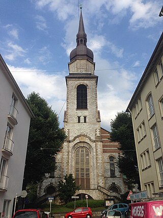
The Immanuelskirche in the Oberbarmen district of Wuppertal is the former reformed church of the Wupperfeld district and has been used as a concert church since the profanation in 1984.

Wikipedia: Immanuelskirche (Wuppertal) (DE), Website

1272 meters / 15 minutes

Sight 18: Familien- und Begegnungshaus

Show sight on map

The Wichlinghausen Church in the Oberbarmen district of Wuppertal is a traditional church building in the district of Wichlinghausen. Until its deconsecration in 2014, it was a church of the Protestant parish of Wichlinghausen-Nächstebreck in the church district of Wuppertal, since 2015 it has been used as a district center.

Wikipedia: Wichlinghauser Kirche (DE)

885 meters / 11 minutes

Sight 19: Haus Abendfrieden

Show sight on map

Haus Abendfrieden is a villa in Wichlinghausen, Wuppertal district of Oberbarmen.

Wikipedia: Haus Abendfrieden (DE)

1651 meters / 20 minutes

Sight 20: St. Paul

Show sight on map
St. Paul

St. Paul is a Roman Catholic church on Bornscheuerstraße on the Hilgershöhe in Wuppertal-Langerfeld, Germany.

Wikipedia: St. Paul (Wuppertal) (DE)

Share

Spread the word! Share this page with your friends and family.

Disclaimer Please be aware of your surroundings and do not enter private property. We are not liable for any damages that occur during the tours.

GPX-Download For navigation apps and GPS devices you can download the tour as a GPX file.