Self-guided Sightseeing Tour #6 in Wuppertal, Germany
Legend
Tour Facts
8.5 km
188 m
Experience Wuppertal in Germany in a whole new way with our free self-guided sightseeing tour. This site not only offers you practical information and insider tips, but also a rich variety of activities and sights you shouldn't miss. Whether you love art and culture, want to explore historical sites or simply want to experience the vibrant atmosphere of a lively city - you'll find everything you need for your personal adventure here.
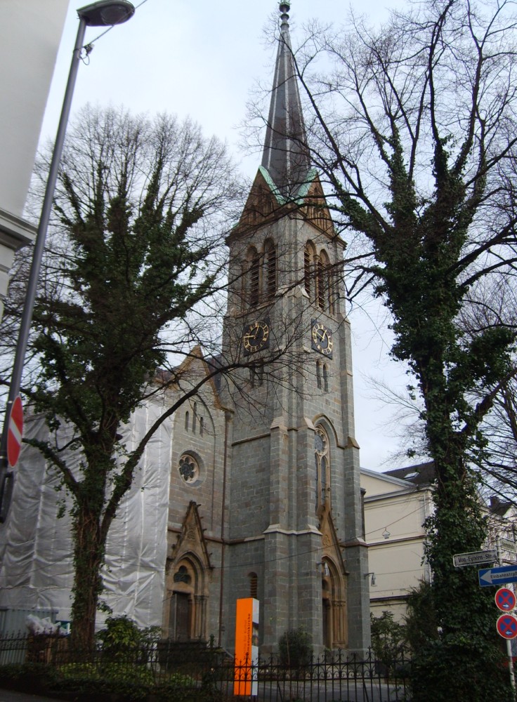
Individual Sights in WuppertalSight 1: St. Johann Baptist

The church of St. Johann Baptist in today's Wuppertal district of Oberbarmen is the second place of worship built for the Catholic Christians of Barmen.
Sight 2: Immanuelskirche
The Immanuel Church in the Wuppertal district of Oberbarmen is the former Reformed church of the Wupperfeld district and has been used as a concert church since its desecration in 1984.
Sight 3: Alte Kirche Wupperfeld

The Old Church of Wupperfeld is a former Protestant church in Wuppertal-Barmen, Germany. It was deconsecrated and sold as a place of worship in 2017.
Sight 4: Werther Brücke

The Werther Bridge is a road bridge built in 1903 with two lanes over the Wupper in the Wuppertal district of Barmen. As part of the Heidter Berg road, it connects the southern bank of the Wupper with the Barmen city centre (Werth) in the north. The bridge is set up as a one-way street, in a northerly direction, and is located in the immediate vicinity of the Werther Brücke suspension railway station, which is named after it.
Sight 5: Otto Graf von Bismarck

The Bismarck monument in the then independent city of Barmen was inaugurated in 1902. It was created by the Berlin sculptor Hugo Lederer and originally stood in front of the old Barmen town hall on Werther Straße ; In the autumn of 1921, the year of completion of the new Barmen town hall, it was moved to its current location in front of the Barmen Hall of Fame on Geschwister-Scholl-Platz.
Sight 6: Haus der Jugend
The Barmer Ruhmeshalle is a historic building in the Barmen district of the German town of Wuppertal, originally built as a hall of fame. It was officially known as the Kaiser Wilhelm- und Friedrich-Ruhmeshalle and later as the Haus der Jugend.
Sight 7: Wuppertaler Brauhaus

The Stadtbad Kleine Flurstraße is a preserved historic municipal swimming pool in the Barmen district of Wuppertal. The building is registered as an architectural monument in the list of monuments of the city of Wuppertal.
Wikipedia: Stadtbad Kleine Flurstraße (DE), Website, Website
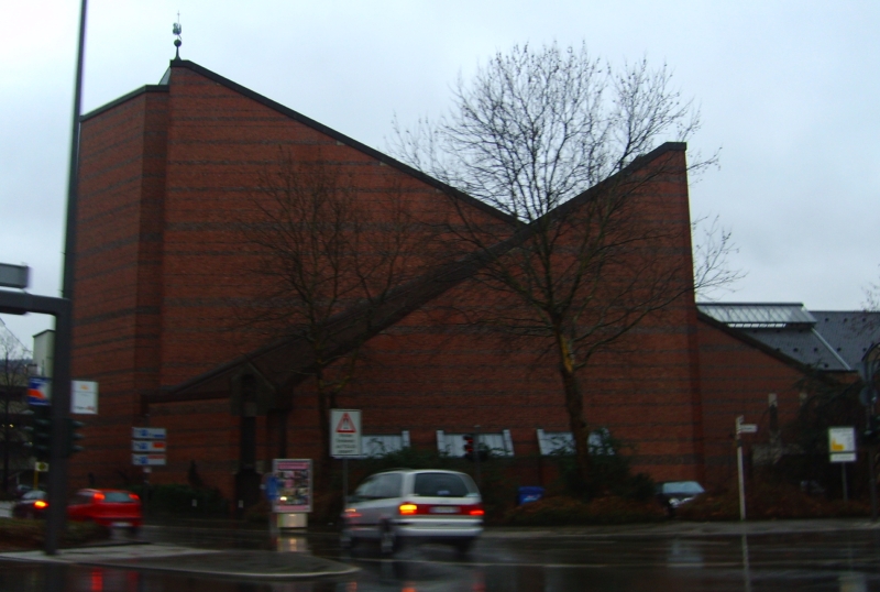
Sight 8: Synagoge

The Bergische Synagoge is the meeting place and place of worship of the Jewish community in Wuppertal.
Sight 9: Gemarker Kirche

The Gemark Church is a Protestant church in the Barmen district of Wuppertal, where the Barmen Confessional Synod of the German Evangelical Church adopted the Barmen Theological Declaration, also known as the Barmen Confession, on May 31, 1934. That was the constituent synod of the Confessing Church.
Sight 10: Bahnhofsempfangsgebäude Barmen

Wuppertal-Barmen station is a station in the city of Wuppertal in the German state of North Rhine-Westphalia on the Elberfeld–Dortmund railway. Its entrance building is protected as a monument. It was Barmen Hauptbahnhof prior to Barmen's incorporation in Wuppertal in 1929. Before the Second World War it was an important stop for express trains and had substantial freight traffic. Its importance declined after the war in favour of Oberbarmen and since the renaming of the Elberfeld station as Wuppertal Hauptbahnhof. The Opernhaus Wuppertal is nearby.
Sight 11: Engelsgarten

The Engelsgarten is a city park in the city of Wuppertal, Germany, named after the Engels family, from which the politician and philosopher Friedrich Engels came from.
Sight 12: Die starke Linke

The Strong Left is a sculpture by the Austrian sculptor Alfred Hrdlicka, who died in 2009 in Wuppertal-Unterbarmen. Until it was erected, it caused a local scandal because of the late completion and the exploded costs. Until the Engels monument was erected in 2014, the Hrdlicka sculpture was sometimes also referred to as the Friedrich Engels Monument.
Sight 13: Haus Barthels

Haus Barthels is a listed villa in the Wuppertal district of Barmen and on Friedrich-Engels-Allee. The property with the address Friedrich-Engels-Allee 384 is a former merchant's villa in the Empire style. The two-storey house was built in 1790 at Berliner Straße 100 and has been inhabited by the entrepreneur Philipp Barthels since about 1820.
Sight 14: Haus Röhrig

The two-storey Röhrig House, built in 1789, together with the Barthels House and the Engels House on the edge of the Engelsgarten, forms an important historical urban building ensemble of the Historic Centre, near Friedrich-Engels-Allee in Wuppertal-Unterbarmen.
Sight 15: Engels-Haus

Engels-Haus is a museum in Wuppertal, Germany, located in the house where Friedrich Engels (1820–1895) grew up. The museum is a constituent member of the Museum of Industrial Culture in Wuppertal.
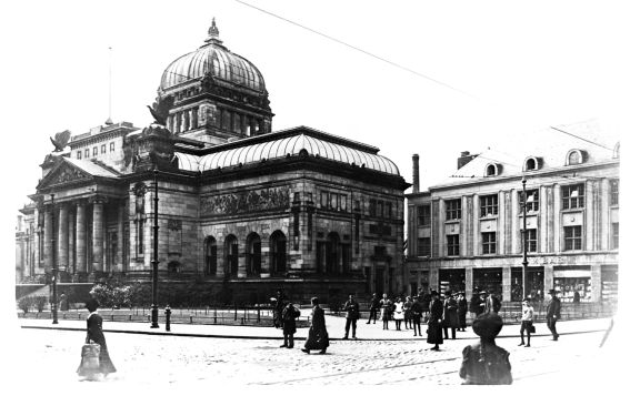
Sight 16: Museum für Frühindustrialisierung

The Museum of Early Industrialization is a museum of industrial and social history in Wuppertal-Barmen, Germany. It is a location of the Museum of Industrial Culture Wuppertal. The theme of the museum is the early development of industry in Wuppertal in the diverse interplay of technical, social, economic and mentality historical factors. The museum was opened on 23 October 1983 and was the first socio-historical museum to address industrialisation at the time.
Sight 17: Astropfad: Jupiter
The Astropfad is a planetary trail in Wuppertal and thus a model of the solar system.
Sight 18: Adlerbrücke

The Eagle Bridge is a road bridge over the Wupper in the Barmen district of Wuppertal, Germany.
Sight 19: St. Antonius
The Church of St. Antonius in Wuppertal is the place of worship of the oldest Catholic community in the district of Barmen after the Reformation.
Sight 20: Hohenstein

The Hohenstein is a dolomite rock cliff in the Wuppertal city area, which is located in a city park of the same name, around 4,450 m² in size.
Sight 21: Eben-Ezer-Kapelle

The Eben-Ezer Chapel is a listed church in Wuppertal-Unterbarmen. It is the place of worship of the Assemblée de Dieu de Wuppertal, a French-speaking Baptist congregation.
Sight 22: Unterbarmer Hauptkirche

Unterbarmer Hauptkirche is a Protestant church in Wuppertal-Barmen, Germany. The Unterbarmer church is an architectural monument of special importance for two reasons: On the one hand, it is the first church building to be executed by the architect Heinrich Hübsch, and on the other hand, it is one of the earliest known buildings of neo-Romanesque architecture.
Sight 23: Cleff´sche Mühle

The Cleff'sche Mühle is a former mill complex in the Wuppertal district of Unterbarmen. The property at Warndtstraße 7 as a mill building with a residential building, including the historic furnishings and the mill ditch on the Wupper, has been protected as an architectural monument since 1 September 1989.
Sight 24: Hardtberg

Hardtberg is a borough (Stadtbezirk) of Bonn, Germany. It has a population of 34,576 (2018).
Share
How likely are you to recommend us?
Disclaimer Please be aware of your surroundings and do not enter private property. We are not liable for any damages that occur during the tours.
GPX-Download For navigation apps and GPS devices you can download the tour as a GPX file.