Self-guided Sightseeing Tour #5 in Nuremberg, Germany
Legend
Guided Free Walking Tours
Book free guided walking tours in Nuremberg.
Guided Sightseeing Tours
Book guided sightseeing tours and activities in Nuremberg.
Tour Facts
5.8 km
127 m
Experience Nuremberg in Germany in a whole new way with our free self-guided sightseeing tour. This site not only offers you practical information and insider tips, but also a rich variety of activities and sights you shouldn't miss. Whether you love art and culture, want to explore historical sites or simply want to experience the vibrant atmosphere of a lively city - you'll find everything you need for your personal adventure here.
Activities in NurembergIndividual Sights in NurembergSight 1: Friedensmuseum

The Nuremberg Peace Museum is a Nuremberg museum of a registered association.
Sight 2: Archivpark

The Archive Park, also known as the Colleggarten or Kolleggarten after the "Colleg-Gesellschaft" that created the park, is an approx. 2.2-hectare neighbourhood park in the Nuremberg district of Gärten hinter der Veste. It emerged from a plot of land owned by the merchant Georg Zacharias Platner in the north of the city of Nuremberg and used as a garden. The garden extended, according to today's street names, from Archivstraße to Pirckheimerstraße and from Bucher Straße to Pilotystraße.
Sight 3: Albrecht Dürer's House
Get Ticket*
Albrecht Dürer's House is a Nuremberg Fachwerkhaus that was the home of German Renaissance artist Albrecht Dürer from 1509 to his death in 1528. The House lies in the extreme north-west of Nuremberg's Altstadt, near the Kaiserburg section of the Nuremberg Castle and the Tiergärtnertor of Nuremberg's city walls.
Sight 4: Historischer Kunstbunker

The Historische Kunstbunker is a tunnel complex under Nuremberg Castle in the old city of Nuremberg, southern Germany. It forms part of the Nuremberg Historic Mile.
Sight 5: Pilatushaus

The Pilatushaus is a town house in Nuremberg, Germany. It is located in the northern district of St. Sebald below Nuremberg Castle on Tiergärtnertorplatz next to Tiergärtnertor. It is one of the few surviving town houses from the late Gothic period and is one of the most important architectural monuments in Nuremberg's old town. The house is a stop on the Nuremberg Historic Mile.
Sight 6: Burggarten

Castle bastions are the name of the bastions built from 1538 onwards to the west and north of the castle in Nuremberg. The Nuremberg Burggarten is laid out in them.
Sight 7: Imperial Castle
Get Ticket*
Nuremberg Castle is a group of medieval fortified buildings on a sandstone ridge dominating the historical center of Nuremberg in Bavaria, Germany.
Sight 8: Fembohaus

The Stadtmuseum Fembohaus is the city museum of the history of Nuremberg. 950 years of city history are vividly presented. It presents a comprehensive view of the city's history in a new museum atmosphere with ambitious exhibitions on current topics of the city's history. The museum is part of the network of museums of the city of Nuremberg.
Sight 9: Historic Rock-cut Cellars
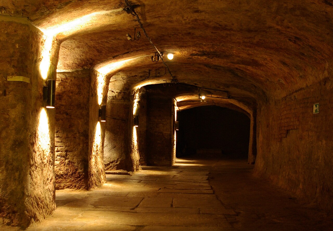
The rock passages are an extensive system of tunnels and cellars under Nuremberg's old town. Until the middle of the 17th century, the tunnel system in particular was secret.
Sight 10: Albrecht-Dürer-Denkmal

The Albrecht Dürer Monument is a statue on Albrecht Dürer Square in Nuremberg, Germany. Created between 1837 and 1840 by the sculptor Christian Daniel Rauch, it depicts the German painter with brush, pen and laurel branch in his right hand. It is one of the most important works of classicist sculpture.
Sight 11: St. Sebald Church
Get Ticket*
St. Sebaldus Church is a medieval church in Nuremberg, Germany. Along with Frauenkirche and St. Lorenz, it is one of the most important churches of the city, and also one of the oldest. It is located at the Albrecht-Dürer-Platz, in front of the old city hall. It takes its name from Sebaldus, an 8th-century hermit and missionary and patron saint of Nuremberg. It has been a Lutheran parish church since the Reformation.
Sight 12: Burgtheater
The Nuremberg Burgtheater is a theatre for cabaret, comedy and cabaret in Nuremberg.
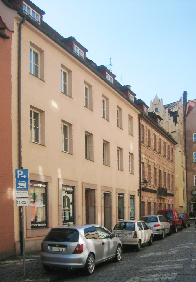
Sight 13: Weißgerbergasse
Get Ticket*
Weißgerbergasse is a street in Nuremberg, Germany. It is one of the few predominantly preserved architectural monument ensembles in Nuremberg's old town. It is lined with bars, restaurants and galleries.
Sight 14: Neutorturm

The Neutor is an old gate in the northwest of the Nuremberg city wall, located southwest of Nuremberg Castle.
Sight 15: Burgschmietbrunnen

The Burgschmietbrunnen fountain in Nuremberg stands on a small square at the junction of Burgschmietstraße and Neutorgraben. The fountain was built in memory of the sculptor and art caster Jacob Daniel Burgschmiet. The bronze figure depicting Burgschmiet was designed by the sculptor Fritz Zadow and cast by Ernst Lenz in 1897. The financing is provided by the residents of Burgschmietstraße.
Sight 16: Kontumazgarten

The Kontumazgarten is a 1.7-hectare green space with a children's playground in the Kleinweidenmühle district of Nuremberg. The simple park is located in front of the Hallertor in the west of the old town, on the left bank of the Pegnitz between the Großweidenmühlsteg and the Hallertor Bridge. Opposite on the other bank of the river stretches the Hallerwiese. Kontumazgarten is also the name of district 054 in district 05 Himpfelshof, but its area is not identical with the green corridor.
Sight 17: Schnepperschützenbrunnen

The Armbrustschützenbrunnen or Schnepperschützenbrunnen is located in Nuremberg, in the Hallerwiese green area in the St. Johannis district. Its installation in 1904 was made possible by a donation from the St. Johannis Civic Association, its creator was the Nuremberg sculptor Leonhard Herzog. Today, the fountain acts as the design centre of this oldest green space in the city and is one of the popular art and architectural monuments of the city of Nuremberg.
Sight 18: Hallerwiese

The Hallerwiese is a 1.7 hectare park in the St. Johannis district of Nuremberg (Nuremberg). The Hallerwiese is located west of the Hallertor and thus outside the old town. It extends along the right bank of the Pegnitz between the Hallertor Bridge and the Großweidenmühlsteg. On the left side of the left bank of the river is the contempora garden. A foot and cycle path leads east through the Hallertürlein to the old town of Sebalder. Hallerwiese is also the name of district 070 in district 07 St. Johannis, but the area of which is not identical to the park.
Sight 19: Hesperidengärten

The hesperid gardens are several baroque gardens in the St. Johannis district of Nuremberg. They were part of a green belt along the city wall, which included 360 gardens used differently and formed the prerequisite for the development of a high -standing garden culture at the gates of the imperial city of Nuremberg. The creation of citrus plants was converted. The green areas were created by patrician families and merchants in the 16th, 17th and 18th centuries after the fruit, vegetable and herb gardens in the old town were gradually built on. The magnificent lust gardens separated the newly created suburbs from the old town. The city wall formed the physical border. In St. Johannis, wealthy citizens have lived since the early modern period who got a touch of Mediterranean culture into the home garden. The Nuremberg patricians and merchants oriented themselves to the model of the nobility in the garden design. Small ornamental gardens were built in the Renaissance and baroque style and equipped with a variety of wells and figures made of sandstone. In the elaborately designed gardens, there were valuable and exotic limon and pomerance collections.
Sight 20: Friedenskirche

The Nuremberg Church of Peace is located in Nuremberg's St. Johannis district at Palmplatz 11. Planning for the construction began in 1916. According to this, the Evangelical Lutheran Church of Peace was to be a memorial and memorial for the entire city. It was built between 1925 and 1928 according to the design of the architect German Bestelmeyer. During the Second World War, it burned down in 1944 after a bombing raid.
Sight 21: St. John's Cemetery

The St. John's Cemetery is a church cemetery in Nuremberg with historical and artistically valuable bronze epitaphs as well as culturally and historically significant lying (standardized) gravestones and burial places of the Nuremberg population from more than five centuries. The burial site is still in operation and is a listed building, and the City of Nuremberg and the Evangelical Lutheran Cemetery Administration are responsible for the burials. Because of the many rose bushes, it is also called the Rose Cemetery. Due to the historical sights, the St. John's Cemetery is a destination within the framework of cemetery tourism and a stop within Nuremberg's Historic Mile.
Share
How likely are you to recommend us?
Disclaimer Please be aware of your surroundings and do not enter private property. We are not liable for any damages that occur during the tours.
GPX-Download For navigation apps and GPS devices you can download the tour as a GPX file.