Self-guided Sightseeing Tour #3 in Nuremberg, Germany
Legend
Guided Free Walking Tours
Book free guided walking tours in Nuremberg.
Guided Sightseeing Tours
Book guided sightseeing tours and activities in Nuremberg.
Tour Facts
11.1 km
184 m
Experience Nuremberg in Germany in a whole new way with our free self-guided sightseeing tour. This site not only offers you practical information and insider tips, but also a rich variety of activities and sights you shouldn't miss. Whether you love art and culture, want to explore historical sites or simply want to experience the vibrant atmosphere of a lively city - you'll find everything you need for your personal adventure here.
Activities in NurembergIndividual Sights in NurembergSight 1: Gedenkstätte für die Opfer des nationalsozialistischen Untergrunds

The NSU murder series refers to nine racially motivated murders of entrepreneurs with a migrant background, eight of them of Turkish origin and one Greek, which were committed by the right-wing extremist terrorist group National Socialist Underground (NSU) in major German cities between 2000 and 2006. The official investigations focused on the victims themselves and their relatives, which led to their victimization and stigmatization, while hardly any investigations were conducted in the direction of a right-wing extremist motivation. In the leading media, the acts were misleadingly called kebab murders or – after the title of the homicide squad involved – the Bosporus series of murders, which was criticized from 2011 onwards as trivializing, clichéd and racist. The eponymous murder weapon, a Česká CZ 83 pistol, caliber 7.65 mm Browning, was seized in November 2011 in the rubble of the last NSU apartment in Zwickau.
Sight 2: 18. Artikel der Menschenrechte

The Way of Human Rights is a monumental outdoor sculpture in Nuremberg, Germany. It was opened on 24 October 1993. It is sited on the street between the new and old buildings of the Germanisches Nationalmuseum, connecting Kornmarkt street and the medieval city wall.
Sight 3: Peter-Henlein-Brunnen

Der Peter-Henlein-Brunnen am Hefnersplatz in Nürnberg wurde zu Ehren des mutmaßlichen Erfinders der Taschenuhr Peter Henlein errichtet. Der von der Stadt Nürnberg und dem Uhrmacherbund gestiftete Brunnen wurde zur Eröffnung einer Uhrenausstellung 1905 enthüllt. Das Bronze-Standbild wurde nach einem Modell des Berliner Bildhauers Max Meißner durch die Nürnberger Kunstgießerei Ernst Lenz ausgeführt.
Sight 4: Ehekarussell
Get Ticket*
The marriage carousel, actually Hans Sachs Fountain, is a large-scale architectural fountain in Nuremberg. It is located directly in front of the White Tower in the pedestrian zone in Nuremberg's city center.
Sight 5: Weißer Turm

The White Tower is a gate tower of the penultimate city fortifications of Nuremberg.
Sight 6: St. Elisabeth
St. Elizabeth's is a Roman Catholic church in Nuremberg in southern Germany. It is dedicated to Elizabeth of Hungary.
Sight 7: Feuerwehrmuseum

The Nuremberg Fire Brigade Museum shows the history of German fire extinguishing in Nuremberg.
Sight 8: St. Jakob

St. Jakob is a medieval church of the former free imperial city of Nuremberg in southern Germany. It is dedicated to Saint James the Greater. The church was badly damaged during the Second World War and later restored.
Sight 9: Salz+Pfeffer

The Salz+Pfeffer Theatre is a private theatre in Nuremberg, Germany. It was opened in 1997 and is run by Paul Schmidt and Wally Schmidt as a partnership under civil law.
Sight 10: Spittlertorturm

The Spittlertor is an old gate in the southwest of the Nuremberg city wall. The name refers to the nearby St. Elisabeth Hospital of the Teutonic Order.
Sight 11: Transit
Get Ticket*
The Forced Laborer Memorial "Transit" is a Nuremberg monument. It is located at the Plärrer, a main traffic junction of the Nuremberg city centre, just outside the city wall. The aim is to keep the memory of the fate of the Nuremberg forced laborers during the Nazi era alive.
Sight 12: Nicolaus-Copernicus-Planetarium Nürnberg

The Nicolaus Copernicus Planetarium in Nuremberg at the inner-city transport hub Plärrer is the only large planetarium in Bavaria. Together with the Nuremberg Education Centre (adult education centre) and the Nuremberg City Library, it forms the Nuremberg Education Campus. In 2017, 78,000 visitors were recorded.
Sight 13: St. Rochusfriedhof

St. Rochus Cemetery (Rochusfriedhof) is a cemetery in Nuremberg, Germany. It is located in the Gostenhof quarter.
Sight 14: Rosenau

The Rosenaupark or the Rosenau is a park of about 3 hectares in Nuremberg. It lies in the Kleinweidenmühle district west of the Fürth Gate in front of the walls of the old town in a depression that geologically appears as a dry oxbow of the nearby Pegnitz.
Sight 15: turmdersinne
The Tower of the Senses is an interactive hands-on museum in the Mohrenturm at the west gate of the Nuremberg city wall. Visitors can try out sensory stimuli and their processing on themselves at experiment stations. Perceptual illusions are also made tangible. The owner of the operating company is the Humanist Association.
Sight 16: Kontumazgarten

The Kontumazgarten is a 1.7-hectare green space with a children's playground in the Kleinweidenmühle district of Nuremberg. The simple park is located in front of the Hallertor in the west of the old town, on the left bank of the Pegnitz between the Großweidenmühlsteg and the Hallertor Bridge. Opposite on the other bank of the river stretches the Hallerwiese. Kontumazgarten is also the name of district 054 in district 05 Himpfelshof, but its area is not identical with the green corridor.
Sight 17: Hangman's Bridge

The Henkersteg, also known as the Langer Steg, is a wooden footbridge over the Pegnitz in Nuremberg, Germany.
Sight 18: hangman's house
Get Ticket*The association Geschichte für Alle e.V. was founded in 1985 by a group of history students from Erlangen to "promote young historians" – as the original subtitle was. From a student initiative, which from the beginning pursued the goal of researching regional history and communicating it to different target groups, an association with over 1400 members and professional structures has grown to this day, which now employs 17 people and over 350 freelancers. The association's headquarters are in Nuremberg, but the field of activity covers the entire region of Nuremberg, Fürth, Erlangen and Bamberg.
Wikipedia: Geschichte Für Alle – Institut für Regionalgeschichte (DE), Website
Sight 19: Weinstadel
Get Ticket*
The Weinstadel is a medieval building in Nuremberg, Germany. It is one of the most famous monuments in Nuremberg's northern old town and is a stop on the Nuremberg Historic Mile. The name Weinstadel derives from its function as a former imperial city wine warehouse, which was established around 1571 on the ground floor of the main building.
Sight 20: Tritonbrunnen

The Triton Fountain is the only Baroque fountain preserved in Nuremberg's Old Town. It is located in the middle of the elongated Maxplatz.
Sight 21: Toy Museum Nuremberg

The Nuremberg Toy Museum in Nuremberg, Bavaria, is a municipal museum, which was founded in 1971. It is considered to be one of the most well known toy museums in the world, depicting the cultural history of toys from antiquity to the present.
Sight 22: Deutsches Museum Nürnberg

The Deutsches Museum Nuremberg – The Museum of the Future is a branch of the Deutsches Museum in Nuremberg. Since 2021, it has been located on the site of the former Augustinerhof in the northern old town district of St. Sebald.
Sight 23: Fleischbrücke
Get Ticket*
The Fleisch Bridge or Pegnitz Bridge (Pegnitzbrücke) is a late Renaissance bridge in Nuremberg, Germany. The bridge crosses the river Pegnitz in the center of the old town, linking the districts St. Sebald and St. Lorenz along the axis of the main market. The single-arch bridge was built between 1596 and 1598 and replaced an earlier mixed construction of stone and wood which had been repeatedly destroyed by flood.
Sight 24: Museumsbrücke

The Museum Bridge is a sandstone arch bridge that spans the Pegnitz River in Nuremberg. The road bridge is located at the beginning of Königstraße and connects the Nuremberg districts of St. Sebald and St. Lorenz. It is located between the main market square and Lorenzer Platz.
Sight 25: Nassauer Haus

The Nassauer Haus or Schlüsselfeldersche Stiftungshaus in Nuremberg is a medieval residential tower made of so-called red castle sandstone. Although originally built in Romanesque style, the house is still characterized by Gothic style elements after some renovations. It is the last surviving residential tower in Nuremberg.
Sight 26: St. Lawrence Church
Get Ticket*
St. Lorenz is a medieval church of the former free imperial city of Nuremberg in southern Germany. It is dedicated to Saint Lawrence by the Roman Catholic Church. The church was badly damaged during the Second World War and later restored. It is one of the most prominent churches of the Evangelical Lutheran Church in Bavaria.
Sight 27: St. Katharina
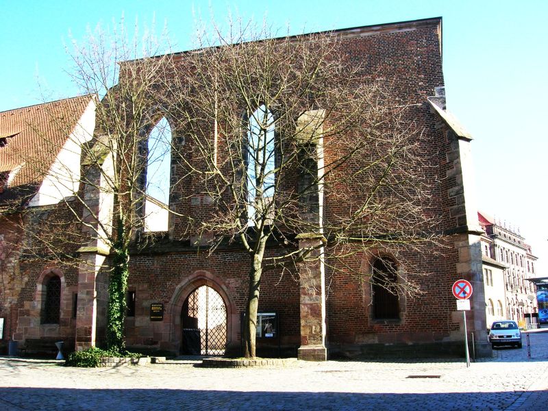
St. Katharina in Nuremberg, Bavaria, was an important medieval church, destroyed during the Second World War and preserved as a ruin.
Sight 28: Uhrenmuseum

The Karl Gebhardt Clock Collection in Nuremberg is a collection of mechanical clocks.
Sight 29: Grande Disco

Grande Disco is a bronze sculpture by Arnaldo Pomodoro from 1972 that is located in Milan.
Sight 30: Stadtarchiv Nürnberg

The Nuremberg City Archive is the central archive for the interests of Nuremberg's city history. As a municipal authority, it is a service provider for the public, research and the city administration. Since 2000, the city archive has been located in the Norishalle at Marientorgraben 8. The holdings of the city archive date back to the 11th century and comprise almost 20 kilometres of shelves.
Sight 31: Naturhistorisches Museum

The Natural History Society of Nuremberg (NHG), founded in 1801, is currently one of the largest voluntary scientific associations in Germany with about 1500 members.
Sight 32: Heilig-Geist-Spital

The Heilig-Geist-Spital in Nuremberg was the largest hospital in the former Free Imperial City of Nuremberg. It was used as a hospital and nursing home.
Sight 33: Synagogendenkmal

The synagogue monument in Nuremberg commemorates the main synagogue on Hans-Sachs-Platz, which was demolished on August 10, 1938, i.e. before the November pogroms, at the behest of Julius Streicher. The monument on the Spital Bridge at the junction of Leo-Katzenberger-Weg consists mainly of a relief of the no longer existing synagogue by Reinhard Heiber (1988) and a memorial stele by August Hofmann (1970) erected in front of it.
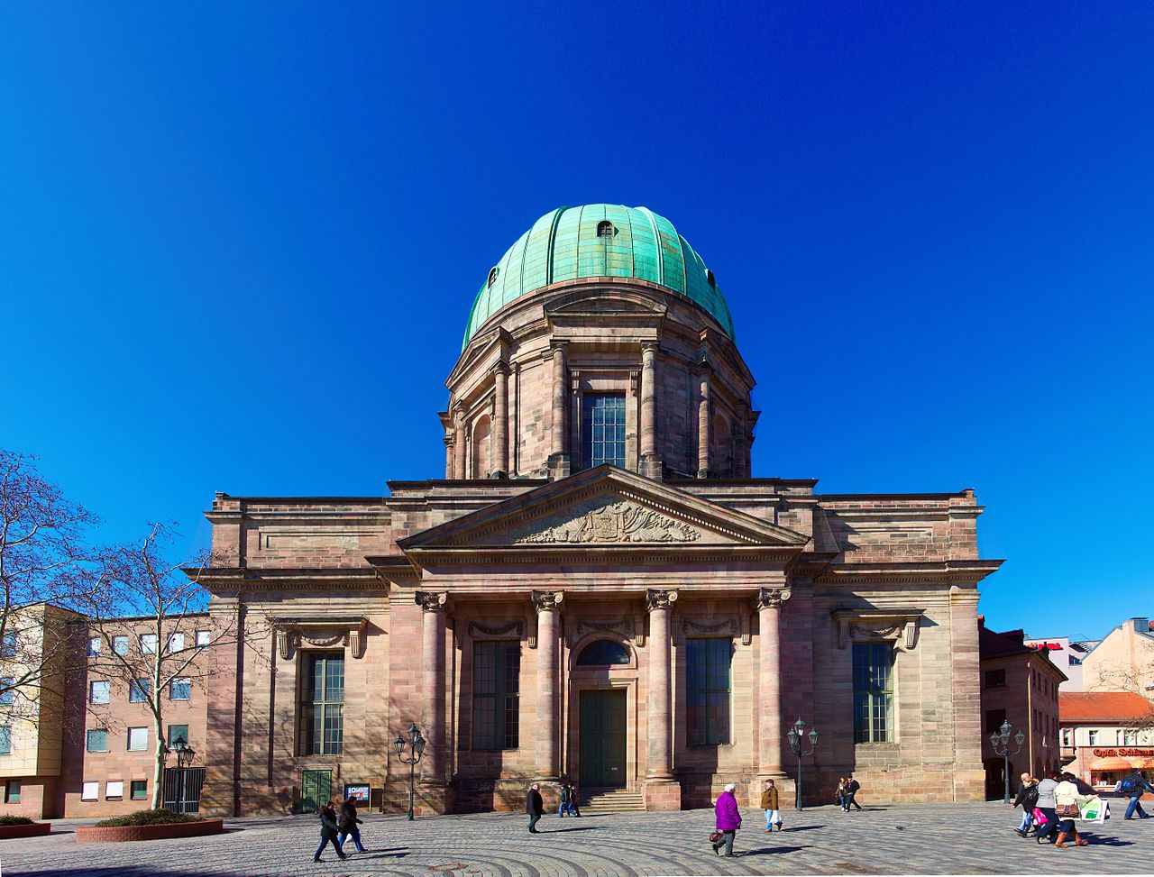
Sight 34: Frauenkirche
Get Ticket*
The Frauenkirche is a church in Nuremberg, Germany. It stands on the eastern side of the main market. An example of brick Gothic architecture, it was built on the initiative of Charles IV, Holy Roman Emperor between 1352 and 1362. The church contains many sculptures, some of them heavily restored. Numerous works of art from the Middle Ages are kept in the church, such as the so-called Tucher Altar, and two monuments by Adam Kraft. It has been a parish church of the Catholic Church since 1810.
Sight 35: Beautiful Fountain
Get Ticket*
Schöner Brunnen is a 14th-century fountain located on Nuremberg's main market next to the town hall and is considered one of the main attractions of the city's Historical Mile. The fountain is approximately 19 metres high and has the shape of a Gothic spire.
Sight 36: St. Sebald Church
Get Ticket*
St. Sebaldus Church is a medieval church in Nuremberg, Germany. Along with Frauenkirche and St. Lorenz, it is one of the most important churches of the city, and also one of the oldest. It is located at the Albrecht-Dürer-Platz, in front of the old city hall. It takes its name from Sebaldus, an 8th-century hermit and missionary and patron saint of Nuremberg. It has been a Lutheran parish church since the Reformation.
Sight 37: Fembohaus

The Stadtmuseum Fembohaus is the city museum of the history of Nuremberg. 950 years of city history are vividly presented. It presents a comprehensive view of the city's history in a new museum atmosphere with ambitious exhibitions on current topics of the city's history. The museum is part of the network of museums of the city of Nuremberg.
Sight 38: Deutsches Spielearchiv Nürnberg

The German Games Archive Nuremberg is an institution of the museums of the city of Nuremberg. The collection comprises around 30,000 board games, and the focus of the collection is on board and table games from the German-speaking world after 1945. The archive also sees itself as a scientific research institute that documents and evaluates the development of board and table games throughout the German-speaking world since 1945, as well as a promoter of the cultural asset of games in society.
Sight 39: Hutmuseum

The Hat Museum Nuremberg is a private museum in Nuremberg that deals with the production and properties of hats. It is located in a former hatter's workshop in Sebald's old town and is considered the smallest museum in Nuremberg.
Sight 40: Laufer Schlagturm

The Laufer Schlagturm is a gate tower of the penultimate city fortification of Nuremberg.
Sight 41: Hirsvogelsaal

The Hirsvogelsaal is an early Renaissance building in Hirschelgasse in Nuremberg. This is an extension of his Gothic residence carried out in 1534 by Lienhard III Hirschvogel, a Nuremberg long-distance trader. The reason for the construction was his marriage to Sabine Welser from Augsburg.
Sight 42: Laufer Torturm

The Laufer Tor was a gate in the northeast of the Nuremberg city wall. Today, the term refers to the road over the former city moat.
Sight 43: Cramer-Klett-Park

Cramer-Klett-Park is a small park in Nuremberg, Germany.
Sight 44: Rotkreuz-Museum

The Red Cross Museum Nuremberg is the largest of 15 museums in the Federal Republic of Germany dedicated to the history and activities of the Red Cross. In addition to various other exhibits, the museum has a vehicle hall in which Red Cross vehicles from different eras are shown.
Share
How likely are you to recommend us?
Disclaimer Please be aware of your surroundings and do not enter private property. We are not liable for any damages that occur during the tours.
GPX-Download For navigation apps and GPS devices you can download the tour as a GPX file.