Self-guided Sightseeing Tour #7 in Munich, Germany
Legend
Guided Free Walking Tours
Book free guided walking tours in Munich.
Guided Sightseeing Tours
Book guided sightseeing tours and activities in Munich.
Tour Facts
7.1 km
101 m
Experience Munich in Germany in a whole new way with our free self-guided sightseeing tour. This site not only offers you practical information and insider tips, but also a rich variety of activities and sights you shouldn't miss. Whether you love art and culture, want to explore historical sites or simply want to experience the vibrant atmosphere of a lively city - you'll find everything you need for your personal adventure here.
Activities in MunichIndividual Sights in MunichSight 1: Postpalast
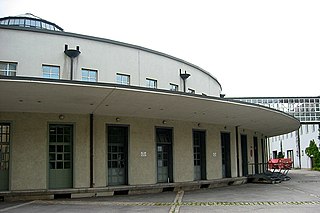
Arnulfstraße 62 is a building complex in Munich's Maxvorstadt district, which was used by the Deutsche Bundespost and Deutsche Post until the mid-2000s.
Sight 2: Altes Pappenheimkrankenhaus
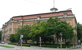
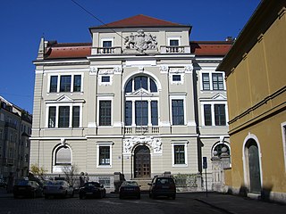
The Bavarian War College, also Bavarian Staff College was the highest military facility to educate, instruct, train, and develop general staff officers.
Sight 3: Mayer'sche Hofkunstanstalt GmbH
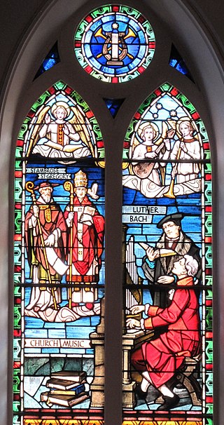
Franz Mayer of Munich is a German stained glass design and manufacturing company, based in Munich, Germany and a major exponent of the Munich style of stained glass, that has been active throughout most of the world for over 170 years. The firm was popular during the late nineteenth and early twentieth century, and was the principal provider of stained glass to the large Roman Catholic churches that were constructed throughout the world during that period. Franz Mayer of Munich were stained glass artists to the Holy See and consequently were popular with Roman Catholic clients. The family business is nowadays managed by the fifth generation and works in conjunction with renowned artists around the world.
Sight 4: Löwenbräukeller
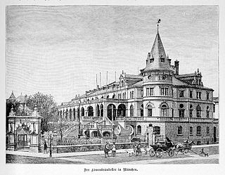
Löwenbräukeller is a beer hall and event center located in Maxvorstadt, Munich, Bavaria, Germany. It has hosted concerts by artists such as Def Leppard, Ozzy Osbourne and Kiss.
Sight 5: Münchner Theater für Kinder
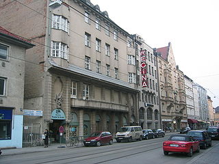
Münchner Theater für Kinder is a theatre located in Munich, Bavaria, Germany.
Sight 6: Lenbachhaus
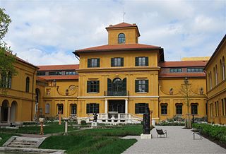
The Lenbachhaus is a building housing the Städtische Galerie art museum in Munich's Kunstareal.
Sight 7: Paläontologisches Museum
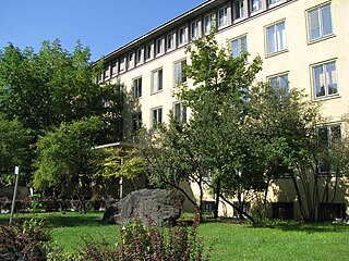
The Palaeontological Museum in Germany, is a German national natural history museum located in the city of Munich, Bavaria. It is associated with the Ludwig-Maximilians-Universität. It has a large collection of fossils of animals and plants such as Mesozoic reptiles, early elephants and saber-toothed cats. The paleontological and geological institute which houses the museum is formally called the Bavarian State Collection for Palaeontology and Geology, which itself is one of several institutions which make up the Bavarian Natural History Collections.
Sight 8: Nusser & Baumgart
Nusser & Baumgart is an art gallery for contemporary art in Munich, founded in 2003 by Gregor Nusser and Susanne Baumgart.
Sight 9: Musiklabor
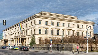
The University of Music and Theatre Munich, also known as the Munich Conservatory, is a performing arts conservatory in Munich, Germany. The main building it currently occupies is the former Führerbau of the NSDAP, located at Arcisstraße 12, on the eastern side of the Königsplatz. Teaching and other events also take place at Luisenstraße 37a, Gasteig, the Prinzregententheater, and in Wilhelmstraße (ballet). Since 2008, the Richard Strauss Conservatory, until then independent, has formed part of the university.
Sight 10: Geologisches Museum
Geologisches Museum München is located in Maxvorstadt, Munich, Bavaria, Germany.
Sight 11: Propyläen
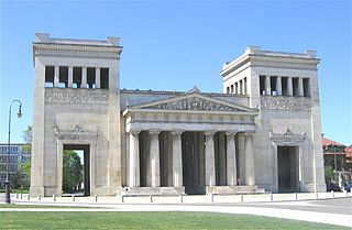
The Propylaea is a city gate in Munich at the west side of Königsplatz.
Sight 12: Haus der Kulturinstitute
Münchner Haus der Kulturinstitute is located in Maxvorstadt, Munich, Bavaria, Germany.
Sight 13: NS-Dokumentationszentrum München
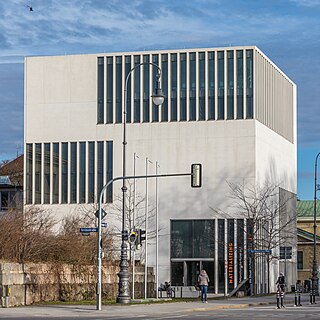
The Munich Documentation Centre for the History of National Socialism is an institution of the City of Munich together with the Free State of Bavaria and the Federal Republic of Germany.
Sight 14: Prinz-Georg-Palais
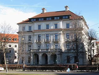
The Prinz-Georg-Palais at Karolinenplatz 5 is a detached building that is registered as an architectural monument in the Bavarian List of Monuments.
Sight 15: Staatliches Museum Ägyptischer Kunst
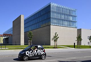
The Staatliches Museum Ägyptischer Kunst is an archaeological museum in Munich. It contains the Bavarian state collection of ancient Egyptian art and displays exhibits from both the predynastic and dynastic periods. The associated small Middle East section displays objects from the areas of Assyrian and Babylonian culture. For decades, the Egyptian museum was located in the Munich Residenz, but it was moved to the Kunstareal in June 2013.
Wikipedia: Staatliche Sammlung für Ägyptische Kunst (EN), Website
Sight 16: Present Continuous
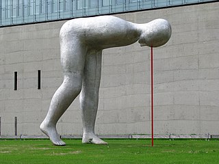
Present Continuous is a monumental sculpture by the Dutch sculptor Henk Visch, which was erected in May 2011 between the entrance of the new building of the University of Television and Film and the entrance of the State Museum of Egyptian Art in Munich on a green strip along Gabelsbergerstraße.
Sight 17: Alte Pinakothek
Get Ticket*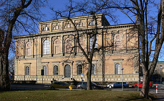
The Alte Pinakothek is an art museum located in the Kunstareal area in Munich, Germany. It is one of the oldest galleries in the world and houses a significant collection of Old Master paintings. The name Alte (Old) Pinakothek refers to the time period covered by the collection—from the fourteenth to the eighteenth century. The Neue Pinakothek, re-built in 1981, covers nineteenth-century art, and Pinakothek der Moderne, opened in 2002, exhibits modern art. All three galleries are part of the Bavarian State Painting Collections, an organization of the Free state of Bavaria.
Sight 18: Große Biga
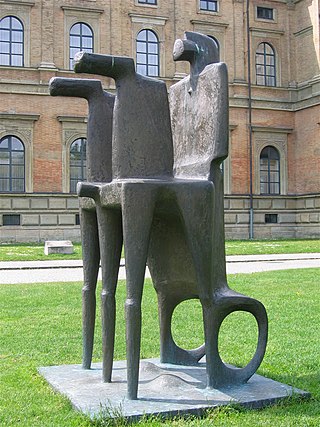
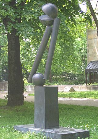
Large Biga is a monumental bronze sculpture by Fritz Koenig. The artwork dates from 2000 and was erected in Munich in front of the Alte Pinakothek in the Maxvorstadt district, in the Munich Art District. A biga is a two-wheeled cart pulled by a pair of horses and driven by a driver. Bigas were used in ancient Rome for exhibition fights and chariot races. The sculpture stylizes an ancient Roman chariot, with horses and man. Carriage, horses and man merge into a unit.
Sight 19: Doppelsäule 23/70
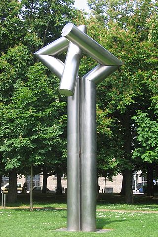
Double Column 23/70 is a stainless steel sculpture by Erich Hauser from 1970. The seven-metre-high sculpture was erected in 1984 in Munich in the Maxvorstadt district on the green strip between the Alte Pinakothek and the Neue Pinakothek. It is part of the Pinakothek Sculpture Park, which has been established in the Munich Art Area in recent decades. The column was part of the Theo Wormland Collection until 2013 and was on permanent loan to the Bayerische Staatsgemäldesammlungen, which received it as a donation from the foundation in 2013.
Sight 20: Two-Piece Reclining Figure: Points
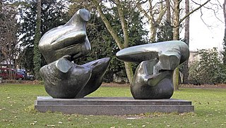
Two-Piece Reclining Figure: Points is a bronze sculpture by Henry Moore, catalogued as LH 606, and created in 1969–70.
Sight 21: Buscando la Luz
Buscando la Luz II is a monumental sculpture by Eduardo Chillida. It is the second in a series of four works of art of the same name: Buscando la Luz I (1997) and Buscando la Luz III (2000) are located in the sculpture park of the Chillida Leku Museum in Spain, Buscando la Luz IV (2001) on the grounds of the University of Qatar in Doha.
Sight 22: The design museum
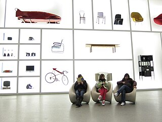
Die Neue Sammlung is one of the leading design museums in the world, with the largest collection of industrial and product design.
Sight 23: Futuro-Haus
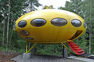
A Futuro house, or Futuro Pod, is a round, prefabricated house designed by Finnish architect Matti Suuronen, of which fewer than 100 were built during the late 1960s and early 1970s. The shape, reminiscent of a flying saucer, and the structure's airplane hatch entrance has made the houses sought after by collectors. The Futuro is composed of fiberglass-reinforced polyester plastic, polyester-polyurethane, and poly(methyl methacrylate), measuring 4 metres high and 8 metres in diameter.
Sight 24: Pinakothek der Moderne
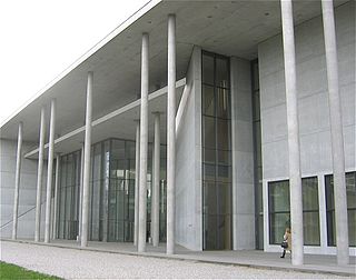
The Pinakothek der Moderne is a modern art museum, situated in central Munich's Kunstareal.
Sight 25: Museum Mineralogia München
The Museum Reich der Kristalle is the publicly accessible part of the Mineralogischen Staatssammlung of Munich, Germany. It features explanations of mineralogical and crystallographic terms using models. It also showcases minerals local to Bavaria. The museum has a few small displays as well as a showroom which hosts special exhibitions.
Sight 26: Große Zwei V
Große Zwei V is a bronze sculpture by the sculptor Fritz Koenig from 1973. It measures 262 × 164.5 × 65 cm and is located in Munich in the Maxvorstadt district in the immediate vicinity of the Neue Pinakothek in the Kunstareal München.
Sight 27: St. Ludwig
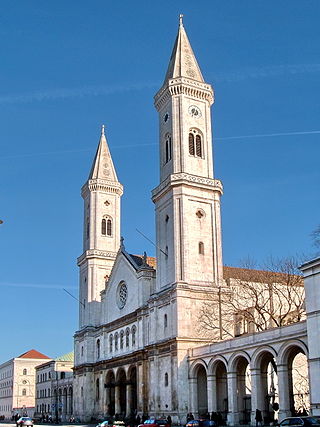
Get Ticket*The Catholic Parish and University Church of St. Louis, called Ludwigskirche, in Munich is a monumental church in Neo-Romanesque style with the second-largest altar fresco of the world. The building, with its round arches called the Rundbogenstil, strongly influenced other church architecture, train stations and synagogues in both Germany and the United States.
Share
How likely are you to recommend us?
Disclaimer Please be aware of your surroundings and do not enter private property. We are not liable for any damages that occur during the tours.
GPX-Download For navigation apps and GPS devices you can download the tour as a GPX file.
