Self-guided Sightseeing Tour #1 in Koblenz, Germany
Legend
Tour Facts
6.3 km
80 m
Experience Koblenz in Germany in a whole new way with our free self-guided sightseeing tour. This site not only offers you practical information and insider tips, but also a rich variety of activities and sights you shouldn't miss. Whether you love art and culture, want to explore historical sites or simply want to experience the vibrant atmosphere of a lively city - you'll find everything you need for your personal adventure here.
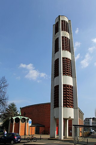
Activities in KoblenzIndividual Sights in KoblenzSight 1: Sankt Elisabeth
The parish church of St. Elisabeth is a Catholic church in Koblenz, Germany. The church, built in the Rauental district, is one of the most important churches of the 1950s on the Middle Rhine. Since 2012, it has been used mainly as a youth church "X-Ground". It bears the patronage of St. Elisabeth of Thuringia.
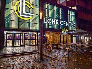
Sight 2: Löhr-Center
The Löhr-Center is a shopping center in the city center of Koblenz. It was opened in 1984 to the north of the Herz-Jesu-Kirche. The operator of the Löhr Center is the ECE Group, which also operates the Forum Mittelrhein on Koblenz's central square.
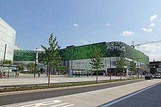
Sight 3: Forum Mittelrhein
The Forum Mittelrhein is a shopping center on the Zentralplatz in Koblenz, Germany. The shopping center was built by ECE Projektmanagement, which already operates the Löhr Center in Koblenz, and opened on September 26, 2012. Next to it is the Forum Confluentes, a cultural building in which the Middle Rhine Museum, the Koblenz City Library, the Romanticum and the Tourist Information Office found a new home on 20 June 2013.
Wikipedia: Forum Mittelrhein (DE), Website, Yelp, Foursquare
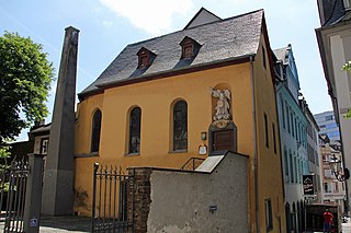
Sight 4: Michaelskapelle
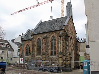
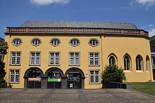
The Michaelskapelle is a former cemetery chapel in the old town of Koblenz. The chapel is located right next to the Church of Our Lady and bears the patronage of the Archangel Michael.
Sight 5: Liebfrauenkirche
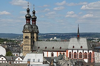
Get Ticket*The Church of Our Lady is a Catholic church in the center of the old town of Koblenz. Together with the other two Romanesque churches, the former collegiate churches of St. Kastor and St. Florin, it shapes the silhouette of the old town. The beginnings of the church, which is located at the highest point of the old town, date back to the 5th century. From the late Middle Ages to the French Revolution, it was the main parish church of Koblenz. It bears the patronage of Mary, the mother of Jesus, and is a major work of medieval sacred architecture on the Middle Rhine.
Sight 6: Ehemalige Stadtkommandantur Koblenz
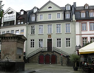
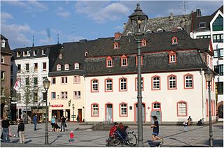
The former Stadtkommandantur Koblenz is a building in Koblenz, Germany. The front is located on the Am Plan square. The building has been used over time as both a town hall and a fire station. Today it is a residential building. The building is an example of strict Baroque architecture based on the French model, which characterized Koblenz at the beginning and in the last third of the 18th century.
Sight 7: Alte Münze
The Old Mint is the former mint master's house of the Electoral Mint in Koblenz. Originally, the mint consisted of several buildings, but these were demolished except for the mint master's house. Today, the Münzplatz in Koblenz's old town is located in this area.
Sight 8: Haus Metternich
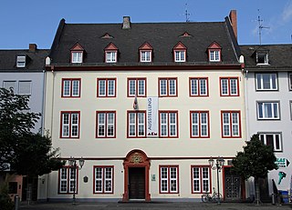
The Haus Metternich, also known as the Metternicher Hof, is a former town courtyard in the old town of Koblenz. The building, built in 1674, was the birthplace of the Austrian statesman Klemens Wenzel Lothar von Metternich.
Sight 9: Alte Burg
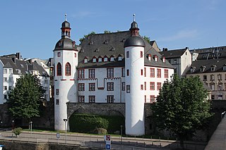
The Old Castle was a former Elector-owned, substantial water castle in the German city of Koblenz, incepted in the 13th century. It is today reduced to the later Burghaus ; which houses the city archives. It sits on tall foundations and has a tall, black slate roof with further floors in the attic and two small cupolas. The lowland castle abutted the remaining building in the old town quarter. The castle house stands tall, next to the Moselle's right-bank towpath downstream of the strategic Baldwin Bridge built in 1342. The bridge, much-repaired, remains intact.
Sight 10: Altes Kaufhaus
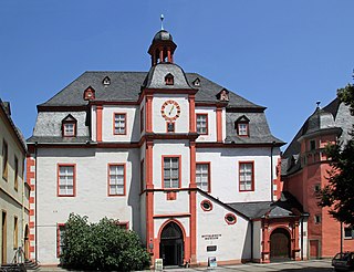
The Altes Kaufhaus, also known as the Altes Kauf- und Tanzhaus, is a medieval building in the old town of Koblenz. The building, built between 1419 and 1425 in the late Gothic style, underwent a Baroque reconstruction in 1724 and housed the Middle Rhine Museum from 1965 to 2013. Together with the Bürresheimer Hof, the Schöffenhaus and the Florinskirche, it forms an ensemble of four historic buildings on Florinsmarkt.
Sight 11: Schöffenhaus
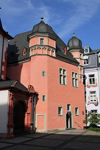
The aldermen's house was the seat of the Electoral Court of Trier for the city of Koblenz. Built between 1528 and 1530 in the late Gothic style, the building housed part of the Middle Rhine Museum until 2013. Together with the Bürresheimer Hof, the Altes Kaufhaus and the Florinskirche, it forms an ensemble of four historic buildings on Florinsmarkt.
Sight 12: Florinskirche
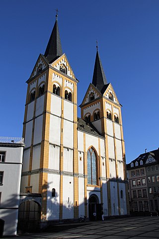
Get Ticket*The Florinskirche is a Protestant church in the old town of Koblenz. The church building, which was built around 1100 and dominates the city skyline, belonged to the canons' monastery of St. Florin, which was secularized in 1802. After that, in 1820, it was assigned to the Protestant parish of Koblenz. The early medieval church building is a prime example of Romanesque sacred architecture on the Middle Rhine. The Florinskirche, together with the Bürresheimer Hof, the Altes Kaufhaus and the Schöffenhaus, forms an ensemble of four historic buildings on Florinsmarkt. It is owned in equal parts by the state of Rhineland-Palatinate, in the legal succession of Prussia, and the Protestant parish of Koblenz-Mitte.
Sight 13: Peter-Friedhofen-Kapelle
The Peter-Friedhofen-Kapelle is a chapel of the Order of the Brothers of Mercy of Mary Help of Christians in the old town of Koblenz. This is where the first motherhouse of the order founded by Peter Friedhofen stood.
Sight 14: Brunnen am Plan
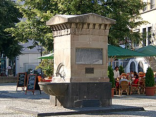
The fountain Am Plan is a classicist fountain in the old town of Koblenz on the square Am Plan. In addition to the obelisk on Deinhardplatz and the Castor Fountain, the Am Plan fountain is one of the last testimonies to the early water supply in Koblenz.
Sight 15: Johannes-Müller-Denkmal
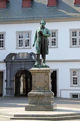
The Johannes Müller Monument in Koblenz is a monument in honor of the physician Johannes Müller, who was born in the city. It is located in the old town in the center of Jesuitenplatz in front of the town hall of the city of Koblenz.
Sight 16: Jesuitenkirche
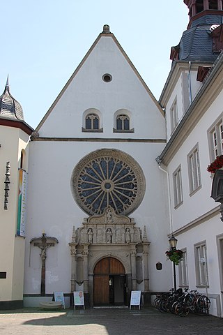
The Jesuit Church of St. John the Baptist, today also called Citykirche, is a branch church of the Catholic parish of St. Kastor in Koblenz. It stands on the site of the 17th-century church on Jesuitenplatz, which was destroyed in 1944, next to the former Jesuit college, which now houses the Koblenz town hall. The patron saint of the church is John the Baptist.
Sight 17: Schängelbrunnen
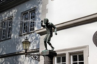
Schängel is a dialect name (Ortsneckname) for the boys born in the city of Koblenz. Koblenz is also often referred to as the "Schängel city". In 1914, a carnival song was dedicated to the Schängeln and in 1941 a fountain was built for them in the town hall courtyard, which became a landmark of the city.
Sight 18: Historiensäule
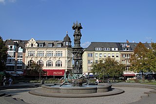
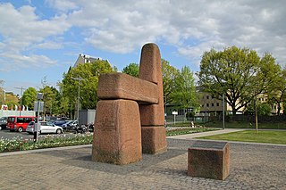
The History Column is the essential part of a fountain on Josef-Görres-Platz in the old town of Koblenz. It was given to the city in 1992 by the state of Rhineland-Palatinate on the occasion of its 2000th anniversary. However, the fountain created by the sculptor Jürgen Weber, including the history column, was not completed and handed over to the city until 1 June 2000 due to illness. The 10.59-metre-high, 3.6-tonne and 1.25-million-DM column tells the moving 2000-year history of the city of Koblenz in ten pictures from Roman times to the present day.
Sight 19: Clemensbrunnen
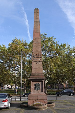
The Clemensbrunnen is a fountain in the old town of Koblenz, Germany. The fountain, built in 1791, originally stood on Clemensplatz and was connected to the first electoral water pipe. Since 1970, it has been standing on Deinhardplatz in front of the theater. It received its name from its builder, the last Elector of Trier, Clemens Wenzeslaus of Saxony.
Sight 20: Struktur- und Genehmigungsdirektion Nord
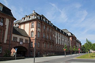
The Structure and Approval Directorate North in Koblenz is a higher state authority that is responsible for certain tasks in the north of the state of Rhineland-Palatinate as well as for some tasks throughout the state.
Wikipedia: Struktur- und Genehmigungsdirektion Nord (DE), Website
Sight 21: Koblenzer Hof
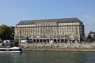
The former Grand-Hotel Coblenzer Hof is a monumental hotel building in the Rhine facilities of Koblenz. Today, the building houses the Federal Office of Bundeswehr Equipment, Information Technology and In-Service Support (BAAINBw), but due to the risk of collapse, most of the building cannot be used. Together with the neighbouring Prussian government building, it forms an ensemble on the banks of the Rhine that characterises the cityscape.
Sight 22: St. Jakobus
St. James is a chapel of the Old Catholic parish in Koblenz, Germany. The Gothic church, built in 1355, was originally a cemetery chapel of the Teutonic Order. It is located opposite the Castor Church and is attached to the south wing of the former Leyensche Hof, which today houses the Rhineland-Palatinate State Office for Roads and Transport. The patron saint of the chapel and community is James the Elder. The Koblenz congregation belongs to the Old Catholic Church in Germany.
Sight 23: Peter-Altmeier-Denkmal
The Peter Altmeier Monument in Koblenz is a monument in honor of the former Prime Minister of Rhineland-Palatinate, Peter Altmeier. The monument, which was inaugurated in 1981, is located in the Moselle facilities (Peter-Altmeier-Ufer) not far from the Deutsches Eck.
Sight 24: Deutsches Eck
Get Ticket*Deutsches Eck may refer to:The union of the Rhine and Moselle with a monumental equestrian statue, see Kaiser Wilhelm Monument at the Deutsches Eck (traffic), a corridor between Salzburg and Kufstein
Sight 25: Kaiser-Wilhelm-Denkmal
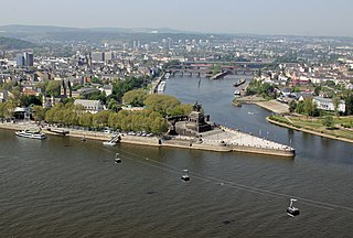
The Deutsches Eck is the name of a promontory in Koblenz, Germany, where the Mosel river joins the Rhine. Named after a local commandry of the Teutonic Order, it became known for a monumental equestrian statue of William I, first German Emperor, dedicated in 1897 in appreciation of his role in the unification of Germany. One of many Emperor William monuments raised in the Prussian Rhine Province, it was dismantled on the orders of the French military government immediately after the Second World War, and only the plinth was preserved as a memorial. Following German reunification, a replica of the statue was erected on the pedestal after controversial discussions in 1993. It is today a Koblenz landmark and a popular tourist attraction.
Sight 26: Kastorbrunnen
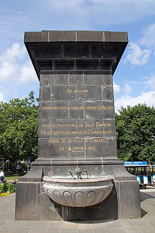
The Kastorbrunnen in the forecourt of the Basilica of St. Kastor in Koblenz, Rhineland-Palatinate, Germany, is a curious testimony of the Napoleonic Wars. The fountain, built in 1812, was connected to the first aqueduct of the Elector Palatine.
Sight 27: Basilika Sankt Kastor
The Basilica of St. Castor is the oldest church in Koblenz in the German state of Rhineland Palatinate. It is located near Deutsches Eck at the confluence of the Rhine and the Moselle. A fountain called Kastorbrunnen was built in front of the basilica during Napoleon's invasion of Russia in 1812. Pope John Paul II raised St. Castor to a basilica minor on 30 July 1991. This church is worth seeing for the historical events that have occurred in it, its extensive Romanesque construction and its largely traditional furnishings.
Share
How likely are you to recommend us?
Disclaimer Please be aware of your surroundings and do not enter private property. We are not liable for any damages that occur during the tours.
GPX-Download For navigation apps and GPS devices you can download the tour as a GPX file.
