Self-guided Sightseeing Tour #5 in Heidelberg, Germany
Legend
Guided Free Walking Tours
Book free guided walking tours in Heidelberg.
Guided Sightseeing Tours
Book guided sightseeing tours and activities in Heidelberg.
Tour Facts
1.8 km
99 m
Experience Heidelberg in Germany in a whole new way with our free self-guided sightseeing tour. This site not only offers you practical information and insider tips, but also a rich variety of activities and sights you shouldn't miss. Whether you love art and culture, want to explore historical sites or simply want to experience the vibrant atmosphere of a lively city - you'll find everything you need for your personal adventure here.
Activities in HeidelbergIndividual Sights in HeidelbergSight 1: Erlöserkirche
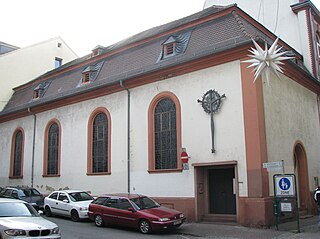
The Church of the Redeemer is a church in the old town of Heidelberg, which was built in 1723/24 as the convent church of the "White Nuns" (Dominican nuns). After the dissolution of the monastery, it was used for various purposes and is now the parish church of the Old Catholic community. Apart from the Jesuit Church, it is the only surviving of the originally numerous monastery churches in Heidelberg's old town.
Sight 2: Peterskirche
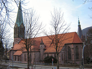
St. Peter's Church is the oldest church in the old town (Altstadt) of Heidelberg, Germany. It has generally served as the university church of the University of Heidelberg since the late Middle Ages.
Sight 3: Stückgarten
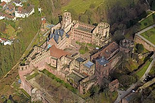
The western terrace of the Heidelberg Castle is referred to as the piece garden. The name is derived from the cannons that were set up there in the early modern period and which were also referred to as "pieces". Initially used for defense purposes, the conversion to a garden took place in the early 17th century. Access is marked by the Elisabethentor, which was created around 1615 as a gift for Elisabeth Stuart. During the usage period of the castle, there was also a bird house in the piece garden, which was later converted into an orangery, of which only foundations are visible today. Today the piece garden serves primarily as a viewpoint for the castle visitors, from which a view of the Palatinate Forest beyond the Rhine plain is possible from a clear view. The piece garden connects the castle atrium in the south with the "thick tower" in the north. To the east is a deep cut in the castle mountain of the "Hirschgraben", to the west the piece garden protrudes on steep support walls above the Heidelberg old town.
Sight 4: Heidelberg Castle
Get Ticket*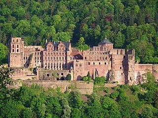
Heidelberg Castle is a ruin in Germany and landmark of Heidelberg. The castle ruins are among the most important Renaissance structures north of the Alps.
Sight 5: Schlossgarten
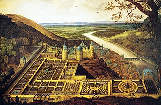
The Hortus Palatinus, or Garden of the Palatinate, was a Baroque garden attached to Heidelberg Castle, Germany. The garden was commissioned by Frederick V, Elector Palatine in 1614 for his new wife, Elizabeth Stuart, and became famous across Europe during the 17th century for the landscaping and horticultural techniques involved in its design. At the time it was known as the 'Eighth Wonder of the World', and has since been termed 'Germany's greatest Renaissance garden.'
Share
How likely are you to recommend us?
Disclaimer Please be aware of your surroundings and do not enter private property. We are not liable for any damages that occur during the tours.
GPX-Download For navigation apps and GPS devices you can download the tour as a GPX file.
