Self-guided Sightseeing Tour #15 in Hanover, Germany
Legend
Guided Free Walking Tours
Book free guided walking tours in Hanover.
Guided Sightseeing Tours
Book guided sightseeing tours and activities in Hanover.
Tour Facts
6.4 km
57 m
Experience Hanover in Germany in a whole new way with our free self-guided sightseeing tour. This site not only offers you practical information and insider tips, but also a rich variety of activities and sights you shouldn't miss. Whether you love art and culture, want to explore historical sites or simply want to experience the vibrant atmosphere of a lively city - you'll find everything you need for your personal adventure here.
Activities in HanoverIndividual Sights in HanoverSight 1: Haus Madsack

The building Walderseestraße 3 in Hanover, also known as Haus Madsack, is a listed villa on the edge of the Eilenriede in the Hanover district of List. The building, which was built by the architect Fritz Höger in the 1920s as a residence for the newspaper publisher Erich Madsack, is characterized by its special quality compared to the surrounding villas.
Sight 2: Marcus Church
St. Mark's Church is an Evangelical Lutheran church building in Hanover-List, Germany. It is the seat of the Superintendent's Office of Hanover-Mitte.
Wikipedia: Markuskirche (Hannover) (DE), Website, Heritage Website
Sight 3: Villa Köhler

The Villa Köhler in Hanover is a listed villa in the Neo-Renaissance style. It was, among other things, the first residence of the General Field Marshal and later Reich President Paul von Hindenburg in Hanover and was temporarily called, as was his later Hanoverian residence, Villa Hindenburg. Today, the building at Am Holzgraben 1 and Wedekindstraße 14 and 15 in the Oststadt district is used by the construction and housing company Gundlach.
Sight 4: Wedekindplatz

Wedekindplatz in Hanover is a square-like extension of Wedekindstraße, which was already laid out in the founding period of the German Empire in the 19th century, and at the same time the star-shaped starting and ending point of the streets Flüggestraße, Drostestraße and In der Steinriede. The square is located on the border of the two districts of List and Oststadt and at the same time forms the almost central centre of a listed building ensemble. The architectural gem is also popularly known as "Little Paris".
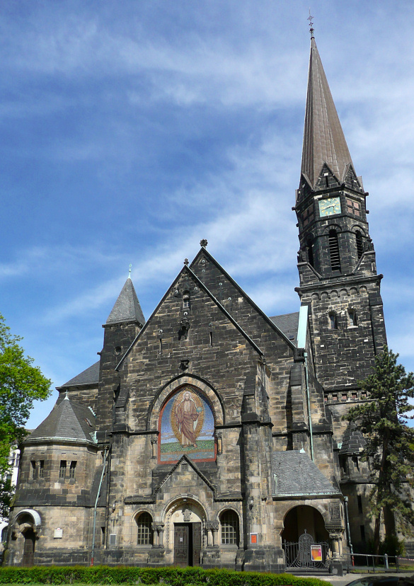
Sight 5: Apostle Church

The Apostle Church in Hanover is the church building of the Evangelical Lutheran Apostle and Mark parish in Hanover, which was consecrated in 1884.
Wikipedia: Apostelkirche (Hannover) (DE), Website, Heritage Website
Sight 6: Weißekreuzplatz

The Weißekreuzplatz is a rectangular green area of about 50 by 100 meters in Hanover in the Oststadt district, which is named after a white cross stone erected there.
Sight 7: Körtingbrunnen

The Körtingbrunnen is an ensemble of fountains in the pedestrian zone of the Lister Meile on the corner of Körtingstraße in the Hanover district of List.
Sight 8: Comeniusschule

The Comeniusschule in Hanover is a co-educational primary school named after Johann Amos Comenius in the Hanover district of List. The location of the listed school building is Kollenrodtstraße 3 at the Bonifatiusplatz school centre, which was designed as a decorative square for the surrounding Lister Stadtfeld residential district.
Sight 9: Bonifatiusplatz

Bonifatiusplatz is a square in the district of List, which belongs to the district of Vahrenwald-List.
Sight 10: WOK - World of Kitchen

The WOK – World of Kitchen Museum in Hanover is the first major museum for kitchens in Europe. It was opened on 15 April 2010 in the company building of the former Fehling printing plant in the List district. The museum is run by the WOK-World of Kitchen Museum e. V. association.
Sight 11: Lukaskirche

The Lukaskirche is an Evangelical Lutheran church in Hanover-Vahrenwald, Germany.
Sight 12: TCH
Get Ticket*
The House of Economic Development in Hanover contains all economic departments of the city and the Hanover region, which in a broader sense deal with economic development and marketing of existing or to be founded companies as well as the region itself. "Under one roof", citizens will find in particular the funding and advisory services of the service providers Hannover Marketing Tourismus (HMTG), Hannover Region Tourismus, hannover.de Internet GmbH and hannoverimpuls. The location of the house is Vahrenwalder Straße 7 in the Vahrenwald district.
Wikipedia: Haus der Wirtschaftsförderung (Region Hannover) (DE)
Sight 13: Christuskirche

The Christuskirche is an Evangelical Lutheran church in Hanover, Germany. It is located in the Nordstadt district northwest of the Klagesmarkt and was built between 1859 and 1864 by Conrad Wilhelm Hase as the residence church of George V. The neo-Gothic brick building is the first new church building in Hanover after 1747 and a model church according to the Eisenach Regulation, a recommendation issued in 1861 for the design of Protestant church buildings, which existed until 1890. As a residence church, the Christuskirche was used only once. However, there is still contact with the former Hanoverian royal family – through the patronage of Ernst August, Prince of Hanover.
Sight 14: Brüggemannhof

The Brüggemannhof in Hanover is a small residential complex built between 1913 and 1924 in several construction phases, which is now a listed building from the time of reform housing construction. The building complex, owned by the Hanoverian housing cooperative Spar- und Bauverein, is located on an irregular, almost three-sided plot, which is bordered on two sides by the streets Am Judenkirchhof and Schloßwender Straße in the Nordstadt district.
Sight 15: Gartenhaus

The Gartenhaus in Hanover is a residential building built around 1820, which is located in the Nordstadt district. It is a testimony to the originally rural settlement outside the former city fortifications of Hanover. The last house of former "garden people" was built as a simple classicist half-timbered building and can be found today at the address Am Judenkirchhof 10/10A. It is the oldest surviving residential building in the district and is a listed building.
Sight 16: Marstallgebäude

The Welfenschloss Stables is the residence of the Technical Information Library at the Leibniz University Hannover. It was built in 1863–1867 during the reign of the last Hanoverian king, George V as the royal stables for the Welfenschloss palace.
Sight 17: Saxon Steed

The list of monuments in Hanover contains a number of selected monuments, memorials, sculptures, artistic objects of sculpture ("street art") and fountains in public spaces, especially in the area of the city center of Hanover. These objects are not congruent with (cultural) monuments within the meaning of the Lower Saxony Monument Protection Act.
Sight 18: Theodor-Lessing-Haus
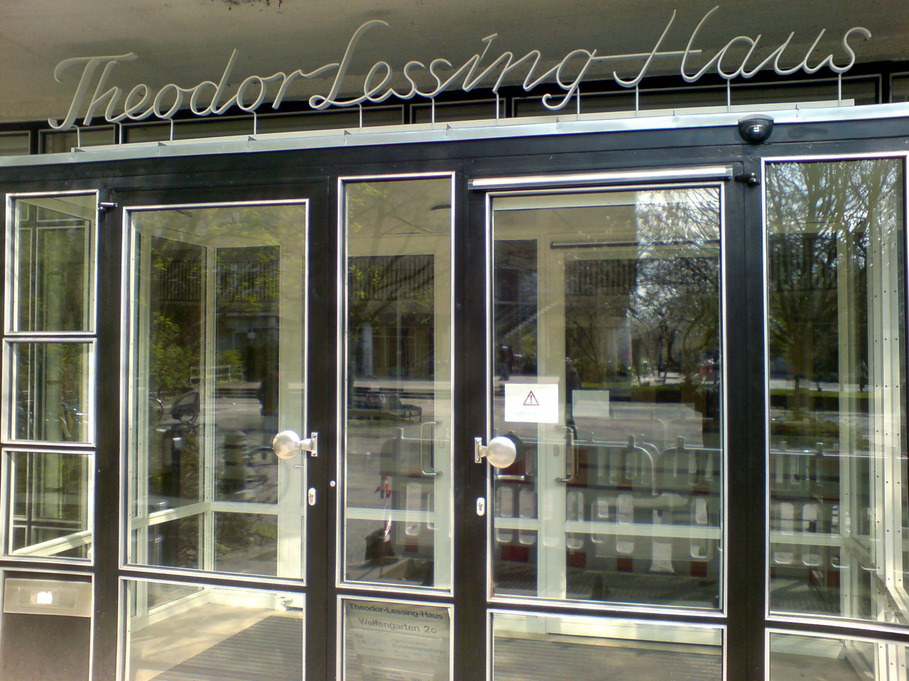
The Theodor Lessing House in Hanover is a building of the Gottfried Wilhelm Leibniz University of Hanover. Among other things, the listed building houses the Social Sciences Library (FBS) as part of the University Library. The location is Welfengarten 2C in the Nordstadt district.
Sight 19: Welfengarten

The Welfengarten in the Hanover district of Nordstadt is a city park in the style of English landscape gardens. Together with the Great Garden, the Berggarten and the Georgengarten, it belongs to the Herrenhausen Gardens.
Share
How likely are you to recommend us?
Disclaimer Please be aware of your surroundings and do not enter private property. We are not liable for any damages that occur during the tours.
GPX-Download For navigation apps and GPS devices you can download the tour as a GPX file.