Self-guided Sightseeing Tour #1 in Görlitz, Germany
Legend
Tour Facts
3 km
73 m
Experience Görlitz in Germany in a whole new way with our free self-guided sightseeing tour. This site not only offers you practical information and insider tips, but also a rich variety of activities and sights you shouldn't miss. Whether you love art and culture, want to explore historical sites or simply want to experience the vibrant atmosphere of a lively city - you'll find everything you need for your personal adventure here.
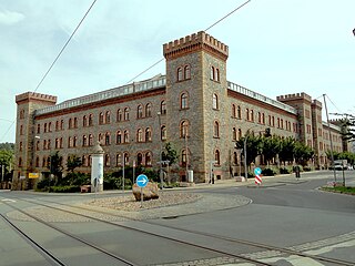
Individual Sights in GörlitzSight 1: Technisches Rathaus Jägerkaserne
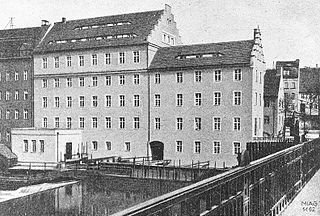
The Jägerkaserne is a former barracks complex and architectural monument on the southern edge of Görlitz's Nikolaivorstadt, whose premises are now used by municipal offices.
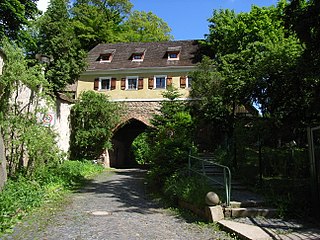
Sight 2: Finstertor
The Finstertor, also known as the Poor Sinner's Gate, was part of the fortification of the Görlitz suburbs. It formed the northern entrance to the Nikolaivorstadt, which was surrounded by a mud wall and fences. The ogival passageway had a portcullis. The Dark Gate is the only surviving gate of the fortifications of the suburbs.
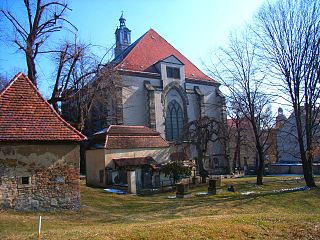
Sight 3: St Nicholas’ Church
The Nikolaikirche is a profaned Gothic hall church in Görlitz, the easternmost city in Germany. It is surrounded by the Nikolaikirchhof and is used as an exhibition and memorial space. The owner is the Evangelische Kulturstiftung Görlitz.
Sight 4: Nikolaiturm
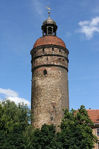
The 45m tall Nikolai Tower probably erected before 1250 is part of the historic fortification of Görlitz. It is located inside the inner part of Görlitz between the old town and the historic nikolai suburb (Nikolaivorstadt). Together with the Thick Tower and the Reichenbach Tower three of four fortified towers are still preserved in Görlitz.
Sight 5: Nikolaizwinger
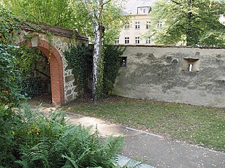
The Nikolaizwinger as one of the two preserved remains of the double city wall ring around Görlitz is now a green space. It is located at the entrance of Nikolaistraße to Nikolaivorstadt. The Zwinger, together with four city towers, many bastions and mighty gates, originally protected the city of Görlitz. The only one that has survived is the corner bastion bordering it, the Hotherbastei. The large, recognizable embrasures for cannons of the Hotherbastei indicate its use to secure the Nikolai and Neisse suburbs. In 1953/54, the Nikolaizwinger was redesigned into a garden by the citizens of Görlitz according to designs by the garden architect Henry Kraft as part of the National Reconstruction Work. In the 1990s, these structures were taken up again in a modified form.
Sight 6: Krebsgasse
Sight 7: Vogtshof
The Vogtshof in Görlitz was built as a seat for the sovereign officials of Upper Lusatia, was later garrison barracks, prison and is now used as a student dormitory.
Sight 8: Sonnenorgel
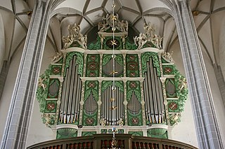
The sun organ in the church of St. Peter and Paul in Görlitz is a special feature. Its façade from 1703 is provided with 17 suns from organ pipes. The current work was built in 1997 by Mathis Orgelbau.
Sight 9: Ratsapotheke
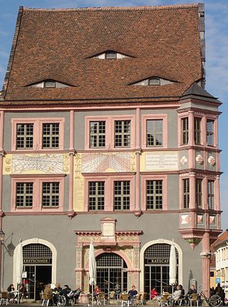
The Ratsapotheke, also known as the Struve Pharmacy, is one of the most famous town houses in the historic old town of Görlitz. The Renaissance building is located on the northern part of the Untermarkt and is the corner house to the confluence with Peterstraße. On the side facing the Untermarkt, the house bears two sundials by Zacharias Scultetus – a brother of the Görlitz astronomer and mathematician Bartholomäus Scultetus. The Renaissance gable of the house faces Peterstraße.
Sight 10: Neues Rathaus
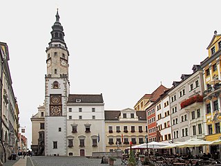
The town hall of the city of Görlitz has been the place of municipal administration, power and jurisdiction since about 1350; in 1369 it is documented for the first time as a town hall by a document of the Görlitz council. Its magnificent interior dates back to the Renaissance period. It consists of several connected buildings at Untermarkt 6–8 and is now the seat of several offices.
Sight 11: Waage
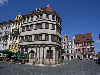
The Waage is a Renaissance house in the town of Görlitz in eastern Upper Lusatia. It is located on the Untermarkt and is part of the so-called Zeile in the middle of the square. The scales structurally close the row on the south-eastern side.
Sight 12: Brauner Hirsch
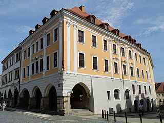
The Brauner Hirsch is a baroque town house in the town of Görlitz in Upper Lusatia, Germany. The corner house is located on the eastern side of the Untermarkt and on Neißstraße, which continues towards the Old Town Bridge over the Lusatian Neisse.
Sight 13: Biblisches Haus
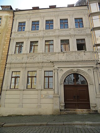
The Biblical House is a town house in Görlitz's old town. The house got its nickname because of its reliefs on the façade on the first and second floors. They show scenes from the Old and New Testaments. It is located on Neißstraße, the connection between Untermarkt and the Old Town Bridge over the Lusatian Neisse and, along with the Schönhof, is one of the most famous Renaissance buildings in the city. In its western neighboring house – the baroque corner house at Neißstraße 30 – is the Görlitz Museum of Cultural History.
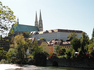
Sight 14: Stadtkirche St. Peter und Paul
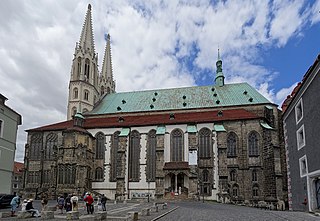
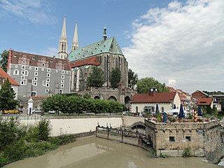
The parish church of St. Peter and Paul in Görlitz, known as St. Peter's Church for short, towers over the Neisse Valley. It dominates the historic old town with its copper-roofed high roof and the pair of towers visible from afar; it is located about 700 m west of the 15th degree of longitude.
Wikipedia: Pfarrkirche St. Peter und Paul (Görlitz) (DE), Website, Heritage Website
Sight 15: Waidhaus
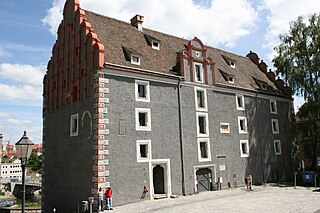
The Woad House is the oldest secular building of Görlitz. During its rich history it served various purposes and underwent numerous alterations. The common name Woad House is based on the woad that was stored in this building in the 16th century.
Sight 16: Ochsenbastei
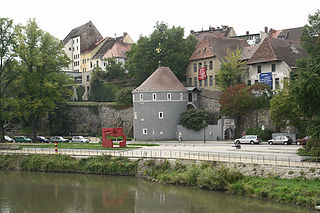
The Ochsenbastei in Görlitz is part of the former city fortifications near St. Peter's Church. While the actual "Tor an der Kahle" was demolished in 1834, the rotunda of the bastion and the ox kennel were preserved and are now protected as cultural monuments.
Sight 17: Vierradenmühle
The Vierradenmühle was one of three large flour mills in the city of Görlitz. But it also served as a fulling mill for clothiers and tanners. In its place there is now a turbine house for the generation of electricity and an inn that has taken up the name Vierradenmühle again.
Sight 18: Dreiradenmühle Zgorzelec
The three-wheeled mill is a former grain mill of the city of Görlitz, also used as a fulling mill, where tanners-fullers worked.
Share
How likely are you to recommend us?
Disclaimer Please be aware of your surroundings and do not enter private property. We are not liable for any damages that occur during the tours.
GPX-Download For navigation apps and GPS devices you can download the tour as a GPX file.
