Self-guided Sightseeing Tour #14 in Frankfurt, Germany
Legend
Guided Free Walking Tours
Book free guided walking tours in Frankfurt.
Guided Sightseeing Tours
Book guided sightseeing tours and activities in Frankfurt.
Tour Facts
2.5 km
43 m
Experience Frankfurt in Germany in a whole new way with our free self-guided sightseeing tour. This site not only offers you practical information and insider tips, but also a rich variety of activities and sights you shouldn't miss. Whether you love art and culture, want to explore historical sites or simply want to experience the vibrant atmosphere of a lively city - you'll find everything you need for your personal adventure here.
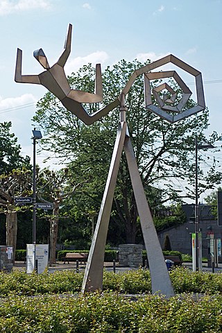
Activities in FrankfurtIndividual Sights in FrankfurtSight 1: Windsbraut
The Bride of the Wind is a steel sculpture by the sculptor E. R. Nele on the Dalbergplatz in Frankfurt-Höchst, which was redesigned in 2007. The artwork was procured for the design of the square on behalf of the city of Frankfurt am Main and installed on 4 April 2008.
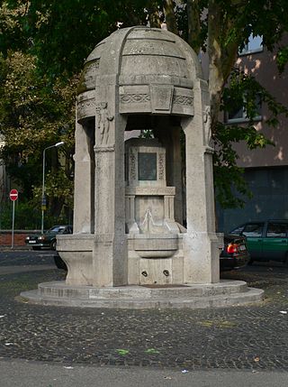
Sight 2: Brüningbrunnen
The Brüning Fountain in Frankfurt-Höchst was inaugurated in 1916. It stands in the northeast corner of the Höchst Markt, bordered northeast by Justinuskirchstraße and northwest by Melchiorstraße. It honors the citizen Adolf von Brüning and his wife, who had created the Höchst works in the city and were charitable.
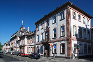
Sight 3: Bolongaropalast
The Bolongaropalast is a large baroque palace in Frankfurt-Höchst. It is located on the south side of Bolongarostraße, the south-facing garden is located on the high bank above the confluence of the Nidda and the Main.
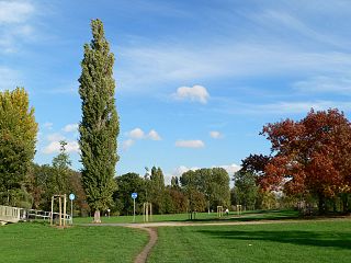
Sight 4: Wörthspitze
The Wörthspitze is a park in the Frankfurt district of Nied. It is part of Frankfurt's green belt, which has its starting point here. The large lawn of the Wörthspitze serves as a public dog run and is used as a sunbathing lawn and play area in summer.
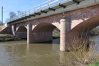
Sight 5: Eisenbahnbrücke Nied
The Nied Railway Bridge in Frankfurt am Main is the second oldest railway bridge in Germany still in operation. The arch bridge was built in 1838 and went into operation in 1839. The Taunus Railway crosses the Nidda on it. The bridge is located between Frankfurt Central Station and Frankfurt-Höchst station in the Nied district.
Share
How likely are you to recommend us?
Disclaimer Please be aware of your surroundings and do not enter private property. We are not liable for any damages that occur during the tours.
GPX-Download For navigation apps and GPS devices you can download the tour as a GPX file.
