Self-guided Sightseeing Tour #2 in Celle, Germany
Legend
Tour Facts
2.1 km
17 m
Experience Celle in Germany in a whole new way with our free self-guided sightseeing tour. This site not only offers you practical information and insider tips, but also a rich variety of activities and sights you shouldn't miss. Whether you love art and culture, want to explore historical sites or simply want to experience the vibrant atmosphere of a lively city - you'll find everything you need for your personal adventure here.
Individual Sights in CelleSight 1: Neues Rathaus
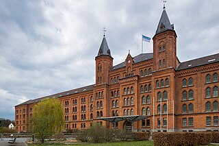
The New Town Hall in Celle, also known as the Heide Barracks or Taunton Barracks, is a former barracks and has been the seat of the city administration and the mayor since 1999.
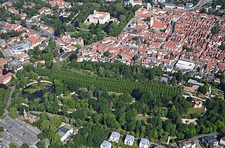
Sight 2: Französischer Garten
The French Garden in Celle, in the German state of Lower Saxony, is a public park in the south of the historic old town or Altstadt. On both sides of a straight avenue of lime trees forming its east–west axis are flowerbeds, lawns, copses and a pond with a fountain. Its current appearance is no longer that of a true French Garden, but rather that of an English Garden. Laid out towards the end of the 17th century as a Baroque courtyard and leisure garden by French gardeners, Perronet and Dahuron, the gardens were given their present shape in the mid-19th century based on plans by the inspector of gardens, Schaumburg.
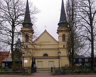
Sight 3: Sankt Ludwig
St. Ludwig is the main Catholic church in the town of Celle in the German state of Lower Saxony. It was consecrated in 1838 and was the third catholic parish church of the new diocese of Hildesheim which was authorised by papal bull and was outside of the former bishopric of Hildesheim and Archbishopric of Mainz. It followed in the footsteps of the first two churches: St Clemens in Hanover and St Michael in Göttingen. Its jurisdiction extends as far as the North Sea coast.
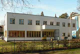
Sight 4: Direktorenwohnhaus
The Director's Residence is a building in the style of Neues Bauen in Celle, Lower Saxony. It was built in 1930 according to the plans of the architect Otto Haesler as a residence for the director of the nearby Gymnasium Ernestinum. The building, which is now a listed building, has been used as an art gallery since 2006.
Sight 5: Reformierte Kirche
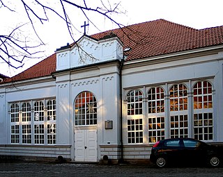
The Reformed Church, the church building of the Evangelical Reformed congregation in Celle, Lower Saxony, belongs to the Evangelical Reformed Church. It was built in 1700 for the Huguenot community of the residential city and is the only surviving Huguenot church building in northwestern Germany.
Sight 6: Edith Kohls
The list of stumbling stones in Celle contains the stumbling stones that were laid in Celle as part of the project of the same name by Gunter Demnig. They are intended to commemorate victims of National Socialism who lived and worked in Celle.
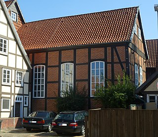
Sight 7: Synagoge
The Celle Synagogue is the oldest preserved half-timbered synagogue in Lower Saxony. It is located near the old town of Celle.
Share
How likely are you to recommend us?
Disclaimer Please be aware of your surroundings and do not enter private property. We are not liable for any damages that occur during the tours.
GPX-Download For navigation apps and GPS devices you can download the tour as a GPX file.
