Self-guided Sightseeing Tour #4 in Bautzen - Budyšin, Germany
Legend
Tour Facts
3.9 km
86 m
Experience Bautzen - Budyšin in Germany in a whole new way with our free self-guided sightseeing tour. This site not only offers you practical information and insider tips, but also a rich variety of activities and sights you shouldn't miss. Whether you love art and culture, want to explore historical sites or simply want to experience the vibrant atmosphere of a lively city - you'll find everything you need for your personal adventure here.
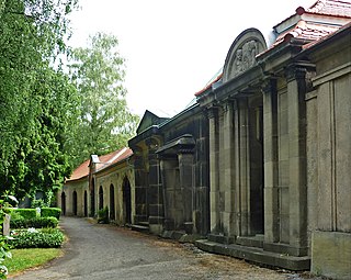
Individual Sights in Bautzen - BudyšinSight 1: Taucherfriedhof
Tuchorski Kěrchow is the highlights of the Pohrjebnišćo w Budyšinje. Nadeńdź with Wuchodnje Old Města W Měšćanski Dawjeluchodny wobkruh Mjez Lubian Dróh in the south and Menkowská to Sewjer.
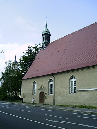
Sight 2: Taucherkirche
The Taucherkirche, Upper Sorbian Tuchorska cyrkej, is one of the seven historic church buildings in Bautzen. The name is derived from the Taucherwald near Uhyst, located about 15 km west of the city.
Sight 3: Weigangvilla
The cultural centre "International Solidarity" in the Villa Weigang in Bautzen existed from 1953 to 1963 and was an institution for the cultural and general care of Western deserters.
Wikipedia: Kulturhaus „Internationale Solidarität“ (DE), Website
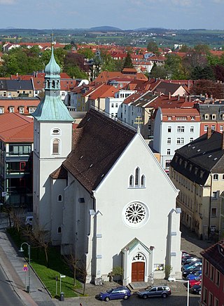
Sight 4: Unserer Lieben Frauen
The Church of Our Lady in Bautzen is a Catholic church that is largely used by Sorbian-speaking parishioners and belongs to the cathedral parish of St. Peter. It is located outside the former inner city wall, east of the Reichenturm on the historic Salzmarkt.
Sight 5: Kursächsische Postmeilensäule
The listed Electoral Saxon postal milestone in Bautzen is one of the postal milestones that were erected in the Electorate of Saxony in the first half of the 18th century by the Land and Border Commissioner Adam Friedrich Zürner on behalf of the Elector of Saxony Friedrich August I. It is an incomplete whole mile column. It is located on the corner of Kornmarkt/Rosenstraße, not far from the Reichenturm in the district town of Bautzen.
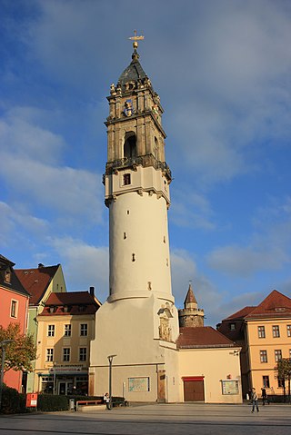
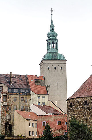
Sight 6: Reichenturm
The Reichenturm (Upper Sorbian: Bohata wěža) is a building of the former city fortifications of Bautzen. It is located on the eastern edge of the old town, forms the end of Reichenstraße and stands on the Kornmarkt, opposite the Liebfrauenkirche. It is open from April to October.
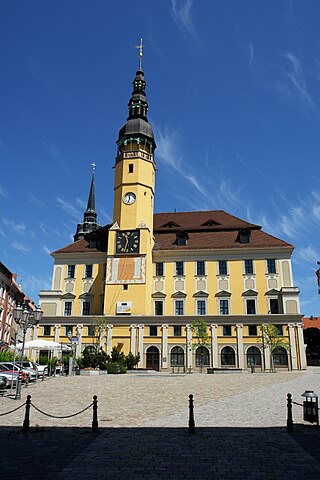
Sight 7: Rathaus Bautzen
The town hall of Bautzen is located between the main market and the meat market in the middle of Bautzen's old town. The construction of the first permanent council seat on this site goes back to a decree of the Bohemian King Ottokar I Přemysl, which allowed Bautzen to build "a particularly stately stone house" here.
Sight 8: Lauenturm
The Lauenturm, Sorbian, is part of the city fortifications of the city of Bautzen. It is located on the southern edge of the old town, on the western side of the Innere Lauenstraße, which leads from the Friedensbrücke to the town hall. The tower got its name from the heraldic animal of the Kingdom of Bohemia, a lion. If you left Bautzen in the direction of Bohemia, you had to cross the Lauentor.
Sight 9: Mönchsbastei
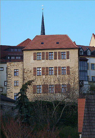
The Monks' Bastion, Sorbian, is one of the seven bastion towers of the city fortifications of Bautzen. It was built around 1324 as a rectangular tower.
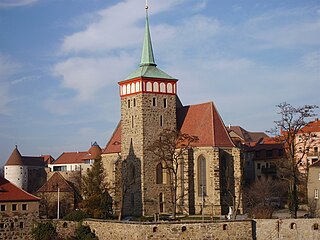
Sight 10: St. Michael Church
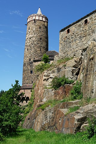
St. Michael's Church in Bautzen is located near the Old Waterworks on the southwest arch of the rocky spur above the Spree, on which Bautzen's old town was built. The square between the church, the waterworks and the inner and outer city walls is known as the Wendischer Kirchhof, as St. Michael's Church has served as a place of worship since the 17th century, mainly for the Protestant Sorbs of the Bautzen area.
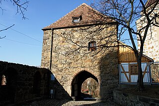
Sight 11: Mühltor
The Mühltor, Sorbian, is a historic city gate in Bautzen and is considered the smallest of the medieval gates of the city. It is the only access to the city from the west side and was built after the Hussite sieges in 1429 and 1431. It was probably intended as a gateway for future defenses of the western section of the city wall.
Sight 12: Alte Wasserkunst
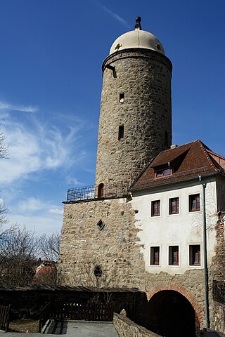
The Alte Wasserkunst, Sorbian, is a building in Bautzen that used to serve the city's water supply.
Sight 13: Friedensbrücke
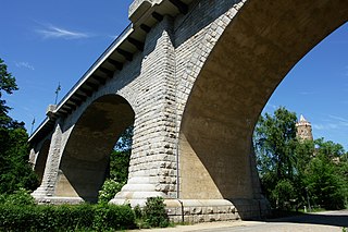
The Peace Bridge in Bautzen is one of the larger stone arch bridges in Saxony and, along with the A 4 motorway bridge and the bridge of the Westtangente, one of the three most important connections for road traffic in the city crossing the Spree. The four basket arches, which are placed on massive pillars and abutments, span the deeply incised and steep-walled Spree valley at a height of over 20 metres over a length of 181 metres.
Sight 14: Neue Wasserkunst
The Neue Wasserkunst, Sorbian Nowa wodarnja, in Bautzen is, like the Alte Wasserkunst, a former water supply facility for the city, which is located on a rocky plateau above the valley of the Spree. The building, which is still preserved today and was rebuilt in 1721, is located in the south of the old town at the entrance from the Spree valley to the Neutor on Lauenstraße.
Sight 15: Deutsch-Sorbisches Volkstheater Bautzen
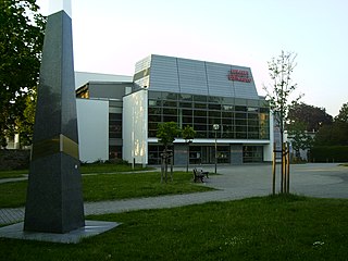
The German-Sorbian People's Theatre, Sorbian Němsko-serbske ludowe dźiwadło, in Bautzen is the only professional bicultural theatre in Germany. It is an important institution of Sorbian, German and German-Sorbian culture.
Sight 16: Serbski dom - Haus der Sorben
The Serbski dom is an administrative building on Postplatz 2 in Bautzen, Saxony, Germany. It is the cultural and political center of the Sorbian people. It was built between 1947 and 1956. It is the seat of Domowina and the Foundation for the Sorbian People.
Share
How likely are you to recommend us?
Disclaimer Please be aware of your surroundings and do not enter private property. We are not liable for any damages that occur during the tours.
GPX-Download For navigation apps and GPS devices you can download the tour as a GPX file.
