Self-guided Sightseeing Tour #6 in Aachen, Germany
Legend
Tour Facts
2.6 km
35 m
Experience Aachen in Germany in a whole new way with our free self-guided sightseeing tour. This site not only offers you practical information and insider tips, but also a rich variety of activities and sights you shouldn't miss. Whether you love art and culture, want to explore historical sites or simply want to experience the vibrant atmosphere of a lively city - you'll find everything you need for your personal adventure here.
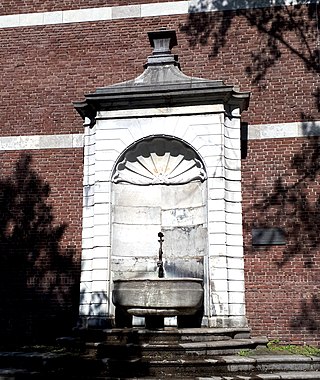
Individual Sights in AachenSight 1: Couvenwandbrunnen
The Couvenwand fountain is located in the Aachen district of Burtscheid, North Rhine-Westphalia, on Abteiplatz.
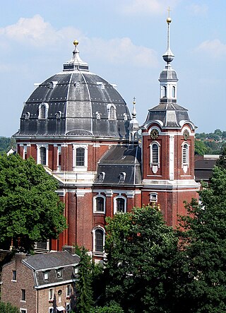
Sight 2: St. Johann Baptist
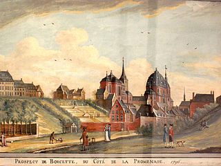
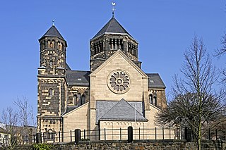
The former parish church of St. Johann-Baptist in Burtscheid is a Roman Catholic church dedicated to John the Baptist and former abbey church of the imperial abbey of Burtscheid. Since 2010, it has been part of the "Catholic Parish of St. Gregory of Burtscheid", a large parish formed in the Diocese of Aachen as part of the municipal structural reform implemented in 2008, which is named after the founder of the abbey, Abbot Gregor von Burtscheid, and to which, in addition to St. Johann-Baptist, the former parishes of St. Michael-Burtscheid and St. Aposteln, St. Gregorius and Herz-Jesu belong.
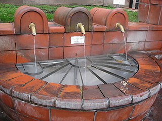
Sight 3: Marktbrunnen
The Burtscheid Thermal Fountain is located in the Aachen district of Burtscheid, North Rhine-Westphalia at the Burtscheider Markt and is therefore also known as the Market Fountain. Since it is a public fountain, thermal water can be taken there free of charge.
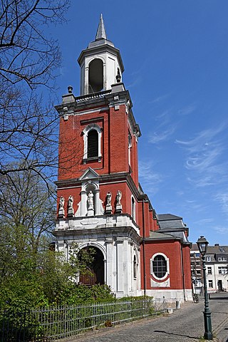
Sight 4: Sankt Michael
The Catholic parish church of St. Michael in Burtscheid was the former "Leutkirche" of the imperial abbey of Burtscheid. It was first mentioned in a document in 1252.
Sight 5: Kurpark Burtscheid
The Kurpark Burtscheid is a green space in the Aachen district of Burtscheid that was laid out at the end of the 18th century. The Burtscheid Kurpark is the oldest park in Aachen and has been changed several times in its size and use over time. Until the middle of the 20th century, more than 15 artesian thermal springs still sprang up within the spa park. There are several listed buildings on the park grounds, such as the translocated Nuellens Pavilion, the Fürstenbad and the former Neubad.
Sight 6: Gartenhaus Nuellens
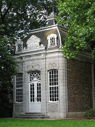
The Nuellens Garden House, also known as the Nuellens Pavilion, is a Baroque garden pavilion built in 1740 by the Aachen master builder Johann Joseph Couven. Today it is located on the edge of the Burtscheid spa gardens and is a listed building.
Sight 7: Burtscheider Viadukt
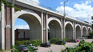
The Burtscheid Viaduct was built between 1838 and 1840 as the first large German railway viaduct by the Rhenish Railway Company and is one of the oldest railway bridges still in use in Germany. It is located in front of Aachen Central Station on the Cologne–Aachen railway.
Sight 8: Burg Frankenberg
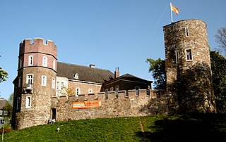
The Frankenberg Castle is a castle in the Frankenberg area of Aachen-Mitte, itself a district of Aachen, Germany. Its name comes from the concept of a "Franke", which was a type of castle that did not owe fealty to any others. Of course, shortly after its construction, the lowland castle became a fief of a Graf, and later belonged to the Duchy of Jülich-Cleves-Berg.
Sight 9: Herz Jesu
The Catholic Sacred Heart Church, colloquially known as Frankenberg Cathedral or Öcher Sacre Coeur, was built between 1908 and 1910 as a neo-Romanesque stone basilica designed by the architect Josef Kleesattel in the Frankenberger Viertel in the Aachen district of Burtscheid. The mosaic above the altar is the second largest in the Diocese of Aachen after the one in Aachen Cathedral.
Sight 10: Krautmühle
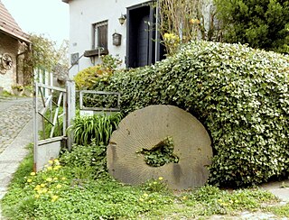
The list of historic mills in Aachen offers an overview of the most famous former water mills on the banks of the Aachen streams on the present-day territory of the city of Aachen. More than 70 mills could be proven on the basis of the sources and substantiated with data, although there were also other mills that have been historically forgotten or about which there is no information. The proven Aachen mills had once served, among other things, as grain, grist or oil mills as well as copper, grinding, fulling or dyewood mills and most of them had an overshot water wheel. From the early modern period onwards, they formed the basis for Aachen's economic rise, especially in the area of the cloth and needle industry in the 18th and 19th centuries, as evidenced, for example, by the history of the cloth industry in Aachen.
Share
How likely are you to recommend us?
Disclaimer Please be aware of your surroundings and do not enter private property. We are not liable for any damages that occur during the tours.
GPX-Download For navigation apps and GPS devices you can download the tour as a GPX file.
