Self-guided Sightseeing Tour #5 in Brno, Czechia
Legend
Tour Facts
5.8 km
92 m
Experience Brno in Czechia in a whole new way with our free self-guided sightseeing tour. This site not only offers you practical information and insider tips, but also a rich variety of activities and sights you shouldn't miss. Whether you love art and culture, want to explore historical sites or simply want to experience the vibrant atmosphere of a lively city - you'll find everything you need for your personal adventure here.
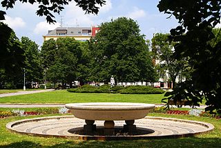
Activities in BrnoIndividual Sights in BrnoSight 1: Schreberovy zahrádky
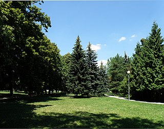
Schreber's Gardens is the name of a park in the Brno-North district. The park with an area of 2.4 hectares is located in the cadastral area of Černá Pole on an approximate triangle between Lesnická, Jugoslávská and Volejníkova streets.
Sight 2: Vila Tugendhat
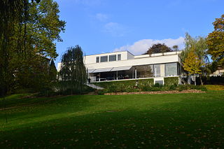
Villa Tugendhat is an architecturally significant building in Brno, Czech Republic. It is one of the pioneering prototypes of modern architecture in Europe, and was designed by the German architects Ludwig Mies van der Rohe and Lilly Reich. It was built between 1928 and 1930 for Fritz Tugendhat and his wife Greta, of the wealthy and influential Jewish Czech Tugendhat family. Of reinforced concrete, the villa soon became an icon of modernism. Famous for its revolutionary use of space and industrial building materials, the building was added to the UNESCO World Heritage List in 2001.
Sight 3: Lužánky
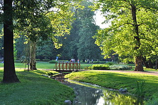
Lužánky is the largest city park in Brno and the oldest municipal park in the Czech Republic. The park is located in the Brno-střed District and covers an area of 22.3 hectares.
Sight 4: náměstí 28. října
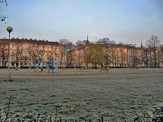
28. října Square is a square in Brno, located in the Černá Pole district between Milady Horákové Street and Lužánky Park. The square has a rectangular floor plan and is oriented from north to south. In the middle of the square there is a city park, where a memorial to the Brno victims of the Holocaust has been located since 2014.
Sight 5: Janáčkovo divadlo
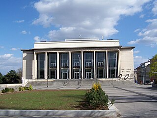
Janáček Theatre is an opera house in the city of Brno, Czech Republic. It is the largest of the three theatres serving the National Theatre Brno ("NdB") opera and ballet company, the others being the Mahen and the Reduta. It was built starting in 1960 after decades of delay and finally opened in October 1965, since when it has premiered some twenty operas and ballets. A major renovation was completed in 2018. The building's façade is north-facing, away from the city center and towards the nearby house of its namesake composer, who is grandly memorialized on the adjacent landscaped green.
Sight 6: Church of St. Thomas
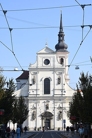
The Church of St. Thomas the Apostle, originally the Church of the Annunciation of the Virgin Mary and St. Thomas the Apostle, is a Baroque parish church, originally a Gothic Augustinian monastery church. It is located in the Brno-střed district of Brno in the south of Moravian Square in the cadastral area of the City of Brno.
Wikipedia: Kostel Zvěstování Panny Marie a svatého Tomáše apoštola (CS), Website
Sight 7: Moravské náměstí
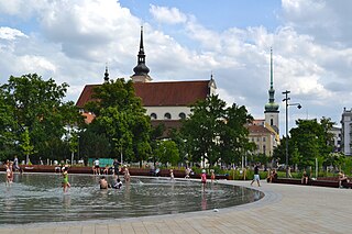
Moravian Square is a public space in the centre of the Brno-centre district, located on the north-eastern edge of the cadastral area of the City of Brno. Its northern part is occupied by two parks, separated by a tram and a road. In the eastern of them there is a monumental monument "Victory of the Red Army over Fascism" by sculptor Vincenc Makovský. The western part takes the form of a recreational park with trees and flower beds, in its center there is a multifunctional area with a water feature and a café. In the southern part of Moravian Square stands the Church of St. Thomas with the adjacent area of the Augustinian monastery. The cobblestone square is closed by the DOPZ building block with the Scala cinema from the south and the seat of the Supreme Administrative Court from the west.
Sight 8: J. A. Komenského
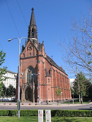
The Red Church is a Protestant Church in Brno, Czech Republic. It was designed by architect Heinrich von Ferstel and built up between 1863 and 1867. Nowadays it is used by the Evangelical Church of Czech Brethren. The building is a cultural monument.
Sight 9: Husův sbor
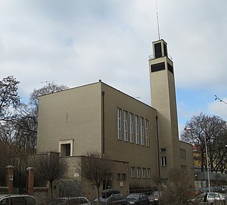
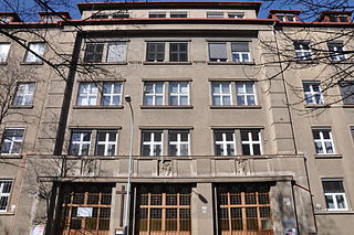
The Hussite Congregation in Botanická Street in Brno is a functionalist building located in the center of Brno.
Sight 10: sv. Rodiny
The Church of the Holy Family is a Roman Catholic monastery church at the Convent of the Sisters of Mercy in Grohova Street in the Veveří district of Brno, Brno-střed. It belongs to the Congregation of the Sisters of Mercy of the Third Order of St. Joseph. It was founded in Brno on March 15, 1886.
Sight 11: Park Obilní trh
Obilní trh is a square with a park in Brno, in the Veveří district, between Údolní and Gorky streets.
Sight 12: Kostel svatého Václava
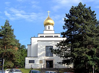
The Church of St. Wenceslas in Brno is a cathedral church of the Czech-Slovak Orthodox Church. It was built in the 1920s in the functionalist style.
Wikipedia: Pravoslavný chrám svatého Václava (Brno) (CS), Website
Share
How likely are you to recommend us?
Disclaimer Please be aware of your surroundings and do not enter private property. We are not liable for any damages that occur during the tours.
GPX-Download For navigation apps and GPS devices you can download the tour as a GPX file.
